Posts

Why Distance is No Longer a Challenge For Pipeline Surveys

pipeline development, pipeline surveying
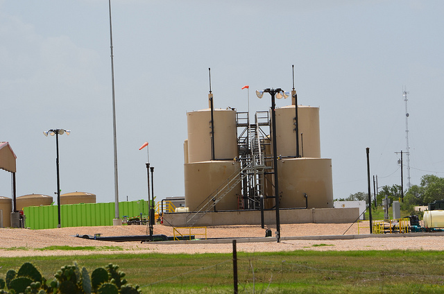
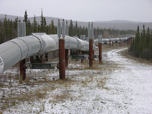
In the pipeline development process, collecting the data for large areas of land has always been one of the most difficult and time consuming aspects of the entire project. This is particularly true when it comes to remote areas that are difficult to reach. In the past, oil and gas companies would have to rely on land surveyors to travel to these locations over difficult terrain for preliminary data collection. This process could be very time-consuming, as the pipeline development project could not begin until the surveyors had the chance to travel all the way out to the terrain in question, complete their data gathering, and then travel back with their data.

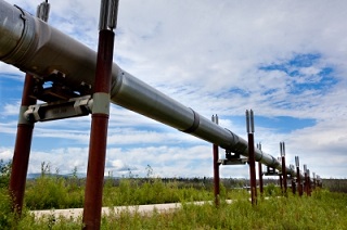
Fortunately, new pipeline surveying technologies have made it so that building pipelines through difficult terrain and hard-to-reach areas no longer has to be an impediment to completing projects on time. In this post, we’ll review how unmanned aerial vehicles (UAVs), also known as drones, can help significantly speed up your pipeline development project, especially for projects that cover large distances.

Faster Pipeline Surveys

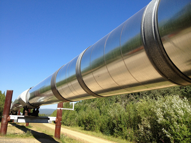
What makes UAVs so beneficial to the pipeline surveying process is the fact that they can travel quickly over long distances, bringing remote locations closer to you. They also have the ability to relay images back to land surveyors on the ground, which allows the land surveyors to begin working immediately, rather than having to wait until they return from the field. Working with a professional land surveying firm that offers aerial data collection services, you’ll be able to enjoy turnaround of ready-to-use survey documents in as little as 24 hours, regardless of the distances involved or the difficulty of the terrain. This makes aerial data collection through UAVs a much less time-consuming process than conducting pipeline surveys through traditional methods.

The surveying images provided by UAVs are taken using the latest in high-resolution cameras, offering a level of detail of one centimeter per pixel. Using these extremely accurate images and point cloud data helps land surveyors create the kind of detailed pipeline survey documents that today’s pipeline development projects require.

Safer Pipeline Surveys

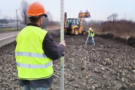
In addition to making it quicker and easier to conduct land surveys in remote, hard-to-reach locations, UAVs are also beneficial because they remove the need for the land surveyors to enter dangerous areas of the field themselves. This makes the whole process of gathering land data significantly safer, especially when difficult terrain is involved. Aside from the obvious human costs that occur whenever a land surveyor is seriously injured, safety should also be a concern because of the financial costs and the delays that these accidents can bring about.

In the past, aerial data collection was often performed using manned aerial vehicles. While these vehicles can offer some of the benefits offered by UAVs, it’s important to remember that putting someone in an airplane still puts them at risk, particularly when they have to fly over remote locations and difficult terrain to gather needed data. In the end, the only truly safe way of gathering data for land surveying projects is by keeping surveyors out of the field altogether, allowing them to work from the comfort and safety of an office setting. UAVs provide this ability, making them among the safest technologies for gathering land data.

In order to gain all of the benefits of UAVs discussed here, you need to make sure that you work with a professional land surveying firm that has the knowledge and expertise to help you put UAVs to work on your pipeline development project. To learn more about how we can help with your project, view an example of our recent surveying work. Or, to get started with using UAVs to support your land surveying efforts, contact Landpoint today.

Image Source: Ryan McFarland

Unmanned Aerial Vehicle

The Biggest Roadblocks to Getting Pipeline Surveys Done

pipeline surveyingThe pipeline construction process start and end with surveys to document topography, plan routes, and record the as- built status. Congested pipeline right-of-ways today make accurate surveys critical to planning routes. Whether front-end or backend, pipeline surveying needs to be done fast to meeting deadlines and make the pipeline operational.

Make sure your surveying company can overcome these hurdles during the pipeline construction process:

Pipeline surveys need to get done fast. Surveys need to be completed on time to meet proposal due dates and avoid pushing back project deadlines. But you can’t speed up a survey if it means losing comprehensive data. The only way to get all the data needed quickly is to use all the advanced technology available, rather than relying on manual surveying methods.

Speed up pipeline planning by using UAVs. Unmanned aerial vehicles (UAVs) can cover ground quickly, capturing high-accuracy data. Long battery life means a single UAV can complete a large scan. Mobile devices and a sophisticated data communications network transmit data quickly and cloud-based project management makes it available anywhere.

UAV scans are also great when questions come up while work is already in progress. They can provide a quick look that shows how the project has evolved and help figure out how to respond to problems or opportunities.

Pipeline survey areas are bigPipeline surveying covers miles, not a few acres in someone’s backyard. The same tech that helps meet time constraints helps cover the ground. UAVs can survey 400 acres per hour and aren’t slowed down by rough terrain. UAVs can conduct scans from lower altitude than manned aerial vehicles, meaning they collect better data. This is the only way to cover a large survey area effectively in terms of accuracy.

Because UAVs reduce the need for pilots in the air or surveyors roaming the ground, safety is improved, too. The UAVs also have a high level of accuracy, meaning fewer problems in the field later.

Pipeline surveying captures a lot of dataBecause of the large distances surveyed and the large amounts of data captured by laser scanning, an immense amount of data is created. Modern oil and gas pipelines, which need to be routed through more populated areas, need a high level of detail that basic topographical maps don’t provide.

But the data is only valuable if it’s usable, which means putting it into multiple formats, using GIS applications that provide detailed maps and support analysis, and using a cloud-based project management site to keep data available and streamline the workflow.

The GIS systems go beyond topographical maps to highlight geographical issues and environmental constraints plus existing pipelines, easements, and other factors. Having the data in the cloud means authorized users can access the files from anywhere there’s an Internet connection. You don’t need to worry about bringing the right printouts with you; as long as you’ve got a smartphone or tablet, you can call up the exact view you need.

Overcome the Roadblocks

The best way to get around the roadblocks common to oil and gas pipeline construction is to work with an experienced team—professional surveyors, GIS analysts, CAD technicians, engineers, and other technical experts—that uses the latest technology, high quality instruments, advanced data communications, and project management methods. Put all these together and pipeline surveying can be completed quickly and accurately, giving pipeline companies the information needed to plan, build, and operate their pipelines.

Landpoint is expert in applying technology to the pipeline construction process and can provide pipeline surveys covering miles of ground. Contact us for more information about pipeline surveys we’ve completed and how we’d complete yours.

Image source: Maureen

Unmanned Aerial Vehicle

How HD Laser Scanning Helps the Pipeline Construction Process At All Levels

pipeline-surveying,-HD-Laser-ScanningWhen a pipeline project experiences any type of delay or isn’t running as efficiently as possible, it has a huge impact on the bottom line. Every aspect of the pipeline construction process, including planning, design, layout, and management, is highly time dependent. The sooner your company is able to get a pipeline functional, the sooner you start seeing ROI. Proper pipeline surveying can help reduce delays and assist with project planning, especially when HD laser scanning is used.

The laser scanning system speeds up the surveying function across all aspects of the pipeline pipeline construction process, from planning to production. Put more simply, it supports multiple stages of pipeline development, from concept to completion.

Pipeline Pre-Design Phase

Aerial imagery and LiDAR data provides an accurate picture of the terrain and existing on-site structures prior to beginning any work. This allows everyone involved to see the “as is state,” before moving to the planning phase. With this pre-existing information, engineers can make better informed decisions throughout the full life cycle of the project.

Getting scans and imagery in the pre-design phase helps with services such as topographic surveys. It is the easiest and most accurate way to get a complete look at the area to be developed and ensures that engineers get their project off to a good start.

Scans may also be completed using Unmanned Aerial Vehicles (UAV’s) where surveys of very large areas can be completed much more quickly and for far less money than previous methods.

Pipeline Design Phase

Once engineers have an accurate understanding of the site that is going to be developed, the next step is to plan for how the pipeline fits into the current environment.  UAV data collection provides an excellent way for engineers to visualize a project during the planning phase of pipeline surveying.

Using the laser scanning results, engineers can confidently predict and avoid any potential issues before beginning the construction phase. Scans can be used to create digital elevation models, which in turn can be used to help identify potential issues as well as assist with the overall planning. The result: your project experiences less setbacks and ends up costing less.

Pipeline Construction Phase

Because the design phase normally requires multiple views of the project as it evolves, laser scanning adds value to the pipeline surveying process in multiple ways. Every time someone needs a fresh look at the project, the scan data can deliver the results.

When it’s time to actually begin construction, the LiDAR data is extremely beneficial. Engineers can very quickly complete as-built surveys showing how the project is evolving and redefining the look of the terrain and existing environment.

Because there are so many interested parties involved in a pipeline surveying project, it is important to complete these “on demand” surveys quickly and easily. UAV scans are perfect for these ad hoc, on demand kinds of surveys.

In the past, projects would grind to a halt waiting for accurate work in process scans. Now, HD scans provide one of the quickest and easiest ways to create as-built surveys during pipeline construction.

Experience is everything in Scanning Surveys

There are many things that can go wrong in a pipeline project one of which being outdated information that can lead to poor decision making. Project managers should carefully consider the company behind the services and work with someone who has several years of practical, field experience who is also capable of providing you with the most up-to-date data.

To learn how Landpoint can help your oil and gas company with pipeline surveying, download our free brochure today.

Image by – cinto2

Unmanned Aerial Vehicle

Why Planning with GIS is Critical for Pipeline Routing Projects

Pipeline SurveyingWhile pipelines do provide a cost-effective method of transporting oil and gas across long distances, it is still crucial for companies to save on pipeline development costs when they can. Pipeline development represents one of the most significant capital investments oil and gas companies will make, so everything they can do to cut costs helps.

One of the key ways oil and gas companies can cut costs on their pipeline development projects is by using GIS mapping tools for pipeline surveying. Of the many factors that drive high expenses for pipeline routing projects, most of them, including things like diameter, distance, and operating pressure, represent fixed costs that companies really have no control over.

On the other hand, companies can control which terrain they choose to route their pipelines through. This means that pipeline routing is one of the few opportunities that oil and gas companies have to easily cut their pipeline development costs, and GIS is one of the best ways to take advantage of that opportunity.

GIS: A Solution for a New Generation of Pipeline Surveying

In the past, oil and gas companies could build their pipelines just about anywhere. Now, as pipeline right-of-ways grow more and more congested, these companies have to be very selective when picking a route in order to avoid both natural obstacles and existing pipelines.

Fortunately, with GIS, oil and gas companies have a new technology that can help them better address this new challenge. GIS helps provide a far more accurate look at a piece of land than ordinary topographical maps could ever provide, offering a clear and complete representation of the spatial relationships around a piece of terrain. As a result, oil and gas companies can get a pipeline route map that helps them make more cost effective decision.

Factors That Define Optimal Pipeline Routing

In pipeline surveying, obstacles like wetland crossings and rough terrain create problems for companies. The pipeline development will have to stop whatever they are doing to find a way to make the pipeline go through, around, or beneath the obstacle. Having to change the pipeline route like this is a waste of time and money, which is why it’s always good to use GIS and just avoid the obstacles in the first place.

It’s also important to recognize that GIS can help you in a variety of other ways as well. When oil and gas companies develop pipelines, they have to account for issues such as how the new pipeline will affect the community. This is important because it helps companies consider things like how the settlements would be affected in the event of oil leakage, and how much the company would have to set aside for compensation payments to existing land owners.

In addition, oil and gas companies have to consider the environmental impact of their project before they can successfully pitch the project to the appropriate regulatory boards. GIS helps planners understand the overall impact of the project, and how to alter the pipeline routing to minimize the damage to vegetation and avoid protected areas like wetlands altogether.

Final Thoughts

In pipeline surveying, what you can’t see definitely can hurt you. Failing to account for poor terrain and other obstacles can delay your project, which costs money. Failing to account for how your pipeline will affect people and the environment can also be very costly, both in terms of financial losses and damage to reputation. Having as much visibility over your pipeline route as possible is key, and GIS can provide that visibility for you.

Ultimately, utilizing GIS services will help you save money and ensure a more efficient and cost effective pipeline route map.

Unmanned Aerial Vehicle

How a Land Surveyor Can Make Pipeline Construction Projects Less Expensive

pipeline developmentWhile using pipelines is the most cost-effective way to transport oil and gas across long distances – that does not mean that it’s not important to save money on the pipeline cost per mile when you can. On the contrary: pipeline construction projects usually represents a significant capital cost for oil and gas companies, so it’s always a good idea to identify saving opportunities. In this post, we’re going to discuss why a quality land surveying company can serve as one of these saving opportunities.

What factors drive up a pipeline’s cost per mile?

In order to cut down on the cost of your pipeline construction project, you must first identify what factors lead to high costs in the first place. According to the report “The Challenges of Further Cost Reductions for New Supply Options” by employees from the International Energy Agency and CEDIGAZ, capital expenses usually account for about 90 percent of the cost of transmission pipelines. As a result, it’s very important to identify potential sources of cost before you begin your pipeline development project.

According to the same report referenced above, the key determinants of cost in a pipeline development project are diameter, operating pressures, distance and terrain. The first three factors are usually determined by circumstances that are beyond your control; however, you do have complete control over what terrain you build your pipeline through. As a result, paying attention to terrain and obstacles up front may be the most effective way of ensuring efficiency and identifying possible cost savings for your pipeline development project.

How can you find the right terrain for your pipeline construction project?

While finding the right route to build your pipeline might seem like a no brainer, it’s something that’s definitely easier said than done. As pipeline right of ways have grown more and more congested, oil and gas companies have been forced to become more selective about where they build their pipelines. In addition, things like freeway crossings and rough terrain can lead to higher pipeline construction costs. As a result, oil and gas companies need to find terrain that avoids these obstacles as much as possible.

How can a land surveying company help?

In order to identify terrain that might be a good location for your pipeline development project, you can’t rely on guesswork or intuition. You need to have actual insights about what types of obstacles might be included with a particular terrain. This is where GIS mapping tools from a land surveying company can help. These tools can help you identify and avoid obstacles such as sudden terrain changes, chasms, and other rough terrain

4 Ways a Land Surveyor Can Help You With Pipeline Routing

Land SurveyorCompanies working in the Eagle Ford Shale Formation face significant challenges including the need for accurate pipeline surveying and quick turnaround times for deliverables. Companies continue to invest millions of dollars into what is “quite possibly the largest single economic development in the history of the state of Texas.”

However, one of the problems that has emerged for oil and gas companies is finding the most efficient route through the increasingly congested right of ways. As more and more pipelines are developed and the amount of acceptable territory a pipeline can pass through decreases, it becomes even more challenging to find an efficient path for pipes. In order to see the largest gains possible from projects in the region, oil and gas companies need exact maps and pipeline survey information to find the most efficient routes for pipeline deployment in the Eagle Ford Shale.

The 4 Primary Ways Land Surveyors Can Help With Pipeline Routing

1. By finding the most efficient path to lay the pipeline
As the first step in pipeline routing, consider going with a professional land surveying company that uses Geographic Information Systems (GIS).

Using GIS mapping tools, field teams identify geographic issues like terrain changes, chasms and other geographic issues not readily apparent on topographical maps. They make recommendations based on environmental constraints, existing and proposed structures, and costs. Additionally, GIS can contain other existing and foreign pipelines and pipeline easements, ownership information, and well locations.

Before GIS technologies, surveyors used topographical maps to plan routes. These maps were not always correct and did not give the level of detail needed for pipeline surveying. Done properly, this critical first step eliminates false starts and reduces costs.

2. By helping to identify some of the legal challenges for a designated path
Land surveyors and right of way agents are responsible for researching ownership, surveys of record, federal and state land status, right of way documents, recorded easements and more. The oil and gas company receives all available information that may result in legal challenges for the proposed path.

The final survey report contains history survey information that includes all surveys performed on the property in question.

3. Byidentifying trouble spots that can lead to issues later
Land surveyors find hidden geographic issues not visible on topographic maps. They can identify whether or not the terrain for a projected path can physically handle the pipeline. They can also identify any potential environmental hazards that could cause trouble in the future. They make recommendations based on all data gathered and will often recommend the best route and alternate routes guided by costs and other considerations.

4. By Reducing Costs and Improving Accuracy
Professional survey companies offer feasibility studies, preliminary mapping for IFB and IFC proposal development, construction studies, BOM development and more. They provide environmental and land use impact studies, governmental analysis, engineering support, and high-definition scanning.

Experienced surveyors access land use records, collect geographic and spatial data, to prepare reports, maps, and surveys including:

  • Preliminary Land and Site Surveys
  • Preliminary Easement Sketches for Initial Site Planning
  • Easement and Boundary Surveys
  • Invitation for Bid (IFB) and Invitation for Construction (IFC) Support
  • Utility Location & Crossing Surveys
  • As-built documentation
Impact on Pipeline Development in the Eagle Ford Shale

Recent technological advancements such as GIS, mobile data gathering, cloud based project management, and 3D scanning allow survey companies to deliver pipeline surveys and reports at lower costs than in the past, without sacrificing accuracy and while improving turnaround times. Measurements, boundaries, layouts, sketches are much more accurate and clients make informed decisions for site selection, well locating, site layouts and pipeline deployment. This allows for better planning when building pipelines in the Eagle Ford Shale, reducing costs and speeding up development.

If you need help with pipeline routing, then get a free land surveying quote today.

Image Source : EARTHWORKS

Three Land Surveying Services That Can Speed up Pipeline Construction Projects

land-surveying-pipelineWhen it comes to the oil and gas industry, it is important that pipeline infrastructure projects are well organized to keep the various subcontracting and supervising entities up to speed. There can be significant consequences if a single pipe is placed in an incorrect location because of a lapse in communication or outdated plats. If an existing pipe were to be punctured because of ill positioning, there could be severe regulatory penalties as well as immediate health and safety hazards. A knowledgeable land surveying company has many tools at their disposal to ensure that intended work areas and techniques are compatible. The primary differentiating tool that Landpoint offers is the project management site to keep all of the subcontracting and supervising entities up to date with shared plats and GIS mapping solutions that are updated in real-time as the licensed surveyors release new information. Landpoint can combine all of the traditional services, such as construction staking and layout or as-builts, and with this proprietary tool to give your company the value added services required for modern pipeline projects.

Construction Staking and Layout

Our qualified land surveyors have a unique understanding of how the pipeline construction industry operates. Once the land group has completed the project design land surveying team can then map out the dedicated easement of the project area and the location of the pipelines’ proposed centerline. The data is then immediately available for review and re-routes.

As-Built Surveying

One of the most important services that all pipeline projects should consider is live construction as-builts.  These surveys can be completed throughout the pipeline construction phase and can be platted as a profile or overview map to show where recently-completed projects lie on a construction site. This process makes sure the construction companies are properly building the pipeline as it has been approved.

GIS Mapping

Land surveying companies should provide GIS mapping to create a database of wells, trunk lines, laterals, and other assets in order to facilitate the organization of the project. Construction workers can use this information to better understand how the site elements of a major construction project fit together. During the planning stages, GIS helps speed up project timelines by showing regulatory agencies or construction crews exactly what designers want; GIS maps are much more intuitive than a flat paper plan, especially with complex design elements. Additionally, the GIS system can link pipelines and other assets to official documentation for ease of access on any device.

Landpoint’s experienced team can help you choose the services that will get your pipeline project started and keep it moving smoothly. Contact us today to learn more about construction as-builts, staking, and the services we offer.

Image By: puttsk

GIS Mapping has Revolutionized Pipeline Surveying

pipeline surveyingWith the ability to manage, analyze, edit, and display data in a multitude of ways, it’s no wonder Geographic Information Systems (GIS) have become an integral part of pipeline surveying and development. Our GIS techniques incorporate first class technology and professional know-how to provide our clients with the very latest pipeline data displayed in real-time at each stage of planning, development, and construction.

What is GIS Used For During Pipeline Surveying?

From the original survey shots for easements and centerlines, to the planned and proposed phases, and all the way up to the finished As-built pipeline, GIS provides the methods to track your data every step of the way. Even multiple re-routes can be kept fully up to date and available to you when time and decision making are of the highest importance. Field crew members, Project Managers, Construction teams, Regulatory Personnel and everyone in between can utilize our GIS services to conduct their tasks more efficiently than ever before.

Pipeline attributes can be very extensive and difficult to organize, but an efficient GIS eliminates this issue. Pipeline size, asset product, grade, wall thickness, length and much more are all made easily available to you both in the office and in the field through our Mobile GIS technology. Pipelines can also be classified and displayed according to their type: Trunkline, Gathering, Lateral, etc. for a clear, concise picture of product flow from the well site to the final destination. From the start of construction to the final regulatory review, our GIS services are aimed to facilitate effectiveness in each and every task for a successful pipeline surveying project.

With an efficient GIS in place, all pipeline data can be housed in a single, well organized location and utilized by multiple positions, departments, and industries each with their own focus and tasks. To learn more on how Landpoint, Inc. GIS mapping can bring success to your pipeline surveying project, contact us today.

Image By: Wessex Archaeology