Why GIS Is Critical to Utility Mapping
When surveying, GIS data can help produce exceptionally useful, exceptionally accurate geographic data. GIS survey data can be used for a variety of activities, ranging from planning pipelines to expanding solar energy farms. Today, we’ll take a look at why GIS is critical to utility mapping.
Using GIS Data for Utility Mapping
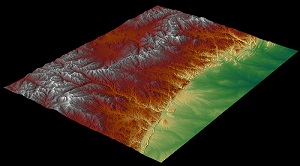
GIS data and surveying go hand-in-hand. When drone technology, such as UAVs (unmanned aerial vehicles) are used with GIS platforms, it makes it easier for drones to report what they have seen in an easily simulated, easy to read way. Drones are able to record data, via either photogrammetric or LiDAR technology, that the GIS can then map it into a topology.
GIS data is used for a variety of applications, not just surveying. It’s a very useful method of ensuring that all data acquired is correctly fixed in topological space. A GIS platform will be able to bring in survey data, simulations, and projects, all of which can then be imported into the technology being used to build a project.
The type of data still matters. LiDAR remains one of the most accurate methods of collecting GIS. Photogrammetric surveying will produce more human-readable data, but LiDAR can produce more accurate, efficient 3D data. Either way, A GIS system will be able to bring the information in so that it can then be used for utility mapping.
Better Planning for Better Construction
GIS and surveying are complementary, producing accurate scans of geographic data that can then be used for the planning of new developments and projects. Whether natural gas lines are being run or fiber optic internet cables, utility mapping is an important first step.
With better planning and better decision-making:
- It will be easier to assess how long a project will take and how much it will cost.
- Damage to the surrounding environment will be lowered or mitigated.
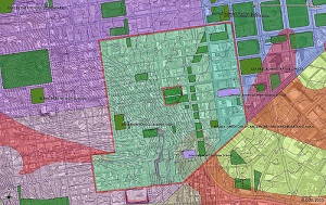
- Accurate property lines can be noted, important for handling any potential legal issues.
- The project will more likely line up to the final desired deliverable.
- The project will be overall more efficient and predictable.
GIS provides additional data when surveying — data that can be critical to the most thorough planning stages. With this additional data, companies are able to produce advanced simulations and predict the course of the development — from the start.
And this GIS data is forever. Once the drone has built out the GIS data, it can be accessed by all stakeholders on the team. It can be re-accessed during repairs and updates — and it can be used if there are questions of improving efficiency.
More Efficient Utility Mapping in GIS
GIS data can be used to create more efficient utility services. Through GIS data and simulation technology, companies will be able to see the configuration of a utility network that would work best. They can avoid potential issues, such as areas that cannot be easily traversed, and bake it all into initial planning.
In most large-scale projects such as utilities, it isn’t the initial cost of the project that ends up being the greatest expense. Rather, it’s re-works that are required to be done later. But this also requires that the data that’s collected through the GIS platform be as accurate as possible — a challenge for the surveyor.
Environmental Surveys and Planning
For environmental surveying and planning, GIS provides superior due diligence mapping. With GIS mapping for water utilities, gas lines, GIS for electric utilities, and other forms of utility mapping in GIS, environmental impact can be more reliably predicted. Better data means less disruption to the environment.
Survey data taken with LiDAR and brought into GIS can create a complete topological map, even cutting through thin cloth, bushes, and underbrush. When combined with GIS data, LiDAR provides incredibly accurate information through which to take an environmental survey. The simulations that are produced can show an organization how things like potential flooding, spills, or even noise and light pollution will impact the area.
Simulations, Projections, and Cost Management
For pipeline utility mapping, simulations and projections can be used to estimate the necessary depth of cover (DOC) and other regions. By using simulations and projections, effective cost management can also be achieved. The better the costing, the less likely that the project might experience delays or an overrun.
Once GIS survey data has been uploaded, it can be used for all manner of simulation, both now and into the future. Simulations can be used to ensure that the project is operating on time. Simulations can be used for projected expansion. If additional waterlines are added, how will they impact the existing lines? If additional electric utilities are needed, what will have to be altered?
In the future, this GIS survey data can be used as retained for expansion and modifications, making it an investment in the longevity of the project.
GIS Data for DIMP and Beyond
Accurate GIS data can help organizations build their Distribution Integrity Mapping Program (DIMP) plan, reduce potential environmental impact, and optimize their utility systems for greater levels of efficiency. Organizations can engage in record research in the future and otherwise manage their existing GIS data.
It is always better that utilities be both safe and efficient. GIS data can be used to ensure that the plans for the utilities themselves are as fine-tuned and optimized as it can be. Once construction has been completed, a combination of GIS data and drone technology can be used to regularly investigate the work site and ensure that issues haven’t emerged.
It’s incredibly important that utility mapping be completed with accuracy, especially underground utility mapping. GIS surveying can help. Learn more about the benefits of GIS surveying with Landpoint.