How a Land Surveying Company Creates 3D Models

land surveying companyTraditional methods of collecting, rendering, and storing survey data are rapidly being replaced with 3D digital data scanning and modeling. Today, three-dimensional surfaces and objects are converted into highly accurate mathematical representations using laser scanners and 3D modeling software. Thanks to the benefits of 3D laser scanning and modeling, construction project managers enjoy an easy, independent, and cost-effective resource for mapping any type of surface.

Using 3D Models

Contractors, engineers, land surveying companies and historical preservation groups all use data modeling. When creating a model, they start by scanning the area to be modeled with 3D laser scanners.

Scanners collect millions of survey-grade points to aid the engineer and land surveying company with design as well as problem identification and resolution. Once the points are collected the modeling process can then begin. This is useful for:

  • 3D BIM (Building Information Modeling)
  • 3D topographical site scans
  • 3D site representations and modeling
  • Construction As-builts
  • Measurements for erosion control plans
  • Grading volumes
  • Height measurements for equipment and crane mobilization
  • Environmental compliance
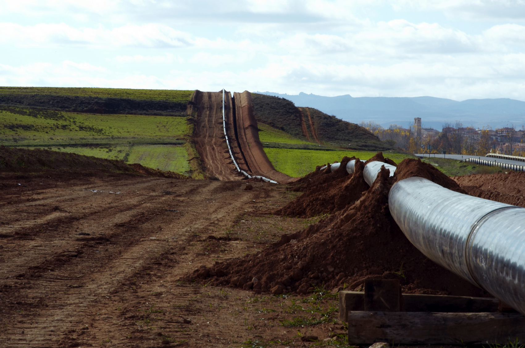
  • 3D laser scanners provide fast data collection and an increased safety envelope in difficult environments such as valleys, quarries, landfills, and facility locations.
  • Surveyed contours, volumes, and cross sections may be delivered as 2D or 3D models. They may be 3D survey points and break-lines used to produce digital terrain / elevation and TIN models, or full-detail models used for advanced designing.

How It Works

3D Laser Scanning for Construction

Thanks to Light Detection and Ranging (LIDAR), extremely accurate data can be collected, and therefore more accurate 3D models can be made.Here are some facts about 3D laser scanners:

  • 3D laser scanning uses high speed lasers fired at incredibly-high rates of speed.
  • 3D laser scanners may be Phase Based, where a constant laser energy beam is released, or Time of Flight based, where the scanner calculates the distance based on the laser light phase change.
  • The more, and closer, scans are taken, the more accurate the scan is. Scanned points are typically every 1/4 inch.
  • Each point taken by the scanner’s high resolution digital image is colored according to the photo.
  • Analysts setup scan stations in multiple areas to collect as much data as possible.
  • GPS can be tied to the scan data to make use of existing local coordinate systems.
3D Mapping Software

3D mapping software takes all of the raw scan data and converts it into a format that the modeling software is able to read. Clients can also request the raw scan data for use in AutoCAD, Miscreation, or other architecture/engineering related programs that can import point clouds.

Here are a few facts about 3D mapping software:

  • Many software platforms provide editing, direct access, visualization, spatial data analysis, and CAD modeling.
  • The initial “raw scan file” can be several gigabytes. When compressed and converted into anAutoCad drawing, the file size will normally drop considerably
  • Videos, digital color photos, Point clouds, survey files, and computer models of roads, bridges, and fully textured objects are all common forms of deliverables.

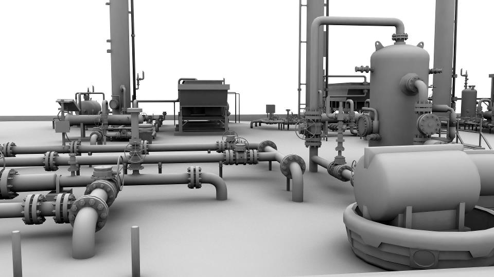
An Example of 3D Modeling for Oil and Gas

Landpoint was contracted to do an As-built 3D intelligent model on a gas processing facility located in Haughton, LA in 2011. The scan produced models within a 1/4 inch of accuracy and provided the contracting company with a complete as-built survey as well as an easy to access asset management model. To learn more about the benefits of 3D laser scanning, contact Landpoint today.

Landpoint Awarded Third Place on 2014 ZweigWhite Hot Firm List

zweigwhite2014Landpoint is excited to announce that it has been awarded the #3 spot on the 2014 ZweigWhite Hot Firm List. This marks the third consecutive year that the company has been awarded a spot on the exclusive list which ranks the top 100 fastest growing firms in the A/E/P and environmental consulting industry.

“We are thrilled to have placed so high on this year’s list” says James Souter, CEO of Landpoint. “Our team has worked very hard to support and control the growth we’ve been experiencing.”

Landpoint has grown to more than 220 professionals, from land surveyors to licensed professional engineers, who are located across the nation. Many of its operations are located in extremely active energy development zones. The company has secured long term relationships with some of the largest clients in the Eagle Ford, Permian Basin, Haynesville Shale, and other emerging oil and gas formations. Additionally, Landpoint and its subsidiaries provide surveying and engineering services for municipalities, construction firms, and industrial companies.

The list looks at more than 100,000 firms located in the United States and Canada and only recognizes those who have outperformed the economy and their competitors. The economic recovery is well underway as firms on the list in 2014 boast an impressive median growth rate of 72 percent, up significantly from 44 percent in 2013.

“Getting on The ZweigWhite Hot Firm list is a tremendous achievement,” said Mark Zweig, ZweigWhite founder. “That’s especially true now the economy is doing better,” Zweig added. “The goal post is getting higher”

The Hot Firm award is the most recent of several accolades presented to Landpoint for 2014. Earlier this year the Association for Corporate Growth awarded Landpoint with the “Deal of the Year” award after successfully creating and executing a long-term acquisition strategy and integration platform. In 2013 Landpoint completed transactions with King Surveyors of Windsor, Colorado and West Company of Midland in Midland, TX.

Oil and Gas Surveying: Simplifying Pipeline Route Selection

oil and gas surveyIf you are using pipelines to transport oil and gas, then one of the most crucial first steps for your project is going to be route selection. Where you put your pipelines is going to affect not just how much pipe to buy but have legal and environmental issues as well. The best pipeline transport routes move oil and gas in the safest, most economically efficient way possible and have the least impact to the environment and landowners. The oil and gas pipeline routes are defined by the pipeline size(s), terrain, soils, and engineering analysis requirements.

The engineers’ assessment based on survey data is essential to the oil and gas pipeline construction project. The most direct route is not always optimal and each solution has an associated cost and schedule increase. Failure to thoroughly investigate all features of the intended route and surrounding lands quickly adds additional time and cost. Thankfully, quality oil and gas surveys can help to mitigate costly errors, geotechnical mishaps, regulatory issues and breaches.

Pipeline Planning

The shortest route is generally not possible due to physical obstacles and environmental limitations that can get in the way. To mitigate costly oversights, surveys should provide engineers typographic, geographic, boundary, environmental, and other in-depth data to help them determine things like:

  • Corridor Selection
  • Route Survey
  • Foreign Pipeline Identification
Selecting a Route During an Oil and Gas Pipeline Construction Project

To determine the preferred / final route, oil and gas survey information should highlight and map constraints within the route corridor. Negotiations can then begin, construction limitations and potential impacts addressed, schedules made, construction method(s) determined and a traffic management plan prepared. The survey should involve the following:

  • A detailed survey of the route and the pipeline’s construction environment.
  • Access roads, construction camps, staging, facility, cathodic protection, and mainline valve sites should be surveyed at this stage.
  • Pipeline corridor design and above-ground facilities locations should be completed in the field.
  • Surveyors should contact appropriate authorities/third parties to obtain information about unknown development or encroachment along the route, underground obstructions, as well as other pipelines, services, and structures that may be in the way. Surveyors should also meet with landowners and land agents along the proposed route.
  • Land and environmental corridor surveys should be wide enough to cover sufficient width and depth around the provisional route and have sufficient accuracy to identify all features that could adversely influence installation and operation of the pipeline.
  • The selected route should be recorded on appropriately-scaled alignment sheets that include significant point coordinates and contour lines.
  • Geo-hazards can be identified and addressed. Geo-hazards are “geological, hydro-geological, or geomorphological events.” The extreme result of a geological hazard on the pipeline is a rupture. This is why terrain evaluation and risk analysis are imperative to selecting the most appropriate pipeline route.
  • Early-stage terrain evaluation and assessments can be performed to reduce design and construction time and cost. Costly remedial measures or site restoration is prevented and the operability of the pipeline is maintained.

Learn more about how land surveying can impact your oil and gas pipeline construction project by downloading Landpoint’s oil & gas brochure.


Oil and Gas Engineering Challenges in the Niobrara Shale

land surveying servicesThe oil and gas development opportunities being explored in the Niobrara Shale area are numerous and have presented the region as a prospectively lucrative venture for many energy companies. However, this has also lead to a number of challenges for oil and gas engineering firms.

Niobrara Shale and the Recent Boom

The Niobrara Shale is attracting large investments from companies in the energy and oil and gas development sector, due to its oil rich and easy to drill stratum. An amount of $4 billion was invested by some of the top companies in the sector during 2013, with plans to pursue drilling activities in 2014 as well.

  • Drilling sites: The 4 major enterprises operating in Niobrara have identified around 15,000 potential drilling sites within the location, targetting the huge amount of oil and gas reserves that the area possesses. Moreover, smaller companies have outlined 5,000 other locations which are prospective spots for oil and gas drilling in Niobrara shale.
  • Increase in rig sites: The North American Rig Count has estimated a 50% increase in the number of oil rigs within the area, only within the past 22 months. The alluring prospects presented by Niobrara Shale has given rise to the amount of investment done by energy sector companies, with around $1 billion already spent on the rail terminals, pipelines and plants, for the processing and shipping of oil.
  • Economic boom: The investment activities in the region have resulted in an economic boom in the area, the effects of which are easily discernible all across the Front Range. Many energy investment companies are still evaluating the true potential of Niobrara, and regard it as a highly lucrative region for exploring and discovering oil and gas development opportunities.
  • Rising demand for drill permits: Statistics show that in the latter part of 2013, there were around 1000 drilling permits which were issued in the Niobrara Shale basin, whereas 250 were still pending. This is evidence of the vast drilling and exploration opportunities being offered by the region for oil and gas development.

Niobrara is included in the list of different shales within the country, which have increased the domestic output of the state to exceed their oil imports, since 1995.

Challenges by Oil and Gas Engineering Firms Faced With Developing the Area

Though Niobrara Shale is rapidly being recognized as an abundant resource of oil and gas reserves in the industry, there are still a number of challenges in its path towards success. These include:

  • Land surveying: Finding quality land surveyors is a major challenge for companies in the energy sector who want to explore the resource potential offered by Niobrara. There are quite a number of land survey companies, but they sometimes lack the appropriate team size and a mobile professional group of professionals, to competently handle large exploration projects, which are major challenges and a cause for delays.
  • Political and community resistance: Many political segments and community associations are resistant to the extent of development change which is fast penetrating into the suburbs of the Niobrara basin, which is one of the major challenges to the development endeavors in the area.
  • Technological expertise: Not many service providers have technological expertise to make use of the instrumentation and software, like GIS mapping, cloud based data sharing, high definition scanning, and many other important services.
  • Permit  issuance: In order to pursue development projects within the area, permits are a necessity, and due to the rising demand, the process has become time consuming, making it difficult for investment companies to explore and develop Niobrara.

In Niobrara, land surveying and exploration is critical to the development of the area. If you are seeking an oil and gas engineering firm, then get a no obligation quote from Landpoint.

Image by : USFWS Mountain-Prairie

How Surveying With Drones Changes Everything

8725078749_b8baf91344_zUnmanned aerial vehicles (UAVs), otherwise known as “drones,” are among the most important technological advances that have been introduced to the land surveying industry in quite some time. These small, ultra-light weight aircraft can be piloted by remote and can take detailed survey information while simultaneously transmitting that data back to the head office. This creates highly accurate maps and provides valuable data to companies and individuals who are considering major projects on large areas of land. In this article, we will take a look at how surveying with drones can help Oil and Gas companies get better, more accurate data.

Why Use Drones for Surveying?

There are a number of reasons why drones are an ideal addition to any land surveying project and can increase accuracy and return on investment.

  • Highly accurate, high-definition maps can be created in a fraction of the time that used to be required
  • Data of all sorts can be gathered by the drone including photography, Lidar, and video
  • All information can be instantly uploaded to a server where it can be accessed by authorized individuals anywhere in the world
  • It becomes much easier to reach difficult locations with drones. This makes using drones significantly safer in certain situations.

These are just a few of the reasons why this technology has been so important to the industry. As applied robotics continue to increase in complexity, there is very little doubt that the capabilities of surveying drones and the breadth of data that they can collected will only increase.

How Land Surveying With Drones Works

While not common place today, more companies are recognizing the benefits of using drone technology in order to produce things like base maps and other important pieces of the surveying puzzle.

To put it simply, drones are deployed over the area to be surveyed equipped with a number of important pieces of scanning technology. Among these are 3D laser scanners that sweep over the region and give the surveyor highly detailed images and ideas of what the terrain actually looks like.

The data from the 3D laser scanners can be used in a process called GIS mapping, which is the creation of a digital map through the employment of cartographic sciences, advanced computer skills, and statistical analysis. The map provided by this process is not only high definition and easy to use, but also gives very specific information regarding the area in an easy to access format.

The GIS map and other data is stored using cloud technology so that what is being seen by the drone and the resultant reports can be instantly uploaded to a server that will provide access to authorized parties. Not only is this the quickest way to inform decision makers on the results of surveys, it also allows them to be informed no matter where they are so long as there is an Internet connection.

Advancing With the Times

More companies are changing their land surveying services to take advantage of the new technologies becoming available. They are finding a much higher return on investment due to more accurate data being accumulated by fewer people in less time with quicker results. Not working with a modern surveyor employing the best techniques is far too expensive a proposition for many companies, and they are finding the change worthwhile.

At the time of writing, the legal use of drones for surveying purposes has not been approved by the government. However, Landpoint has already begun investing in Research and Development for drones so that when they do become legal it can offer this service to its customers soon after.

If you’re interested in seeing what a difference the latest advance in land surveying technology can make, both in terms of accuracy and bottom line, don’t hesitate to request a no obligation quote so that you can see for yourself the incredible benefits.


Image by : Don McCullough