Oil and Gas Surveying: Simplifying Pipeline Route Selection
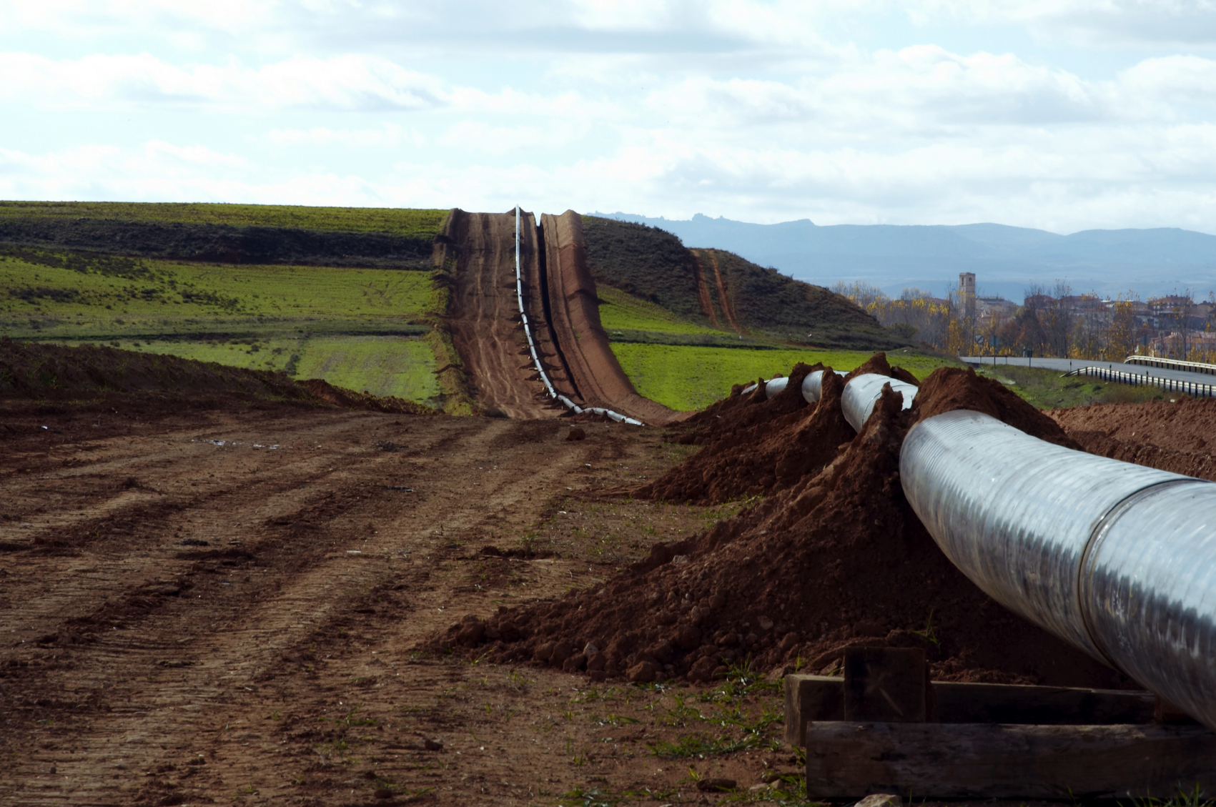 If you are using pipelines to transport oil and gas, then one of the most crucial first steps for your project is going to be route selection. Where you put your pipelines is going to affect not just how much pipe to buy but have legal and environmental issues as well. The best pipeline transport routes move oil and gas in the safest, most economically efficient way possible and have the least impact to the environment and landowners. The oil and gas pipeline routes are defined by the pipeline size(s), terrain, soils, and engineering analysis requirements.
The engineers’ assessment based on survey data is essential to the oil and gas pipeline construction project. The most direct route is not always optimal and each solution has an associated cost and schedule increase. Failure to thoroughly investigate all features of the intended route and surrounding lands quickly adds additional time and cost. Thankfully, quality oil and gas surveys can help to mitigate costly errors, geotechnical mishaps, regulatory issues and breaches.
Pipeline Planning
The shortest route is generally not possible due to physical obstacles and environmental limitations that can get in the way. To mitigate costly oversights, surveys should provide engineers typographic, geographic, boundary, environmental, and other in-depth data to help them determine things like:
- Corridor Selection
- Route Survey
- Foreign Pipeline Identification
Selecting a Route During an Oil and Gas Pipeline Construction Project
To determine the preferred / final route, oil and gas survey information should highlight and map constraints within the route corridor. Negotiations can then begin, construction limitations and potential impacts addressed, schedules made, construction method(s) determined and a traffic management plan prepared. The survey should involve the following:
- A detailed survey of the route and the pipeline’s construction environment.
- Access roads, construction camps, staging, facility, cathodic protection, and mainline valve sites should be surveyed at this stage.
- Pipeline corridor design and above-ground facilities locations should be completed in the field.
- Surveyors should contact appropriate authorities/third parties to obtain information about unknown development or encroachment along the route, underground obstructions, as well as other pipelines, services, and structures that may be in the way. Surveyors should also meet with landowners and land agents along the proposed route.
- Land and environmental corridor surveys should be wide enough to cover sufficient width and depth around the provisional route and have sufficient accuracy to identify all features that could adversely influence installation and operation of the pipeline.
- The selected route should be recorded on appropriately-scaled alignment sheets that include significant point coordinates and contour lines.
- Geo-hazards can be identified and addressed. Geo-hazards are “geological, hydro-geological, or geomorphological events.” The extreme result of a geological hazard on the pipeline is a rupture. This is why terrain evaluation and risk analysis are imperative to selecting the most appropriate pipeline route.
- Early-stage terrain evaluation and assessments can be performed to reduce design and construction time and cost. Costly remedial measures or site restoration is prevented and the operability of the pipeline is maintained.
Learn more about how land surveying can impact your oil and gas pipeline construction project by downloading Landpoint’s oil & gas brochure.

