Common Environmental Review Issues (And How to Fix Them)

environmental consulting
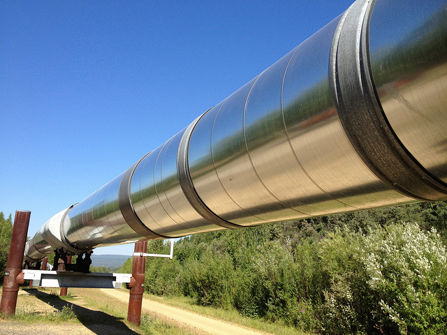
Oil and gas projects can cover a large geographical area, making environmental review issues a major area of concern. When a company doesn’t prepare to address these issues in advance, they may find themselves scrambling to address them after the project has already started, leading to major delays and budget shortages that can be hard to overcome.

In this post, we’ll discuss some of the major environmental review issues that could interfere with your project and talk about how to prepare your company for these issues so they cause the least amount of complication possible.

Major Environmental Review Issues for Oil and Gas Projects

1. Wetlands Mitigation Regulations and Permitting
Getting a permit to work in or around wetlands is a very time-consuming process, so it’s important that you start thinking about what permits you might need well in advance of your project. Depending on the location, size, and scope of your project, it could take anywhere from 6 to 18 months to get your permit.

Another complicating factor is that the entire permitting process is handled by a single federal organization, the US Army Corps of Engineers (USACE). Even if you work with an environmental consulting firm, there is nothing they or anyone else can do to speed up the permitting process. The timeline for securing a permit will depend on the USACE’s schedule.

2. State Regulated Waters
Depending on what state your project is located in, you may need a permit to work around protected waters; this permit would be separate from the 404 permit that covers federal wetlands regulations. An example of this can be found in the Louisiana Scenic Rivers System.

The hard part of these regulations is knowing which bodies of waters are regulated, since the exact rules vary from state to state. Working with a partner that has an intimate knowledge of an area can be extremely helpful in this regard.

3. Well Spacing on Oil and Gas Projects
There will often be cases where you’re unable to secure a wetlands permit. In these instances, you may find yourself having to improvise by relocating a project site. In turn, this could lead to complications when a well ends up being located too far away from its assigned unit.

It’s critical to strike a balance between ensuring proper well spacing on your oil and gas project and complying with all environmental regulations.

4. Endangered Species
Your company must take the time to learn about any endangered species habitats that can be found in the area of your project site. If an endangered species does live in the area, your project will not be allowed to go ahead. It’s important to know about these situations in advance so that you can make other plans.

5. Archeological and Historical Sites
If areas of cultural or historical significance are discovered on the project site, your project will have to be shut down or relocated. These areas could include sites such as Native American mounds or cemeteries. While there may be no way to predict where these sites will be found, you can come up with a contingency plan to use in the event that such sites are found.

6. Wildlife Management Areas
Working in a wildlife management area can be very time-consuming and difficult. These areas are highly protected, and often require special clearances and notifications in order to access them. Once again, working with an environmental consulting firm can help you navigate this issue while also pursuing the satisfactory completion of your project.

To learn more about how to tackle environmental issues and avoid complications and delays, contact Landpoint today.

Image Source : USAG Livorno PAO

The Biggest Permitting Issues That Arise in Oil and Gas Projects

Oil and Gas SurveyingWhen planning a new oil and gas project, it’s very important that you educate yourself about the permit issues that you might run into along the way. While there are many different permitting issues that could arise, all of these can be boiled down into two main factors: wasted time and wasted money.

Wasted Time

As you are no doubt aware, oil and gas projects operate according to a strict schedule. When a permit issue appears unexpectedly, companies will find themselves putting a stop to things while they wait for the needed permits to come through. This could end up setting the project back weeks, which could in turn have a ripple effect that greatly disturbs the rest of the project schedule. The only way to avoid unexpected sources of wasted time is by planning ahead and making sure that your company knows about any perspective permit issues before they become problems.

Wasted Money

Just like oil and gas surveying projects have to adhere to strict timelines, they also have to adhere to strict budgets. Oil and gas companies that don’t take the time to familiarize themselves with all of the permitting issues they might face before the project begins risk going significantly over their budgets, which could in turn affect what the company is and is not able to do going into the future. This is another reason why it’s important for oil and gas businesses to look into potential permitting issues as early as possible.

What Types Of Permitting Issues Should Oil And Gas Companies Be Worried About?

Oil and gas companies are subject to a variety of state and federal regulations regarding what they can and can’t do. While some states may require a particular type of permit, others may not.  On top of this, the turnaround time for permits can vary greatly and some permits can take well over a year to obtain.

Here are a couple major permits that we have seen oil and gas companies have issues with:

404 Permit

A 404 Permit, named for Section 404 of the federal Clean Water Act, is something that all companies must obtain before pursuing a project that might affect bodies of water such as wetlands. To be more specific, the regulation limits the discharging of potentially harmful dredged or fill material into bodies of water.

In order to receive a permit to proceed with a project that requires the discharge of such material into a body of water, an organization must be able to demonstrate to the EPA that there is no practical alternative available that would be less damaging to the aquatic environment, and that the damage to the water would be limited as much as possible during the project. Gathering and presenting this kind of information takes time, so it’s important to know whether or not you need this permit in advance.

Louisiana Natural and Scenic Rivers System Permit

A good example of a permit required by state regulations can be found in Louisiana. A company must secure one of these permits before beginning an oil and gas project that might affect any of the scenic waterways listed on the Louisiana Scenic Rivers Act.

Working with a professional land surveying company that has certified environmentalists is the best way to ensure that your company is aware of all the possible permit issues that apply to your project. With this knowledge, you can ensure that these issues don’t stand in the way of you completing your oil and gas project successfully. Contact Landpoint today to learn more about what our oil and gas surveying knowledge and experience can do for you.

Image Source : Scottish Greens

How a Land Surveyor Can Make Pipeline Construction Projects Less Expensive

pipeline developmentWhile using pipelines is the most cost-effective way to transport oil and gas across long distances – that does not mean that it’s not important to save money on the pipeline cost per mile when you can. On the contrary: pipeline construction projects usually represents a significant capital cost for oil and gas companies, so it’s always a good idea to identify saving opportunities. In this post, we’re going to discuss why a quality land surveying company can serve as one of these saving opportunities.

What factors drive up a pipeline’s cost per mile?

In order to cut down on the cost of your pipeline construction project, you must first identify what factors lead to high costs in the first place. According to the report “The Challenges of Further Cost Reductions for New Supply Options” by employees from the International Energy Agency and CEDIGAZ, capital expenses usually account for about 90 percent of the cost of transmission pipelines. As a result, it’s very important to identify potential sources of cost before you begin your pipeline development project.

According to the same report referenced above, the key determinants of cost in a pipeline development project are diameter, operating pressures, distance and terrain. The first three factors are usually determined by circumstances that are beyond your control; however, you do have complete control over what terrain you build your pipeline through. As a result, paying attention to terrain and obstacles up front may be the most effective way of ensuring efficiency and identifying possible cost savings for your pipeline development project.

How can you find the right terrain for your pipeline construction project?

While finding the right route to build your pipeline might seem like a no brainer, it’s something that’s definitely easier said than done. As pipeline right of ways have grown more and more congested, oil and gas companies have been forced to become more selective about where they build their pipelines. In addition, things like freeway crossings and rough terrain can lead to higher pipeline construction costs. As a result, oil and gas companies need to find terrain that avoids these obstacles as much as possible.

How can a land surveying company help?

In order to identify terrain that might be a good location for your pipeline development project, you can’t rely on guesswork or intuition. You need to have actual insights about what types of obstacles might be included with a particular terrain. This is where GIS mapping tools from a land surveying company can help. These tools can help you identify and avoid obstacles such as sudden terrain changes, chasms, and other rough terrain

Why 3D Scanning is Critical to Building Information Modeling

3d-laser-scanningWhile 3D laser scanning has been used in various surveying capacities for many years, it has only been recently that companies have begun to apply it to Building Information Modeling. As both hardware and software have become more capable, applying 3D laser scanning to BIM has become more practical in a wider range of settings.

Why applying 3D laser scanning to BIM makes sense

The value that 3D laser scanning can add to the BIM process is really quite clear: whether you’re scanning existing construction in order to plan updates or improvements, or scanning terrain in advance of new construction, using lasers to create BIM models allows you to optimize the BIM process, reduce the amount of project risk your company takes on, and reduce the cost and time to completion for the project.

In addition, converting your laser scanning point clouds into object-based BIM models opens up an entirely new set of possibilities for what you can do with that data. For instance, you can use the data to create 2D documents that are easier to share with team members and plan ahead for things like scheduling, quantities, and cost.

What is BIM, and how can it be applied?

To put it quite simply, Building Information Modeling is the process of creating digital representations of physical spaces. These BIM models are created using specialty scanning hardware and modeling software. BIM is important to the construction and land surveying industries because it allows companies to approach projects with a higher level of insight, since they’ll be able to view the building or landscape in question at their convenience, from a variety of different angles.

How 3D laser scanning works with BIM in Construction

With 3D laser scanning, a series of scanners lets off thousands of laser bursts per second and then measures the time of flight and phase shift as the laser beams return to the source in order to create a point cloud of data that provides an extremely detailed representation of the physical environment being scanned.

In order to apply your 3D laser scans to BIM in construction, you must first register multiple scans together, in order to create a full view of the building or terrain being scanned from multiple angles. Then, you can convert your point clouds into object-based BIM models using a software program or an external modeling application.

In order to get the best results from laser scanning, it is very important that you plan ahead, because the scanning process can be time consuming. In addition, you must be able to know what your objectives are in advance, and be able to describe exactly what you plan to do with the information you gather from your scan in order to get the best results possible.

How laser scanning leads to more accurate BIM models

Laser scanning takes something good and makes it even better. By providing highly detailed scans of a 3D building or terrain as it actually exists in the physical space, 3D laser scanning supports a BIM model that matches up closer with reality.

In addition to offering a more accurate model, 3D laser scanning can also offer the following benefits when applied to BIM modeling:

  • The ability to coordinate or prefabricate construction plans, saving time and cutting down on project risk
  • The ability to use quantity information to support estimation and scheduling

With the decreasing cost of hardware and software involved with conducting 3D laser scans, there is less reason than ever for companies to put off trying the new technology. Those companies that do take the time to try it will surely find that it supports a more thorough, accurate BIM experience. By partnering with a surveyor that is an expert in laser scanning and experienced in using BIM in construction, you can reduce or eliminate the time to learn about the process and receive the models you need without the headache.

What Should Oil and Gas Companies Look For in a Registered Land Surveyor?

land surveyorIn the business world, standards and regulations exist for a good reason: by creating an agreed-upon set of standards for an entire industry, everyone operating within that industry knows what to expect when it comes to hiring contractors or doing business with other companies. This can help cut down on the amount of surprises a company experiences while working on a project. This post examines the standards and regulations that you should expect from a registered land surveyor.

Standards and Regulations for Land Surveying

The oil and gas industry is filled with different standards and regulations, all of which are aimed at helping companies do business quicker, safer and more efficiently. However, in order to get the best benefits out of these regulations, you have to take the time to understand what they really mean, and how they affect your business.

This is particularly true when it comes to selecting a registered land surveyor to work with. Knowing what standards and regulations land surveyors comply with, and what those standards and regulations really mean, can help you make sure you select the right professional registered land surveyor to work with, and that can make all the difference for your project.

Land surveying standards and regulations that you should be aware of include:

  • Safety regulations
  • Drug and alcohol regulations
  • Pipeline data standards
Safety Regulations

Safety regulations for contractors in the land surveying industry are offered by a number of third party organizations, including:

  • ISNetworld
  • PEC Safety
  • PICS

While each of these different organizations functions in their own unique way, they are all alike in that they offer services for verifying the safety knowledge and compliance of oil and gas surveying professionals. These third party programs often pull from a diverse set of industry safety standards and safety regulations set by state and federal governments.

It’s important that you take a little bit of time to get to know each of these organizations to find out how they’re alike and how they differ; this will help you know exactly what each of these certifications really signifies.

Drug and Alcohol Regulations

Keeping a standard that oversees your contractors’ drug and alcohol usage can play an important role in creating a successful project with no unpleasant surprises or major safety concerns. Fortunately, National Compliance Management Service (NCMS), another third party standards organization, provides drug and alcohol auditing services that are specifically designed to help contractors live up to the expectations of their clients.

These NCMS audits establish a program that helps a contract organization put the specific drug and alcohol requirements of their client organization into practice. This program can include things like written policies, established screening methods, randomized testing, and regularly scheduled annual testing. As a result, any client that establishes a drug and alcohol monitoring program for their contractor organizations through NCMS can always be sure that they have a full and accurate understanding of what steps are being taken to ensure compliance.

Pipeline Data Standards

Pipeline data standards can help give you a better idea of the final product that your registered land surveyor will provide you. Keeping these standards open and well established helps ensure that all companies that work in the oil and gas industry will be able to deliver data to one another without having to worry about custom software programs or vendor-specific data architectures that stand in the way of the free distribution and easy use of data.

The two main pipeline data standards for the oil and gas surveying industry are the Pipeline Open Data Standard (PODS) and the ArcGIS Pipeline Data Model (APDM). These two standards should not be considered competitors; they have some similarities, but function in slightly different ways. Getting to know both of these standards is important, as it will help you select the standard that best meets your needs, and then select a registered professional land surveyor that can work within the context of that standard.

Image Source : Elvert Barnes

How Using Tablets For Construction Vastly Streamlines the Process

professional land surveyorsIn today’s business environment, many different industries are starting to see the advantages of keeping employees connected to their work and each other with mobile devices. This is especially true in surveying. Allowing field crews to access documents and information from mobile devices allows them to be just as productive on site as they would be at an office. This means that projects can progress more quickly, without the need for long delays caused by employees being offline or needing to travel back and forth between a job site and an office.

Traditional surveying handhelds do not offer the variety of applications that are needed in modern surveying. Professional land surveyors, especially those working on oil and gas projects, have a lot more data to collect and process while on site. They also need to be able to review this information, answer emails, and perform any number of other tasks on the fly, which is something that is simply not possible with traditional handhelds.

Fortunately, there is a solution: professional land surveyors can utilize “rugged tablets” for construction, which are designed specifically for use in high-intensity industry settings like an oil and gas job site. These tablets, like the Trimble Yuma 2, are built from the ground up to be tough, effective, and easy to use while on a job site.

These tablets are designed with the importance of accurate GPS data squarely in mind. For example, the Trimble Yuma 2 offers 1-2 meter real time Enhanced GPS positional accuracy, allowing users to get extremely detailed and accurate positions while on the job site.

The GPS abilities of these tablets are also very convenient and easy to use, as they are built right into the tablet itself. Users don’t need to attach an external antenna in order to get an accurate reading; they have everything they need to do that right in their hands. However, these tablets often provide the flexibility to add an external GPS antenna when needed to achieve maximum accuracy.

Greater Strength and Durability

While consumer tablets have made a lot of advancements over the years, the fact remains that these tablets are simply not designed with durability or ruggedness in mind. As far as the tablet manufacturers are concerned, the most stress that will ever be placed on one of these tablets is being dropped from a few feet.

On the other hand, tablets used on oil and gas sites constantly have to deal with dust, water, extreme temperatures, high altitudes, vibrations and shock. A consumer tablet can’t deal with these factors, even if you do slap a hard protective case on them. Surveyors need tablets for construction that are durable by design, and that’s exactly that a rugged tablet is.

A Touchscreen That’s Easy To Use and Read

Most consumer tablets are designed to be used indoors, under optimal conditions. Try using one on a job site, and you’ll have to deal with a glare off the screen that makes it hard to read.

Rugged tablets like the Trimble Yuma 2 offer a screen with an outdoor readable display, as well as the flexibility to control the touch screen using fingers, a stylus, or capacitive gloves. This means that surveyors on oil and gas job sites will always be able to read and control the screens on their tablets, no matter what the conditions.

To learn more about how Landpoint uses tablets for construction and how these devices can help bring unique benefits to your project, download our oil and gas brochure.

Image Source : NEC Corporation of America

How Aerial Survey Drones are Going to Revolutionize the Oil and Gas Industry

land surveyingIt’s no secret that the oil and gas industry is changing: “easy oil” reserves are getting more and more difficult to find, and companies therefore need to find new and innovative ways to drive more efficient operations in order to remain profitable. Unmanned aerial vehicles (UAVs), also known as drones, are the latest technology that’s driving the oil and gas industry forward, giving companies new opportunities to increase their efficiency, effectiveness and profitability.

UAV technology is not exactly new, but it’s only been in recent years that the drones, the batteries they are powered by, and the photography equipment they use to conduct land surveys have become lightweight and affordable enough to be feasible for use in large-scale land surveying operations for the oil and gas industry. This means that we’re currently standing at a crossroads in the history of the industry: those companies that identify UAV technology as the great opportunity it is and prepare themselves to capitalize on it will be in the best position to succeed going forward, while those that don’t will risk falling behind.

While there are a variety of ways in which aerial survey drones can benefit the Oil and Gas industry, one area that will be particularly impacted is land surveying. UAVs can offer three main benefits over more traditional surveying methods:

  • The ability to complete land surveys quicker
  • The ability to create land surveys that have a much higher level of detail
  • The ability to complete land surveys without having to put surveyors in danger
Complete Land Surveys Quicker

One of the clear advantages that UAV surveying offers over traditional surveying methods is the speed at which the surveys can be completed. This is a key benefit, as land surveying is only one of the first steps of many involved with completing an oil and gas project. When the land surveying process can be completed quicker, the rest of the project can proceed as planned, and the company can reach its goals with no delays.

UAV surveying is quicker than traditional surveying because it does not require surveyors to travel over difficult terrain in order to get to the survey site. Instead, the drones are able to travel directly to the site in the air, and then allow surveyors to see the visuals they need, no matter where those surveyors are.

Provide a Higher Level of Detail

Today’s aerial survey drones use top-of-the-line photography technology to provide the high level of detail needed to create a quality land survey. While surveyors operating from the ground might miss out on important details, drones have the ability to look down on a site from above, getting a complete view of everything.

These drones can also change camera angles or move in closer to get a better view of something if necessary. As a result, using drones to help complete land surveys allows oil and gas companies to get a better view than they would otherwise, and therefore increases the chances that a project will be successful.

Keep Surveyors Off Of Dangerous Terrain

Finally, using unmanned aerial vehicles removes the need for surveyors to travel over difficult terrain in order to complete their work. This has a dual benefit of keeping surveyors safe and avoiding accidents that can lead to costly and time-consuming delays.

On the job site, keeping workers safe is always the highest priority. That’s why drone technology, which allows land surveyors to complete their work from a safe position, is such a promising technology for use in the oil and gas industry. Since it also provided quicker, more detailed surveys, UAV technology is a real no-brainer for the oil and gas industry.

To learn more about groundbreaking surveying technologies like aerial survey drones, download our oil and gas brochure.

Image Source: Michael MK Khor

Why Big Data is Critical to the Growth of the Oil and Gas Industry

land surveying technologiesBig data is changing many industries across the world, and oil and gas is no exception. Big data refers to data that is entering business systems at a much higher volume and velocity than ever before. This data is created by a constantly growing network of interconnected systems and devices, creating a new opportunity for businesses to capitalize on the insights around them.

However, while big data presents an opportunity for businesses, it also presents a challenge: organizations that continue to rely on old-fashioned ways of storing, securing and analyzing data will quickly find themselves overwhelmed by the amount of information coming into their business systems. In order to prepare themselves to capitalize on big data, oil and gas organizations need to make sure they have the right tools in place to handle the exponentially growing volume of data and that their company culture is optimally configured to pursue the benefits of big data.

When handled appropriately, big data can offer oil and gas companies three major benefits:

  • The ability to process highly detailed land surveys, like those created using GIS mapping
  • The ability to make exploration and production decisions quickly, and with a higher degree of confidence
  • The ability to build the best and most engaged workforce possible
Process Highly Detailed Land Surveys

When it comes to land surveying, the current state of the industry is clear: there is no more easy oil out there to be found. This means that companies that continue to rely on low-detail land surveying technologies—the kind of technology that may have worked just fine when oil reserves were greater—will soon find these technologies to be time-consuming, inefficient, and unprofitable.

Luckily, there are new land surveying technologies out there that can provide the level of detail needed to run a profitable oil and gas operation in the current energy environment. However, these new technologies, such as GIS mapping, are just as data-intensive as they are detail-intensive. Organizations will need to be ready to handle large volumes of data if they’re going to make the most of these new surveying technologies.

Make Exploration and Production Decisions Quickly and Confidently

Oil and gas companies today have to deal with two competing priorities when it comes to making exploration and production decisions. Making the wrong decision can cost a company time and resources, eating away at profit margins. At the same time, decisions have to made in a timely manner if the company is going to succeed and grow.

With big data, it’s possible for companies to balance both of these priorities. The level of data that’s available in the oil and gas industry today means that it’s no longer necessary to rely on guesswork and intuition. By processing big data and analyzing it to extract the useful business insights, a company can make the right move quickly, while also feeling confident about the decision they’ve made.

Hire the Best and Most Engaged Workforce

The benefits of big data don’t stop in the field; oil and gas organizations can use big data to maximize success in the office as well. By analyzing data patterns to identify skill gaps, adjust recruitment priorities, and make the best, most informed hiring decisions possible, human resources organizations can dramatically reduce the amount of costly bad hires they make.

In addition, once the hires have been made, HR can use big data to make sure that employees are feeling engaged in their work, while also identifying opportunities for greater engagement.

Image Source : supakitmod

Tips for Speeding up As-built Surveys

3D Laser ScanningFor construction projects, anything that gets in the way of the project progressing according to schedule is a roadblock that must be removed as quickly as possible. However, when it comes to as-built surveys, project managers may feel trapped: they need these surveys to make sure their project proceeds safely and accurately, but at the same time, these surveys frequently take weeks to turn around, which often gets in the way of established project schedules.

Since project managers need these as-built surveys to make sure their project are proceeding according to plan, most of them assume that there is nothing they can do other than wait patiently for the surveyors to complete their work. However, two technologies are showing that this no longer has to be the case. Using these technologies, project managers can get the as-built documentation they need, without having to wait too long for them.

Read on to learn more about these two new technologies, and how you can apply them in your own construction projects.

3D Laser Scanning

With 3D laser scanning, land surveyors no longer have to travel from point to point on a job site collecting the information they need to complete their as-built surveys. Instead, they are able to gather all of the information they might need using high-tech laser scanning, which in turn allows them to build accurate 3D models that can give them all the detail they need to complete their work. As a result, a process that once took weeks can now be completed in a matter of a few days.

3D laser scanning, also referred to as LiDAR data collection, works by bouncing laser beams off the area that needs to be surveyed. Then, the scanner records a point everywhere the laser hits a surface. After the laser has scanned the entire job site, the result is a massive “point cloud” made up of millions of survey grade points. These points can then be connected to form an extremely detailed representation of the environment at the job site. Finally, this representation will be transformed into a 3D model, which is then used to support the work of the land surveyor. All of this happens much faster than a traditional as-built survey, which should make project managers everywhere very happy.

Project Management Suite

Unfortunately, actually completing the as-built survey is often just one factor in the construction delays they can cause. Turning your land surveys around quickly is great, but if you can’t put those surveys into the hands of the right people as quickly as possible, then it won’t translate into quicker, more efficient projects.

That’s where a good project management suite comes into the equation. A project management suite can provide a central hub for the entire project, giving all stakeholders a single place to go to upload and download vital project documents as needed.

With this technology in place, a project manager never has to worry about when the land surveyor will get around to sending in the completed as-built documentation. Instead, they can feel confident that they have the most recent and accurate versions of all documents, and that they will instantly be informed when the as-built surveys are ready. Then, they will be able to download and start utilizing those as-built surveys immediately, even if they are on the job site using a mobile device.

To learn more about these new technologies from Landpoint, and how they can help you get your as-built documentation sooner, contact us today.

Image Source: NOAA’s National Ocean Service