What Are The Common Types of Environmental Reviews?

types-of-environmental-reviewLandpoint’s environmental consulting team provides a number of different services that help clientsplan and implement projects from start to finish. Our highly trained and experienced team works hand-in-hand with clients to conduct the following types of environmental reviews:

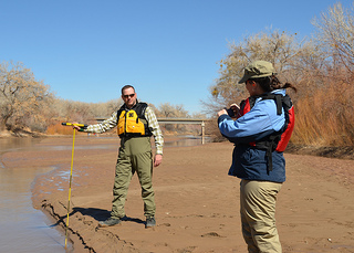
Wetland Determination, Delineation, and Permitting

Wetlands provide significant economic, social, and cultural benefits; they are also federally protected. Landpoint’s environmental and wetland staff has extensive training and experience to ensure that your project is not in violation of these precious resources. It is vital that any development project is assessed for any potential jurisdictional wetland impacts. Our staff is trained to recognize wetland criteria and advise our clients on the proper actions to avoid extensive delays, fines, and penalties that can occur when these guidelines are violated.

Spill Prevention, Control, and Countermeasure (SPCC Plan)

SPCC plans are required on all energy production locations, and are vital to the integrity of the environment. These documents include detailed information and procedures in the case of an accidental spill or leak. Landpoint has all resources that are required to complete these plans and implement them for our clients.

Commercial SWD & Class II SWD Well Permitting

The permitting and construction of a commercial saltwater disposal site is a tremendous and extremely timely procedure. Our staff has extensive experience in all aspects of this immense process. Landpoint has all resources to carry out the permit process including site selection, geology, environmental review, mapping, construction, and development of the facility. We ensure that these projects meet all state and federal requirements and are environmentally secure.

These are just some of the many environmental reviews and services offered by Landpoint. Contactour experienced team today to learn more about how environmental reviews can help your project from the planning stage to implementation!

Image By: USACE HQ

The Dangers of a Poor Property Line Survey

land surveyingWe all know the importance of having accurately mapped-out property lines, but do you know how this is actually accomplished and what some of the consequences are if it is not done correctly?

Determining an accurate boundary line is accomplished by considering many factors. First, a land surveyor will review the deed work and the legal description of the property and surrounding properties. This entails that all common boundaries are addressed. Then a field search is performed for existing monumentation. The land surveyor will use specialized GPS systems to measure exact angles and distances of these located monuments. This data is then compared with previous survey data by a professional land surveyor. After the boundary is resolved, the surveyor will set any new monuments that were destroyed or lost and mark all finalized monuments with stakes, flagging, or spray paint. Finally, any deliverables such as a survey plat will be provided to the client or corresponding companies.

When is a property line survey needed?

Professional land surveys may be needed to establish boundary lines when an individual or a business purchases a new property or refinances an existing one. Financial institutions need to know the precise acreage of land, and insurance companies must be aware of the proximity of hazards, like streams or creeks, to the property.

Boundary lines may also need to be established if an individual or business wishes to make changes on their land, such as erecting a fence or building service roads. It is important that whatever is built does not go onto a neighboring property because the property owner may face criminal trespassing charges or be told to destroy it, therefore losing their investment. A professional boundary survey can prevent this issue from becoming a problem.

Why do I need a property line survey? Why can’t I just use an approximation?

An approximation of a location stems from “hunches,” but a professional land survey is based on precise calculations that considers all legal requirements. Approximations may not be used in a court of law during disputes; only the professional opinion of a certified land surveyor may be admitted as evidence. Establishing the true property line protects your property value and rights and helps you plan better projects.

Choosing to invest in a property line survey is a great decision, but the company you choose is just as important. Contact a professional, reputable, skilled surveying firm, like Landpoint, to get the most accurate results and avoid any pitfalls when mapping out your property lines. If you would like to receive a free quote on your project, click here and provide the necessary information.

Image By: Johan G

The Benefits of a 3D Laser Scanning Survey

laser-scanningLaser scanning has undeniably revolutionized the field of land surveying. The latest laser scanning technologies enable us to help our clients plan and execute the most efficient projects, and they allow customers to analyze every component of any facility or site. These capabilities help us make better decisions during every step of the project – from the planning stages through completion.

The versatile technology can be applied to a variety of land surveying needs, including change detection, accident reconstruction, 3D drawing creation, pre-project scanning and more.

A 3D Laser Scanning Survey Produces Faster Results, Cuts Field Time

In the past, field surveys could take days or even weeks to complete. Using laser scanning technology, it’s possible for us to complete the same field surveys in just one single day. Laser scanning also enables us to complete fly-throughs, 3D models, detailed animations and maintenance materials in less time than ever before.

A 3D Laser Scanning Survey Reduces Overall Project Costs

The increased speed and accuracy of laser scanning means that our survey team has to complete fewer field visits to collect data. This reduces the overall cost of a project for you.

A 3D Laser Scanning Survey is Highly Accurate

Laser scanning technology produces the most accurate data available. This solid knowledge base helps us help you plan better projects.

A Laser Scanner Survey Is A Versatile Tool

We use laser scanning technologies in many aspects of land surveying. We rely on laser scanning for budgetary and timeline preparation, application implementation, historical preservation, reaching once-impossible areas, change detection, hazard surveying and accident reconstruction. We also use laser scanning to produce detailed topological maps, volumetric calculations, 2D drawings, 3D models and more.

Overall, laser scanning helps us better understand building conditions, and this enables us to make better decisions regarding your projects. To learn more about laser scanner surveying and how it has changed the field of land surveying, contact our team today.

Image By: USACE HQ

Land Surveying Techniques: How Construction Staking Helps Projects Run Smoothly

and survey service, land survey, land surveyingLand survey services provide vital support to construction projects, most importantly through construction staking. This crucial step can influence whether a project is completed on budget, on time and free from errors, and it is in the best interests of a developer or construction company to invest in land survey services to perform the staking. An experienced, knowledgeable land surveyor can use the data collected to assist with project planning to ensure an optimal outcome.

A Land Surveying Technique That Streamline the Construction Process

Land survey companies provide construction staking for many different projects, such as utilities, subdivisions, multi-story building sites, streets and more. A team of construction stakers lays out survey points that act as a guide for creating site improvements, and the process ensures that the project is being constructed according to the builder’s, engineer’s and architect’s plans. Good construction staking is essential to good buildings.

To complete construction staking, land surveyors complete topographic and boundary surveys and perform field staking for utilities, streets, gutters, curbs, parking lots and more. They then address the proposed buildings by staking the structures’ walls, foundations and column lines. This is an essential step in the construction process because building foundations that are not properly staked can be detrimental to the entire project and costly to fix. To avoid future problems, an experienced land survey service is the best tool a builder can have.

It is important to choose a professional land survey service for construction project support. If the staking process is not correctly completed, the consequences can be dire for the remainder of the project. The importance of a properly completed staking is even more magnified in commercial construction projects due to the larger budgets and structures.

Ensuring that a qualified professional from a reputable land survey service is conducting your staking survey is the most worthwhile investment you can make. Learn more about construction staking and other land surveying techniques by contacting Landpoint today.

Image By: survcentex

GIS Services for Environmental, Transportation and Civil Development Projects

gis mapping services, gis services, gis mappingGIS mapping services have transformed the way we perform land surveys and have allowed us to better serve a variety of industries. At Landpoint, we rely on the ESRI ArcGIS suite of core software to incorporate GIS data in every one of our projects. After creating a GIS database from tradition surveys and external datasets, we create online maps that can be accessed instantly and easily on any device by our clients, giving them the information they need to plan successful projects.

Advantages of GIS With Landpoint

Expert Analysis

One of the key advantages of GIS with Landpoint is the expert analysis that is provided. The data we collect through our GIS mapping services is carefully analyzed by our team of experts. We look for details that can make the difference between finishing your project on time and on budget or having headaches and hindrances throughout your project. This expert analysis helps our clients make the best decisions throughout the project planning process. This strategic decision making is only possible thanks to GIS mapping services.

The GIS information we provide to our clients in a variety of industries helps them plan the most accurate and cost effective projects. Gaining the insight provided by GIS mapping services upfront lets our clients make great decisions from the preliminary conceptual stages right through to project completion.

A Variety of GIS Mapping Services Offered

Another one of the advantages of GIS with Landpoint is the breath of experience that is brought to every project. Landpoint uses GIS mapping services in every industry – environmental, civil development, oil and gas, industrial, commercial and residential. Some of the many GIS mapping services we offer include ArcGIS server and image server applications, geodatabase design and management, infrastructure management, custom application development, land use and zoning applications, 3D visualization, marketing and demographics research, cartographic services, mobile GIS solutions, site suitability modeling, web-based services, base mapping, real estate and business mapping, statistical analysis, utility management and more.

To learn more about how Landpoint uses GIS mapping services to improve project planning and outcomes, contact us today!

Image By: rbitting

Oil and Gas Surveying: What You Should Know

pipeline land surveying (1)Accurate mapping is crucial to the success of all oil and gas projects. Landpoint provides the most accurate and detailed maps possible by utilizing sophisticated GIS technology.These maps and tools help land departments plan their oil and gas development projects better, organize data, and build infrastructure.

GIS Mapping for Land Departments in Oil and Gas Projects

When a land department contacts Landpoint to assist in the development of infrastructure projects, our team leverages GIS mapping technologies to produce highly accurate and detailed maps. While traditional land surveying firms only produce a simple PDF plat, Landpoint’s GIS technologies produce maps and visualizations that make it easy to analyze and assess different map types and data sets while still providing the same deliverables that agents are accustomed to receiving. The large amount of data collected by survey crews on the ground is seamlessly transferred to GIS databases in our private cloud, making the information accessible to authorized parties at any time from any device. All you need to access the maps and data is a device with an Internet connecting, such as a tablet or smartphone. This accessibility coupled with the high level of detail provided by GIS technologies makes for faster, more efficient and more effective project planning and execution. Check out this demo that shows the data we manage, including well locations, ownership, pipeline centerlines and pipeline right of ways.

Why Turn to Landpoint for Oil and Gas Surveying

Landpoint’s knowledgeable oil and gas team stays committed to the customer and the project. The initial survey is only the first step in the process, and the customized services such as GIS consist of tools that provide significant value to infrastructure projects.

Unlike 97% other oil and gas surveying companies that employ less than 24 personnel, Landpoint is made up of over 200 highly trained and experienced experts. This large professional team enables us to mobilize quickly and complete projects faster. Our team has over 20 years of experience in the oil and gas industry, and we work closely with land departments to plan projects of any size.

Image by – Simon_Nathan

GIS Mapping Services: Taking Land Surveying Projects to the Next Level

land surveying companies
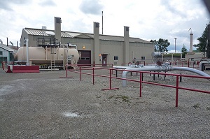
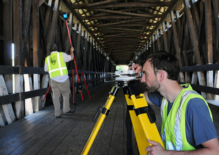
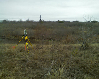
Many large projects rely on detailed, accurate maps. Landpoint understands the intricacies of creating accurate technical maps, and we leverage GIS technology to ensure the highest level of accuracy with the most complete sets of data. Read on to learn why GIS is one of the most important land surveying methods available to construction managers.

GIS Mapping for both Accuracy and Efficiency

Landpoint utilizes GIS mapping to capture, store, analyze and manage data with a spatial reference. This technology enables customers to better understand and analyze the data our field teams collect in a precise and efficient manner. The result is a faster turnaround time and more detailed project tracking planning for our clients.

The data and maps we create with GIS mapping give our clients extensive levels of information that help manage projects at any stage. GIS mapping gives data analysis new dimensions by providing visual representation to even the most extensive sets of data, and this helps our clients make better, more informed decisions that allow them to come to the best outcomes for their project.

More Benefits of GIS Mapping with Landpoint
  • Our GIS data and tools exist in the cloud. This means you can review your maps and survey results anywhere, including on your PC, tablet or phone.
  • GIS dataset sizes are unlimited. You can populate as much data as needed.
  • Our team has extensive experience in creating and managing GIS solutions for nearly any industry.

We use GIS technology to fill a variety of needs, including site suitability modeling, infrastructure management, utility management, 3D visualization, geospatial data acquisition and creation, site selection and prioritization, cartographic services, real estate and business mapping, base mapping and more.

To learn more about our land surveying methods and how we use GIS mapping in the oil and gas development industry, check out this demo. It shows the data we manage, including well locations, ownership, pipeline centerlines and pipeline right of ways.

Image by – Jesse Varner

Land Surveying Services for Every Need

land surveying servicesLand surveying services provide the market’s most accurate maps by using advanced techniques and the most cutting-edge equipment. These maps and the data they include are used to plan efficient solutions to a wide variety of projects.

Environmental Land Surveying Services

Highly-trained and experienced land surveyors create innovative solutions and gain ecological approvals through wildlife studies, developing wetland strategies, conducting overall environmental reviews or environmental impact assessments and creating sustainable storm water management solutions and creative mitigation strategies.

Land Surveying Services for Civil Development

Landpoint provides support for services like feasibility studies, irrigation design, traffic studies, tree inventory, environmental preservation plans, theme development, construction management, cost estimates, site selection, site inventory, code review and urban design, our land surveying services creates effective solutions for civil development projects that maximize clients’ investments.

Land Surveying Services for Oil and Gas Development

The accurate data collected by land surveyors supports complex projects in the oil and gas industry. We offer siting and permitting support, including aerial mapping, regulatory analysis and site reconnaissance, design support, including 3D laser scanning, GIS, and construction support, such as staking, restoration mediation and detailed as-built surveys. Revise sentence structure.

Residential Land Surveying Services

Our residential land surveying services take an integrated approach to residential development that includes land evaluation services, such as topographical surveys, renewable energy assessments and boundary surveys, land use entitlement services, design planning and construction services, including lot surveys and construction coordination.

Land Surveying Services for Commercial Development

Our team streamlines land-use entitlements while creating eco-sensitive solutions through site constraint analysis, renewable energy investments, field surveys, due diligence investigations, project management, traffic analysis and more.

Land Surveying Services for Transportation

We work with civil engineering firms to help create more effective transportation systems through traffic impact studies, traffic data collection, parking system analysis, transportation planning studies, and 3D scanning technology that enables us to better understand the impact of traffic operations.

Image By – dan

GIS Consulting Services for Intelligent Transportation Systems

GIS mapping, GIS consulting GIS consulting services provide critical assistance for planning, maintaining, evaluating and managing the infrastructure of transportation systems around the globe. Intelligent transportation systems are based on the results of GIS consulting, enabling decision makers to prioritize their work and make the best choices. With GIS mapping technology, you can build rich, dynamic and detailed mapping applications that will guide your project from start to finish.

How GIS Consulting Services Help At Every Stage of Development

Transportation planning projects stem from a lifecycle that starts with the planning stage and includes design, environmental management, asset and maintenance management, construction, operations, safety, security management and more. GIS mapping is an essential element of each step in this process, producing tools like as-built drawings, multi-layered data maps and more. The performance of a transportation system and the productivity of employees both increase when these GIS tools are utilized.

During the initial planning stage, GIS mapping helps transportation pros analyze their projects in regard to a variety of factors, including environmental, land-use and energy consumption factors. GIS mapping brings all these factors together in one easy-to-use medium.

GIS consulting during the design stage benefits engineers by producing detailed imagery, elevation models and critical environmental information. Design and financial software can easily be integrated into a GIS, making construction cost estimations simpler.

One of the most important applications of GIS mapping during the planning of transportation systems is environmental management. Through GIS maps, project planners can better understand environmental issues, determine eco-friendly solutions and identify the impact of their decisions on the environment. Growth issues are addressed through integrated information regarding land-use, employment density, housing and other factors. This information helps planners make better decisions regarding environmentally-sensitive matters.  Having a detailed design plan displayed within GIS allows the engineers and planners see the effect every option will have on the land and economy surrounding the project before even breaking ground.

These are just a few of the ways Landpoint’s GIS consulting services and GIS mapping services can improve your transportation projects. Learn more about how GIS mapping can help you through every stage of the process by contacting us today!

Image By –  edibleoffice