Ways to Improve Pipeline Route Selection in the Permian Basin
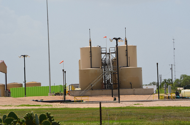
 The recent boom in oil production in the Permian Basin has created a bottleneck situation,where the pipelines that are currently in place are not capable of moving crude to refinery locations fast enough to keep pace with the level of production. While the rate of production has increased significantly over the last couple of years, the infrastructure in place to move that oil has not increased at a similar rate, creating a situation where refiners have to pay an additional premium to acquire crude. This is especially costly with volatile oil prices.
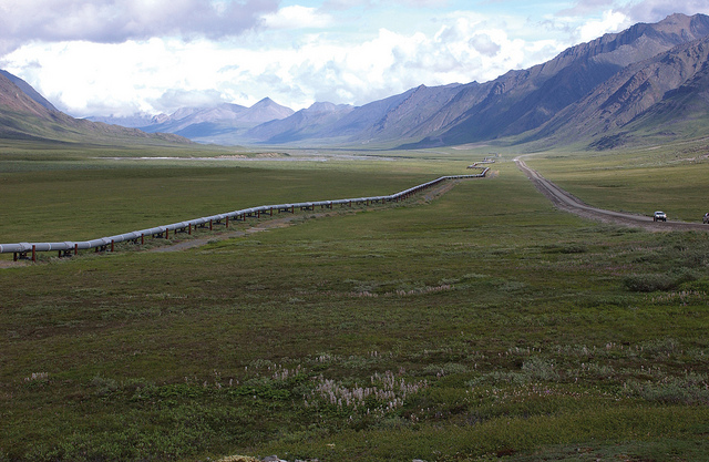
Clearly, there is a need for more pipelines to service the region; the issue is that the pipeline infrastructure in the Permian Basin is already quite significant, in spite of the fact that it can’t keep up with the current level of demand. This fact means that pipeline right of ways in the region are already very congested, making it a real challenge to find efficient routes to lay new pipelines. An experienced land surveying company can help oil and gas companies overcome the challenges that are currently facing them in the Permian Basin by finding an efficient route that does not overlap with existing routings.
4 Ways Land Surveyors Can Help With Pipeline Route Selection In the Permian Basin
1. Identifying the Most Efficient Routing Possible For the Pipeline
It the past, developing pipeline routings depended on topographical maps. These maps were frequently incorrect and offered very little detail, but were usually good enough to get the job done.
Now, in an era where the Permian Basin is already crowded with pipelines, “good enough” no longer gets the job done. Luckily, land surveyors have developed new technologies to help overcome the current challenges facing oil and gas companies. With GIS mapping tools, land surveyors can help their oil and gas clients get a more detailed pipeline route survey than a traditional topographical map could ever offer, allowing them to identify potential issues such as terrain change and chasms.
2. Increasing Accuracy and Completeness of Information
Simply put, if you’re considering a pipeline routing project in the Permian Basin, you can’t afford to enter the game with anything less than the most complete, accurate information possible. Anything you don’t know coming into the project could come back to haunt you later on in the form of higher costs and unexpected delays.
A land surveyor can provide you with all of the studies and analyses needed to make sure your pipeline project progresses according to plan.
3. Performing Environmental and Cost Analyses
Knowing how much a pipeline will cost to build depends on a wide variety of variables, and failing to account for any one of these variables could result in unpleasant surprises down the line.
A land surveyor can help oil and gas companies account for all costs involved with a pipeline routing, and suggest alternate routes that may be more efficient uses of resources. They can also help identify environmental hazards that might lead to higher-than-expected costs.
4. Identifying Potential Legal Issues with a Proposed Routing
When it comes to a pipeline route survey, what you don’t know definitely can hurt you. A land surveyor can help oil and gas companies research legal issues such as land status, right of ways, and easements.
As a result, the company can gather all of the information they would need to feel confident about moving forward with a proposed routing, knowing that they don’t have to worry about legal challenges in the future. This is a particularly beneficial service in a very crowded region such as the Permian Basin.
To learn how Landpoint can help with your Permian Basin pipeline development project, get a free land surveying quote today.
Image Source : U.S. Geological Survey