Posts

How Using Drones For Surveying Actually Improves Data Accuracy

land surveying technologyLike any other business, the oil and gas industry is constantly benefiting from new technological developments that can revolutionize the way operations are conducted. A recent example of a new development that could lead to big things for the industry can be found in the field of land surveying technology.

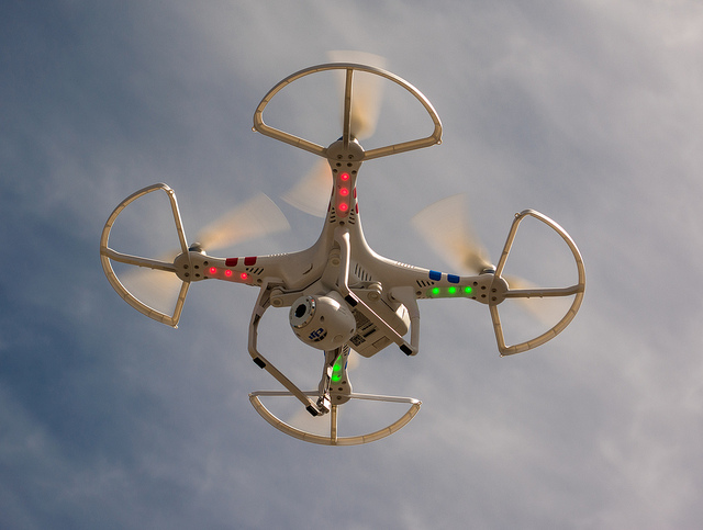
New unmanned aerial vehicles (UAVs), also known as drones, could go on to provide the ability for oil and gas companies to gain a much more detailed and accurate look at the land they will be using for their projects. Although this new land surveying technology is still being adopted, the possibilities offered by using drones for surveying promise that they warrant a closer look.

Benefits of UAVs Over Traditional Land Surveying Techniques

Drones used for land surveying offer many different advantages over traditional land surveying techniques, which require surveyors to go from place to place to conduct their work. Since this kind of old-fashioned survey work often has to take place in dangerous or difficult terrain, using UAVs instead can lead to land surveys that are much quicker and much less likely to put workers in harm’s way.

However, the most exciting advantage offered by using drones for surveying may perhaps be the increased accuracy it offers. Over recent years, developments in high-resolution camera technology, along with greater battery life and increased levels of control for the UAVs themselves, has finally made it practical to use UAVs to conduct high-resolution photography work from above.

Unlike earthbound land surveyors, these UAVs are able to conduct their work without interference from the land around them, meaning that they can get as close to the terrain as needed in order to get the images required for the project. They are also less likely to have to worry about time constraints, as they can stay in an area conducting a survey for as long as the battery life of the device allows.

As a result, UAVs are able to create highly accurate land surveys that are capable of meeting the needs of all oil and gas projects.

Why UAVs Offer Better Results When Used With LiDAR

Light Detection and Ranging (LiDAR) technology has become the latest word in terrain scanning over the last couple of years. With LiDAR, land surveyors use thousands of tiny sensors that bounce light points off the terrain, and then collect the result of the sensors into a data cloud that forms an extremely detailed and accurate representation of the land in question.

Pairing this new land surveying technology with an aerial vehicle is perhaps one of the best ways to maximize the quality of the results. However, up until now, the majority of the LiDAR work done from the air has been performed by manned aerial vehicles, which are unable to provide the quality of results that UAVs can. For one thing, manned vehicles have to conduct LiDAR from much higher in the air, which increases the likelihood that atmospheric conditions will interfere with the results of the scan.

On the other hand, drones used for land surveying are able to get as close to land as needed to conduct high-quality, accurate LiDAR scans, and as a result, are able to avoid any issues related to atmospheric interference.

While there are still several hurdles that need to be cleared before UAVs can find widespread use in land surveying applications, the potential for better, more accurate surveying already provides a lot to get excited about. As this land surveying technology continues to develop and grow more sophisticated, the possibilities will only continue to grow with it.

To learn more about using drones for surveying, request a free land surveying quote today.

Image Source : Adam Meek

Why Big Data is Critical to the Growth of the Oil and Gas Industry

land surveying technologiesBig data is changing many industries across the world, and oil and gas is no exception. Big data refers to data that is entering business systems at a much higher volume and velocity than ever before. This data is created by a constantly growing network of interconnected systems and devices, creating a new opportunity for businesses to capitalize on the insights around them.

However, while big data presents an opportunity for businesses, it also presents a challenge: organizations that continue to rely on old-fashioned ways of storing, securing and analyzing data will quickly find themselves overwhelmed by the amount of information coming into their business systems. In order to prepare themselves to capitalize on big data, oil and gas organizations need to make sure they have the right tools in place to handle the exponentially growing volume of data and that their company culture is optimally configured to pursue the benefits of big data.

When handled appropriately, big data can offer oil and gas companies three major benefits:

  • The ability to process highly detailed land surveys, like those created using GIS mapping
  • The ability to make exploration and production decisions quickly, and with a higher degree of confidence
  • The ability to build the best and most engaged workforce possible
Process Highly Detailed Land Surveys

When it comes to land surveying, the current state of the industry is clear: there is no more easy oil out there to be found. This means that companies that continue to rely on low-detail land surveying technologies—the kind of technology that may have worked just fine when oil reserves were greater—will soon find these technologies to be time-consuming, inefficient, and unprofitable.

Luckily, there are new land surveying technologies out there that can provide the level of detail needed to run a profitable oil and gas operation in the current energy environment. However, these new technologies, such as GIS mapping, are just as data-intensive as they are detail-intensive. Organizations will need to be ready to handle large volumes of data if they’re going to make the most of these new surveying technologies.

Make Exploration and Production Decisions Quickly and Confidently

Oil and gas companies today have to deal with two competing priorities when it comes to making exploration and production decisions. Making the wrong decision can cost a company time and resources, eating away at profit margins. At the same time, decisions have to made in a timely manner if the company is going to succeed and grow.

With big data, it’s possible for companies to balance both of these priorities. The level of data that’s available in the oil and gas industry today means that it’s no longer necessary to rely on guesswork and intuition. By processing big data and analyzing it to extract the useful business insights, a company can make the right move quickly, while also feeling confident about the decision they’ve made.

Hire the Best and Most Engaged Workforce

The benefits of big data don’t stop in the field; oil and gas organizations can use big data to maximize success in the office as well. By analyzing data patterns to identify skill gaps, adjust recruitment priorities, and make the best, most informed hiring decisions possible, human resources organizations can dramatically reduce the amount of costly bad hires they make.

In addition, once the hires have been made, HR can use big data to make sure that employees are feeling engaged in their work, while also identifying opportunities for greater engagement.

Image Source : supakitmod

Why Scalability is Key to Oil & Gas Surveying

land surveying projectsScalability is the ability to quickly adjust to changing conditions as they occur. Projects need to continue even when new information changes the nature of the operation and demands an increase in scope. When it comes to oil and gas projects, land surveyors must meet deadlines, manage change, and ensure the end result meets company needs and regulatory standards.

As oil and gas industry operations expand, land surveying scalability becomes a major challenge. Many surveying companies are small and unable to scale, while others may not be able to scale quickly enough to accommodate oil and gas companies’ needs. As a result, companies may experience much longer turnaround times. “Time is money,” and increased survey turnaround is inefficient and costly.

It is extremely beneficial when land surveying firms can efficiently and effectively provide accurate oil and gas field data to aid engineers in decision making and problem resolution. Land surveyors may be required to change course quickly. Regardless of conditions and obstacles, oil and gas surveying projects must meet deadlines and milestones. To do so, they need the team and the technology to be able to easily handle project changes as well as the ability to properly manage resources once they are in place.

Land Surveying Projects & Scalable Technologies

Most oil and gas surveying projects are multi-phased, from field data collection, to surveyors review, to client deliverable distribution. Oil and gas surveys tend to become more complex as the project progresses. An original survey may turn into re-rotes, moves, and overall scope increases, requiring more resources and in many cases additional skill sets. The survey firm should have the capacity and resources to be able to add additional crews and equipment as needed.

Having access to some of the latest surveying technologies enhances scalability. For example, the best GIS uses significantly more data and keeps all of the information in the cloud. Data is made available through smartphones and tablets, enhancing communication between teams and keeping everyone in the loop. When information is kept in a central location and made easily available to those in the field, it means that no matter how many new teams are added, everyone will still be on the same page.

Some important methods, programs, and project management features indicating a surveying company is focused on continued scalability are:

  • Advanced GNSS
  • 3D scanning applications
  • Mobility / mobile devices
  • A real-time, in-house project management system
  • Knowledge of oil and gas companies’ multiple land leases and operations
  • A large pool of readily-available on-call survey teams
  • A reputation for updating and incorporating the latest technologies
  • Professionals that are knowledgeable of the most current land survey technologies

The Benefits of Scalable Oil and Gas Surveying

Ultimately, partnering with a firm that can easily scale helps your oil and gas project with three critical elements:

  1. Speed – By being able to add additional resources as soon as they are needed, a scalable land surveying company can vastly reduce the time needed to complete a project.
  2. Accuracy – A land surveying company needs to have a broad skill set and experience in a number of different oil and gas surveying related disciplines in order to take on the additional tasks that may come up in a project. If they do not have these things, they may attempt to take on tasks with mixed results.
  3. Efficiency – The more a project expands and changes, the more necessary it is that the surveying company be able to communicate with other teams and share information.

It is better for an oil and gas company to pick a land surveying company that can scale right from the start, instead of having to change midway when it becomes clear that the current surveying company cant. For more information, take a look at our oil and gas brochure.