Why Distance is No Longer a Challenge For Pipeline Surveys
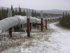
pipeline development, pipeline surveyingIn the pipeline development process, collecting the data for large areas of land has always been one of the most difficult and time consuming aspects of the entire project. This is particularly true when it comes to remote areas that are difficult to reach. In the past, oil and gas companies would have to rely on land surveyors to travel to these locations over difficult terrain for preliminary data collection. This process could be very time-consuming, as the pipeline development project could not begin until the surveyors had the chance to travel all the way out to the terrain in question, complete their data gathering, and then travel back with their data.

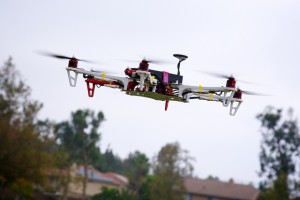
Fortunately, new pipeline surveying technologies have made it so that building pipelines through difficult terrain and hard-to-reach areas no longer has to be an impediment to completing projects on time. In this post, we’ll review how unmanned aerial vehicles (UAVs), also known as drones, can help significantly speed up your pipeline development project, especially for projects that cover large distances.

Faster Pipeline Surveys

What makes UAVs so beneficial to the pipeline surveying process is the fact that they can travel quickly over long distances, bringing remote locations closer to you. They also have the ability to relay images back to land surveyors on the ground, which allows the land surveyors to begin working immediately, rather than having to wait until they return from the field. Working with a professional land surveying firm that offers aerial data collection services, you’ll be able to enjoy turnaround of ready-to-use survey documents in as little as 24 hours, regardless of the distances involved or the difficulty of the terrain. This makes aerial data collection through UAVs a much less time-consuming process than conducting pipeline surveys through traditional methods.

The surveying images provided by UAVs are taken using the latest in high-resolution cameras, offering a level of detail of one centimeter per pixel. Using these extremely accurate images and point cloud data helps land surveyors create the kind of detailed pipeline survey documents that today’s pipeline development projects require.

Safer Pipeline Surveys

In addition to making it quicker and easier to conduct land surveys in remote, hard-to-reach locations, UAVs are also beneficial because they remove the need for the land surveyors to enter dangerous areas of the field themselves. This makes the whole process of gathering land data significantly safer, especially when difficult terrain is involved. Aside from the obvious human costs that occur whenever a land surveyor is seriously injured, safety should also be a concern because of the financial costs and the delays that these accidents can bring about.

In the past, aerial data collection was often performed using manned aerial vehicles. While these vehicles can offer some of the benefits offered by UAVs, it’s important to remember that putting someone in an airplane still puts them at risk, particularly when they have to fly over remote locations and difficult terrain to gather needed data. In the end, the only truly safe way of gathering data for land surveying projects is by keeping surveyors out of the field altogether, allowing them to work from the comfort and safety of an office setting. UAVs provide this ability, making them among the safest technologies for gathering land data.

In order to gain all of the benefits of UAVs discussed here, you need to make sure that you work with a professional land surveying firm that has the knowledge and expertise to help you put UAVs to work on your pipeline development project. To learn more about how we can help with your project, view an example of our recent surveying work. Or, to get started with using UAVs to support your land surveying efforts, contact Landpoint today.

Image Source: Ryan McFarland

Unmanned Aerial Vehicle

How Surveyors Can Get Data from Those “Hard to Reach” Locations

Aerial Data CollectionIn the past, rough terrain was one of the biggest obstacles for oil and gas companies that needed an area surveyed. This issue would come up frequently, as pipelines often covered long distances and crossed over remote and difficult terrain. Because of this, waiting for land surveyors to gather data for the entire proposed pipeline route was often one of the most time-consuming and frustrating aspects of the entire project.

Fortunately, things have changed in recent years: new technologies have been developed that allow land surveys to be completed quickly, even when the survey involves gathering data from locations that are difficult to reach. In addition to speeding up pipeline development projects significantly, these new technologies can also save money for oil and companies by cutting down on the total number of hours that land surveyors need to work, and also contribute to a safer pipeline development project, by removing the need for land surveyors to put themselves in harm’s way by crossing difficult terrain.

As is the case with most new technologies, the land surveying technologies in question are only beneficial to those who take the time to learn what they’re all about and how they’re used. In this post, we’ll cover a couple of the land surveying technologies that are completely revolutionizing pipeline development, and help you get a jump start on making the most of them.

Unmanned Aerial Vehicles (UAVs)

Unmanned aerial vehicles, also known as drones, can offer a number of clear benefits when it comes to collecting land surveying data in difficult terrain. These UAVs are able to fly over difficult terrain and cover large distances faster than earthbound land surveyors ever could.

While the idea of using aerial data collection to speed up the land surveying process is certainly not a new one, UAVs represent a completely new take on the concept. Manned airplanes aren’t able to get as close to the ground as UAVs can, and are also unable to move with the level of pinpoint accuracy and control that UAVs can. Of course, there’s also the fact that putting land surveyors in airplanes can be just as dangerous as asking them to cover difficult terrain on land. The only land surveying method that can promise complete safety is the one that doesn’t require the land surveyors to enter the field in the first place.

In addition, today’s high-definition cameras have developed to the point where using them on UAVs is practical. As a result, UAVs are able to quickly relay extremely detailed and accurate images back to surveyors in an office setting, where they can begin to use those images to complete their work.

Laser Scanning (LiDAR)

Laser scanning technology, also known as LiDAR, can be used to support terrestrial or aerial data collection by creating extremely detailed scans of the terrain as it actually exists. By using LiDAR, fewer on-the-ground scans are needed, resulting in less time spend trying to traverse difficult terrain.

LiDAR works by setting up a scanner that bounces thousands of laser points off of a particular building or terrain. The scanner then measures the flight path of those laser points as they return, and combines those points into a data cloud that can used to create a detailed representation of the thing that’s being scanned. This technology can be used to create scans that are accurate to within four millimeters, a level of accuracy that traditional land surveying technologies simply can’t match.

At Landpoint, we have a team of experienced professional land surveyors that can help you put these new technologies to work on your pipeline development project. Look over some examples of our recent pipeline development projects to learn more, or contact us today to get started.

Image Source: Richard Unten

Expanding an Oil and Gas Facility? Consider 3D Laser Scanning Services

3D PrintIf your organization is considering making an update or addition to an existing oil and gas facility, there are no shortage of issues you must account for. You must be able to design your addition so that it can quickly and easily integrate with the existing facility. This is the only way to ensure that the facility won’t have to go offline for longer than necessary during the construction process and will be up and running at its full potential as soon as possible after the addition.

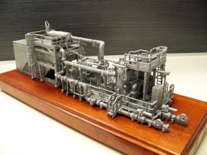
Unfortunately, the addition of new elements requires you to have exact measurements of the existing facility. This is where using the latest land surveying technologies can be beneficial. By using employing 3D laser scanning services to create exact models of your existing facility before you begin working on the addition, you’ll be able to take exact measurements, allowing you to determine things like pipe configurations in advance. In turn, this will ensure that your oil and gas facility addition project will proceed according to schedule.

In this post, we’ll talk a little bit about how 3D laser scanning services work, go over some of the specific benefits it can offer your project, and describe how you can get started making the most of this technology.

3D Laser Scanning: A Brief Overview

3D laser scanning works by setting up a series of scanners around the facility that is to be scanned. These scanners will then user a laser, then track the flight path of those lasers as they bounce back off the surface of the facility. By combining data about the flight paths of these many different laser points into a single data cloud, the 3D laser scan provides very detailed information that can be used to create extremely realistic and accurate 3D models of the facility in question.

By conducting a 3D laser scan of a facility before the project enters the design phase, organizations will start with a baseline of their current facility, making it quick and easy to design a plan for the new elements that are to be added on to the facility during the construction phase. Since these new pieces can be configured early on in the process, instead of an organization having to wait until later in the design process to configure the components on site, 3D laser scanning can lead to a greatly expedited timeframe for an expansion or upgrade project.

3D Laser Scanning Services Can Help Save Time and Money

The actual on-site scanning of an oil and gas facility can be completed in as fast as a single day, while finished deliverables can often be turned around in less than a week. This makes 3D laser scanning a much faster alternative for gathering information about a facility than traditional scanning methods. In addition, since 3D laser scanning helps provide detailed information about a facility, including exact measurements and potential areas for concern, it contributes to a project that is quicker and more efficient overall. Finally, since 3D laser scanning can help engineers and designers spend less time on measuring and gathering information and more time on actually executing the project, it also helps to cut down on the total costs of the project.

In order to pursue the many benefits of 3D laser scanning for oil and gas facilities projects, it’s important that you work with a trusted, experienced partner that can help you make the most of the technology. This is where Landpoint can help. Review some examples of our recent projects to get a better idea for what we can do with 3D laser scanning, or contact us today to get started.