How 3D Laser Scanning Services Can Support Multiple Stages of Development

3D laser scanning servicesMore and more businesses are starting to realize the potential benefits offered by 3D laser scanning services. However, many of them fail to recognize just how helpful 3D scanning can be throughout the lifespan of a project. 3D scanning is so inherently valuable because it can provide key visibility at all three main phases of the project: the pre-design phase, the design phase, and the construction phase. Gaining a greater understanding of what role a 3D laser scanning survey plays in each of these three phases is key to understanding just how much of a competitive advantage this technology can provide.

Pre-Design Phase

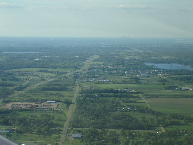
In the pre-design phase, getting an accurate picture of the terrain and existing structures that are on-site is vital. With this visibility to guide you, you can make better decisions about the best way to move forward with your project. You can also feel confident that your decisions are based on real insights, and not on guesswork or outdated aerial photography.

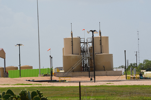
A 3D laser scanning survey at the pre-design phase is particularly helpful for things like oil and gas facility location surveys and terrain surveys. In both of these examples, 3D laser scanning is both the fastest and most accurate way to get a complete look at the area that is to be developed, providing the right level of understanding to get your project off to a good start. As a result, your project will be better positioned to proceed according to plan, with no delays and no budget overages.

Design Phase

Once you have gained an accurate understanding of the site that is going to be developed, the next logical step is to consider how the development will fit together with the terrain around it. Fortunately, 3D laser scanning can help with this as well, by supporting 3D modeling.

3D modeling gives you greater visibility into how your development will look, in relation to the terrain and any enduring structures around it. This will also help you create the optimum design and identify any potential issues before they get a chance to wreak havoc on your project once the construction process actually begins.

A good example of a design processes where laser scanning surveying can be helpful is with field map preparation for oil and gas facilities. By creating 3D models before you begin construction, you can be more prepared and get started on construction sooner.

Construction Phase

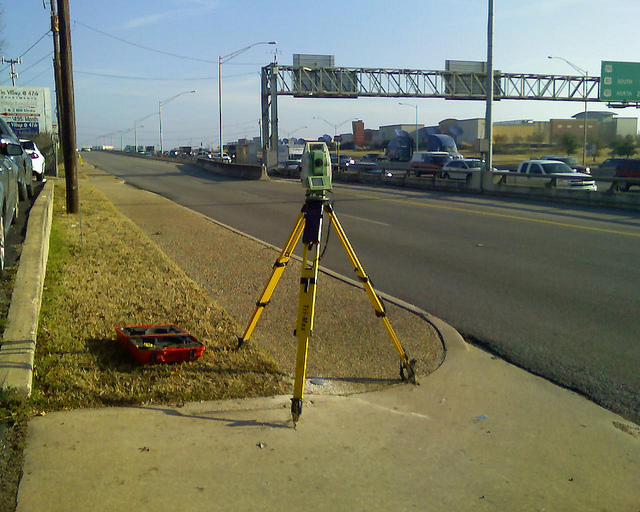
Finally, once it’s time to actually begin the construction process, laser scanning surveying is there to help once again. By allowing you to quickly create as-built surveys, 3D laser scanning gives you greater visibility into how the project is improving the site around it.

Being able to turn these as-built surveys around as quickly as possible is a tremendous benefit for your project, as it insures that the construction process won’t grind to a halt while you are stuck waiting for the surveys to come in. Since 3D laser scanning represents one of the quickest methods of creating as-built surveys, it can be a tremendous value-add to the construction process.

In addition, laser scanning surveying can also help you to identify potentially unsafe environments. Safety should be a top concern for any construction project, and scanning can help project managers be more aware of potential safety issues before they can get in the way of a safe, orderly construction project.

To learn more about how Landpoint 3D laser scanning services can help your business gain visibility and drive value throughout the different phases of your project, contact us today.

Image Source : survcentex

Construction Site Safety: Surveying in Unsafe Environments

land surveying company safetyWorker safety should be the number one focus for all construction project managers. However, since construction work consistently rates among the most dangerous forms of employment in countries across the globe, it is clear that there’s still a lot more that needs to be done to address safety issues on the job site.

How a Land Surveying Company Addresses Construction Site Safety

Part of preparing for construction safety means getting an accurate understanding of what hazards are expected, so you can prepare for and mitigate them as much as possible. From a land surveying perspective, that means knowing where unstable work surfaces might be putting your workers at risk. Using traditional technology, acquiring a survey on a potentially unsafe terrain would require the surveyor to traverse through the rugged landscape in order to gather information. In addition to being extremely time consuming, this process also puts the surveyors themselves at risk.

In many cases, construction site safety can take a back seat when project managers are concerned that the construction project may not be progressing according to schedule. The process for issuing surveys is time consuming, and can lead to forced down time on the job site, which is something that every project manager wants to avoid.

As a result, many project managers are content to proceed with their projects without waiting for the land surveys to be returned. While this may seem like a time-saving measure, it’s actually quite shortsighted, as injuries on the job site caused by lack of terrain visibility can be just as much of a time waster as waiting for land surveys.

Project managers need a solution that will allow them to balance the seemingly contradictory goals of ensuring project safety and avoiding unnecessary delays. With 3D laser scanning technology, there is no reason that project managers can’t achieve both of these important goals.

3D Laser Scanning Helps Balance Speed and Safety

3D laser scanning contributes to increased safety on the job site, as it removes the need for land surveyors to place themselves in harm’s way to complete their surveys. Since the surveyors no longer have to risk going from place to place to manually collect the information, 3D laser scanning can also help avoid project delays, as land surveyors will now be able to turn around their finished work much faster

By making quick and safe land surveys an integrated part of the organization’s construction process, 3D laser scanning can help project managers balance the competing goals of project speed and project safety in a manner that works best for everyone involved.

Aerial Mapping

3D laser scanning technology can also be supported through the use of aerial mapping. Using either fixed-wing aircraft, helicopters, or unmanned aerial vehicles, land surveyors can get the visibility they need to complete terrain maps without having to set foot on dangerous terrain themselves.

When used together with 3D laser scanning, aerial mapping allows construction project managers to get the visibility they need to understand and plan for risk in the construction project, without having to wait for the land surveys to be completed. Together, these technologies are making it so that project managers no longer have to choose between speed and safety.

To learn more about aerial mapping and 3D laser scanning services from Landpoint, and how they can help improve construction site safety, contact us today.

Image Source : Michael Gil

How New Technology Equals Better Engineering Support

professional land surveyorToday’s civil and construction engineers need access to the right information at the right time in order to support fast, accurate and efficient work. In order to get the visibility they need, engineers depend on engineering support services like land surveying.

In the past, land surveying was a time-consuming process that could seriously delay an engineer’s work. However, there are new technologies in use today that enable engineers to get the visibility and information they need quickly, by significantly speeding up the land surveying process.

Read on to learn more about some of these surveying technologies and to find out how you can put them to work for your organization.

Laser Scanner Surveying

High definition scanning is an innovative technology that allows land surveyors to create detailed representations of a terrain and structures without having to individually visit each point of interest on the job site. Laser scanner surveying helps engineers do their jobs better by providing a more detailed deliverable, and doing it much quicker than a traditional land survey. With terrestrial laser scanning, a process that once took months can now be completed in a matter of a few days, making sure that engineers never have to wait to get the information they need.

High definition scanning, also referred to as LiDAR, works by bouncing laser beams off the terrain and recording a point everywhere the laser hits a surface. Once the area has been scanned, the result is a “point cloud” made up of millions of different points. These millions of points represent a level of detail that engineers could never dream of seeing in the past.

3D Modeling

Once a professional land surveyor has collected data using high definition scanning, they can use those data points to create a survey-grade 3D model of the area. Using this extremely detailed model, engineers are able to get an up-close look at the terrain, without having to waste time by traveling the location themselves.

3D modeling from the point cloud gives engineers a more detailed and accurate look at the terrain and structures they’re going to be working on, and does so in a fraction of the time required to complete a traditional land survey. Also, these models can be used to help inform the survey documents that will drive the entire project forward, ensuring that engineers and all other key stakeholders will always have the information they need right at their fingertips. It’s really no wonder that so many engineers are excited about the possibilities of using 3D modeling as an engineering support tool.

Aerial Mapping

Finally, today’s engineers no longer have to be limited to terrain visibility that is captured from ground level. Using either fixed-wing aircraft, helicopters, or UAV’s, a professional land surveyor has the ability to conduct aerial mapping. This technique can work using a variety of different scanning methods, including the high definition laser scanning described above.

Unlike aerial photography, which merely provides a visual of what the terrain looks like from above, aerial mapping can give engineers a detailed 3D rendering of the terrain, displaying every crack and hole in astonishing detail. Since aircraft have a far greater range of visibility when operating from above than land surveyors do when operating from ground level, aerial mapping can allow quick and efficient scanning of a large area, making it the perfect technology to use on very large engineering projects.

To learn more about new technologies that help engineers work quicker and more effectively,contact Landpoint today.

Image Source : Laura

Landpoint Named As One of the Fastest Growing Land Surveying Companies

inc5000smBossier City, LA – For the third year in a row, Landpoint has been named to the Inc. 5000 list of America’s fastest growing privately-held companies. At number 769 and with more than 590% growth, the company has outpaced other land surveying companies across the nation.

Landpoint is one of Louisiana’s 49 privately held companies to make the list, coming in at number 9 in the state this year. The company has also been listed as the number 5 top engineering firm in the nation. By adding over 150 jobs in three years, Landpoint has demonstrated consistent organic growth.

“We are very excited to be included for a third year on Inc’s list of the fastest growing American companies,” said Chad Souter, Vice President of Landpoint. “While we are thrilled to have cracked the top 1,000 companies, we continue to see substantial growth opportunities for our company in the coming years with what we have built,” Souter added. “Our employees take pride in their ability to provide an exceptional service, and they are incredibly deserving of this recognition.”

The Inc. 5000 ranks businesses in a variety of sectors – from engineering and health care, to communications and finance. In these rankings, company revenue and growth are just two of the considerations.

In addition to being listed in the Inc. 5000, Landpoint was also ranked the number three fastest growing engineering services firm by ZweigWhite and was awarded Deal of The Year by the Association for Corporate Growth upon completion of two acquisitions in 2013 and the creation of a platform for future acquisitions.

About Landpoint

Landpoint is an award winning firm that performs land surveying and engineering services for oil and gas, transportation, commercial land development, and alternative energy sectors. The company also provides environmental consulting, GIS mapping and laser scanning. The value added services and solutions offered by Landpoint are unmatched by other land surveying companies, allowing customers to realize significant time and cost savings.

To learn more about Landpoint’s services in around the country, visit https://www.landpoint.net.

4 Ways a Land Surveyor Can Help You With Pipeline Routing

Land SurveyorCompanies working in the Eagle Ford Shale Formation face significant challenges including the need for accurate pipeline surveying and quick turnaround times for deliverables. Companies continue to invest millions of dollars into what is “quite possibly the largest single economic development in the history of the state of Texas.”

However, one of the problems that has emerged for oil and gas companies is finding the most efficient route through the increasingly congested right of ways. As more and more pipelines are developed and the amount of acceptable territory a pipeline can pass through decreases, it becomes even more challenging to find an efficient path for pipes. In order to see the largest gains possible from projects in the region, oil and gas companies need exact maps and pipeline survey information to find the most efficient routes for pipeline deployment in the Eagle Ford Shale.

The 4 Primary Ways Land Surveyors Can Help With Pipeline Routing

1. By finding the most efficient path to lay the pipeline
As the first step in pipeline routing, consider going with a professional land surveying company that uses Geographic Information Systems (GIS).

Using GIS mapping tools, field teams identify geographic issues like terrain changes, chasms and other geographic issues not readily apparent on topographical maps. They make recommendations based on environmental constraints, existing and proposed structures, and costs. Additionally, GIS can contain other existing and foreign pipelines and pipeline easements, ownership information, and well locations.

Before GIS technologies, surveyors used topographical maps to plan routes. These maps were not always correct and did not give the level of detail needed for pipeline surveying. Done properly, this critical first step eliminates false starts and reduces costs.

2. By helping to identify some of the legal challenges for a designated path
Land surveyors and right of way agents are responsible for researching ownership, surveys of record, federal and state land status, right of way documents, recorded easements and more. The oil and gas company receives all available information that may result in legal challenges for the proposed path.

The final survey report contains history survey information that includes all surveys performed on the property in question.

3. Byidentifying trouble spots that can lead to issues later
Land surveyors find hidden geographic issues not visible on topographic maps. They can identify whether or not the terrain for a projected path can physically handle the pipeline. They can also identify any potential environmental hazards that could cause trouble in the future. They make recommendations based on all data gathered and will often recommend the best route and alternate routes guided by costs and other considerations.

4. By Reducing Costs and Improving Accuracy
Professional survey companies offer feasibility studies, preliminary mapping for IFB and IFC proposal development, construction studies, BOM development and more. They provide environmental and land use impact studies, governmental analysis, engineering support, and high-definition scanning.

Experienced surveyors access land use records, collect geographic and spatial data, to prepare reports, maps, and surveys including:

  • Preliminary Land and Site Surveys
  • Preliminary Easement Sketches for Initial Site Planning
  • Easement and Boundary Surveys
  • Invitation for Bid (IFB) and Invitation for Construction (IFC) Support
  • Utility Location & Crossing Surveys
  • As-built documentation
Impact on Pipeline Development in the Eagle Ford Shale

Recent technological advancements such as GIS, mobile data gathering, cloud based project management, and 3D scanning allow survey companies to deliver pipeline surveys and reports at lower costs than in the past, without sacrificing accuracy and while improving turnaround times. Measurements, boundaries, layouts, sketches are much more accurate and clients make informed decisions for site selection, well locating, site layouts and pipeline deployment. This allows for better planning when building pipelines in the Eagle Ford Shale, reducing costs and speeding up development.

If you need help with pipeline routing, then get a free land surveying quote today.

Image Source : EARTHWORKS

How a Land Survey Company Helps Get Your Team Up to Speed on Projects

Oil and Gas ProjectsNew technologies such as GIS mapping are helping to drive the oil and gas boom forward, providing a greater level of visibility and detail that lets companies make more informed decisions. However, in order to fully take advantage of the possibilities offered by these new technologies, companies need to make sure that they are providing an easy way for their employees to access the maps, documents and information they need.

Getting New Employees Up To Speed

This problem is especially challenging in the case of new employees. When employees join a project from outside the company, or move over from another department within the same company, they often find themselves having to start from square one. While other employees can find information from past e-mails or coworkers they know are familiar with the project, new employees don’t have this luxury. Instead, they often find themselves having to sift through massive archives of maps and other documents trying to find the information they need. This process is inefficient and time-consuming, and it can even cause a project to grind to a halt.

The Solution: Cloud Based Project Management

What oil and gas companies need to combat this problem is greater organization and centralization of project assets. Fortunately, some land surveying companies provide project management solutions that help make the process of managing and organizing project assets a simple and ingrained part of a company’s everyday operations. This helps ensure that employees and authorized subcontractors will always have access to all the documents they need to do their jobs well. In turn, this will help significantly reduce the time it takes for new employees to go from uninformed to contributing members of the team.

Easy Access Across All Device Types

Perhaps one of the greatest benefits offered by cloud based project management solutions offered by a land survey company is that they can provide the only information and documentation portal that a company could ever need for a specific project. In the past, important documents might have been stored in different locations throughout a company. This meant that a new employee would often have no idea where to start looking to find the documents they needed.

They would have to waste their own valuable time, as well as their colleagues’ time, tracking down those documents. Worst of all, since there was no single repository to cover the entire project, different employees might end up working with different versions of the same document, which could lead to confusion and miscommunication.

Project management solutions provide the single document repository oil and gas teams need to keep everyone on the same page. In addition, this one central repository can also be accessed from anywhere, meaning that employees can always access the documents they need, even if they need to do so using a tablet or smartphone while working in the field.

The Delicate Balance of Security and Easy Access

To ensure the level of easy access to information and documents that new employees need in order to get up to speed quickly, project assets can’t be stored on internal company networks that have special access requirements. This creates another challenge, as companies still need to be certain that their sensitive data is secure.

A project management platform can provide the balance between security and openness, allowing companies to store assets off their network for easy access, while also relying on the dedicated data security of a third-party partner–the land survey company. This means that new employees will always be able to access the assets they need, without exposing the company to risk.

Contact us today to learn more about how out how a land survey company can make project management easier. If you want to get started with Landpoint’s cloud-based project site, you can sign up here.