Improve Your Construction Project with High Definition Surveying
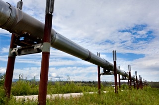
 When it comes to commercial and industrial remodeling projects or the expansion of existing infrastructure, it is important to know everything you can about the proposed project – from the ground it sits on to how the new construction will blend with the old. A licensed land surveyor can help you to find out about those issues with high definition surveying and 3D modeling services. The information gained from surveying techniques like these can help to increase a business owner’s confidence in the project, as well as, keep the project on time and on budget.
Why Use 3D Laser Scanning for Construction
High definition scanning gives architects and engineers information that they can use to design projects. This information can help the architects and engineers prepare for emergencies and plan for the future, such as what could happen to a building during a catastrophic flood or earthquake.
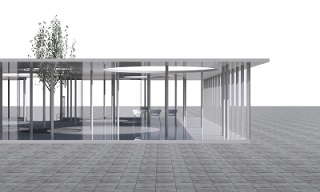
The information from the high definition surveying process can then be used to create a 3D model that shows how the project will eventually come together – how it will look and how structurally sound it will be. Additionally, the models can be used in a BIM workspace for extensive projects.
Choosing a land surveying company that provides high definition surveying and 3D modeling can help to speed up a construction project by providing accurate measurements and information about potential hazards that designers can then mitigate. This not only keeps the project on schedule, but also plays a part in keeping the project on budget. Documents created through these scanning services can be transformed into survey documents that help construction crews and engineers to better understand the overall project.
Our experienced team can help you choose the services that will get your project started and keep it moving smoothly. Contact us today to learn more about 3D laser scanning for construction projects, as well as the other services we offer.
Image By: Sira Anamwong