What Factors Do You Need to Consider When Looking for 3D Laser Scanning Services
Before starting a construction project, you need to know what’s already out there. The more information you have up front, the fewer surprises you’ll encounter once work gets started. Laser scanning offers the most detailed and specific information you can get in a map or survey, as it bounces lasers off of targets to form a precise point cloud. To make sure you get the most benefit from using 3D laser scanning services, keep these questions in mind:
How good is the captured data?
A map that isn’t based on good data is at best a pretty picture. 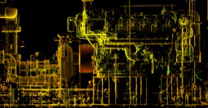 Compared to other surveying techniques, 3D laser scanning is a high-definition process that captures millions of data points. Modern scans are accurate to within 4mm, making maps generated from this data extremely useful for planning purposes.
How quickly is the data available?
Depending on who you go with for you 3D laser scanning services, data can be acquired from the ground or from the air. Scanning from the air can be completed quickly, as drones can cover 400 acres per hour. Drones travel faster than land-based surveyors because they can just fly over rough terrain without being affected by it. Aerial scans can also be quicker to perform because drones can be operated remotely; the operator doesn’t need to travel with the machinery.
How usable is the data?
It doesn’t matter how quickly you get the 3D laser scan survey if it doesn’t provide the data in a format you can work with. These days, simple PDF files of a topographic map aren’t nearly flexible enough, but at the same time, you can’t work directly with the hundreds of gigabytes of raw data captured during the mapping process.
The captured data point clouds need to be turned into digital elevations and other 3D models. GIS and other analytics software let you work with the numbers, while virtual reality technology can literally let you walk through the mapped environment.
It’s also important to be able to access the 3D scan output from anywhere, on any device, at any time even—or maybe especially—when workers are out in the field. When data is stored “in the cloud,” it’s always accessible, wherever you are. Having the scan always available means you can easily use the map to adjust your plan to the current circumstances, rather than being locked into an early decision or having an expensive delay while an issue is sorted out.
How experienced is the firm doing the mapping?
The oil and gas boom has led to a corresponding boom in surveyors, but new companies don’t have the experience to get the job done right. Because important decisions are made based on what the map shows, it’s important to work with an experienced surveying firm. Make sure the firm has a history of success in working with current technology.
How expensive will it be to capture the data?
It’s almost impossible to avoid cost as a factor in your decision making process. You need to get the data you need, but in a cost-effective way. A 3D laser scan survey done from the air, using UAVs, are often cheaper as well as quicker and safer than ground-based surveys. Keep in mind that data you can use flexibly is more valuable than data that isn’t flexible, so a higher up-front cost can be more cost-effective when you take a long-term point of view.
Having a good map helps you find your way, make better, more cost-effective plans and document the legalities of infrastructure. If you want to capture the data you need to manage your project, contact Landpoint to find out how our 3D laser scanning services will help you get your job done.


