Posts

How Municipalities Can Reduce Costs by Using Land Surveying Services

Land Surveying servicesMunicipal government agencies face a variety of challenges when it comes to major building projects. Their projects must meet the same standards for quality and safety that every other building project is held to, but at the same time, they must also make the most of taxpayer funding.

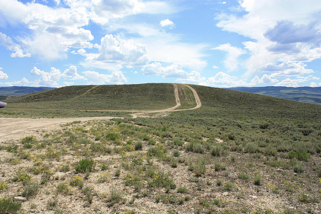
One way that municipal agencies can cut costs for their building projects without negatively impacting results is by taking advantage of new technologies. Specifically, new land surveying technologies such as 3D laser scanning and unmanned aerial vehicles can make it significantly less expensive to gather needed data, allowing an agency to save money before the project even breaks ground.

In this post, we’ll take a quick look at these new technologies and talk about how these land surveying services can be beneficial to municipal governments.

3D Laser Scanning

3D laser scanning, also known as LiDAR, is a technology that can be used to quickly gather land surveying data to support the creation of very detailed models and survey documents.

The technology works by setting up a series of laser scanners around the building or terrain that is to be scanned. Then, the scanners emit thousands of laser points, which bounce off the object being scanned. The scanners track the flight path and trajectory of the laser points as they return. Finally, the scanners assemble the data from all the various laser points into a single data cloud, which can in turn be used to form 3D models and land survey documents.

The cost savings aspect of the technology can be traced back to the fact that laser scanning can be performed quickly, requiring a small fraction of the man hours that go into traditional land surveying methods. In addition, the extremely detailed models created with the data gathered from laser scanning helps a project get off to the right start and removes the potential for expensive delays and rework once the project has already started.

Unmanned Aerial Vehicles

Unmanned aerial vehicles (UAVs), also known as drones, are another example of a new technology that is helping to make the land surveying process cheaper, faster, and more accurate.

UAVs can be fitted with relatively inexpensive high-definition cameras to capture very detailed images from above. While traditional land surveyors would have to travel over land to complete their work, often crossing unsafe terrain in the process, UAVs are able to travel direct routes, significantly reducing the amount of time they have to spend gathering data.

Unlike manned aerial vehicles, UAVs are able to get very close to the ground or the structure being surveyed and have no difficulty getting into and out of tight spaces.

Using UAVs for land surveying projects costs a small fraction of traditional land surveying methods because they are able to cover large areas in a relatively short period of time—as much as 400 acres in a single hour, in fact. In addition, most of the processes involved with UAV data capture are now completely automated, significantly cutting down on the amount of time a team has to spend on the data gathering effort. Finally, the data captured using UAVs can be ready for use in as little as a few hours, with a 24 hour turnaround at the maximum. This helps engineers make better use of their valuable time by cutting down the time they have to wait to get the data they need to do their jobs.

If you’re ready to make the most of the taxpayer funding for your municipal project, while also ensuring a land survey that is highly accurate and quick to produce, Landpoint is here to help. Contact us today to learn more about our land surveying services.

Image source: CDC Global

Construction Site Safety: Surveying in Unsafe Environments

land surveying company safetyWorker safety should be the number one focus for all construction project managers. However, since construction work consistently rates among the most dangerous forms of employment in countries across the globe, it is clear that there’s still a lot more that needs to be done to address safety issues on the job site.

How a Land Surveying Company Addresses Construction Site Safety

Part of preparing for construction safety means getting an accurate understanding of what hazards are expected, so you can prepare for and mitigate them as much as possible. From a land surveying perspective, that means knowing where unstable work surfaces might be putting your workers at risk. Using traditional technology, acquiring a survey on a potentially unsafe terrain would require the surveyor to traverse through the rugged landscape in order to gather information. In addition to being extremely time consuming, this process also puts the surveyors themselves at risk.

In many cases, construction site safety can take a back seat when project managers are concerned that the construction project may not be progressing according to schedule. The process for issuing surveys is time consuming, and can lead to forced down time on the job site, which is something that every project manager wants to avoid.

As a result, many project managers are content to proceed with their projects without waiting for the land surveys to be returned. While this may seem like a time-saving measure, it’s actually quite shortsighted, as injuries on the job site caused by lack of terrain visibility can be just as much of a time waster as waiting for land surveys.

Project managers need a solution that will allow them to balance the seemingly contradictory goals of ensuring project safety and avoiding unnecessary delays. With 3D laser scanning technology, there is no reason that project managers can’t achieve both of these important goals.

3D Laser Scanning Helps Balance Speed and Safety

3D laser scanning contributes to increased safety on the job site, as it removes the need for land surveyors to place themselves in harm’s way to complete their surveys. Since the surveyors no longer have to risk going from place to place to manually collect the information, 3D laser scanning can also help avoid project delays, as land surveyors will now be able to turn around their finished work much faster

By making quick and safe land surveys an integrated part of the organization’s construction process, 3D laser scanning can help project managers balance the competing goals of project speed and project safety in a manner that works best for everyone involved.

Aerial Mapping

3D laser scanning technology can also be supported through the use of aerial mapping. Using either fixed-wing aircraft, helicopters, or unmanned aerial vehicles, land surveyors can get the visibility they need to complete terrain maps without having to set foot on dangerous terrain themselves.

When used together with 3D laser scanning, aerial mapping allows construction project managers to get the visibility they need to understand and plan for risk in the construction project, without having to wait for the land surveys to be completed. Together, these technologies are making it so that project managers no longer have to choose between speed and safety.

To learn more about aerial mapping and 3D laser scanning services from Landpoint, and how they can help improve construction site safety, contact us today.

Image Source : Michael Gil

Oil and Gas Engineering Challenges in the Niobrara Shale

land surveying servicesThe oil and gas development opportunities being explored in the Niobrara Shale area are numerous and have presented the region as a prospectively lucrative venture for many energy companies. However, this has also lead to a number of challenges for oil and gas engineering firms.

Niobrara Shale and the Recent Boom

The Niobrara Shale is attracting large investments from companies in the energy and oil and gas development sector, due to its oil rich and easy to drill stratum. An amount of $4 billion was invested by some of the top companies in the sector during 2013, with plans to pursue drilling activities in 2014 as well.

  • Drilling sites: The 4 major enterprises operating in Niobrara have identified around 15,000 potential drilling sites within the location, targetting the huge amount of oil and gas reserves that the area possesses. Moreover, smaller companies have outlined 5,000 other locations which are prospective spots for oil and gas drilling in Niobrara shale.
  • Increase in rig sites: The North American Rig Count has estimated a 50% increase in the number of oil rigs within the area, only within the past 22 months. The alluring prospects presented by Niobrara Shale has given rise to the amount of investment done by energy sector companies, with around $1 billion already spent on the rail terminals, pipelines and plants, for the processing and shipping of oil.
  • Economic boom: The investment activities in the region have resulted in an economic boom in the area, the effects of which are easily discernible all across the Front Range. Many energy investment companies are still evaluating the true potential of Niobrara, and regard it as a highly lucrative region for exploring and discovering oil and gas development opportunities.
  • Rising demand for drill permits: Statistics show that in the latter part of 2013, there were around 1000 drilling permits which were issued in the Niobrara Shale basin, whereas 250 were still pending. This is evidence of the vast drilling and exploration opportunities being offered by the region for oil and gas development.

Niobrara is included in the list of different shales within the country, which have increased the domestic output of the state to exceed their oil imports, since 1995.

Challenges by Oil and Gas Engineering Firms Faced With Developing the Area

Though Niobrara Shale is rapidly being recognized as an abundant resource of oil and gas reserves in the industry, there are still a number of challenges in its path towards success. These include:

  • Land surveying: Finding quality land surveyors is a major challenge for companies in the energy sector who want to explore the resource potential offered by Niobrara. There are quite a number of land survey companies, but they sometimes lack the appropriate team size and a mobile professional group of professionals, to competently handle large exploration projects, which are major challenges and a cause for delays.
  • Political and community resistance: Many political segments and community associations are resistant to the extent of development change which is fast penetrating into the suburbs of the Niobrara basin, which is one of the major challenges to the development endeavors in the area.
  • Technological expertise: Not many service providers have technological expertise to make use of the instrumentation and software, like GIS mapping, cloud based data sharing, high definition scanning, and many other important services.
  • Permit  issuance: In order to pursue development projects within the area, permits are a necessity, and due to the rising demand, the process has become time consuming, making it difficult for investment companies to explore and develop Niobrara.

In Niobrara, land surveying and exploration is critical to the development of the area. If you are seeking an oil and gas engineering firm, then get a no obligation quote from Landpoint.

Image by : USFWS Mountain-Prairie

How Surveying With Drones Changes Everything

8725078749_b8baf91344_zUnmanned aerial vehicles (UAVs), otherwise known as “drones,” are among the most important technological advances that have been introduced to the land surveying industry in quite some time. These small, ultra-light weight aircraft can be piloted by remote and can take detailed survey information while simultaneously transmitting that data back to the head office. This creates highly accurate maps and provides valuable data to companies and individuals who are considering major projects on large areas of land. In this article, we will take a look at how surveying with drones can help Oil and Gas companies get better, more accurate data.

Why Use Drones for Surveying?

There are a number of reasons why drones are an ideal addition to any land surveying project and can increase accuracy and return on investment.

  • Highly accurate, high-definition maps can be created in a fraction of the time that used to be required
  • Data of all sorts can be gathered by the drone including photography, Lidar, and video
  • All information can be instantly uploaded to a server where it can be accessed by authorized individuals anywhere in the world
  • It becomes much easier to reach difficult locations with drones. This makes using drones significantly safer in certain situations.

These are just a few of the reasons why this technology has been so important to the industry. As applied robotics continue to increase in complexity, there is very little doubt that the capabilities of surveying drones and the breadth of data that they can collected will only increase.

How Land Surveying With Drones Works

While not common place today, more companies are recognizing the benefits of using drone technology in order to produce things like base maps and other important pieces of the surveying puzzle.

To put it simply, drones are deployed over the area to be surveyed equipped with a number of important pieces of scanning technology. Among these are 3D laser scanners that sweep over the region and give the surveyor highly detailed images and ideas of what the terrain actually looks like.

The data from the 3D laser scanners can be used in a process called GIS mapping, which is the creation of a digital map through the employment of cartographic sciences, advanced computer skills, and statistical analysis. The map provided by this process is not only high definition and easy to use, but also gives very specific information regarding the area in an easy to access format.

The GIS map and other data is stored using cloud technology so that what is being seen by the drone and the resultant reports can be instantly uploaded to a server that will provide access to authorized parties. Not only is this the quickest way to inform decision makers on the results of surveys, it also allows them to be informed no matter where they are so long as there is an Internet connection.

Advancing With the Times

More companies are changing their land surveying services to take advantage of the new technologies becoming available. They are finding a much higher return on investment due to more accurate data being accumulated by fewer people in less time with quicker results. Not working with a modern surveyor employing the best techniques is far too expensive a proposition for many companies, and they are finding the change worthwhile.

At the time of writing, the legal use of drones for surveying purposes has not been approved by the government. However, Landpoint has already begun investing in Research and Development for drones so that when they do become legal it can offer this service to its customers soon after.

If you’re interested in seeing what a difference the latest advance in land surveying technology can make, both in terms of accuracy and bottom line, don’t hesitate to request a no obligation quote so that you can see for yourself the incredible benefits.


Image by : Don McCullough

Why Scalability is Key to Oil & Gas Surveying

land surveying projectsScalability is the ability to quickly adjust to changing conditions as they occur. Projects need to continue even when new information changes the nature of the operation and demands an increase in scope. When it comes to oil and gas projects, land surveyors must meet deadlines, manage change, and ensure the end result meets company needs and regulatory standards.

As oil and gas industry operations expand, land surveying scalability becomes a major challenge. Many surveying companies are small and unable to scale, while others may not be able to scale quickly enough to accommodate oil and gas companies’ needs. As a result, companies may experience much longer turnaround times. “Time is money,” and increased survey turnaround is inefficient and costly.

It is extremely beneficial when land surveying firms can efficiently and effectively provide accurate oil and gas field data to aid engineers in decision making and problem resolution. Land surveyors may be required to change course quickly. Regardless of conditions and obstacles, oil and gas surveying projects must meet deadlines and milestones. To do so, they need the team and the technology to be able to easily handle project changes as well as the ability to properly manage resources once they are in place.

Land Surveying Projects & Scalable Technologies

Most oil and gas surveying projects are multi-phased, from field data collection, to surveyors review, to client deliverable distribution. Oil and gas surveys tend to become more complex as the project progresses. An original survey may turn into re-rotes, moves, and overall scope increases, requiring more resources and in many cases additional skill sets. The survey firm should have the capacity and resources to be able to add additional crews and equipment as needed.

Having access to some of the latest surveying technologies enhances scalability. For example, the best GIS uses significantly more data and keeps all of the information in the cloud. Data is made available through smartphones and tablets, enhancing communication between teams and keeping everyone in the loop. When information is kept in a central location and made easily available to those in the field, it means that no matter how many new teams are added, everyone will still be on the same page.

Some important methods, programs, and project management features indicating a surveying company is focused on continued scalability are:

  • Advanced GNSS
  • 3D scanning applications
  • Mobility / mobile devices
  • A real-time, in-house project management system
  • Knowledge of oil and gas companies’ multiple land leases and operations
  • A large pool of readily-available on-call survey teams
  • A reputation for updating and incorporating the latest technologies
  • Professionals that are knowledgeable of the most current land survey technologies

The Benefits of Scalable Oil and Gas Surveying

Ultimately, partnering with a firm that can easily scale helps your oil and gas project with three critical elements:

  1. Speed – By being able to add additional resources as soon as they are needed, a scalable land surveying company can vastly reduce the time needed to complete a project.
  2. Accuracy – A land surveying company needs to have a broad skill set and experience in a number of different oil and gas surveying related disciplines in order to take on the additional tasks that may come up in a project. If they do not have these things, they may attempt to take on tasks with mixed results.
  3. Efficiency – The more a project expands and changes, the more necessary it is that the surveying company be able to communicate with other teams and share information.

It is better for an oil and gas company to pick a land surveying company that can scale right from the start, instead of having to change midway when it becomes clear that the current surveying company cant. For more information, take a look at our oil and gas brochure.

Pre-Construction Planning Process: How Land Surveying Services Help

ID-100208177A construction survey typically consists of determining current site conditions for future above-ground and in-ground infrastructure. Land surveyors stake elevations for footings, collect topographic data for mapping existing drainage courses, invert elevations and diameters of pipe and manholes perform a number of other services. Land surveying services are used to establish the accurate location of proposed structures, accesses, pipelines, buildings, and other improvements.

Most land surveying services are provided by local companies or companies with local offices. They typically have some prior knowledge of the area to be surveyed, including its history, soil& water conditions, sensitive areas, habitats and protected species. This not only reduces the time to get to the designated site, but also provides the client valuable area insight upfront, from which decisions may be made and plans designed.

Land surveying services can include due diligence as well. Land survey teams may inspect buildings for hazardous materials such as asbestos, lead, and PCBs, which must be addressed prior to demolition, new construction or exploratory operations. Land surveyors may also discover other issues such as buried fuel tanks or ground water contaminants.

How Land Surveying Services Help With Pre-Construction Project Planning

A surveying firm adds more value to the pre-construction planning stages of any project. In addition to site analysis, boundary & topographic surveys, maps, and plats, they also:

  • Help mitigate the risk of potential future regulatory enforcement actions
  • Minimize or eliminate costly delays in project schedules
  • Maximize project startup efficiencies through comprehensive regulatory planning
  • Provide data which helps define project scope and aids strategic pre-construction planning
3D Scanning for Retrofits

Retrofitting involves modifying existing structures or equipment to reinforce and add structural life to it. Many existing buildings, overpasses, bridges, and towers are being retrofitted to withstand potential seismic shaking and shocks.

Surveying teams collect data which is used to construct a 3D model of the existing environmental features, structures, and objects. 3D scanning is ideal for analyzing, planning, and designing retrofit projects. The surveying team collects its data points in the field and creates a digital model that depicts height, width, and depth.

3D maps and point clouds show elements and measurements of buildings, utilities, construction and structural objects such as pipe, cable, and plumbing. This is very helpful when an existing building or structure (such as a bridge) is scheduled for retrofitting. Engineering departments find these deliverables invaluable when working on retrofit projects.

Establishing Survey Standards

For any given project there may be more than one surveying company involved. One surveying firm may well establish basic standards in the pre-planning phase for other surveying teams to follow. A responsible and reputable surveying company may set the standard for work production and quality, safety, schedule, and deliverables. This indirect competition and expectation tends to escalate project progress. Additionally, established standards clarify expectations which contribute to enhanced quality control.

GIS and BIM (Building Information Modeling) Software Tools

Land and air surveys provide data to build models and 3D mapping. GIS (Geographic Information System) software aids in large scale planning. Data collected may be analyzed and processed. GIS applications may be used to assist project pre-planning in areas of:

  • Resource management
  • Utility management
  • Infrastructure management
  • Environmental impact studies and land management
  • Leased land, land use, zoning, and boundaries
  • Plats and development
  • Legal descriptions and measurements
  • Market and statistical analyses

BIM (Building Information Modeling) is another software decision making tool that assists in planning physical features and infrastructure such as water, gas, communication, power lines, buildings, and roads. BIM expands 3D modeling. It includes concepts of time and cost in addition to height, width, and depth. Component quantities and spatial relationships are integrated into the process. BIM extends through the project lifecycle, far beyond the pre-construction planning process. The BIM program supports:

  • Construction management
  • Project management
  • Facilities management
  • Cost management

For more information on GIS, BIM, and pre-construction planning offerings, please take a look at our brochure.

Image By : Stockimages

Land Surveying Services for Every Need

land surveying servicesLand surveying services provide the market’s most accurate maps by using advanced techniques and the most cutting-edge equipment. These maps and the data they include are used to plan efficient solutions to a wide variety of projects.

Environmental Land Surveying Services

Highly-trained and experienced land surveyors create innovative solutions and gain ecological approvals through wildlife studies, developing wetland strategies, conducting overall environmental reviews or environmental impact assessments and creating sustainable storm water management solutions and creative mitigation strategies.

Land Surveying Services for Civil Development

Landpoint provides support for services like feasibility studies, irrigation design, traffic studies, tree inventory, environmental preservation plans, theme development, construction management, cost estimates, site selection, site inventory, code review and urban design, our land surveying services creates effective solutions for civil development projects that maximize clients’ investments.

Land Surveying Services for Oil and Gas Development

The accurate data collected by land surveyors supports complex projects in the oil and gas industry. We offer siting and permitting support, including aerial mapping, regulatory analysis and site reconnaissance, design support, including 3D laser scanning, GIS, and construction support, such as staking, restoration mediation and detailed as-built surveys. Revise sentence structure.

Residential Land Surveying Services

Our residential land surveying services take an integrated approach to residential development that includes land evaluation services, such as topographical surveys, renewable energy assessments and boundary surveys, land use entitlement services, design planning and construction services, including lot surveys and construction coordination.

Land Surveying Services for Commercial Development

Our team streamlines land-use entitlements while creating eco-sensitive solutions through site constraint analysis, renewable energy investments, field surveys, due diligence investigations, project management, traffic analysis and more.

Land Surveying Services for Transportation

We work with civil engineering firms to help create more effective transportation systems through traffic impact studies, traffic data collection, parking system analysis, transportation planning studies, and 3D scanning technology that enables us to better understand the impact of traffic operations.

Image By – dan