Posts

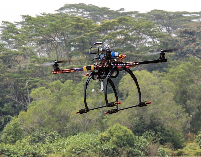
Drone Surveying: The Advantages of Using Drones for Agriculture & Forestry

Drone Surveying

While drone surveying certainly has important applications within the construction and mining industries, many people don’t realize that the significant role drones will play when it comes to land management in forestry and agricultural settings. By conducting quick and accurate surveys from above, unmanned aerial vehicles can help land management agencies gain a much better understanding of what’s happening on ground level, which will, in turn, empower them to make informed decisions. In this post, we’ll take a brief look at some of the advantages of using drones for agricultural land management purposes.

Advantages of Using Drones for Agriculture & Forestry

Understanding Land Health

One of the most important, yet most challenging, charges faced by any land management agency is making sure the area under their supervision is healthy. If they aren’t careful and attentive, plant-based diseases can cause significant damage to forests and agricultural land before the agency in question even realizes what’s happening.

UAV surveying can help alert land managers to any possible signs of problems so that they can respond before things get out of hand. In addition, UAVs can be outfitted with NDVI cameras that use infrared and thermal imaging to create detailed models. These models allow land managers to take a proactive approach to plant health. Instead of waiting for symptoms of a disease to show themselves, land managers can make a plan to take targeted samples.

While taking samples using traditional land surveying technology can be extremely costly and time-consuming, starting with a 3D model allows the agency to be smarter about when and where they take samples. As a result, they are able to get the even better results with a fraction of the headache.

Understanding Economic Impact

While a land management agency’s first priority should be to protect the land that it manages, it can also play an important role in helping businesses and other commercial interests take advantage of the economic value of land, while doing so in a socially responsible manner. For all of the many different factors that go into managing forests and farmland as economic resources, UAVs can help out tremendously.

One of the first steps in making sure that land is being used responsibly is to detect signs of illegal land use, such as unsanctioned logging. Illegal land use may be very difficult to detect using traditional surveying methods, particularly when an agency has very large areas of land to manage. However, UAVs are capable of surveying as much as 400 acres in a single hour, making it very difficult to hide any illegal activity that may be going on in an area.

In addition, UAV surveying can be used for purposes of inventory assessment. In order to fully capitalize on the economics of land, an agency must be able to place an accurate value on a piece of land, allowing for proper levels of taxation. This can’t be accomplished until the agency has a full understanding of the piece of land, and the economic resources it may contain. Using UAVs makes it much easier for an agency to gain this level of understanding.

While the benefits of UAVs as a land surveying technology are impossible to ignore, it’s important to realize that you must work with the right land surveying partner if you hope to really make the most of using drones for agricultural purposes. At Landpoint, we are here to help. We understand the challenges that land management agencies face, and we have direct experience using UAVs to help them overcome these challenges. Review an example of our land management work to get an idea of what we’re capable of, or contact us today to find out more about what we can do for you.

landpoint-ebook-cta

Image Source: Richard Unten

How Aerial Survey Drones are Going to Revolutionize the Oil and Gas Industry

land surveyingIt’s no secret that the oil and gas industry is changing: “easy oil” reserves are getting more and more difficult to find, and companies therefore need to find new and innovative ways to drive more efficient operations in order to remain profitable. Unmanned aerial vehicles (UAVs), also known as drones, are the latest technology that’s driving the oil and gas industry forward, giving companies new opportunities to increase their efficiency, effectiveness and profitability.

UAV technology is not exactly new, but it’s only been in recent years that the drones, the batteries they are powered by, and the photography equipment they use to conduct land surveys have become lightweight and affordable enough to be feasible for use in large-scale land surveying operations for the oil and gas industry. This means that we’re currently standing at a crossroads in the history of the industry: those companies that identify UAV technology as the great opportunity it is and prepare themselves to capitalize on it will be in the best position to succeed going forward, while those that don’t will risk falling behind.

While there are a variety of ways in which aerial survey drones can benefit the Oil and Gas industry, one area that will be particularly impacted is land surveying. UAVs can offer three main benefits over more traditional surveying methods:

  • The ability to complete land surveys quicker
  • The ability to create land surveys that have a much higher level of detail
  • The ability to complete land surveys without having to put surveyors in danger
Complete Land Surveys Quicker

One of the clear advantages that UAV surveying offers over traditional surveying methods is the speed at which the surveys can be completed. This is a key benefit, as land surveying is only one of the first steps of many involved with completing an oil and gas project. When the land surveying process can be completed quicker, the rest of the project can proceed as planned, and the company can reach its goals with no delays.

UAV surveying is quicker than traditional surveying because it does not require surveyors to travel over difficult terrain in order to get to the survey site. Instead, the drones are able to travel directly to the site in the air, and then allow surveyors to see the visuals they need, no matter where those surveyors are.

Provide a Higher Level of Detail

Today’s aerial survey drones use top-of-the-line photography technology to provide the high level of detail needed to create a quality land survey. While surveyors operating from the ground might miss out on important details, drones have the ability to look down on a site from above, getting a complete view of everything.

These drones can also change camera angles or move in closer to get a better view of something if necessary. As a result, using drones to help complete land surveys allows oil and gas companies to get a better view than they would otherwise, and therefore increases the chances that a project will be successful.

Keep Surveyors Off Of Dangerous Terrain

Finally, using unmanned aerial vehicles removes the need for surveyors to travel over difficult terrain in order to complete their work. This has a dual benefit of keeping surveyors safe and avoiding accidents that can lead to costly and time-consuming delays.

On the job site, keeping workers safe is always the highest priority. That’s why drone technology, which allows land surveyors to complete their work from a safe position, is such a promising technology for use in the oil and gas industry. Since it also provided quicker, more detailed surveys, UAV technology is a real no-brainer for the oil and gas industry.

To learn more about groundbreaking surveying technologies like aerial survey drones, download our oil and gas brochure.

Image Source: Michael MK Khor

How Surveying With Drones Changes Everything

8725078749_b8baf91344_zUnmanned aerial vehicles (UAVs), otherwise known as “drones,” are among the most important technological advances that have been introduced to the land surveying industry in quite some time. These small, ultra-light weight aircraft can be piloted by remote and can take detailed survey information while simultaneously transmitting that data back to the head office. This creates highly accurate maps and provides valuable data to companies and individuals who are considering major projects on large areas of land. In this article, we will take a look at how surveying with drones can help Oil and Gas companies get better, more accurate data.

Why Use Drones for Surveying?

There are a number of reasons why drones are an ideal addition to any land surveying project and can increase accuracy and return on investment.

  • Highly accurate, high-definition maps can be created in a fraction of the time that used to be required
  • Data of all sorts can be gathered by the drone including photography, Lidar, and video
  • All information can be instantly uploaded to a server where it can be accessed by authorized individuals anywhere in the world
  • It becomes much easier to reach difficult locations with drones. This makes using drones significantly safer in certain situations.

These are just a few of the reasons why this technology has been so important to the industry. As applied robotics continue to increase in complexity, there is very little doubt that the capabilities of surveying drones and the breadth of data that they can collected will only increase.

How Land Surveying With Drones Works

While not common place today, more companies are recognizing the benefits of using drone technology in order to produce things like base maps and other important pieces of the surveying puzzle.

To put it simply, drones are deployed over the area to be surveyed equipped with a number of important pieces of scanning technology. Among these are 3D laser scanners that sweep over the region and give the surveyor highly detailed images and ideas of what the terrain actually looks like.

The data from the 3D laser scanners can be used in a process called GIS mapping, which is the creation of a digital map through the employment of cartographic sciences, advanced computer skills, and statistical analysis. The map provided by this process is not only high definition and easy to use, but also gives very specific information regarding the area in an easy to access format.

The GIS map and other data is stored using cloud technology so that what is being seen by the drone and the resultant reports can be instantly uploaded to a server that will provide access to authorized parties. Not only is this the quickest way to inform decision makers on the results of surveys, it also allows them to be informed no matter where they are so long as there is an Internet connection.

Advancing With the Times

More companies are changing their land surveying services to take advantage of the new technologies becoming available. They are finding a much higher return on investment due to more accurate data being accumulated by fewer people in less time with quicker results. Not working with a modern surveyor employing the best techniques is far too expensive a proposition for many companies, and they are finding the change worthwhile.

At the time of writing, the legal use of drones for surveying purposes has not been approved by the government. However, Landpoint has already begun investing in Research and Development for drones so that when they do become legal it can offer this service to its customers soon after.

If you’re interested in seeing what a difference the latest advance in land surveying technology can make, both in terms of accuracy and bottom line, don’t hesitate to request a no obligation quote so that you can see for yourself the incredible benefits.


Image by : Don McCullough