Which Utilities Need Underground Mapping?

Which utilities need underground mapping? All of them, really. Whenever a construction project, addition, renovation, or modification begins, one of the first steps should be an underground utility survey.

Utility lines are everywhere, but they aren’t always visible. Using utility location services, you can identify where they are and hopefully avoid them.

Today, we’re going to take a look at some of the most common types of underground utilities and why it’s critically important to map them properly before a big project.

Why is Underground Utility Mapping Important?

Mapping underground utilities is important for a few reasons: safety, accuracy, and efficiency.

  • Safety. If you’re digging and hit an unknown utility line, you could be in for an interesting surprise. Not only could you cause serious damage to the line, but you could also endanger yourself and those around you.
  • Accuracy. When you’re planning a construction or renovation project, you need to know exactly where all of your utilities are. Otherwise, you could find a line too late and have to disrupt the entire project.
  • Efficiency. By mapping out your utilities ahead of time, you can save yourself a lot of time and hassle. You’ll know exactly where to dig, and you won’t have to worry about damaging any lines while you’re working.
  • Cost. No construction company wants to tell the city that they just hit a gas main. Not only is that expensive, but it’s also going to lead to an expensive work disruption.

Utility lines are out there. Sometimes, they’re nowhere near where you think they should be. Underground utility mapping is what prevents you from experiencing a disaster every time you build on a previous site.

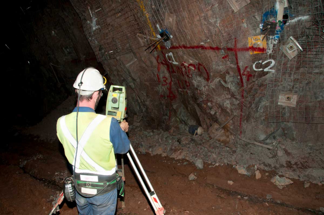
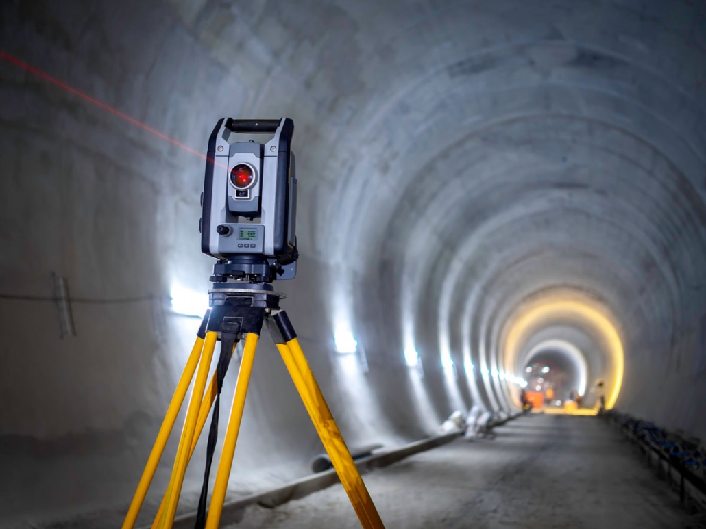
What Are Utility Location Services?

What do you do if you don’t have the technology to find utility lines yourself and you don’t have maps to determine where the lines might be?

Utility location services are exactly what they sound like—services that help you locate underground utilities. There are a few different types of utility location services, but the most common is ground penetrating radar (GPR). Drones can be used to get information over large sites fast.

GPR works by sending out a signal and measuring the time it takes for the signal to bounce back. This information can be used to create a map of the underground utilities in the area. Other methods, such as electromagnetic induction (EMI) and direct current resistivity (DCR), can also be used to detect utilities.

Either way, utility location services are absolutely essential to the process of underground mapping. Without utility location services, you won’t know where to dig. You should virtually never rely on pre-existing maps for your utility lines. Utility lines get adjusted over time, they shift, and they may not be where you think they should be.

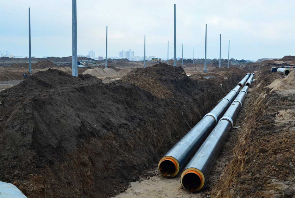
Underground Mapping for Water Utilities

Water utilities are some of the most important lines to map properly. They’re also one of the most challenging types of utilities to work with, since they can be located in a variety of different places.

Most waterlines are, of course, underground, where they can be susceptible to damage from excavation and construction projects. But the positive side of water lines is that they don’t usually cause injury when accidentally hit, unlike gas lines or electrical lines.

The negative is that they can cause an extraordinary amount of damage to the actual work site. When a water line bursts, it can cause damage within just a few minutes—and it can take that long to get the water shut off.

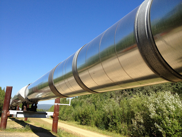
Underground Mapping for Gas Utilities and Pipelines

Gas pipelines are another important type of utility. While there are some pretty strict regulations as to where they can be, they can also be just about anywhere. Since they run underground, they frequently run through both public and private places.

Mapping gas pipelines is critical for safety reasons. If you hit a gas pipeline while you’re digging, you could cause a serious explosion. That’s why it’s so important to know where these pipelines are before you start any excavation or construction project.

One lucky thing is that gas pipelines are generally located by the city, which means you can usually call the city and have them mark out where the gas is, even if you’re going through serious commercial construction. It’s the responsibility of the city and the gas company to know where their gas lines are.

Underground Mapping for Electrical Utilities

Mapping electrical utilities is another important task. Like gas pipelines, they can be located in a variety of places, but they’re most commonly found underground. Of course, it’s getting to be more common that electrical utilities are run through the air. Largely, it depends on the size of your city, the extensiveness of its infrastructure, and whether it gets damaging weather.

One of the biggest dangers with electrical utilities is contact. If you touch an electric line while you’re working on your project, you could be seriously injured or even killed. Since a worker might not notice a live electrical line while they’re working, it’s essential that they know where those lines might be.

Underground Mapping for Telecommunications Lines

Mapping telecommunications lines is another important task. Like electrical utilities, they can be located in a variety of places, but they’re most commonly found underground.

Telecommunications lines are unique because there are many companies that run them. As a whole, most telecommunications lines aren’t dangerous, but you won’t typically find a single, consolidated map of where all the lines are, because they may have been placed by multiple service providers.

The biggest problem with telecommunications lines is that cutting a telecom line means that you could bring the entire neighborhood’s internet down. It’s certainly not a way to endear them to what is already a construction project in their backyard. And if you’re developing a business, it’s very possible that you could accidentally cut your own underground telecom lines.

Mapping Utilities: The Bottom Line

Mapping utilities is an important task, and it’s one that should be done carefully and accurately. By mapping out your underground utilities ahead of time, you can save yourself a lot of time, as well as a call to your insurance company. For most city-wide utilities, you can give them a call and have them mapped. Otherwise, you may want to commit to more involved surveying services.

Are you interested in how to survey and map your worksite? Do you need your utilities mapped now? Contact the experts at Landpoint for more information about utility surveying and underground utility mapping.

how-to-choose-land-

The Importance of SUE Surveying and Underground Mapping

SUE surveying, or Subsurface Utility Engineering, is a process that involves the mapping of underground utilities. This is done through the use of various surveying and scanning techniques in order to create a 3D model of the area. The importance of SUE surveying cannot be overstated. It is critical for businesses and municipalities alike to have an accurate map of underground utilities so that any construction or excavation projects can be carried out safely and without incident.

In this article, we will discuss the importance of SUE surveying and underground mapping, as well as the challenges that come with it. We will also highlight why it is so important to have a provider that can do it well.

When Would You Need to Use SUE Surveying?

There are many occasions when SUE surveying would be necessary. Some of the most common use cases include:

  • Construction projects. Any time there is construction taking place, it is critical to have an accurate map of underground utilities. This will help prevent damage to any existing infrastructure and ensure that the construction project goes smoothly (such as, without flooding, or electrical damage).
  • Excavation. Whenever there is excavation taking place, it is important to know what lies beneath the surface. This will help avoid hitting any underground utilities and causing damage. Excavation could occur, for instance, if the ground is settling and has to be re-filled, or if a basement or a pool is being installed during major construction operations.
  • Land development. When planning for new development, it is necessary to understand the existing infrastructure. This includes both aboveground and underground utilities.
  • Emergency response. While rarer, this is something that can happen. In the event of a natural disaster or another emergency, it is important to be able to quickly assess the damage and locate any underground utilities that may have been damaged.

Essentially, whenever you are going to be disrupting the ground, you need SUE surveying. Underground mapping is criticalfor avoiding major underground utilities, in addition to general utility mapping.

Why Is SUE Surveying So Important?

There are several reasons why SUE surveying is so important. SUE surveying is essentially risk management. Without it, you can’t know what situation you’re digging into. The benefits of thorough, accurate surveying include:

  • Safety. The number one priority when it comes to any construction or excavation project is safety. By having an accurate map of the underground utilities, workers can avoid potential hazards and work safely.
  • Efficiency. When everyone involved in a project has access to the same information, it leads to more efficient and coordinated work. This can save time and money on projects large and small.
  • Accuracy. SUE surveying provides an incredibly accurate map of the underground utilities. This allows for better planning and execution of projects, as well as fewer surprises down the road.

As you can see, SUE surveying is a critical process that should not be overlooked. By having a provider that can do it well, businesses and municipalities can avoid many of the challenges and dangers that come with underground utilities.

What Are the Major Challenges of SUE Surveying?

And, like any other process, SUE surveying has its own set of challenges. Some of the most common challenges include:

  • Coordination. In order for SUE surveying to be effective, it is necessary to have coordination between all the different parties involved. This includes the owner of the utilities, the contractor, and the surveyor.
  • Technology. The best technology is needed to conduct proper surveys. An inaccurate survey is, in many ways, worse than not having a survey at all. If you’re digging with confidence in the wrong spot, it’s worse than digging without confidence in the wrong spot.
  • Time. A SUE survey has to be completed in the initial surveying process, which means any delays with the SUE survey can delay the entirety of the project, a costly issue. You need a provider you can trust.

These are just a few of the challenges that come with SUE surveying. By understanding them, businesses and municipalities can be better prepared for what to expect.

What Should You Look for in a SUE Surveying Provider or Underground Mapping Company?

When looking for a provider of SUE surveying, there are several things you should keep in mind. Some of the most important factors include:

  • Experience. The provider should have experience in both subsurface utility engineering and 3D laser scanning. This will ensure that they are capable of performing accurate surveys and mapping.
  • Accuracy. The provider should be able to provide accurate maps of the underground utilities. This will help avoid any costly mistakes down the road.
  • Flexibility. Your SUE surveying provider should have the technology necessary to complete the job. A wide breadth of technology (such as different types of UAVs or scanning utilities) might be necessary to get all the data you need.
  • End-to-end data management. A SUE surveying company that manages all the data itself is always preferable. This reduces the chances for error and ensures that you will get your data back on time.
  • Technology. Advanced GIS technologies, drone technologies, and software systems are necessary for best-in-class underground mapping.

Do you need SUE surveying or underground mapping completed for your next project? It’s absolutely essential that you get an accurate, complete survey before you ever break ground.

The right surveying can be used to simulate the most effective, efficient builds for your project—and be used to avoid disaster. Contact Landpoint today for more information about our SUE surveying, underground mapping, and 3D laser scanning services.

how-to-choose-land-

6 Fundamentals of a Safe Natural Gas Distribution System

Pipelines are known to be one of the safest types of natural gas distribution systems. But they still require proper planning, active maintenance, and monitoring. While pipelines rarely experience disasters, when they do experience a disaster, the results can be tremendous and long-lasting.

Today, we’re going to take a look at what keeps a natural gas distribution system safe — both before it’s designed and after it’s been developed. 

1. The Pipeline First Needs the Right Planning

The first safety consideration for a natural gas distribution system is the location of the pipeline. Pipelines should be located in areas that are free from potential hazards, like wetlands and floodplains. They should also be buried deep enough to avoid damage from construction or other activities.

Pre-planning surveys can be used not only to protect pipelines, but also to ensure that the routes are as efficient as possible. With the right surveys, pipelines can be simulated to determine the eventual results of the build — and to compare the efficiency and safety of different options.

2. Conducting the Right Environmental Surveys

Before a pipeline is built, the company must also conduct extensive environmental surveys. This includes surveying the land for any endangered species or habitats and assessing potential risks to groundwater.

A thorough survey can head off many environmental problems. Today, simulations can be run to detect issues with water or soil runoff, or how potential spills could spread into the surrounding territory. Doing this due diligence can greatly reduce the environmental impact should there be a spill or other incident. 

3. Schedule Regular Inspections of the Pipeline

Once a pipeline is up and running, safety still needs to be a top priority. Pipelines should be regularly inspected for damage or corrosion. Drones, also known as UAVs, can be used to survey the land on a regular basis, using LiDAR scanning to detect potential issues, like overgrowth.

Before UAVs, many inspections had to be done on foot. Not only was this time-consuming and expensive, but it was potentially dangerous work. Inspections weren’t completed any more frequently than they absolutely had to be. Now, inspections can be done very frequently.

And another benefit is that when these inspections are done, the issues can be reported directly to a dispatch team.

4. Faster, More Effective, Disaster Control

If there is a problem with a pipeline and a drone detects it, the drone can send back its exact GPS coordinates as well as information about the issue. The individual flying the drone will be able to take pictures or other sensor data, so the technicians who are going to fix the problem aren’t going in blind. Teams only need to be dispatched once with the right technology and tools—which means the issues are addressed much faster.

Time is essential when it comes to a safe natural gas distribution system. A small leak can become disastrous if it’s allowed to grow over time. So, another major advantage of UAVs is that they provide information about issues before the technician is even dispatched, making the entire process faster and more efficient. Otherwise, once an issue is detected, the technicians would need to go out an extra time to determine what supplies were necessary.

5. Monitoring for Leaks with Sensors

Obviously, the biggest safety concern is leaking. Today, there are many IoT devices and sensors that can trigger if even a minor leak is detected. When these sensors trigger, the company can shut down the pipeline and repair it immediately. Better sensors are making it easier to detect problems with pipelines before they ever trigger. Thus, gas pipe maintenance can be performed before the gas distribution pipeline is disrupted.

As these sensors become more advanced, they are able to report more data. Soon, machine learning intelligence will be able to identify the signs of failure before they occur. Today, these sensors can at least notify companies immediately about a leak. From there, they can work to address the leak as soon as possible.

6. Adhering to a System of Accountability

With regular inspections, leak detection, and fast dispatch, natural gas companies can create a system of accountability and safety. It’s essential that companies hold themselves accountable to environmental protection, ensure that they are doing all they can to detect issues proactively and respond very swiftly to any potential issues.

Thus, organizations should maintain audits of their current safety features, ensure that their safety processes are being followed, and look for any potential gaps in their safety management. If spills and other issues do occur, the organization should undergo a complete investigation to find the source of the issue and address it.

By following these six fundamentals, gas companies can ensure that their pipelines are safe and reliable. Not only does this help to preserve the environment, but it also reduces disruption and unnecessary costs.

Of course, all safety measures begin with a survey. Without a survey, the pipeline installation itself may be in an area that is potentially dangerous, difficult to maintain, or otherwise untenable. Contact Landpoint today to find out more about the services we provide for natural gas and beyond.

Surveys at Scale - How Landpoint Tackles Survey Projects of Any Size