Advice from an Environmental Consulting Firm: Winning a Review

5265582279_1a3c9a12c2_z
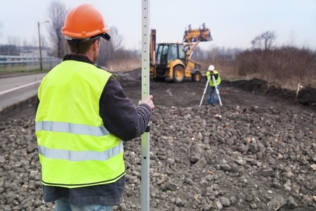
For oil and gas companies, winning environmental reviews can be a challenge. Getting the appropriate regulatory bodies the information they need can halt the actual construction project, which in turn wastes the company’s time and money.

These issues usually arise when companies are unaware of what is actually required to win an environmental regulatory review and can’t prepare for them properly in the early days of the project. In this post, we’ll discuss several steps you can take to make sure an environmental site assessment goes your way with the least amount of delay possible. Take a look at these points, but also bear in mind that working with professional environmental consulting firms may be worthwhile.

Things you should do to win an environmental site assessment

1. Know what the requirements are

It may sound obvious, but some oil and gas companies are unsuspecting of the environmental regulations that pertain to their project until it’s too late. Factoring in these issues in advance can help remove many of the headaches involved with environmental site assessment.

One way to do this is by building a good working relationship with the environmental agencies that oversee issues related to the project. Environmental regulations change frequently over time, so keeping up with agencies and how they work is the best way to make sure you’re always up to date on the most recent requirements. Since building good working relationships can take years, you can always consider hiring an environmental consulting firm to help you in the meantime. Working with a firm will allow you to piggyback on their expertise and relationships, helping you understand your environmental review requirements going into a project.

2. Make environmental issues an ingrained part of your project from Day 1

Oil and gas companies sometimes run into problems when unexpected environmental issues arise. Once the project is already in development, it can be hard to go back and tack on environmental compliance as an afterthought.

Instead, oil and gas companies can make sure that they win their environmental reviews by preparing for them every step of the way. This means understanding what environmental issues might be included in the project, and taking steps to make sure those requirements are being met before any work begins on the actual construction project itself. In order to accomplish this, it can be beneficial for organizations to ensure cooperation and openness between planners and engineers. Making sure that the right people are working together and communicating with one another is the best way for environmental concerns to be accounted for long before the review process begins.

3. Use the right technology

Finally, organizations must remember that environmental regulations are so complex that even when one has a complete and accurate understanding of what they are, it can still be difficult to act on them correctly. This is where technology comes into play. Using the right technology helps take the guesswork out of environmental reviews, ensuring that an organization has selected the optimal land use patterns that allow them to meet environmental requirements without sacrificing the success of the project.

Once again, working with an environmental consulting firm can be very helpful in this regard. These firms have experience using the latest technology, and know how to put it to use to support your environmental concerns.

Landpoint offers a level of service unlike other environmental consulting firms, giving you the knowledge and resources you need to ensure a successful outcome for your environmental reviews. To learn more about environmental consulting services from Landpoint, contact us today.

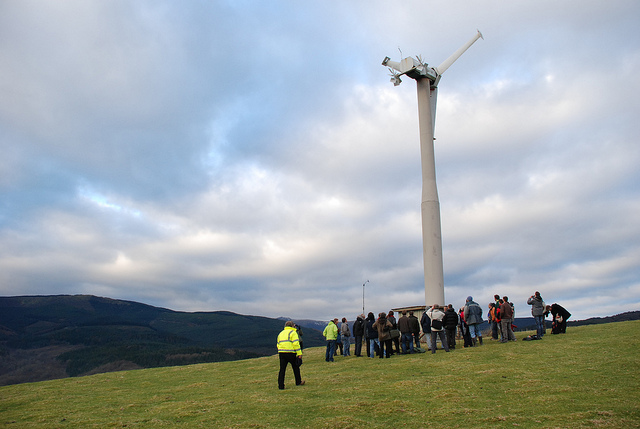
Image Source : Centre for Alternative Technology

How Terrestrial Laser Scanning Makes Pre-Project Planning a Faster Process

3D Laser Scanning

In today’s competitive oil and gas landscape, companies are looking for any advantage they can get to help them finish their projects on time and under budget. Unfortunately, many oil and gas leaders fail to recognize just how important it is for them to get their projects off on the right foot. When companies make an effort to start off a project right with pre-project planning based on complete and accurate land surveys, the rest of the project phases have a way of falling into place by themselves.

Today we’ll discuss terrestrial 3D laser scanning, and how it can be an important tool in getting off to the best start possible with effective pre-project planning. While 3D laser scanning can play an important role throughout a construction project, it has many special advantages when it comes to pre-project planning. As a result, there’s really no reason that anyone should ever consider beginning an oil and gas construction project without first completing a 3D laser scan of the terrain.

What Is 3D Laser Scanning?

Simply put, 3D laser scanning is a process that involves bouncing laser beams off of a building or a piece of terrain. As the light points bounce back, the scanner collects data about the laser’s flight and integrates this data into a point cloud. Companies can then use this point cloud to create detailed 3D models that support pre-project planning.

What Makes 3D Laser Scanning So Beneficial?

The hallmarks of terrestrial laser scanning are that it allows land surveyors to complete extremely detailed scans of an area in a very quick period of time. Traditional land surveying methods take significantly more time to complete than 3D laser scans, meaning that they also cause delays in the beginning of the project. In addition, the surveys that traditional land surveyors create are nowhere near as detailed as those created by laser scans, and often require the surveyors to place themselves in harm’s way on dangerous terrain.

After a team has a complete and accurate laser scan, they can begin working on the pre-project planning process with no delay. In addition to being quicker, 3D laser scans also support better decision making during the pre-project planning process. Team leaders will be able to make educated decisions about the best way to proceed with a project, while also feeling completely confident that their decisions are based on a complete and accurate understanding of the terrain as it actually exists, rather than the computer generated contours that go along with traditional surveying methods.

Finally, the accuracy and completeness provided by 3D laser scanning will prove to be an asset even when plans change. If, during the course of your pre-project planning, your team decides to move in a different direction with a project, you will most likely still be able to leverage information included in your original 3D laser scans, rather than having to take time out from your planning to complete additional measurements. 3D laser scans provide complete and detailed information that covers an entire area, meaning that you’ll never have to pay to bring surveyors out for another pre-planning site visit.

Simply put, 3D laser scanning is the best way to ensure that your oil and gas project gets off to the right start, while also ensuring that your team will be prepared to adapt to any issues that may arise along the way. With 3D laser scanning, you can help make sure that your pre-project planning process is completed on time and under budget, setting you up nicely for a successful project.

To learn more about how 3D laser scanning services from Landpoint can help your company conduct better pre-project planning, contact us today.

Why Planning with GIS is Critical for Pipeline Routing Projects

Pipeline SurveyingWhile pipelines do provide a cost-effective method of transporting oil and gas across long distances, it is still crucial for companies to save on pipeline development costs when they can. Pipeline development represents one of the most significant capital investments oil and gas companies will make, so everything they can do to cut costs helps.

One of the key ways oil and gas companies can cut costs on their pipeline development projects is by using GIS mapping tools for pipeline surveying. Of the many factors that drive high expenses for pipeline routing projects, most of them, including things like diameter, distance, and operating pressure, represent fixed costs that companies really have no control over.

On the other hand, companies can control which terrain they choose to route their pipelines through. This means that pipeline routing is one of the few opportunities that oil and gas companies have to easily cut their pipeline development costs, and GIS is one of the best ways to take advantage of that opportunity.

GIS: A Solution for a New Generation of Pipeline Surveying

In the past, oil and gas companies could build their pipelines just about anywhere. Now, as pipeline right-of-ways grow more and more congested, these companies have to be very selective when picking a route in order to avoid both natural obstacles and existing pipelines.

Fortunately, with GIS, oil and gas companies have a new technology that can help them better address this new challenge. GIS helps provide a far more accurate look at a piece of land than ordinary topographical maps could ever provide, offering a clear and complete representation of the spatial relationships around a piece of terrain. As a result, oil and gas companies can get a pipeline route map that helps them make more cost effective decision.

Factors That Define Optimal Pipeline Routing

In pipeline surveying, obstacles like wetland crossings and rough terrain create problems for companies. The pipeline development will have to stop whatever they are doing to find a way to make the pipeline go through, around, or beneath the obstacle. Having to change the pipeline route like this is a waste of time and money, which is why it’s always good to use GIS and just avoid the obstacles in the first place.

It’s also important to recognize that GIS can help you in a variety of other ways as well. When oil and gas companies develop pipelines, they have to account for issues such as how the new pipeline will affect the community. This is important because it helps companies consider things like how the settlements would be affected in the event of oil leakage, and how much the company would have to set aside for compensation payments to existing land owners.

In addition, oil and gas companies have to consider the environmental impact of their project before they can successfully pitch the project to the appropriate regulatory boards. GIS helps planners understand the overall impact of the project, and how to alter the pipeline routing to minimize the damage to vegetation and avoid protected areas like wetlands altogether.

Final Thoughts

In pipeline surveying, what you can’t see definitely can hurt you. Failing to account for poor terrain and other obstacles can delay your project, which costs money. Failing to account for how your pipeline will affect people and the environment can also be very costly, both in terms of financial losses and damage to reputation. Having as much visibility over your pipeline route as possible is key, and GIS can provide that visibility for you.

Ultimately, utilizing GIS services will help you save money and ensure a more efficient and cost effective pipeline route map.

Unmanned Aerial Vehicle