How a Land Surveying Company Can Reduce Bottlenecks for Oil and Gas Projects
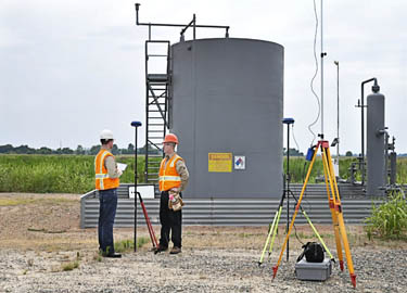 As the oil and gas boom continues, projects are increasing in scope, size and complexity. Companies often find themselves unable to adjust to the new realities of their project, leading to bottlenecks that can cause extending delays and wasted resources.
In order to remove these bottlenecks and keep your oil and gas projects progressing according to plan, you need to work with an experienced land surveying company that you can trust to provide scalability, rapid access to deliverables, and open lines of communication between key project stakeholders, no matter where they are in the country.
Working With The Wrong Land Surveyor Is A Major Cause Of Bottlenecks
One of the byproducts of the oil and gas boom has been a proliferation of new land surveying companies across the country. These new companies come in many different sizes and experience levels, and choosing to work with the wrong land surveying company can have grave consequences for your oil and gas project.
Working with a land surveying company that is too small or too inexperienced can cause project bottlenecks due to:
- Lack of scalability
- Inability to distribute information quickly
- Inexperience in oil and gas surveying
Working with the right land surveying partner can help you address these issues, ensuring that bottlenecks won’t occur with your project.
Ensuring Scalability
In the context of land surveying, “scalability” refers to a company’s ability to keep up with rapid changes in product scope. Scalability is frequently an issue in the oil and gas industry, as new obstacles and complexity arise frequently as these projects progress.
Oil and gas companies simply can’t afford the long turnaround times that occur when a land surveyor can’t complete field work and produce deliverables quickly. It’s also important that these companies assess a land surveying company’s ability to scale before the project begins; having to replace a land surveyor that can’t scale will only delay the project even further. It’s a better idea to do your homework beforehand, and make sure you’re working with the right land surveyor right from the start.
A land surveying company can ensure scalability by having a large team of experts and the latest technology. When change in project scope creates the need to have more surveyors in the field, a larger company that has experienced teams spread out across the country can easily make that happen, ensuring that the project can continue with no major delays.
On the other hand, smaller land surveying companies often lack the resources needed to respond quickly to changes in project scope. If they need more surveying teams in the field, it may take them weeks to get those teams lined up, if they are able to do at all.
Ensuring Distribution of Information
Today’s industries are more spread out than ever before, and oil and gas is no exception. Key stakeholders from the same project can often be stationed at different locations throughout the country, making it difficult for everyone to be on the same page. As project scope changes, this problem only gets worse. Oil and gas companies need to work with a land surveyor who can provide the ability to distribute information quickly across dispersed geographic locations.
Land surveyors with cloud-based project management offerings can help address this issue. When new information arises that changes the nature of a project, team members have one centralized portal they can upload that information to, and instantly ensure that everyone is able to see it. This removes the bottleneck involved with trying to make sure that everyone is on the same page. Land surveyors can also offer field teams the ability to access the project management system on mobile devices, so that new information can flow from job sites to offices as quickly as possible.
For more information on land surveying services from Landpoint, read our oil and gas brochure, or request a free land surveying quote.
