How Cloud Computing is Revolutionizing Oil and Gas Projects

cloud computingCost cutting and improved efficiency are central to oil and gas companies. Changes in the industry, new regulations, and increased competition have companies looking at technology differently than they did even five years ago. In particular, cloud computing is revolutionizing the oil and gas industry, particularly in areas of oil and gas surveying and project management.

Cloud computing platforms can be somewhat invisible. Because they are so simple to use and make previously complicated tasks easy, it is entirely possible that the user may not realize just how much this technology is impacting their business.

The Value of Cloud Computing to the Oil and Gas Industry

Cloud computing, in general terms, is the ability to simultaneously distribute information over a computer communication network to many users. The flip side to this is the ability to access and retrievethe vast amounts of stored dataregardless of time and location.

Cloud computing is extremely popular in industry and business for the same reasons any innovation or technology is popular: improved efficiency and cost effectiveness.

This is especially useful for the oil and gas industry, which has to handle large amounts of data as well as manage multiple, often remote teams. With any oil and gas project there are a lot of moving parts, and cloud computing can be used to make these parts work more seamlessly with one another. Important data and documents can be easily accessed by those partners who are cleared to view them. Since information is available onany internet capable device, data can be uploaded from a project site and made instantly available back at regional centers or corporate headquarters.

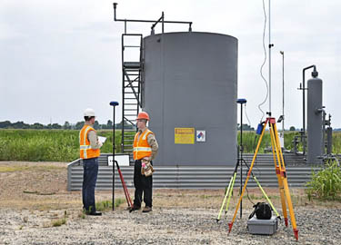
Land Surveying and GIS Mapping via the Cloud

Quality control, connectivity, and real-time survey and drilling data are enhanced through cloud computing. Mobile devices are already used by oil land surveyors to collect data and upload it to servers. Seismic crews use wireless recording stations to ensure quality control.

Data can be collected from the field and immediately uploaded. Land surveyors collect data and cartographers in an office in the next state can interpret and map it for immediate uploading and distribution. Stored map information may be integrated into other internal systems, or used on-site by the project manager and crews.

Oil and Gas Data Management: Now in the Cloud

Project managers utilize cloud technology to query and view cross-project and multiple task data files. Historical, geological, and drilling operations data relevant to the project they are working on, can be accessed by simply logging into the cloud repository.

Using cloud technology for Oil and gas data management also makes it easy for the project manager to share pertinent information with all project stakeholders. Additionally, data can be easily cross analyzed and interpreted, leading to decisions being made and conveyed faster, thus reducing adverse impacts to the community, company, and environment. This efficiency also translates into minimization of costs associated with delays, slowdowns, catastrophes, or other unplanned interruptions.

Using cloud data also provides project managers with additional information to effectively determine critical milestones, create achievable schedules, and generate more complete reports and more informed budgets.

The cloud provides a continuous and secure flow of information from a variety of cross-disciplined experts. When oil and gas companies implement a cloud computing platform, they will see much more reliable service results while saving money at the same time.

If you are looking to use cloud technology to cut costs and increase efficiency, then try our Oil & Gas Data Management Demo for free and see what a difference it can make.

Image By : SweetCrisis

5 Challenges Oil and Gas Companies Are Facing in the Eagle Ford Shale

Oil and Gas Companies Eagle Ford ShaleDomestic shale extraction of oil and natural gas has created a substantial economic boom for the country. Oil and gas companies working the Eagle Ford Shale area of Texas are generating wealth and jobs, but financial, human-resource and technology challenges persist. Nearly 400 drilling rigs operate in West Texas, and Eagle Ford Shale contains 3.351 billion barrels of oil and 20.81 trillion cubic feet of natural gas. The area generates more than one million barrels of oil and nearly 5,000 cubic feet of gas per day. Oil production in 2013 topped 688,429 barrels. Shale extraction at Eagle Ford has generated an unparalleled economic windfall for localities, Texas and the nation. Prospects for continued increases in production are astonishing.But there are still a number of challenges that oil and gas companies are facing in that region. Here is a look at 5 main issues they are facing.

Problems that Technology and Regulation Must Solve


Challenge 1—Skilled Labor Shortages

Drillers, truck drivers and skilled workers are increasingly hard to find. Eagle Ford Shale gas and oil companies employed 38,000 workers in 2011, and demand is steadily growing. The 14 surrounding counties have sparse populations, and transient workers create hosts of service problems for localities.

Challenge 2—Failure to Invest in New Technologies

New technologies drive efforts to revisit old fields and extract oil and gas. Failing to invest in technology, pipelines and other energy-delivery systems could cause production companies to miss potential revenue generating operations. Stakeholders in raising funds for research include drillers, landowners, major energy users, utility companies and regulators at all levels of government. Technology challenges include finding better methods of detecting methane leaks, optimizing production, cutting costs and minimizing environmental damage.

Challenge 3—Ensuring Safety and Security

For oil and gas companies, safety and security issues are interrelated to all the other challenges of shale extraction. Drillers, landowners and residents face the following risks:

Proximity to Mexico

Mexican drug cartels smuggle drugs, people and contraband across the border.

Inexperienced Workers

Scarce labor causes companies to hire inexperienced people to work in hazardous environments where mistakes could cause major risks.

Poor Records

Poor record-keeping results in mistakes, inefficient field data collection and faulty security reviews.

Oil and gas companies concerned with security also need to make sure that they partner with contractors who put strong emphasis on safety. If safety isn’t a top priority for everyone involved with a project then it can easily result in a hazardous work environment.

Challenge 4—Protecting the Environment

Water use and conservation are big issues in Texas, and overlapping and contradictory regulatory requirements create challenges at the federal, state and local level. Texas has the unique distinction of supporting environmentalism and big energy. Environmental challenges that oil and gas companies face in Eagle Ford Shale include:

Water Shortages

Texas suffers from ongoing water shortages, and fracking shale requires vast amounts of water.

Air emissions

Perhaps the most well known oil and gas environmental regulation. Dealing with problems of air emissions include those generated by drilling and air emissions by large fleets of tanker trucks. Diesel rigs produce fumes and drilling releases volatile organic compounds, methane and greenhouse gases.

Challenge 5—Transportation

While it’s possible to transport oil and gas by rail or by truck, these methods tend to be costlier. The most efficient and inexpensive method is by pipeline, although this comes with its own set of challenges:

Property Rights and Landowners

As local landowners become more educated about their rights there has been a rise in cases regarding right-of-ways, shut-in-wells, lease terms, and other legal issues. This makes running pipelines through their property more challenging and requires a greater degree of field data collection and planning beforehand in order to ensure that a clear legal picture is made during the initial surveying work.

Line Capacity

In some areas of the Eagle Ford Shale, the current amount of pipelines is at capacity and in some cases wells have been shut in. As a result, there has been a drive to build new lines and expand existing ones in order to increase capacity.

The Bottom Line

Oil and gas companies provide 62 percent of energy consumption in the United States. The energy industry must deal with technology changes as well as environmental and regulatory challenges and conflicting agendas from stakeholders. Advanced field data collection and 3-D modeling has helped to reduce costs as well as keep projects organized and running on time. What are the challenges that concern you the most? What are the best ways of tackling these issues? Please post your thoughts in the comments below.

landpoint

How Modern Surveying Means Less Time Spent On Site

Oil and Gas ProjectsTechnological advances in land surveying equipment and methods are transforming the industry by streamlining the surveying process and reducing the number of resources needed to complete projects, especially on the ground. Traditionally, field data collection has been a very hands-on process, whereby surveyors expend considerable time and resources on-site to manually map out areas and provide a basic blueprint for clients.

Now, armed with sophisticated technologies, like 3D scanning and modeling, modern GPS surveying tools, GIS mapping, and high-tech data collectors, some land surveyors are transforming the industry. The results – the field data collection process is significantly shortened and clients receive more detailed and accurate results, all the while with fewer resources, especially on site. Ultimately, these outcomes improve clients’ bottom line, expedite the survey life cycle and minimize the risk of costly errors and need for rework.

Which technologies should companies be looking for when it comes to field data collection?

GNSS Surveying. The Global Navigation Satellite System (GNSS) is the foundation for modern surveying. GNSS pulls data not only from the American global positioning service (GPS) but from other entities as well, creating even more accurate results. Historically, surveyors physically canvassed areas to plot coordinates and demarcate boundaries; everything was done manually and on-site. Using GNSS surveying equipment, surveyors can access geographic data points gathered by a network of satellites that rotate around the earth and collect positioning data on an ongoing basis. This switch has dramatically increased surveyors’ productivity and made their surveys much more accurate

High-Tech Data Collectors. In the past, collecting data was one of the most time consuming parts of the surveying process. While manually canvassing an area, surveyors would physically enter their data and sketches, often using a pencil and paper. High-tech field data collectors enable automatic entry of thousands of points of data into an online system. This process has revolutionized the surveying field by significantly reducing the number of people and the time it takes to complete a survey. In addition, automating the field data collection process minimizes errors caused by human entry.

GIS Mapping. Geographic information systems (GIS) are systems that store mapping information and attributes in digital form so that it can be easily accessed and analyzed. For surveyors, using GIS mapping is a powerful tool, because it helps provide a simple, visual context for what would otherwise be complex, spatial datasets. Further, GIS mapping allows data to be easily manipulated using a multitude of variables that can be layered over one another. GIS mapping information is stored in the cloud, so data can be accessed in real-time from the convenience of any device connected to the internet. This feature helps improve communications between surveyors and their clients and gives clients the ability to effectively manage projects on a daily basis from remote locations.

3D Scanning and Modeling.  3D scanning and modeling or “high definition scanning,” as it is sometimes called, is a process that uses advanced lasers to map an area in extremely high detail. Essentially, 3D scanning technologies capture image data points at an incredibly rapid pace to create a precise, almost life-like visual of the project area. Most importantly, 3D scanning technologies precisely map out coordinates to millimeter accuracy, thereby significantly improving the reliability of the survey itself. In turn, clients can make more informed decisions about their projects.

Selecting a surveyor with experience using these technologies can significantly improve a project’s bottom line, especially for Oil & Gas, Clean Energy and other companies, for whom surveying is an integral part of their business. To see how cutting-edge surveying technologies and techniques can help you save time and cut costs, get a no obligation quote today.

Is It Time To Consider Another Professional Land Surveying Company?

Oil and Gas ProjectsLoyalty between business partners is an admirable trait. Businesses depend on customer loyalty and the benefit to stable trading partners extends in both directions and usually result in a mutually beneficial relationship. One business provides a service that is important to the other while maintaining a high level of customer service. However, when times change and new technologies and practices emerge, if a professional land surveying company isn’t keeping up with it then it’s their clients who suffer.

When Technology and Services Change Significantly, It’s Time to Reevaluate the Status Quo

The standard technology for geodetic surveying was established in 1787 with the introduction of the Ramsden theodolite, and many land surveying companies – especially older land surveying companies – still use modified versions of the theodolite today as their primary means for data collection. A professional land surveying company that is still using this as their default method of surveying is generally not providing the best results for their clients.

When the satellite-based Global Positioning System became fully operational in 1995, surveying changed significantly. Unlike ground-based data collection with theodolites, GPS data collection does not require line of sight visibility between measuring points. Professional land surveying no longer requires trekking to difficult locations to set up tripods. GPS measurements yield 3-D coordinates with high geodetic accuracy, and data can be collected around the clock without regard to weather. GPS surveys aren’t necessarily better than those made with conventional equipment, but they can often be completed more quickly. Graphic Information Systems took GPS land surveying data to another level by changing the way data is stored, retrieved and shared. Spatial coordinates and map features are stored as spatial data and can be organized into various map layers with common features. A survey is no longer just a paper map with line drawings of roads, easements and power lines. It becomes a collection of data layers that can be peeled back or added as desired.

Additional information, called attributes, can be linked to the spatial data to give maps tremendous new abilities. Population demographics, political districts, school districts, fire districts and census data are all examples of attributes that are easily linked to spatial data. Maps can now be customized in amazing new ways.

Many professional land surveying companies began using new GPS/GIS technology as soon as it had been proven accurate and reliable. Others felt that transit theodolites were sufficient for the work they were asked to perform and saw no reason to change.

What Are Your Needs?

Both technologies work extremely well. Each has benefits in certain applications. For example, GPS surveys require an unobstructed view of the sky to receive satellite signals. They cannot be used underground, and mine surveys rely on theodolites. Mapping mountain ranges requires strenuous and dangerous climbing, and GPS mapping is both safer and convenient. The majority of applications, however, can be performed equally well by both technologies.

The deciding factor is often how the data is to be handled. Energy companies are a good example of a business sector that often has a long-standing relationships with a professional surveying company. They continue to do business with the associated surveying company even though they know newer technology is available.

So is the company losing opportunities because of these long-standing relationships? The answers depend on the level of service being provided and the company’s goals for using the data.

Long term business relationships can lead to complacency. Long turnaround times become viewed as just a normal facet of the business when, in fact, GPS surveying can usually be completed much more quickly than standard theodolite surveying. Is time valuable to the project? In most cases, it is.

Surveyors may have been providing standard paper surveys for decades, and these may have been sufficient for the needs of the company in the past. They may still be. But today businesses have to ask questions like “could the company benefit by knowing the demographics of the areas in which gas drilling or wind turbine construction is predicted to grow?” Companies should ask whether there are additional data needs or not.

Is The Status Quo Good Enough For Your Company?

There’s a lot to be said for company loyalty. There’s also a lot to be said in favor of growing and adapting to new business opportunities. Don’t be afraid to consider a new professional land surveying partner, especially if old relationships have grown stale.

If you are looking for a change then Landpoint can help. Get a quote today and see how we can save your company both time and money.