The Role of Surveys in Pipeline Pig Tracking & Operations

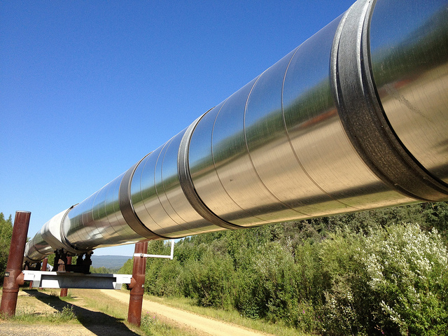
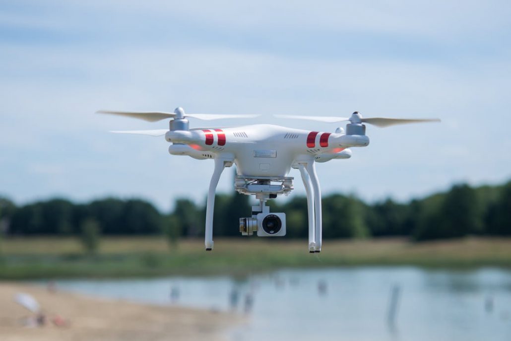
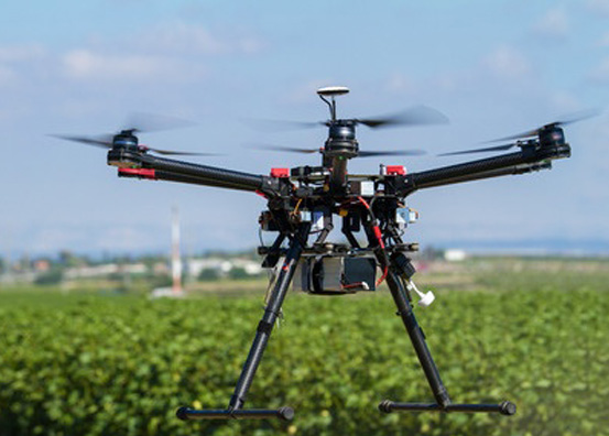
Pipelines always begin with surveys. And it’s easy to see how a UAV can help with an initial pipeline survey. But pipeline management, maintenance, and repair go well beyond the initial surveys. Today, we’re going to take a look at the role of surveys and UAVs in pipeline pig tracking (as well as general operations).

What is Pipeline Pig Tracking?

Pipeline pig tracking refers to the process of monitoring the general health of the pipeline. A pipeline pig is put through the pipeline and then its progress is monitored, indicating any issues as it goes. There are various origin stories for this phrase. 

The clearest origin is that the “pig” devices make a squealing sound as they move through the pipes. In later days, “pig” started to refer to Pipeline Inspection Gauge or Pipeline Intervention Gauge. But this is likely what’s known as a “backronym,” someone inventing a reason to use an acronym rather than the other way around.

Either way, pipeline pig tracking is a form of in-line inspection that makes it possible to manage and monitor a pipeline without having to open it up or potentially disrupt it. As pipelines are often buried, difficult to access, and usually need to stay in continuous operation, it can be otherwise very difficult to determine whether a pipeline is experiencing issues.

In-Line Inspections (ILI) for Pipeline Integrity

An in-line inspection (ILI) refers to the same thing as pipeline pig tracking. It’s a non-destructive method of ensuring that a pipeline isn’t leaking and that its structural integrity is still holding.

Pipeline maintenance involves some challenges. The pipeline has to remain up and continue flowing, which can make it difficult to determine whether something’s wrong with the pipeline itself.

Consequently, many methods have arisen to make it easier to identify cracks and damage in the pipeline.

Even if a pipeline has some measure of exterior integrity, there comes a concern that it could be damaged by things like adjacent tree growth, earthquakes, and other disruptive and destructive events.

Surveying with Pig Tracking

Pig tracking can be performed through a survey, with the surveying UAV looking for a sensor that would be connected to the pig. By completing surveying in this fashion, pig tracking can be faster, easier, and more accurate.

UAVs are increasingly being used not only for new constructions, but also for the management and monitoring of already constructed projects. When it comes to surveying pipelines, a UAV survey can identify potential areas of intrusion (such as large trees growing by a pipeline) as well as potentially damaged pipelines (using sensors).

As time goes on, sensors will only become more advanced and more able to identify issues. Consistent in-line inspections can reduce the chances that a major incident might occur and can overall improve operations. By improving the management and maintenance of the operation, surveys can also reduce the overall costs of the pipeline site.

Initial Drone Surveys

At the beginning of a pipeline project, UAVs and surveying can also be used to ensure that the project is completed as it should be. Surveys can be used to isolate the best areas for the pipeline to go in. Simulations based on these surveys can identify any potential environmental risks.

A drone survey is a very accurate way to map out the area that’s being developed. The drone survey data can then be assessed and used in simulations until the best possible pipeline has been constructed.

Once that pipeline has been constructed, that’s when the organization will need to look at pig tracking, in-line inspections, and general pipeline integrity. 

Initial drone surveys can be used to ensure that the present-day pipeline still looks the same as it did before; these comparisons can be used via drone technology to identify areas of damage after a large event, such as an earthquake or severe hailstorm. Initial drone surveys can also be kept and simulated, if in the future the pipeline needs to undergo expansion.

Monitoring through UAV Technology

UAVs can be used to deliver information about tell-tale signs that a pipeline may have lost its integrity. For instance, a UAV might be able to notice from above that the ground appears to be saturated in a given area, that trees and plants are not faring well, or even that a sensor such as a Pipeline Inspection Gauge has gone off. 

The more monitoring provided to the pipeline, the safer and more valuable it becomes. By heading off issues before they become major problems, the pipeline won’t just save money but will also be able to preserve the environment and its surroundings. All this can happen through more regular monitoring with unmanned aerial vehicles.

UAVs and the Pipeline Industry

Ultimately, there are many ways in which unmanned aerial vehicles can help with pipeline operations. From dig staking to determining pipeline integrity, a UAV can assist by putting eyes on potential issues, by interfacing with sensors, by producing initial surveys, and by helping determine where problem spots may be.

And the more often regular assessments are completed over the territory, the less likely there are to be significant incidents.

Want to learn more about UAVs and the pipeline industry? Contact Landpoint to find out.

Learn-How-to-Increase-the-Efficiency-of-an-Oil-and-Gas-Pipeline-Project

Necessary Components of Safe Pipeline Maintenance

Pipeline maintenance is incredibly important. Not only does the industry go through revisions of regulations and standards with some frequency, but no organization wants to have to deal with the consequences of a catastrophic failure. With that in mind, there are some necessary components of safe pipeline maintenance that can make the entire process easier.

Pipeline Integrity Management Software

Pipeline integrity services create a framework for pipeline integrity management. These pipeline integrity services help organizations follow given sets of codes and standards, such as how often inspections should be done, and how inspectors should be trained. 

Organizations can lean heavily on pipeline integrity platforms as a method by which they don’t just plan out their maintenance efforts, but also create a paper trail of those efforts that can show that they have done their due diligence.

Pipeline Integrity Assessments

Pipeline integrity assessments are assessments designed to ensure that the pipelines are being managed and maintained correctly. Through a regular assessment, an organization can audit any improvements they need to make in the management of their pipeline. 

By auditing the organization’s standards, the organization can ensure that it doesn’t become lax about its pipeline inspections and pipeline management.

Pipeline In-Line Inspections

In-line inspections can be performed to identify potential issues regarding the pipeline from within. In-line inspections will reveal issues such as cracks, defects, and warping, which could eventually cause failure. A pipeline in-line inspection should be done semi-frequently; if it catches anything, repairs can be made before the issues become severe. 

It is very rare for an in-use pipeline to be taken down. For the most part, pipelines have to be inspected while they are still in use. Often, they also have to be repaired while they’re still in use. This creates additional challenges — challenges that can be resolved through the right applications of the right technology.

Drone Pipeline Inspections

Drone pipeline inspections can substantially reduce maintenance costs. Drones can be used to fly over and survey a pipeline that has already been built, to identify areas in which the pipeline could be revealed, potentially damaged, or otherwise breached. Drone pipeline inspections are much safer than traditional inspections. At the same time, pipeline exposure and depth of cover can also be assessed.

UAVs are inherently safer than manned aerial vehicles, because they don’t involve any danger to a crew within. Further, drone pipeline inspections can also be safer than inspections on the ground, as an individual doesn’t have to risk danger to physically inspect the pipeline.

Drone pipeline inspections can also be combined with pipeline sensors to determine exactly where an issue is and what that issue could potentially be. Because drone pipeline inspections are so easy to deploy, they can also lead to an organization completing more inspections more frequently, as well.

Pipeline Sensors

In addition to using drones to improve safety, pipeline sensors can also be incorporated to detect issues such as potentially high or low pressure. Pipeline sensors are increasingly being included in pipe construction, added to the Internet of Things, and automated. A pipeline sensor can set off an alarm if it detects something that it shouldn’t, feeding its own exact location to its management and maintenance team.

A pipeline sensor can become one part of a much broader network of sensors and devices that are all designed to report on the current status of the pipeline. Thus, manufacturers are able to take a more hands-off approach. Between regular surveying and pipeline sensors, an alert can be raised every time an issue occurs.

Losses and Other Data

Apart from physical devices and systems, such as sensors and drones, pipeline organizations must also crunch large volumes of data. If a sensor doesn’t go off and no damage is visible, this data may still reveal that more materials are getting lost in transit than should be getting lost — a leak may be involved but be undetectable. 

Software solutions that are designed to crunch large volumes of data and identify patterns (as well as issues that don’t fit into an established pattern) can be used to automate the process of identifying these types of detectable signs. There are pipeline maintenance companies that can use advanced solutions to detect problems swiftly.

Oil and Gas Pipeline Maintenance

For pipeline maintenance, faster is always better. The faster that an issue can be identified and resolved, the less likely it is to cause widespread issues throughout the region. With a combination of UAVs, sensors, data analysis, and assessments, organizations are able to better monitor their pipeline technology and are able to more quickly identify potential faults.

Once faults have been discovered, it’s essential that the organization resolve them right away. The longer an issue goes on, the more likely it is to cause significant damage. 

Oil and gas pipeline maintenance is essential to the industry. Without the right pipeline integrity management, it’s very easy to see how a pipeline could damage the surrounding environment, disrupt the organization, and ultimately cost quite a lot to repair. 

With the above components, pipeline maintenance can be achieved at reduced costs and greater levels of safety.

Are you interested in learning more about pipeline integrity management? Through surveying, monitoring, and maintenance, the UAVs of Landpoint can help. Contact Landpoint today to find out more.

Learn-How-to-Increase-the-Efficiency-of-an-Oil-and-Gas-Pipeline-Project

How Does a LiDAR Drone Survey Work?

If you’re thinking of conducting a survey, you might be wondering if you should use a UAV. UAVs are a swiftly growing branch of the surveying industry — so quickly, in fact, that it’s becoming a standard.

Today, we’re going to discuss some of the types of LiDAR mapping drone, how you perform a LiDAR survey, and what you do with the GIS data that emerges.

The Types of LiDAR Mapping Drone

There are two major types of LiDAR mapping drone: fixed-wing and quadcopter. A fixed-wing drone is much like a plane. It’s easy to fly straight but it can take a little more work to maneuver. Because it glides, it cannot hover. A quadcopter is more like a helicopter. It can be more challenging to fly, but it can also hover. Frequently, it’s more maneuverable than a fixed-wing drone.

The type of drone you select is going to depend on the type of survey you need. If you need a survey that goes under something like a bridge, or inside of something like a cavern, a quadcopter drone is probably better. If you need something that can cover a large volume of territory very quickly, a fixed-wing drone is likely an ideal solution.

And, of course, it isn’t always about drones. LiDAR can also be used with planes and helicopters. Because these are manned vehicles, they are more dangerous and need additional permitting. Planes may go too fast and too high to get a good, high-resolution image, whereas helicopters may not be stable if they’re asked to do too much maneuvering and can’t safely approach places a drone can.

Performing a LiDAR Drone Survey

Performing a LiDAR drone survey is easy. First, permits may be needed; it depends on the area. It’s still faster and more affordable than trying to use a manned aerial vehicle, such as a manned plane or helicopter. The drone will already be fitted with LiDAR technology. One drone or multiple drones, depending on the size of the property, will fly over the area and capture images. The LiDAR images will be exceptionally clear and high quality; they will even cut through brush. 

All of this is handled by the experts. A drone survey professional is able to setup a survey very quickly. Multiple drones may be used depending on the amount of power they can store in their batteries. The drone will already have built-in LiDAR technology which can then be exported directly to a GIS system.

Corridor Mapping for a LiDAR Drone Survey

Corridor mapping is one of the strategies that can be used for directing survey drones.

Today, a lot of drones can be programmed to do some complicated maneuvers. For instance, most drones have a “hover” mode that sets a point in space that the drone is supposed to circle or hover by. Because a lot of this is automated, it’s easy to perform these maneuvers as necessary.

Corridor mapping means that the drone is simply going straight and collecting data. While it may not be as fun as twists and turns, corridor mapping is what makes a LiDAR drone survey so efficient.

In addition to corridor mapping, you can have drones wait where they are. Corridor mapping is simply the most efficient method for surveying large volumes of land quickly. It’s often best suited to fixed-wing UAVs, as they operate like planes and can fly very fast.

GIS Data for Aerial Mapping

Once the data has been collected, it will be brought into a GIS platform. Most GIS data, whether it’s from LiDAR or another source, will be in a standardized format. From there, you’ll be able to look at your GIS data as points in 3D space. You can even manipulate this space, building on it, and potentially planning new projects.

GIS data will stay forever. But it isn’t just automatically converted to data that can be seen and understood. Rather, the raw data that’s recovered from the drone will usually be processed to ensure that it’s accurate. Most companies are not end-to-end data companies; they rely on a third person for their GIS data management. Working with an all-in-one company, such as Landpoint, will often involve fewer issues.

Simulating Topographic Data

A LiDAR survey is one of the fastest, easiest ways to survey any territory. A UAV is uniquely well-suited to the task, flying with precision accuracy and collecting the data at a much higher resolution. LiDAR and drone surveying can be used to simulate and store topographic data, which can then be used for virtually any need. 

GIS data can be used to simulate modifications that are made to the survey area not just now, but decades from now. If the simulated data is kept hosted, it may be able to be used in the future for expansions, teardowns, or repurposing. It can also be used in a variety of different simulated software platforms.

There are other solutions other than LiDAR for topographic mapping. But presently, LiDAR remains the most accurate and feasible solution. 

If you want to learn more about having an unmanned aerial vehicle complete your next LiDAR survey, the time to ask questions is now. Connect with us at Landpoint to find out what we can offer.

Surveys at Scale - How Landpoint Tackles Survey Projects of Any Size

Why GIS Is Critical to Utility Mapping

When surveying, GIS data can help produce exceptionally useful, exceptionally accurate geographic data. GIS survey data can be used for a variety of activities, ranging from planning pipelines to expanding solar energy farms. Today, we’ll take a look at why GIS is critical to utility mapping.

Using GIS Data for Utility Mapping

GIS data and surveying go hand-in-hand. When drone technology, such as UAVs (unmanned aerial vehicles) are used with GIS platforms, it makes it easier for drones to report what they have seen in an easily simulated, easy to read way. Drones are able to record data, via either photogrammetric or LiDAR technology, that the GIS can then map it into a topology.

GIS data is used for a variety of applications, not just surveying. It’s a very useful method of ensuring that all data acquired is correctly fixed in topological space. A GIS platform will be able to bring in survey data, simulations, and projects, all of which can then be imported into the technology being used to build a project.

The type of data still matters. LiDAR remains one of the most accurate methods of collecting GIS. Photogrammetric surveying will produce more human-readable data, but LiDAR can produce more accurate, efficient 3D data. Either way, A GIS system will be able to bring the information in so that it can then be used for utility mapping.

Better Planning for Better Construction

GIS and surveying are complementary, producing accurate scans of geographic data that can then be used for the planning of new developments and projects. Whether natural gas lines are being run or fiber optic internet cables, utility mapping is an important first step. 

With better planning and better decision-making:

  • It will be easier to assess how long a project will take and how much it will cost.
  • Damage to the surrounding environment will be lowered or mitigated.
  • Accurate property lines can be noted, important for handling any potential legal issues.
  • The project will more likely line up to the final desired deliverable.
  • The project will be overall more efficient and predictable.

GIS provides additional data when surveying — data that can be critical to the most thorough planning stages. With this additional data, companies are able to produce advanced simulations and predict the course of the development — from the start. 

And this GIS data is forever. Once the drone has built out the GIS data, it can be accessed by all stakeholders on the team. It can be re-accessed during repairs and updates — and it can be used if there are questions of improving efficiency.

More Efficient Utility Mapping in GIS

GIS data can be used to create more efficient utility services. Through GIS data and simulation technology, companies will be able to see the configuration of a utility network that would work best. They can avoid potential issues, such as areas that cannot be easily traversed, and bake it all into initial planning.

In most large-scale projects such as utilities, it isn’t the initial cost of the project that ends up being the greatest expense. Rather, it’s re-works that are required to be done later. But this also requires that the data that’s collected through the GIS platform be as accurate as possible — a challenge for the surveyor.

Environmental Surveys and Planning

For environmental surveying and planning, GIS provides superior due diligence mapping. With GIS mapping for water utilities, gas lines, GIS for electric utilities, and other forms of utility mapping in GIS, environmental impact can be more reliably predicted. Better data means less disruption to the environment.

Survey data taken with LiDAR and brought into GIS can create a complete topological map, even cutting through thin cloth, bushes, and underbrush. When combined with GIS data, LiDAR provides incredibly accurate information through which to take an environmental survey. The simulations that are produced can show an organization how things like potential flooding, spills, or even noise and light pollution will impact the area.

Simulations, Projections, and Cost Management

For pipeline utility mapping, simulations and projections can be used to estimate the necessary depth of cover (DOC) and other regions. By using simulations and projections, effective cost management can also be achieved. The better the costing, the less likely that the project might experience delays or an overrun.

Once GIS survey data has been uploaded, it can be used for all manner of simulation, both now and into the future. Simulations can be used to ensure that the project is operating on time. Simulations can be used for projected expansion. If additional waterlines are added, how will they impact the existing lines? If additional electric utilities are needed, what will have to be altered?

In the future, this GIS survey data can be used as retained for expansion and modifications, making it an investment in the longevity of the project.

GIS Data for DIMP and Beyond

Accurate GIS data can help organizations build their Distribution Integrity Mapping Program (DIMP) plan, reduce potential environmental impact, and optimize their utility systems for greater levels of efficiency. Organizations can engage in record research in the future and otherwise manage their existing GIS data.

It is always better that utilities be both safe and efficient. GIS data can be used to ensure that the plans for the utilities themselves are as fine-tuned and optimized as it can be. Once construction has been completed, a combination of GIS data and drone technology can be used to regularly investigate the work site and ensure that issues haven’t emerged.

It’s incredibly important that utility mapping be completed with accuracy, especially underground utility mapping. GIS surveying can help. Learn more about the benefits of GIS surveying with Landpoint.

how-to-choose-land-