Three Benefits of Using Drones for Pipeline Surveying
Building an oil and gas pipeline project is a major challenge for any organization to undertake. When it comes to building a successful pipeline, the costs and time requirements are high and the margin for error must be minimized. As a result, if organizations hope to complete a successful pipeline development project with no major interruptions and minimal unforeseen costs, it’s essential that they take advantage of the most advanced technologies available to them to collect as much data up front as possible.
One example of a technology that can help organizations experience better results with their pipeline projects is the unmanned aerial vehicle (UAV), commonly known as drones. The benefits of drones for the land surveying portion of a pipeline project are numerous. We will cover three of the most important benefits in this post:
- Completing large surveys with a high degree of accuracy
- Turning around survey results quickly
- Sharing the data with key contractors and stakeholders
3 Benefits of Drones for Pipeline Surveying Projects
Completing Large Surveys With A High Degree Of Accuracy
One of the chief challenges of pipeline projects is the sheer amount of distance they must cover, and nowhere is this challenge felt more than in the land surveying stage of the project. Of course, pipeline projects require a high degree of detail and accuracy, but organizations need a way to ensure that getting this accuracy doesn’t slow down the project too much.
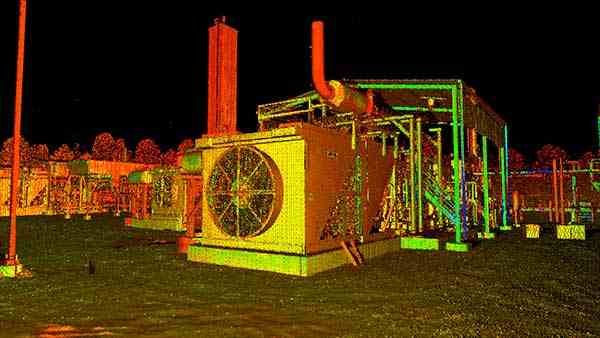
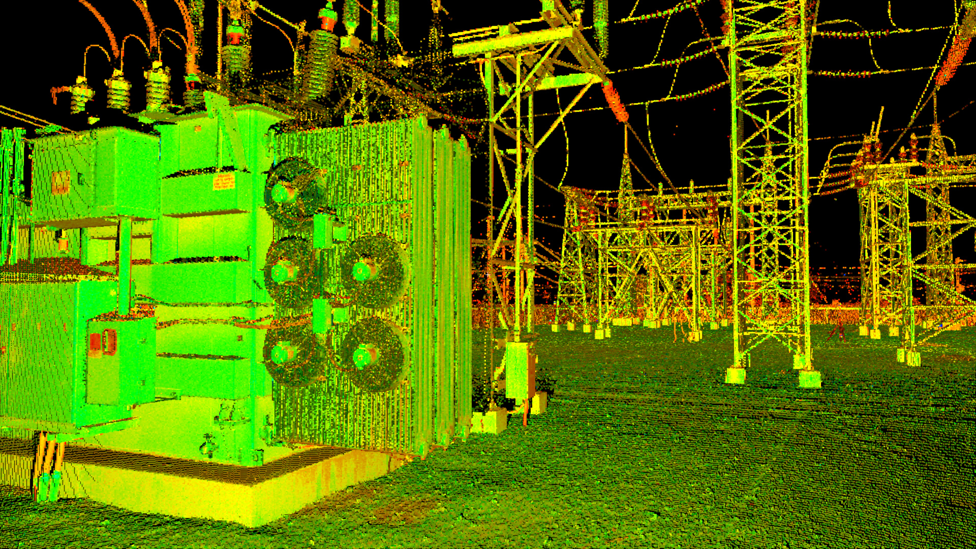
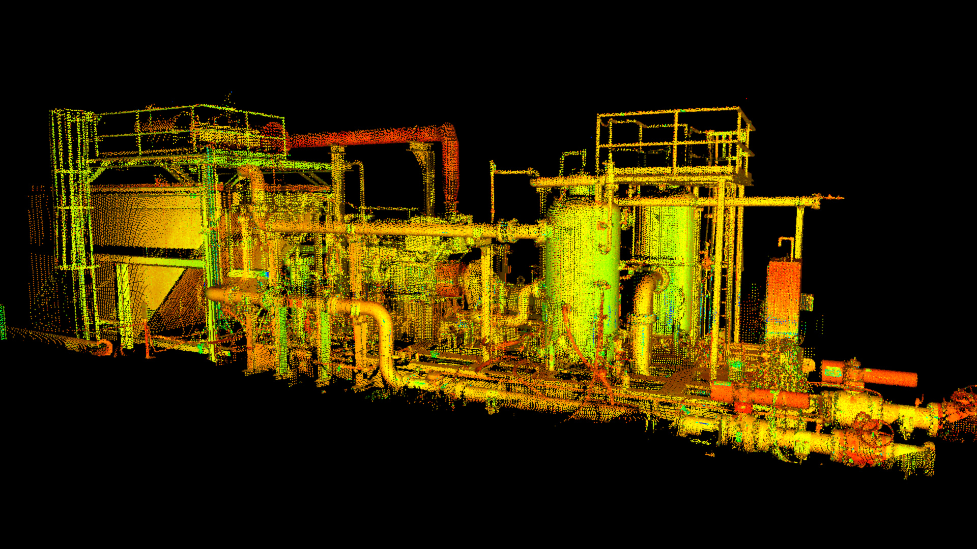
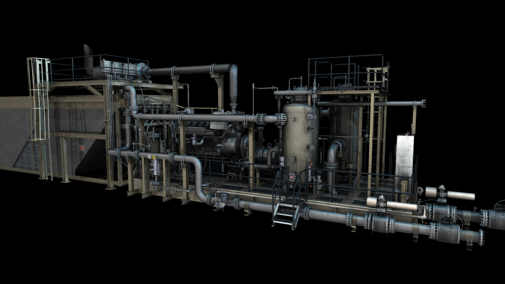
Some UAVs can cover miles of linear coverage per day, meaning that they can fly the large distances required by pipeline projects much faster than traditional surveyors traversing the land. At the same time, UAVs can fly close to the ground while using high-resolution image capturing technology that offers up detail as fine as one centimeter per pixel. UAVs truly offer the best of both worlds when it comes to covering long distances and providing high levels of accuracy.
By bypassing difficult terrain altogether, UAVs allow a land surveyor to gather all of the information they might need without actually having to put people on the ground. Instead, surveyors can operate the UAVs from a position of complete safety. Additionally, the amount of data that is collected is exponentially more than that collected by traditional crews.
Turning Around Survey Results Quickly
Another important goal for land surveyors should be to complete their work as quickly as possible so that the pipeline can begin construction. However, this can’t take place if the results of the land survey require weeks or even months of processing time before they can be used. Working with a team of experienced UAV operators is not just a great way to speed up the actual data collection process; such an operator can also begin processing and analyzing that data immediately after it is captured.
As a result, land surveying results captured by UAVs are often processed and available for use within 24 -48 hours of when they were originally captured. This extremely fast turnaround enables organizations to start building their pipelines quicker, which in turn enables them to start experiencing returns quicker.
Sharing the UAV Data
Collecting massive amounts of data is pointless unless decision makers have a way to access the information easily and extract what they need.
Key divisions/subcontractors that should receive access to UAV data at the earliest possible stages include:
- Surveyors (internal use)
- Engineering
- Environmental
- Land / Right of Way
- Project Managers
- And any other companies (such as construction) who are authorized to view and bid on the upcoming project.
Sharing this data will ensure that everyone is on the same page and that bids are much more accurate since the most recent conditions along the route are available for analysis.


To learn more about the benefits of drones and how they can supplement traditional survey crews, contact Landpoint today.