Tips for Getting Detailed 3D Models of Your Site

3D-Laser-ScanningThere are many reasons why construction companies might choose to create 3D models of their sites, including using the models for pre-project planning, as-built drawings, and ensuring that quality assurance measures are being followed. No matter how you’ll be using your 3D models, it’s important that they be accurate and precise in order for you to get the best results from them.

Accurate and precise 3D models are dependent on collecting complete data from your site. In this post, we’ll cover what it takes to get complete, accurate and precise data, which in turn helps ensure that your 3D models are a true representation of the site. Follow the tips outlined here, and you’ll be able to get 3D models that meet your needs, no matter what those needs may be.

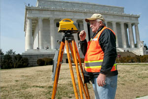
Tip 1: Make sure your surveyor offers 3D land surveying

3D laser scanning is one of the most advanced land surveying technologies in existence today, and working with a partner that knows how to properly take advantage of this advanced technology is one of the most important factors involved in getting good results for your 3D models.

Here’s how 3D land surveying works: a series of scanners let out thousands of individual laser bursts every second. The laser beams then bounce off the building or terrain that’s being surveyed, before returning back to the scanner. The scanner then tracks the phase shift and time of flight for the individual beams. The results of the thousands of different laser beams are combined into a single point cloud, allowing the land surveyor to form an extremely detailed depiction of the building or terrain as it actually exists.

Insist on a land surveyor that provides 3D laser scanning, and you’ll get better site representation as a result in the 3D models.

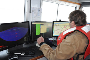
Tip 2: Use aerial scans, if possible

Aerial scans are another example of a technology that has greatly increased the accuracy at which scanning data can be gathered. In fact, aerial data scans have developed to the point where scans can be performed at a resolution of 1 centimeter per pixel.

Aerial scans are performed using unmanned aerial vehicles (UAVs), which are also commonly known as drones. Today’s UAVs can be equipped with high-resolution cameras, and the ability to relay data back to a data management portal. In addition to providing extremely detailed scans, UAVs also contribute to quicker scans, and a safer work environment. When land surveyors don’t have to cross difficult terrain in order to do their jobs, they can get their jobs done quicker, and at less personal risk.

Tip 3: Request that your 3D model be fully textured

The technology behind 3D models has come a long way in recent years, and it shows in the significantly improved details of what today’s 3D models can convey. In years past, companies were lucky if they could get a basic wireframe and a few texture-less shapes on their 3D models. While today, 3D models can now pick up on many different details, including things like colors and textures.

Depending on how you intend to use your 3D models, this level of detail can really make a difference. For things like project planning, having this level of detail is nice, but may not be essential. However, for things like training and marketing, it can make all the difference in the world, as these are the kinds of settings where you really want people to get a realistic view of what it is they’re looking at.

To learn more about 3D land surveying  and how to get the most detailed, accurate, and precise 3D models possible, contact us at Landpoint today.

Image by : New York District

The Four Environmental Review Steps For Wetland Regulatory Compliance

Environmental-ReviewWetlands play an important role in the environment, which is why there are very strict policies in place when it comes to development in or around wetland areas. If you’re planning a project in an area that turns out to include wetlands, there are a number of environmental review steps you must take in order to ensure that your project is compliant. These steps include:

  • Delineation
  • Permitting
  • Mitigation banking
  • Monitoring

In this post, we’ll cover each of these four steps and what they mean to you. However, working with environmental assessment services is the best way to ensure that your project is compliant.

Delineation

The first step in responsible wetland regulatory compliance is finding out exactly where the wetlands are within your project plan. This is accomplished through a process known as delineation.

When you hire an environmental analyst to conduct a wetlands delineation on your behalf, the analyst will come to your project site and collect scientific data about the soil, vegetation and topography of the area. If, based on these three elements, the analyst finds that the area meets the legal definition of wetlands, then performing work in that area will require special considerations on your part.

Once the reviewer has an idea of where the wetlands are, the professional land surveyor can  mark the boundaries of the area. Then they can map the wetland boundaries and add the map to a project plan, which can be presented to local authorities.

Permitting

The specific wetlands regulatory compliance permits required for a project will vary greatly based on the specific local, state, and federal regulations. This is why it can be so helpful to work with experienced professionals who know the specifics of a particular area and can walk you through the process.

In spite of the fact that there are so many different permits out there, almost all construction projects will be held in compliance with the federal Clean Water Act. In order to conduct a project that may affect the area in or around wetlands, a company must first receive a permit from the Army Corps of Engineers. These permits are issued in accordance with Section 404 of the Clean Water Act. Your professional environmental review firm can help you understand what’s involved with Section 404, so that you can approach the permit application process with confidence.

Mitigation Banking

The idea behind mitigation banking is that companies should have a plan in place to help offset the negative impact they may cause to a wetlands area. By performing preservation, enhancement, restoration or creation (PERC) activities in similar ecosystems near the affected area, organizations can make sure they are in compliance with any mitigation banking requirements that affect their project.

Mitigation banking requirements are also covered by Section 404 of the Clean Water Act, and involve the use of credits assigned by a Mitigation Banking Review Team. A MBRT is made up of representatives from various different local, state, and federal environmental agencies.

Mitigation banking credits are a qualitative representation of ecological value, and if a company is able to secure enough credits before beginning their project, it is assumed that they can complete the project while causing no net loss of habitat for wetland species.

Monitoring

Finally, it’s important to remember that wetlands regulatory compliance isn’t just something that happens once before a project begins. Organizations must monitor their projects to ensure that they stay compliant over time, because permits can be pulled even after a project has already started. In order to ensure ongoing compliance and avoid unscheduled delays, organizations should work with surveying firm that offers environmental assessment services to help perform monitoring.

To learn more about wetlands regulatory compliance and how it can impact your construction project, contact us at Landpoint today. Our environmental assessment services can ensure that your project stays compliant and on-track.

Image Source : New York District

How a Professional Land Surveyor Provides Litigation Support

professional land surveyorWhile most construction and development companies have at least some understanding of the benefits of working with a professional land surveyor, one of the services they may fail to take into account is litigation support. Most people never plan on having to go to court, but when you find yourself in a situation where you do need legal support, having an expert you can count on can be an invaluable asset.

The land surveyor as construction expert witness

Our judicial system relies heavily on the use of construction expert witnesses. Basically, this idea rests on the fact that judges and juries can’t be expected to make rulings on certain technical issues without a deep understanding of those issues. Instead, litigants can bring in expert witnesses to explain the situation to the court in a way that they understand.

The key thing to remember is that if you find your company embroiled in a legal conflict, you can expect for your rival party to bring their own expert witness in front of the court to explain the issues in a way that is favorable to their clients. Showing up without your own construction expert witnesses to counteract this could be disastrous for your case.

In addition, it’s important to realize that credibility matters when it comes to expert witnesses. The people doing the judging are not experts themselves; therefore, a big part of whether or not they believe a witness’ testimony has to with how credible they find the witness as an expert. Since professional land surveyors spend a good chunk of their lives engaged in land surveying, it’s safe to assume that they make credible experts on the subject.

What types of cases can a land surveyor provide litigation support for?

Your organization could be taken to court for any number of different reasons, including for things that occur before, during, or after a project. Any time a plaintiff can allege that your company caused injury or financial damage through negligence, your company may be at risk from a legal standpoint.

The cases that a land surveyor could help you with include, but are not limited to, accident scene documentation, construction dispute resolution, project errors and omissions, and all types of encroachment issues related to boundaries or easements.

What to look for in a land surveyor for litigation support

If your organization is facing legal action, and you’re considering hiring a land surveying firm to help your case, there are a number of different factors you should take into account in order to make sure that you’re making the right choice.

The first factor to consider is experience. Litigation support is not something that all land surveying firms do on a regular basis, and if you hire a land surveyor that doesn’t know the ins and outs of the courts, then chances are good that they won’t be able to provide you with the kind of protection you’re looking for. Make sure you hire a land surveyor who has experience providing the specific kind of litigation support you need.

Also, make sure to consider turnaround time when picking a land surveying firm to provide litigation support. If the firm you hire doesn’t move quickly, sending a team to investigate the site and start gathering information within a few days, then you might not be able to count on them to get results for you when your case goes to court.

Final thoughts

Hiring a land surveyor is not a guarantee of victory, but it will put you in the best possible position to protect yourself against legal action. To learn more about how a professional land surveyor can help you, contact Landpoint today.

Image Source : NOAA’s National