How Oil and Gas Surveying Will Change in 2015

Oil and Gas SurveyingIn the early days of 2015, the oil and gas industry finds itself at a crossroads: external forces are in play, creating a situation where companies have to get accurate, detailed land surveys quickly, without having to pay too much for them. Those companies that can ensure the most affordability and value possible from their oil and gas surveying will be the ones that are in the best position to succeed in 2015 and beyond.

In this post, we’re going to take a look at the future of oil and gas industry and provide a quick overview of some of the ways that land surveying is changing the industry in 2015.

Three ways that oil and gas surveying will change in 2015

1. The surveying technology that companies use will grow more sophisticated.

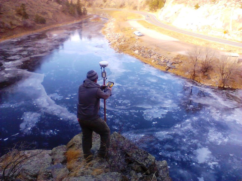
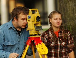
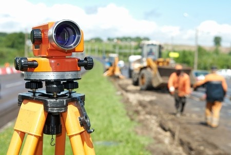
Whenever an industry faces new challenges, there will always be new technologies available to help companies overcome those challenges. This is certainly true of the future of the oil and gas industry. In order to meet their needs for faster, more accurate land surveys at the most affordable rate possible, today’s oil and gas companies have a number of increasingly sophisticated tools in their toolbox. These include things like cloud-based systems for better communication, collaboration, and storage, advanced handheld devices to facilitate better connections between home offices and job sites, and unmanned aerial vehicles to make it easier and safer to conduct land surveys on remote or dangerous terrain.

Although these solutions are available for all oil and gas organizations, only the ones that make an effort to integrate them into their regular business processes will truly benefit from the opportunities they present.

2. Oil and gas companies will need to make turnaround time a priority.

Getting a complete and accurate land survey is a prerequisite for beginning any new project in the field. Without the completed survey, projects will have to be delayed, which costs time and money for everyone involved: that’s why it’s so important to be able to turn these surveys around quickly.This has always been the case for as long as there has been an oil and gas industry, but in 2015—when the need for value is the greatest it has ever been, and the technology needed to create that value is readily available for anyone to apply—continuing to turn out slow land surveys is simply no longer acceptable.

In 2015, oil and gas companies will focus on making quick land surveys an established part of their organizational culture. This means adopting new technologies and implementing new processes to ensure that delays are avoided as much as possible.

3. The accuracy of land surveys will reverberate throughout the entire construction process.

Most oil and gas leaders understand that accurate land surveys are important, but just how important are they really, particularly in 2015? The accuracy of a land survey affects everything that a company does after it, from the pre-project planning to the actual construction of the project itself. It’s no exaggeration to say that an accurate land survey is the foundation that the entire project rests on; if there are problems with the foundation, it could result in project delays and additional costs later on in the project.

Final Thoughts on the Future of the Oil and Gas Industry

Oil and gas surveying is changing. The companies that insist on doing things the same way they’ve always done them will find themselves quickly left behind, while those that adapt to the change and ensure quick, accurate, and cost-effective land surveys will flourish. To learn how land surveying services from Landpoint could help your company succeed in 2015, contact us today.

Oil and Gas Surveying: What You Need to Know About Easements

JRocke5As you may already know, an easement refers to the right granted to a person or entity to use a piece of land for a particular purpose. It’s very important that oil and gas companies understand the easement situation in an area when planning projects, as failing to do so could result in higher costs and legal trouble down the line. In this post, we’ll give a brief overview of some of the things every oil and gas company should know about easements; however, working with an experienced oil and gas surveying provider is the best way to truly understand the issue and avoid problems.

Are there any existing easements on a particular piece of land?

If you’re considering a piece of land for an oil and gas project, an existing easement from another organization would legally prevent you from developing it or taking out an easement of your own. Of course, the only way to find out for sure what existing easements there are in an area is to conduct a thorough review of the land records for the area. An oil and gas surveying provider can help with this investigation, thereby limiting the chance that you’ll end up with an unpleasant surprise later on, when your project is already in progress.

Is the piece of land that’s being considered for an easement in danger of experiencing significant erosion?

Over time, land erosion has the ability to significantly alter the features of a terrain. In the case of an easement, this fact matters because it could result in a company being unable to access their easement, or unable to use it for its stated purpose. When this happens, all of the hard work put into gaining the easement ends up being for nothing.

A land surveyor can help you study the possible effects of erosion on a particular piece of land, so that you’ll have a better idea of how that land will function as an easement over time. By taking into account all possible outcomes related to erosion, the surveyor can help you come up with contingency plans, or seek out a new piece of land that might be less sensitive to the effects of erosion.

What type of easement is your company getting?

Legally, land easements are divided into two different types: easements appurtenant and easements in gross. An easement appurtenant is an easement that is tied to the land itself; if the ownership of the land where the easement lies or the land served by the easement ever changes hands, the easement will change hands accordingly. Also, the owner of an easement appurtenant must own a piece of land that is somehow affected by the easement, which usually means a piece of land that is adjacent to the easement.

On the other hand, an easement in gross is owned by an entity that does not need to own land adjacent to the easement. Since this type of easement is not tied to the land, changes in ownership of the land do not affect ownership of the easement.

Will you need to change the easement later on?

If the scope of a project changes unexpectedly after the project is already in progress, this means that the easement might need to change as well. In cases like this, the land owner might choose to request significantly more money for the expanded easement, knowing that the company has no choices other than to pay the increased rate or abandon all the work they’ve already done on the project.

Work with your land surveying firm to anticipate your future needs so that you can get your easement right the first time and not end up paying increased fees in the future.

Contact Landpoint today to learn more about what our oil and gas surveying knowledge and experience can do for you.
landpoint-cta

Image Source :  dan

How Professional Land Surveyors Can Assist With Site Zoning

Before you begin your oil and gas project, it’s important that you have a complete and accurate understanding of what you can and can’t do with the particular piece of land in question. The rules and regulations surrounding land use can be very complex and by not fully understanding them you risk major delays on your They can help you take the guesswork out of land use, so that you can be sure your land meets all of the requirements of your project.

There are two similar but distinct subjects that professional land surveyors can assist you with: land use planning and site zoning.

Land Use Planning

Land use planning is a general term to describe what can be done with a particular piece of land. It is usually framed using open-ended descriptions; for instance, a team of professional land surveyors may help you to determine that a particular piece of land is well suited to become a high-end retail center or a utility site, without going into more detail than that. In other words, a surveyor can help you shape land use policy by providing professional recommendations.

If you have questions about the possible land uses of an area you own, working with a land surveyor can help you determine where the boundaries are for the piece of land, while also painting you a picture of what could be accomplished with the land in question. This service is very important, because finding out that a piece of land is ill-suited for a particular project after you’ve already begun to plan the project could be a huge waste of time and resources for your organization.

Site Zoning

When compared with land use, site zoning is a much more detailed description of how the land will be used. While land use provides a very brief description of what the eventual purpose of the land development might be, site zoning actually provides exact details about things like how many stories will be in each building, how densely the buildings will be situated on the piece of land, and more.

While a team of professional land surveyors can be helpful when it comes to preparing a land use survey, they are absolutely essential when it comes to site zoning. That’s because a detailed and accurate site zoning map is required to move forward with getting a zoning permit, which is one of the requirements for being able to proceed with your project. Also, if your project needs to be financed in any way, the lender will most likely ask to see zoning maps before agreeing to provide a loan to your company.

As a result, site zoning is something that you simply cannot afford to leave up to chance. Working with a team of experienced land surveyors will help you make sure you get the site zoning maps you need to keep your project moving forward on schedule. They will inspect the land, meet with you to figure out what your requirements are for the project, and then come up with a plan that meets those requirements, while also complying with all applicable laws and land use standards. Finally, after the team delivers the site zoning maps. They will also assist you with getting the site zoning permits approved for your project.

Whether you’re just in the conceptual land use phase, or ready to get down to business with a site zoning plan, a professional land surveyor can help you understand what can be done with your land, and then help you turn your project requirements into reality. To get started with your land surveying project, contact the team of professional land surveyors at Landpoint today to get a free land surveying quote.

Image Source : Daniel Lackey