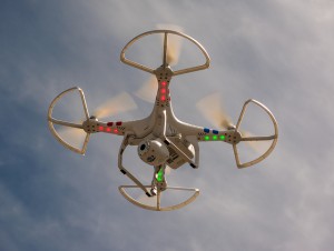
How Using Drones For Surveying Actually Improves Data Accuracy
 Like any other business, the oil and gas industry is constantly benefiting from new technological developments that can revolutionize the way operations are conducted. A recent example of a new development that could lead to big things for the industry can be found in the field of land surveying technology.
New unmanned aerial vehicles (UAVs), also known as drones, could go on to provide the ability for oil and gas companies to gain a much more detailed and accurate look at the land they will be using for their projects. Although this new land surveying technology is still being adopted, the possibilities offered by using drones for surveying promise that they warrant a closer look.
Benefits of UAVs Over Traditional Land Surveying Techniques
Drones used for land surveying offer many different advantages over traditional land surveying techniques, which require surveyors to go from place to place to conduct their work. Since this kind of old-fashioned survey work often has to take place in dangerous or difficult terrain, using UAVs instead can lead to land surveys that are much quicker and much less likely to put workers in harm’s way.
However, the most exciting advantage offered by using drones for surveying may perhaps be the increased accuracy it offers. Over recent years, developments in high-resolution camera technology, along with greater battery life and increased levels of control for the UAVs themselves, has finally made it practical to use UAVs to conduct high-resolution photography work from above.
Unlike earthbound land surveyors, these UAVs are able to conduct their work without interference from the land around them, meaning that they can get as close to the terrain as needed in order to get the images required for the project. They are also less likely to have to worry about time constraints, as they can stay in an area conducting a survey for as long as the battery life of the device allows.
As a result, UAVs are able to create highly accurate land surveys that are capable of meeting the needs of all oil and gas projects.
Why UAVs Offer Better Results When Used With LiDAR
Light Detection and Ranging (LiDAR) technology has become the latest word in terrain scanning over the last couple of years. With LiDAR, land surveyors use thousands of tiny sensors that bounce light points off the terrain, and then collect the result of the sensors into a data cloud that forms an extremely detailed and accurate representation of the land in question.
Pairing this new land surveying technology with an aerial vehicle is perhaps one of the best ways to maximize the quality of the results. However, up until now, the majority of the LiDAR work done from the air has been performed by manned aerial vehicles, which are unable to provide the quality of results that UAVs can. For one thing, manned vehicles have to conduct LiDAR from much higher in the air, which increases the likelihood that atmospheric conditions will interfere with the results of the scan.
On the other hand, drones used for land surveying are able to get as close to land as needed to conduct high-quality, accurate LiDAR scans, and as a result, are able to avoid any issues related to atmospheric interference.
While there are still several hurdles that need to be cleared before UAVs can find widespread use in land surveying applications, the potential for better, more accurate surveying already provides a lot to get excited about. As this land surveying technology continues to develop and grow more sophisticated, the possibilities will only continue to grow with it.
To learn more about using drones for surveying, request a free land surveying quote today.
Image Source : Adam Meek


