6 Considerations When Selecting a Wind Farm Surveyor

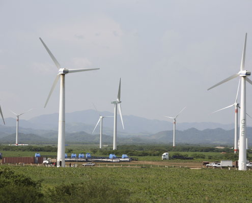
When conducting a wind turbine survey, time and accuracy is of the essence. If your land survey is delayed, then your project will be delayed. Wind farms rely upon the accuracy of their land surveys to plan out the most efficient, effective routes for their turbine placement. The more accurate a land survey is, the more productive the wind farm will be. All of this makes selecting the right wind farm surveyor critical.

Here are six important questions to ask.

1. Are They Able to Cover Large Distances Quickly?

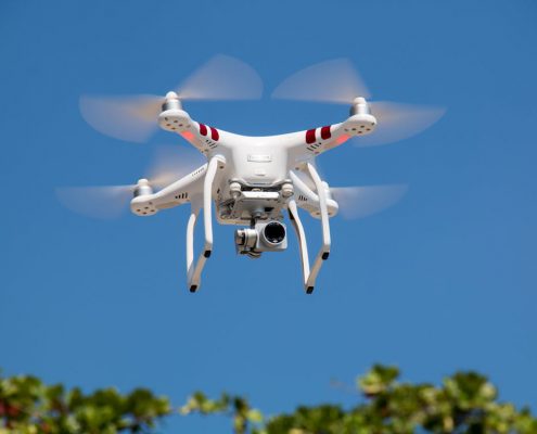
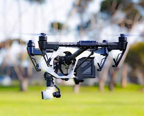
A ground survey is going to take a lot of time—time that a wind farm project may not have to spare. Wind farms tend to be over very large expanses of land, land which can be overgrown. If the environment is right, drone-supported LiDAR technology can be used to scan an entire project in as little as a few hours, depending on the size of the project. Airplane-supported LiDAR surveys can complete large surveys even faster—ideal early in the process of site selection. 

2. What Methods of Scanning Do They Provide?

Many companies provide drone, helicopter, or airplane scanning, but very few provide all of these types. When looking for a wind farm surveyor, ask about the options the survey company has available. Depending on the size of the project and the weather, you may need to pivot between types of survey. If the area is windy, a helicopter or airplane will be better than a drone; if there are large areas to cover, an airplane will be better than a drone or a helicopter. Your needs for survey may change, depending on whether you’re using the survey for initial site location or turbine placement.

3. Can They Provide 3D Data? 

Accurate data is absolutely critical to the success of a wind farm project. Wind farm projects demand a certain type of environment; once surveys are completed, a wind farm is going to need to be prepared for expensive, heavy, and advanced wind farm equipment. Landpoint’s ​LiDAR technology can provide up to 1 centimeter to pixel resolution. These LiDAR scans can then be used to create a 3D model for simulations and modeling. The entirety of a wind farm project can be simulated and tested before it begins. 

4. Are They Able to See Through Overgrown Regions?

LiDAR has a clear advantage over traditional, photogrammetric analysis: it can see through overgrowth wires, and even thin cloth. If you need high resolution data that can cut straight down to the ground topology, then LiDAR is the best choice. Wind farms need to be placed extremely accurately if they are to be effective, and unexpected changes in elevation will need to be addressed during the process of development. Photogrammetric analysis can only map the topology that is visible to cameras, while LiDAR can go beyond the naked eye.

5. Can They Process and Analyze Land Survey Data Quickly?

If a surveyor provides in-house data analysis, they can likely produce land survey data quickly. If a surveyor needs to outsource their data analysis, it may take much longer. Relying upon a third-party to analyze the data that is produced by the survey can lengthen the amount of time a project takes, as both parties will need to wait on the other. It can also increase costs, as an organization that develops its data in-house will be able to reduce the total amount of overhead needed for each service. 

6. Are They Able to Provide Both Initial and Monitoring Surveys?

Initial land surveys aren’t the only type of survey a wind farm may need. Monitoring surveys, when paired with sensors, are an easy way to quickly identify maintenance or repair issues with wind farm equipment. Through GPS tracking, the drones can immediately report the exact position of any identified issues. Drone surveys can save a company money when compared to on-the-ground surveys, which can lead to having more surveys completed and better maintenance overall. 

Through aerial drones, planes, helicopters, and LiDAR, the right wind farm surveyor will be able to quickly survey a large wind farm plot with exceptional accuracy. At Landpoint, not only is advanced LiDAR technology used to produce high-resolution topological data, but drones and sensors can be used for both land surveys and continued monitoring services. For more information about the advantages of LiDAR, contact Landpoint.

ebook-cta

Aerial Mapping With Drones – Does It Make Sense For Your Project?

Drone technology is the latest in land surveying, but does it make sense for your project? If you’re looking for an aerial data service and considering the use of UAVs, you may want to learn more about the UAV process and whether other options would be better for you. Here are a few questions to ask yourself about your project before you commit to any type of aerial surveying. 

Questions to Ask When Selecting an Aerial Data Service

How quickly do you need the survey?

If you need your survey fast, use a drone. Drones are fantastic if you need a fast turnaround time. Not only can they be deployed almost immediately, but they will be able to scan and report the data back quickly. And at Landpoint, your data will also be analyzed quickly in-house. Aerial mapping with drones is typically the fastest option when you have relatively small areas that you need to be surveyed.

What are the current weather conditions?

If there are high winds involved, then you may not be able to send out drones. Drones cannot function in high wind, significant rain, or storms, because they are light and get blown around. In high winds, helicopters usually make sense. They are more affordable than airplanes, but they can stabilize themselves even in fairly poor weather (UAV technology has advanced to the point where light winds are usually not an issue).

How large an area do you need to cover?

While drones can cover fairly large areas quickly, a very large area may call for an airplane survey instead. Airplanes can cover large tracts of land faster, which is important for general purpose surveys of significant chunks of property. However, since an airplane does need to fly higher than a drone, you a may not get as high-resolution imagery as you would using drone technology.

What is the terrain like?

UAVs, helicopters, and airplanes all do well with rough terrain. When you need detailed data from, say, inside a canyon, however, then drones are going to be the best bet. Drones can survey close to the ground and can take detailed, high-resolution scans of rugged areas. While the same LiDAR technology can be used on both helicopters and airplanes, they just can’t reach as close to the same terrain and consequently can’t deliver as accurate results. 

How much have you budgeted for the survey?

If you want to save money, aerial mapping with drones makes sense. Drones are the most affordable type of survey out there. Both helicopters and planes naturally cost more because they involve larger crew as well as more substantial risk, as the crew could potentially get injured if the aircraft gets damaged. Regardless of the cost savings, though, the technology that is used to capture the survey data is separate; a reduction in the budget doesn’t mean a reduction in quality. 

Are there any anti-drone regulations in the area?

Some areas have enacted regulations against drone flight. If drones aren’t allowed to fly in the area that you want to survey, it makes more sense to use either a helicopter or an airplane. With some anti-drone regulations you may be able to get a permit for the flight and the survey; with others, it may just be faster to choose a different option.

There are many situations in which drones are the best option, but don’t forget that there are other choices, too. While there are many drone companies that have emerged within the last few years, there are fewer companies that offer all three different types of aerial survey. At Landpoint, drone, helicopter, and plane surveys are all available, all with high levels of reliability, accuracy, and speed. For a consultation regarding our aerial data services (and to find the option that’s best for you) contact Landpoint today.

landpint-UAV-CTA

Aerial LiDAR: What Are Your Options?

Aerial LiDAR is undoubtedly one of the fastest and most accurate methods of completing a land survey. However, there are multiple ways that you can acquire aerial LiDAR data. An aerial LiDAR scan can be completed through the use of helicopters, planes, and drones. Here’s everything you need to know about selecting the right option for your project.

The Three Types of Airborne LiDAR

LiDAR scans can be used from multiple airborne vehicles. Planes, helicopters, and drones can all be used to capture LiDAR information, but there are differences in the ways that they will capture this information. While UAV drone technology has proven to be the most versatile all around, there are also scenarios in which helicopters or planes may be preferable.

Budget

  • Drone. A drone is going to be the most affordable method of aerial LiDAR by far. Drones are less expensive because they don’t require a crew to run them.
  • Helicopter. Helicopters are less expensive than planes but more expensive than drones. While they do require a crew like a plane, a helicopter itself is generally less expensive to operate.
  • Plane. Planes are the most expensive aerial LiDAR option. Not only do they require a crew, but they may also require some permits or licenses to run.

Safety

  • Drone. A drone is an unmanned craft, which means even if it does experience issues, it won’t cause injury to a crew. This makes it the safest option for an aerial survey, and is one of the primary reasons it has become a popular method. 
  • Helicopter. Contrary to popular belief, helicopters are only slightly more dangerous than planes—though this depends a lot on the environment they are flying in. However,  both helicopters and planes can be dangerous because they have a crew which can get injured.
  • Plane. As mentioned, both helicopters and planes are substantially more dangerous than drones. That being said, it isn’t always a significant risk: most planes and helicopters will never experience issues. Safety is a major concern with any equipment, and a plane can malfunction more spectacularly than a drone. 

Accuracy

  • Drones. Drones have the highest levels of accuracy because they can fly the lowest of the aerial options. The lower they fly, the more detailed their scans and the higher their scan resolution. 
  • Helicopters. Not only can helicopters fly lower than airplanes, but they can also hover. This means they can produce higher levels of accuracy than planes, even if they may not meet the accuracy of a UAV.
  • Planes. Though a plane does need to be at a higher elevation (and therefore produces lower levels of accuracy), these levels of accuracy are usually still significant enough to be suitable for most applications.

Weather

  • Drone. A drone cannot fly in exceptionally poor weather conditions or in high winds. While there’s always the possibility of waiting, it can make it difficult to survey areas that are frequently windy.
  • Helicopter. Helicopters are able to collect LiDAR data in bad weather, though very bad weather should still be avoided. Helicopters can hover even in high winds.
  • Plane. Planes can collect LiDAR in nearly every type of weather, as the weather does not impact an aircraft the same way it might impact a drone or helicopter. However, it can interfere with some types of scanning.

Speed

  • Drone. Drones can report back data in a matter of hours, primarily because they can be deployed quickly and complete a scan fast. This can be important for projects which have close deadlines.
  • Helicopter. With helicopters as well as planes, requisitioning and prepping the equipment and crew may take longer. However, once in the air, a helicopter survey will be quite fast.
  • Plane. Once the crew and equipment have been prepared, a plane survey should be quite fast. In fact, over large areas, planes are usually the fastest way to get an aerial survey done. 

Choosing a Method of Aerial LiDAR

By assessing the five factors above, you can decide whether you need drone, helicopter, or aerial LiDAR. Regardless, you’ll get high resolution imagery that has been plotted out by advanced laser scanning technology. Aerial LiDAR is always going to be an effective option; the method is just going to alter how safe, fast, and expensive the process is going to be. 

Are you still wondering whether aerial LiDAR is right for your next survey? Contact Landpoint to find out more about the benefits of aerial LiDAR and the differences between different types of airborne LiDAR technology.

Understanding Drone Survey Accuracy

Everyone knows that drone surveys are faster and safer, but are they really more accurate? UAV mapping technology has made some substantial strides within the past decade and now encompasses a huge industry. From small, mobile “toys” to hardy, military-grade equipment, drones are now used throughout many sectors and for many purposes. How can you compare drone survey accuracy to the accuracy of older surveying methods?

What Does “Accuracy” Mean?

When it comes to land surveying, accuracy can mean multiple things. As an example, older photogrammetric technology is occasionally said to have higher resolution because it takes a series of high-resolution photos and creates a 3D plane from these photos. However, this great level of resolution isn’t always meaningful because it doesn’t necessarily correlate to useful 3D point data. Comparatively, advanced LiDAR technology may not have the same pixel size, but contains many times the amount of useful topological data.

Rather than using resolution or pixels, accuracy in a ground survey is usually associated with the accuracy to which the 3D data can simulate the real-world. In other words, how accurate the measurements are, both absolute and relative to the surroundings and the site itself. This is understandably more complex; while anyone can say that you can create scans of a specific resolution, it requires a lot of real-world data to say that you create scans of a specific level of accuracy.

How Do Drones Determine Their Position?

Drones can scan the ground with highly precise technologies such as LiDAR. These technologies send out hundreds of thousands of pulses per second to map topological differences relative to each other, contributing to a very high degree of relative accuracy. However, absolute accuracy is determined using GPS. GPS isn’t always able to produce a completely accurate relative position, and consequently, further data analysis is often required.

This data analysis is often supported through the use of ground control points. Ground control points create fixed and known points that the drones can use to position themselves and continually correct their own positioning. Understandably, these ground control points must also be carefully positioned for the right level of accuracy.

Drones may be adversely impacted by things such as weather conditions, terrain profiles, and, of course, the drone hardware. Hardware matters when hiring a drone surveying company, as the more advanced the UAV mapping hardware is, the less likely the drones are to be influenced by things such as poor weather conditions and difficult terrain profiles.

How is the Accuracy of Drones Tested?

Drone survey accuracy is tested through margins of error when drone data results are compared to real-world information and conventional surveying methods. By testing drone accuracy against known sets of data, operators and surveyors can determine how accurate the drones are as a whole. From there, they can publish how accurate their surveys are. The accuracy level must be reproducible to be claimed. When accuracy is reported for a drone survey, it is reported using the exact same accuracy measurements as any other type of surveying. A drone survey that boasts 2 CM accuracy will be as accurate as another type of survey that boasts 2 CM accuracy.

Best-in-class UAV mapping technologies can currently resolve surveying sites to 1 CM of accuracy. This accuracy is extremely competitive with other technical models and is supported through the use of careful real-world analysis and testing. While drone survey accuracy can be influenced through a number of factors, the right drone surveying company can carefully control these factors and create reliable, reproducible results.

CTA-Landpoint-UAV

Everything You Need to Know About UAV LiDAR Mapping

If you’re currently planning a land survey, you may be wondering about the advantages and disadvantages of LiDAR mapping technology. Through UAV LiDAR mapping, environments can be mapped down to extraordinary detail, even through brush and foliage. UAV LiDAR mapping is the most technologically-advanced and convenient solution today and understanding the technology behind it is critical to understanding its core benefits.

What is LiDAR mapping technology?

In a nutshell, LiDAR:

  • Uses laser light to determine the distance between a sensor and an object, whether on the ground or from the air.
  • Penetrates through minor obstructions, which may include tree canopies, man-made objects, and brush on the ground.
  • Creates a point cloud, which can then be used to create a detailed terrain and object models.

LiDAR (“light radar”) mapping technology uses multiple pulses of laser light to determine the distance between a sensor and an object. These light pulses are sent out extraordinarily quickly – up to millions of points a second. Sensors use the amount of time that it takes for these pulses to be bounced back to determine how far away an object is.

In LiDAR surveying, laser lights are bounced from above along the terrain to create a 3D model of the terrain, which is extremely detailed. As laser light can go through objects such as tree foliage and brush, LiDAR can be used to create an accurate model of terrain even if the terrain is over-grown or developed.

LiDAR has been in use since the 1960s, and it is currently the most accurate form of creating models of digital elevation. Some forms of LiDAR can even be used to map terrain under water, such as riverbeds and shallow lakes. LiDAR is often used in conjunction with advanced software solutions, which determine the type of objects that are being scanned by the LiDAR in addition to just elevation.

Through the use of advanced software platforms, LiDAR can be used to not only record elevations but also accurately identify things such as street lamps, power lines, or even birds. Software systems compare different elevation studies with potential items on the ground and are consequently able to identify the difference between things such as man-made items and things such as bushes.

LiDAR is used throughout industries such as agriculture, archeology, geology, and even law enforcement. The most popular alternative to LiDAR is another technology called photogrammetry.

What is the Relationship Between UAVs and LiDAR?

  • Unmanned aerial vehicles (UAVs), often referred to as drones, can be deployed over virtually any terrain for the purposes of fast scanning.
  • Unlike manned aerial vehicles, UAVs do not present safety hazards to operators and can be used low to the ground.
  • UAVs are cheaper and faster than manned aerial vehicles, saving companies both time and money on their surveying.

LiDAR can be used by land as well as via the air. When used by land, for instance, LiDAR can be used in the “speed guns” that police use to determine whether someone is speeding. For the mapping of terrain, however, LiDAR is almost always used via an aircraft. These aircraft can be manned or unmanned.

When used in conjunction with a manned aircraft, LiDAR scans are more costly, less precise, and more dangerous. Multiple individuals need to be on a manned aircraft, as both the craft and the scanner must be operated. Aircraft can crash, which could cause injury or even death to those onboard. Further, manned aircraft cannot fly low to the ground, which means their scans are of lower resolution.

Comparatively, Unmanned Aerial Vehicles (UAVs) are able to fly with a single operator, can fly low to the ground, and will not injure anyone if they crash. UAVs can be deployed to cover large areas of an environment at once and can quickly create high-resolution scans, which can then be directly imported into the relevant software.

Used together, UAV and LiDAR technology forms the most powerful surveying tool presently available.

What is the difference between LiDAR and Photogrammetry?

Photogrammetry is a method by which a large number of overlapping photographs of a region are taken and then processed to determine the measurements between multiple points. It is a fast and affordable method of mapping large areas of land quickly.

As photogrammetry uses 2D objects to interpret 3D space, it can only produce many of the same deliverables, depending on the terrain. With big data and new analysis tools, photogrammetry can be accurate enough for smaller projects or projects that need to cover a very large expanse at a lower than average cost. This is why photogrammetry is often used for projects that need to map entire cities.

Photogrammetry has one technological advantage over LiDAR: it also provides seamless imagery of the mapped area. As it relies upon photographs, it is capturing the color and the texture of the terrain, which means that photogrammetry maps can be more understandable to the human eye even if they are less accurate overall. LiDAR scans can still be textured, but these textures may not be as accurate.

However, this advantage is often side-stepped by using photogrammetry and LiDAR together, to create accurate 3D data that has also utilized photogrammetric imaging. This process is both more involved and more expensive but can produce both human-readable and machine-readable models.

As photogrammetry requires that the 3D space be derived from 2D images, it produces fairly low-resolution results and often cannot identify smaller or thinner objects. Power lines, for instance, are often not viewable through photogrammetric data. Finally, photogrammetry does work on photographic technology, which means photogrammetry has to be completed during the day and it has to be done during the appropriate weather conditions. UAV LiDAR mapping has fewer environmental concerns.

In terms of cost, photogrammetry is substantially less expensive than LiDAR, and it can also be used with UAV technology. In fact, UAV technology remains the most effective way to complete surveying regardless of wither LiDAR or photogrammetry is being used. However, this cost savings may not be substantial if it comes at the ultimate cost of a delayed project or mistakes being made.

LiDAR captures the data that is necessary for modeling terrain; this is highly specific, highly technical data that needs to be worked on by professionals. Photogrammetry produces large volumes of photographic data, which then needs to be parsed using the appropriate software.

Does Your Survey Need LiDAR or Photogrammetry?

Both of these technologies are still in use today for an important reason: they’re both useful tools given the right circumstances.

If you’re wondering whether your survey needs LiDAR or photogrammetry, you can ask yourself the following questions:

  • Is there anything obscuring the terrain from above? If there are trees, bushes, or manmade objects above the terrain, photogrammetry isn’t going to be able to penetrate down to get an accurate elevation.
  • Is there a reason why you would need full-color maps? If your project needs accurate terrain color, you may need to use photogrammetry or to combine photogrammetry with LiDAR.
  • Is there a need to model small objects? Photogrammetry cannot pick up small objects, such as power lines, which makes it unsuitable for projects that need higher resolution.

Other than specific use cases, LiDAR is generally the better tool — if the budget is there for it. Many people believe that the future of surveying may actually be in combined LiDAR and photogrammetric mapping, but few argue that LiDAR isn’t the superior technology when the two are compared.

LiDAR mapping technology is still more expensive than some alternatives, but the use of UAV can make it a faster and more cost-effective solution overall. In many projects, LiDAR may be able to pay for itself in terms of time and cost saved — and, as it becomes an industry standard, the costs related to it have been steadily decreasing. For those who need accurate, fast, and safe results, the best choice is almost universally UAV LiDAR mapping, though you may still want to consult a professional land surveyor to find out which option is best for your specific project.

UAV-Ebook-CTA-2

A Look at Landpoint’s Turnkey 3D Surveying Services

3D surveying isn’t just a single process; it’s composed of multiple parts. From initial planning to processing ansd compiling the data, there are several technologies and specializations involved. Finding a 3D survey provider who can complete your 3D surveying end-to-end will provide faster, cheaper, more accurate results.

The Importance of a High-Quality Survey

3D surveying services are used to improve the maintenance of large facilities, survey the land before development, and identify the need for potential repairs or risks across work sites. Understandably, the utility of a 3D survey is only as significant as its accuracy. In order to be beneficial to a project, a 3D survey must be accurate and fast. A slow survey can delay an entire project, while an incorrect survey could eventually lead to costly issues later on. Getting a high-quality survey begins by determining the accuracy requirements of your survey given your current survey budget.

Understanding the Workflow of Your 3D Survey

Once your survey has been completed, the job isn’t done. Your 3D survey data is still going to need to be analyzed, processed, and given to you in a format that you can use. 3D land surveys are used for everything from building and architectural simulations to pipeline site inspection. Depending on your individual needs for a 3D survey, you may need different formats of data or different data provided for your analysis.

Some companies complete all of their survey in-house or end-to-end, while others outsource processing and data storage.

The Benefits of End-to-End 3D Surveying Services

When other services send data out for analysis, they’re relying on other third-party providers for a critical part of their 3D surveying. End-to-end services have the following benefits:

  • Fast data capture. As your 3D surveying service doesn’t need to rely upon another provider, they can complete the survey on their own schedule without any potential unanticipated roadblocks. The more parties you involve in your 3D surveying, the more the chances go up that there could be some form of delay or incident.
  • Consistent data processing. Your data is being analyzed in-house by a team of specialists who can guarantee that your data is going to be analyzed to the same level of accuracy each time. If you’re running multiple projects, you need to have similar and reproducible results if you want to plan ahead.
  • Complete data access. A turnkey surveying service is able to house and store your data as well, letting you access your data from anywhere via a hosted service. This is particularly important if you are viewing remote sites or if multiple parties need access to your survey data.
  • Reduced costs. Every time multiple parties are involved in a survey, the costs go up, as services need to be negotiated on a granular basis. End-to-end surveying services provide everything you need in a single, cost-effective turnkey package, and there won’t be any unexpected costs added on.
  • Improved service and security. As you’re only working with a single company, you only have a single point-of-contact. They will be able to update you continually on the progress of your project and will be able to let you know immediately when the project is done.

Through an end-to-end 3D surveying process, you’ll be more likely to get guaranteed, fast, and cost-effective results. Outsourced services may be unpredictable, unsafe, or just less than accurate. When it comes to data that your project requires for current and on-going success, being able to rely upon a single provider is often preferred. Landpoint offers complete end-to-end drone-powered 3D surveying services with a 24-hour turn-around and survey grade accuracy.

Landpoint-CTA-New2

Top 6 Advantages of BIM Modeling Services

For building developments, architecture projects, and construction, building information modeling (BIM) services offer critical data that can be used to improve a company’s bottom line. Through BIM, companies can analyze and simulate every aspect of their project, empower their team to work more closely together, and sidestep potential problems along the way. Here are some of the core advantages to BIM modeling services.

6 Advantages to BIM Modeling Services

1. Simulate Environmental Aspects of Your Build

How will your building look in the winter or the spring? Where will the light hit the windows — and could that cause issues for the buildings nearby? BIM service providers can simulate environmental aspects, from sunlight to wind; this is of particular importance for energy-related projects. As your project continues to grow and develop, you can further simulate these changes and identify whether any core issues may have arisen.

2. Detect Potential Conflicts Between Different Systems

Any construction project involves multiple systems, such as electrical, plumbing, and ventilation. BIM is advanced enough to identify potential conflicts between these systems, such as crossovers between plumbing and electrical services that could be impossible to design in real life — or just ineffective. Rather than having architects attempting to isolate all of these details, the software can do it for them.

3. Present Designs to Stakeholders and Product Owners

Though your designs maybe complete, stakeholders often want to see something that makes it easy for them to visualize the finished project. Few things that are as effective as BIM for this task. Not only does BIM create a complex 3D render of the project, but you can assure your stakeholders that these 3D renders of the project are completely based on the real plans and designs (and environment) that the project is going to involve. Your stakeholders will feel more secure knowing that real information is being used to present them their finished product.

4. Collaborate Easily Between Different Departments

BIM creates a centralized source of up-to-date information, so different departments can easily collaborate without the risk of potentially over-writing each other’s changes or making changes that could be damaging. Often, different departments may not even be in the same office or may need to work on the project at different times. Rather than sending files back and forth, you can have a single complete file that all parties can utilize.

5. Maintain Complete Control Over Your Project

Once projects have been finalized, data can be locked down and still distributed to all of the necessary individuals and departments. Up until that point, you’ll be able to see where changes have been made in the project and who has made these changes. Changes can even be rolled back as needed and your data will never be lost; all of your data will be backed up and automatically saved through the BIM solution. The BIM modeling solution will keep snapshots of the project as it continues, so you can easily revert to previous changes without losing anything that’s important.

6. Utilize Real-Time, Real-World Data

Finally, your BIM modeling services aren’t occurring in a vacuum. Rather, your building information can utilize real-time, real-world data, to determine how your building and architecture will stand over existing land surveys. Digital surveying and aerial imaging can be used to simulate exactly where your building and architecture will sit in 3D space, identifying any potential issues that could arise in the real world.

BIM is being used in architecture, manufacturing, and construction, to consolidate existing information, simulate future information, and overall improve a project’s bottom line. With the right BIM service providers, builders can improve the outcomes of their projects, creating more consistent and reliable end products while still saving money.

how-to-choose-land-