Posts

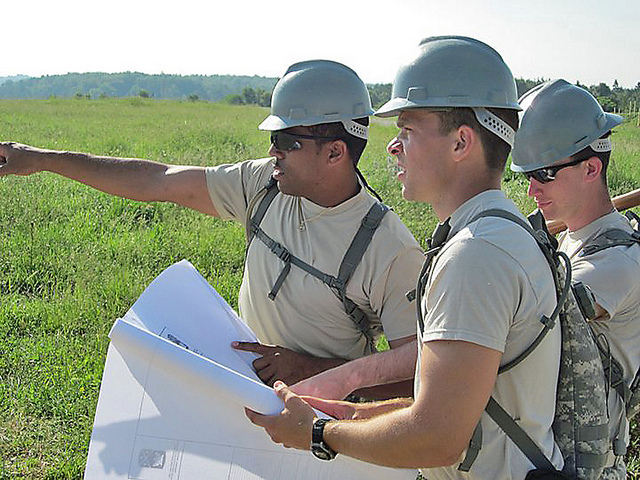
How Professional Land Surveyors Can Assist With Site Zoning

Before you begin your oil and gas project, it’s important that you have a complete and accurate understanding of what you can and can’t do with the particular piece of land in question. The rules and regulations surrounding land use can be very complex and by not fully understanding them you risk major delays on your They can help you take the guesswork out of land use, so that you can be sure your land meets all of the requirements of your project.

There are two similar but distinct subjects that professional land surveyors can assist you with: land use planning and site zoning.

Land Use Planning

Land use planning is a general term to describe what can be done with a particular piece of land. It is usually framed using open-ended descriptions; for instance, a team of professional land surveyors may help you to determine that a particular piece of land is well suited to become a high-end retail center or a utility site, without going into more detail than that. In other words, a surveyor can help you shape land use policy by providing professional recommendations.

If you have questions about the possible land uses of an area you own, working with a land surveyor can help you determine where the boundaries are for the piece of land, while also painting you a picture of what could be accomplished with the land in question. This service is very important, because finding out that a piece of land is ill-suited for a particular project after you’ve already begun to plan the project could be a huge waste of time and resources for your organization.

Site Zoning

When compared with land use, site zoning is a much more detailed description of how the land will be used. While land use provides a very brief description of what the eventual purpose of the land development might be, site zoning actually provides exact details about things like how many stories will be in each building, how densely the buildings will be situated on the piece of land, and more.

While a team of professional land surveyors can be helpful when it comes to preparing a land use survey, they are absolutely essential when it comes to site zoning. That’s because a detailed and accurate site zoning map is required to move forward with getting a zoning permit, which is one of the requirements for being able to proceed with your project. Also, if your project needs to be financed in any way, the lender will most likely ask to see zoning maps before agreeing to provide a loan to your company.

As a result, site zoning is something that you simply cannot afford to leave up to chance. Working with a team of experienced land surveyors will help you make sure you get the site zoning maps you need to keep your project moving forward on schedule. They will inspect the land, meet with you to figure out what your requirements are for the project, and then come up with a plan that meets those requirements, while also complying with all applicable laws and land use standards. Finally, after the team delivers the site zoning maps. They will also assist you with getting the site zoning permits approved for your project.

Whether you’re just in the conceptual land use phase, or ready to get down to business with a site zoning plan, a professional land surveyor can help you understand what can be done with your land, and then help you turn your project requirements into reality. To get started with your land surveying project, contact the team of professional land surveyors at Landpoint today to get a free land surveying quote.

Image Source : Daniel Lackey

Professional Land Surveyors Helping Reduce the Risk of Drilling Dry Wells

Oil and Gas ProjectsGIS technology is critical when mapping well sites for drilling operations. The cost of drilling a dry well can quickly eat into an operation’s budget. However, a professional land surveyor can use GIS mapping to leverage central geological and physical datasets to help analyze, summarize, and make determinations more effective planning.

Finding the Right Location

Geologists typically analyze the prospective well drilling area by checking rock and soils types, land terrain, as well as the gravitational and magnetic area fields. Geologists perform seismic surveys and test for hydrocarbons in and around the site. Seismic surveys are not fool proof as they may find what appears to be an excellent reserve trap but which may turn out to be dry when drilled. Dry holes are the lack of charging or breaching of previously charged reservoirs where the hydrocarbons have escaped. Geochemical soil gas surveys used in conjunction with seismic surveys can significantly improve successful hydrocarbon exploration ratios and reduce “dry hole” risk.

Once geologists select the prospective well drilling location, surveyors are called to stake the well site. It is the job of professional land surveyors to prepare 2D and 3D mappings. A plat map, stamped and signed by one of the licensed land surveyors, showing the staked well location is required by various states prior to drilling. This provides insurance of the correct location, to the best of the geologist and land surveyor’s knowledge. Erroneous information may result in the drilling company losing the ability to hydraulically fracture all segments of the downhole well lateral, or encounter a dry well. It is not uncommon for a well to be relocated several times on the surface before drilling. Accurate documentation is vital.

Prior to Drilling

The drilling site must be prepared and free from hazards. The professional land surveyors should conduct a line location survey in preparation to level the drill site as well as for the excavation of the reserve and settling pits. Access roads and the drill pad must be staked and prepared prior to commencing drilling operations.

Cost and Consequences of Dry Drilling

Drilling risks may be moderate to high depending on the proximity of drilling to existing producing wells. Wildcat or high risk drilling occurs greater than 1.5 miles from the nearest producing oil well or 3 miles from the nearest producing gas well. Conversely, low risk, developmental drilling operations, are within half a mile of oil or within one mile of gas wells already drilled and producing. Geochemistry is not as critical, but is useful in determining where blind compartments of stratigraphic traps lie. Outpost drilling offers moderate risk. Drilling is located within 0.5 – 1.5 miles of the nearest producing oil well or 1-3 miles to the nearest active gas well. Geochemistry is a cost efficient means of locating the extreme limits of newly-discovered fields.

When GIS tools are not used during analysis, dry drilling can occur. Dry drilling is loss of circulation and fluid. Although the well is bored, the fluid does not rise to the top. Operation losses may be as little as a broken drill bit or as major as a damaged wellbore, drill string, snapped pipe, or damaged rig. In terms of barrels per day and revenue, a “minor loss” is considered to upto 470 barrels in a 48 hour period. Severe losses exceed 470 barrels or occur when fluid gushes to the surface and is wasted or lost.

To learn more about how experienced professional land surveyors can help with oil and gas projects, download our free ebook about modern land surveying technologies.

Construction Project Planning Tips for Managing Multiple Survey Teams

Land SurveyorsA survey assignment’s complexity depends on the type of surveys needed, the time required to complete the field work, and the office time it takes to process the data and generate maps and plans. It’s not uncommon on large projects to utilize several different land surveying teams.

When the job calls for more than one survey team, the land surveyor’s primary intent is to efficiently collect all necessary data. The challenge, however, is to effectively plan, coordinate, and manage these teams in such a way to avoid mis communications and task redundancy, overlap, and need to re-survey. This post provides a number of construction project planning tips in order to help managers seamlessly oversee these multiple teams.

Managing Multiple Land Survey Teams

Land surveying firms offer a variety of services. For any major project there is a need for:

  • Pre-construction planning
  • Amendments and changes
  • Construction
  • Post-construction

Within any project phase there are needs to simultaneously provide layout, staking and control services:

  • Permits– Accesses, drainage and pipeline crossings, river and stream diversions, relocations.
  • Environment Concerns– Pre-construction and construction delineation and mitigation.
  • Site Design / Earthwork – Boundary lines and plats, well pads, staging, building, production.
  • Layout And Control – Grade, pipe and pipeline bridges, structure and equipment foundations
  • Geotech Data – Borrow sites, volume calculations, bearing capacity, slope stability
  • Post Construction – As-builts, claims.

Criteria for Survey Team Management

Utilization of the latest land surveying technologies and current software is important to efficiency. Land surveyor teams with better tools are more flexible, mobile, and scalable. The land surveying manager then is not as concerned with equipment reliability, availability, and accuracy, and can focus on deploying teams that can fully execute their assignment in a timely manner.

There are three basic things that can be done in order to effectively coordinate multiple survey teams and help ensure survey assignments are completed on time and within budget:

1. Utilize Land Surveyors Experienced In Working Together And/or Familiar With The Particular Region.

When teams have experience working together, there is usually better communication. This communication is especially helpful if at least one of the teams has experience working in the region that is being surveyed, as they can provide better insight into how to go about the survey.

Land surveying teams are comprised of a party chief/lead, and technicians knowledgeable in the specialty (utility, right of way, seismic, geotechnical, and environmental, boundaries) that the particular assignment requires. Familiarity with the region, landmarks, markers, and unique obstacles such as streams, rivers, rugged terrain and total open space help reduce the potential for unpreparedness and unnecessary complications. These issues can include un-calibrated equipment, poor field organization, slow decision making and problem solving delays. It is also not uncommon to find a survey team lost enroute to a remote jobsite. When at least one team is experienced working in a particular region, they are able to communicate and wok through the challenges.

2. Establish Criteria for Plats at the Start of a Project

Preliminary plats are used as a starting point for most projects. They are considered comprehensive tools and may be changed during the course of the project. They should contain significant information to lay out the proposed project. Plat maps should show:

  • As-built geological data and legal descriptions
  • Identified boundaries, floodplains, drainage courses, road accesses, easement, right of way
  • Past and proposed site development
  • Underground as well as above-ground structures
  • Ownership, occupancy, legal rights, third-party rights, claims, and liens

However, different surveying teams may use different criteria for each of the plats that they create. This can create confusion and miscommunication when information needs to be compared between plats from two different teams. If you are bringing in multiple survey teams, make sure to establish the criteria for the plats early on to prevent this confusion.

3. Utilize a Project Management System

A project management system is invaluable to construction project planning. A project management system allows different survey teams to easily share information on a single platform and collaborate effectively with the client. This improves communication between teams and creates a single depository of information for them to put upload data to. This greatly increases the speed from which the multiple teams work and makes it less likely to have discrepancies between data collected between the two different teams.

For more information on construction project planning for oil and gas companies, download our free eBook on the latest land surveying technologies and how they benefit oil and gas projects.

Image By : Georgia National Guard