Posts

Oil and Gas Surveying: What You Need to Know About Easements
JRocke5As you may already know, an easement refers to the right granted to a person or entity to use a piece of land for a particular purpose. It’s very important that oil and gas companies understand the easement situation in an area when planning projects, as failing to do so could result in higher costs and legal trouble down the line. In this post, we’ll give a brief overview of some of the things every oil and gas company should know about easements; however, working with an experienced oil and gas surveying provider is the best way to truly understand the issue and avoid problems.

Are there any existing easements on a particular piece of land?

If you’re considering a piece of land for an oil and gas project, an existing easement from another organization would legally prevent you from developing it or taking out an easement of your own. Of course, the only way to find out for sure what existing easements there are in an area is to conduct a thorough review of the land records for the area. An oil and gas surveying provider can help with this investigation, thereby limiting the chance that you’ll end up with an unpleasant surprise later on, when your project is already in progress.

Is the piece of land that’s being considered for an easement in danger of experiencing significant erosion?

Over time, land erosion has the ability to significantly alter the features of a terrain. In the case of an easement, this fact matters because it could result in a company being unable to access their easement, or unable to use it for its stated purpose. When this happens, all of the hard work put into gaining the easement ends up being for nothing.

A land surveyor can help you study the possible effects of erosion on a particular piece of land, so that you’ll have a better idea of how that land will function as an easement over time. By taking into account all possible outcomes related to erosion, the surveyor can help you come up with contingency plans, or seek out a new piece of land that might be less sensitive to the effects of erosion.

What type of easement is your company getting?

Legally, land easements are divided into two different types: easements appurtenant and easements in gross. An easement appurtenant is an easement that is tied to the land itself; if the ownership of the land where the easement lies or the land served by the easement ever changes hands, the easement will change hands accordingly. Also, the owner of an easement appurtenant must own a piece of land that is somehow affected by the easement, which usually means a piece of land that is adjacent to the easement.

On the other hand, an easement in gross is owned by an entity that does not need to own land adjacent to the easement. Since this type of easement is not tied to the land, changes in ownership of the land do not affect ownership of the easement.

Will you need to change the easement later on?

If the scope of a project changes unexpectedly after the project is already in progress, this means that the easement might need to change as well. In cases like this, the land owner might choose to request significantly more money for the expanded easement, knowing that the company has no choices other than to pay the increased rate or abandon all the work they’ve already done on the project.

Work with your land surveying firm to anticipate your future needs so that you can get your easement right the first time and not end up paying increased fees in the future.

Contact Landpoint today to learn more about what our oil and gas surveying knowledge and experience can do for you.
landpoint-cta

Image Source :  dan

How Using Drones For Surveying Actually Improves Data Accuracy

land surveying technologyLike any other business, the oil and gas industry is constantly benefiting from new technological developments that can revolutionize the way operations are conducted. A recent example of a new development that could lead to big things for the industry can be found in the field of land surveying technology.

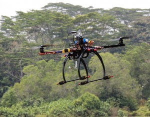
New unmanned aerial vehicles (UAVs), also known as drones, could go on to provide the ability for oil and gas companies to gain a much more detailed and accurate look at the land they will be using for their projects. Although this new land surveying technology is still being adopted, the possibilities offered by using drones for surveying promise that they warrant a closer look.

Benefits of UAVs Over Traditional Land Surveying Techniques

Drones used for land surveying offer many different advantages over traditional land surveying techniques, which require surveyors to go from place to place to conduct their work. Since this kind of old-fashioned survey work often has to take place in dangerous or difficult terrain, using UAVs instead can lead to land surveys that are much quicker and much less likely to put workers in harm’s way.

However, the most exciting advantage offered by using drones for surveying may perhaps be the increased accuracy it offers. Over recent years, developments in high-resolution camera technology, along with greater battery life and increased levels of control for the UAVs themselves, has finally made it practical to use UAVs to conduct high-resolution photography work from above.

Unlike earthbound land surveyors, these UAVs are able to conduct their work without interference from the land around them, meaning that they can get as close to the terrain as needed in order to get the images required for the project. They are also less likely to have to worry about time constraints, as they can stay in an area conducting a survey for as long as the battery life of the device allows.

As a result, UAVs are able to create highly accurate land surveys that are capable of meeting the needs of all oil and gas projects.

Why UAVs Offer Better Results When Used With LiDAR

Light Detection and Ranging (LiDAR) technology has become the latest word in terrain scanning over the last couple of years. With LiDAR, land surveyors use thousands of tiny sensors that bounce light points off the terrain, and then collect the result of the sensors into a data cloud that forms an extremely detailed and accurate representation of the land in question.

Pairing this new land surveying technology with an aerial vehicle is perhaps one of the best ways to maximize the quality of the results. However, up until now, the majority of the LiDAR work done from the air has been performed by manned aerial vehicles, which are unable to provide the quality of results that UAVs can. For one thing, manned vehicles have to conduct LiDAR from much higher in the air, which increases the likelihood that atmospheric conditions will interfere with the results of the scan.

On the other hand, drones used for land surveying are able to get as close to land as needed to conduct high-quality, accurate LiDAR scans, and as a result, are able to avoid any issues related to atmospheric interference.

While there are still several hurdles that need to be cleared before UAVs can find widespread use in land surveying applications, the potential for better, more accurate surveying already provides a lot to get excited about. As this land surveying technology continues to develop and grow more sophisticated, the possibilities will only continue to grow with it.

To learn more about using drones for surveying, request a free land surveying quote today.

Image Source : Adam Meek

How Aerial Survey Drones are Going to Revolutionize the Oil and Gas Industry

land surveyingIt’s no secret that the oil and gas industry is changing: “easy oil” reserves are getting more and more difficult to find, and companies therefore need to find new and innovative ways to drive more efficient operations in order to remain profitable. Unmanned aerial vehicles (UAVs), also known as drones, are the latest technology that’s driving the oil and gas industry forward, giving companies new opportunities to increase their efficiency, effectiveness and profitability.

UAV technology is not exactly new, but it’s only been in recent years that the drones, the batteries they are powered by, and the photography equipment they use to conduct land surveys have become lightweight and affordable enough to be feasible for use in large-scale land surveying operations for the oil and gas industry. This means that we’re currently standing at a crossroads in the history of the industry: those companies that identify UAV technology as the great opportunity it is and prepare themselves to capitalize on it will be in the best position to succeed going forward, while those that don’t will risk falling behind.

While there are a variety of ways in which aerial survey drones can benefit the Oil and Gas industry, one area that will be particularly impacted is land surveying. UAVs can offer three main benefits over more traditional surveying methods:

  • The ability to complete land surveys quicker
  • The ability to create land surveys that have a much higher level of detail
  • The ability to complete land surveys without having to put surveyors in danger
Complete Land Surveys Quicker

One of the clear advantages that UAV surveying offers over traditional surveying methods is the speed at which the surveys can be completed. This is a key benefit, as land surveying is only one of the first steps of many involved with completing an oil and gas project. When the land surveying process can be completed quicker, the rest of the project can proceed as planned, and the company can reach its goals with no delays.

UAV surveying is quicker than traditional surveying because it does not require surveyors to travel over difficult terrain in order to get to the survey site. Instead, the drones are able to travel directly to the site in the air, and then allow surveyors to see the visuals they need, no matter where those surveyors are.

Provide a Higher Level of Detail

Today’s aerial survey drones use top-of-the-line photography technology to provide the high level of detail needed to create a quality land survey. While surveyors operating from the ground might miss out on important details, drones have the ability to look down on a site from above, getting a complete view of everything.

These drones can also change camera angles or move in closer to get a better view of something if necessary. As a result, using drones to help complete land surveys allows oil and gas companies to get a better view than they would otherwise, and therefore increases the chances that a project will be successful.

Keep Surveyors Off Of Dangerous Terrain

Finally, using unmanned aerial vehicles removes the need for surveyors to travel over difficult terrain in order to complete their work. This has a dual benefit of keeping surveyors safe and avoiding accidents that can lead to costly and time-consuming delays.

On the job site, keeping workers safe is always the highest priority. That’s why drone technology, which allows land surveyors to complete their work from a safe position, is such a promising technology for use in the oil and gas industry. Since it also provided quicker, more detailed surveys, UAV technology is a real no-brainer for the oil and gas industry.

To learn more about groundbreaking surveying technologies like aerial survey drones, download our oil and gas brochure.

Image Source: Michael MK Khor

How a Land Survey Company Helps Get Your Team Up to Speed on Projects

Oil and Gas ProjectsNew technologies such as GIS mapping are helping to drive the oil and gas boom forward, providing a greater level of visibility and detail that lets companies make more informed decisions. However, in order to fully take advantage of the possibilities offered by these new technologies, companies need to make sure that they are providing an easy way for their employees to access the maps, documents and information they need.

Getting New Employees Up To Speed

This problem is especially challenging in the case of new employees. When employees join a project from outside the company, or move over from another department within the same company, they often find themselves having to start from square one. While other employees can find information from past e-mails or coworkers they know are familiar with the project, new employees don’t have this luxury. Instead, they often find themselves having to sift through massive archives of maps and other documents trying to find the information they need. This process is inefficient and time-consuming, and it can even cause a project to grind to a halt.

The Solution: Cloud Based Project Management

What oil and gas companies need to combat this problem is greater organization and centralization of project assets. Fortunately, some land surveying companies provide project management solutions that help make the process of managing and organizing project assets a simple and ingrained part of a company’s everyday operations. This helps ensure that employees and authorized subcontractors will always have access to all the documents they need to do their jobs well. In turn, this will help significantly reduce the time it takes for new employees to go from uninformed to contributing members of the team.

Easy Access Across All Device Types

Perhaps one of the greatest benefits offered by cloud based project management solutions offered by a land survey company is that they can provide the only information and documentation portal that a company could ever need for a specific project. In the past, important documents might have been stored in different locations throughout a company. This meant that a new employee would often have no idea where to start looking to find the documents they needed.

They would have to waste their own valuable time, as well as their colleagues’ time, tracking down those documents. Worst of all, since there was no single repository to cover the entire project, different employees might end up working with different versions of the same document, which could lead to confusion and miscommunication.

Project management solutions provide the single document repository oil and gas teams need to keep everyone on the same page. In addition, this one central repository can also be accessed from anywhere, meaning that employees can always access the documents they need, even if they need to do so using a tablet or smartphone while working in the field.

The Delicate Balance of Security and Easy Access

To ensure the level of easy access to information and documents that new employees need in order to get up to speed quickly, project assets can’t be stored on internal company networks that have special access requirements. This creates another challenge, as companies still need to be certain that their sensitive data is secure.

A project management platform can provide the balance between security and openness, allowing companies to store assets off their network for easy access, while also relying on the dedicated data security of a third-party partner–the land survey company. This means that new employees will always be able to access the assets they need, without exposing the company to risk.

Contact us today to learn more about how out how a land survey company can make project management easier. If you want to get started with Landpoint’s cloud-based project site, you can sign up here.

How a Land Surveying Company Creates 3D Models

land surveying companyTraditional methods of collecting, rendering, and storing survey data are rapidly being replaced with 3D digital data scanning and modeling. Today, three-dimensional surfaces and objects are converted into highly accurate mathematical representations using laser scanners and 3D modeling software. Thanks to the benefits of 3D laser scanning and modeling, construction project managers enjoy an easy, independent, and cost-effective resource for mapping any type of surface.

Using 3D Models

Contractors, engineers, land surveying companies and historical preservation groups all use data modeling. When creating a model, they start by scanning the area to be modeled with 3D laser scanners.

Scanners collect millions of survey-grade points to aid the engineer and land surveying company with design as well as problem identification and resolution. Once the points are collected the modeling process can then begin. This is useful for:

  • 3D BIM (Building Information Modeling)
  • 3D topographical site scans
  • 3D site representations and modeling
  • Construction As-builts
  • Measurements for erosion control plans
  • Grading volumes
  • Height measurements for equipment and crane mobilization
  • Environmental compliance
  • 3D laser scanners provide fast data collection and an increased safety envelope in difficult environments such as valleys, quarries, landfills, and facility locations.
  • Surveyed contours, volumes, and cross sections may be delivered as 2D or 3D models. They may be 3D survey points and break-lines used to produce digital terrain / elevation and TIN models, or full-detail models used for advanced designing.

How It Works

3D Laser Scanning for Construction

Thanks to Light Detection and Ranging (LIDAR), extremely accurate data can be collected, and therefore more accurate 3D models can be made.Here are some facts about 3D laser scanners:

  • 3D laser scanning uses high speed lasers fired at incredibly-high rates of speed.
  • 3D laser scanners may be Phase Based, where a constant laser energy beam is released, or Time of Flight based, where the scanner calculates the distance based on the laser light phase change.
  • The more, and closer, scans are taken, the more accurate the scan is. Scanned points are typically every 1/4 inch.
  • Each point taken by the scanner’s high resolution digital image is colored according to the photo.
  • Analysts setup scan stations in multiple areas to collect as much data as possible.
  • GPS can be tied to the scan data to make use of existing local coordinate systems.
3D Mapping Software

3D mapping software takes all of the raw scan data and converts it into a format that the modeling software is able to read. Clients can also request the raw scan data for use in AutoCAD, Miscreation, or other architecture/engineering related programs that can import point clouds.

Here are a few facts about 3D mapping software:

  • Many software platforms provide editing, direct access, visualization, spatial data analysis, and CAD modeling.
  • The initial “raw scan file” can be several gigabytes. When compressed and converted into anAutoCad drawing, the file size will normally drop considerably
  • Videos, digital color photos, Point clouds, survey files, and computer models of roads, bridges, and fully textured objects are all common forms of deliverables.

An Example of 3D Modeling for Oil and Gas

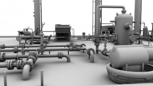
Landpoint was contracted to do an As-built 3D intelligent model on a gas processing facility located in Haughton, LA in 2011. The scan produced models within a 1/4 inch of accuracy and provided the contracting company with a complete as-built survey as well as an easy to access asset management model. To learn more about the benefits of 3D laser scanning, contact Landpoint today.

Top North American Large Infrastructure Projects to Watch

Land SurveyingAs the world’s population rises, so too does the need for additional infrastructure. This has led to a greater number of large infrastructure projects, which in turn has led to a greater need for land surveying and engineering services. These projects range from roads and highways to oil and gas pipelines and other energy related structures. When completed, many of these projects will have a huge impact not just on the local communities but in some cases all of North America and even the world.

While there are a number of impressive infrastructure projects, these are some of the most current and exciting projects that are either underway or close to being started:

  • The $6.2 billion Dulles Transit Extension in Washington, D.C. started in 2008 is the largest Metro system expansion in the city’s history. Mostly above-ground public transportation, it will provide access from Downtown D.C. to Dulles Airport and North Virginia suburbs. One intent is to reduce traffic congestion on the Beltway.
  • The $746 million Lone Star Transmission Competitive Renewable Energy Zone 345-KV Electric Transmission Line is Texas’ largest single transmission project. It consists of 320 miles of new lines. Six hundred seventy-one parcels are crossed by the new lines. Three 345kV substations and two compensation stations are part of the construction. Ten million dollars in property tax revenue will be generated in the first operation year.
  • The estimated $2.5 billion Crescent Corridor Expansion is an aggressive series of freight rail projects running from New Orleans to New Jersey through thirteen states. Intermodal terminals and approximately 300 miles of track is planned. Freight companies desire cost savings while achieving the removal of interstate congestion and pollution. The upgrade depends on public funding, and is tentatively scheduled for completion by 2030.
  • The $3.1 billion Alaskan Way Viaduct project is intended to strengthen Seattle’s iconic double-decker, elevated highway that runs through downtown, adjacent to the Puget Sound. A 2001 earthquake damaged an already weakened structure. Replacing the viaduct is more cost-effective than repairing it. Initial debate about replacing the elevated roadway with a tunnel delayed the project. The tunnel will create more open space along the waterfront and the south portion of roadway will be rebuilt. Both structures are designed to withstand a 9.0 earthquake. The 2015 completion date may be delayed however, due to the immense tunnel boring machine breaking down and sitting inactive for months.
  • Although no longer a US territory, the 99-year old Panama Canal is currently undergoing a $5.25 billion expansion. Three 1,400-foot long by 180-foot wide by 60-foot deep locks will be added to each end and the Atlantic end will be dredged. Strict environmental and reforestation phases are part of the project. The upgrade that will accommodate larger container vessels is hailed by the largest global shipping companies. Begun in 2007, the Canal Expansion Program has become a major trainer and employer of land surveyors, engineers, inspectors, and others.
  • The $5.3-billion Alberta, Canada to Nebraska Keystone XL oil pipeline has been a political issue for many years. The project that potentially provides the US decades of fuel, extends the existing Keystone pipeline carrying Canadian crude oil and diluted bitumen to Nebraska and Illinois to continue to other Midwest and Texas Gulf refineries and saltwater ports. The Contractor says the pipeline is the safest ever built. Environmentalists and alternative energy advocates are not convinced and there have been spill prevention, leakage, and potable water concerns among communities along the route.

For more information about land surveying for large infrastructure projects, please feel free to contact us. Landpoint has extensive experience with various infrastructure projects, especially when it comes to oil and gas.

Image by : Khunaspix

Why Scalability is Key to Oil & Gas Surveying

land surveying projectsScalability is the ability to quickly adjust to changing conditions as they occur. Projects need to continue even when new information changes the nature of the operation and demands an increase in scope. When it comes to oil and gas projects, land surveyors must meet deadlines, manage change, and ensure the end result meets company needs and regulatory standards.

As oil and gas industry operations expand, land surveying scalability becomes a major challenge. Many surveying companies are small and unable to scale, while others may not be able to scale quickly enough to accommodate oil and gas companies’ needs. As a result, companies may experience much longer turnaround times. “Time is money,” and increased survey turnaround is inefficient and costly.

It is extremely beneficial when land surveying firms can efficiently and effectively provide accurate oil and gas field data to aid engineers in decision making and problem resolution. Land surveyors may be required to change course quickly. Regardless of conditions and obstacles, oil and gas surveying projects must meet deadlines and milestones. To do so, they need the team and the technology to be able to easily handle project changes as well as the ability to properly manage resources once they are in place.

Land Surveying Projects & Scalable Technologies

Most oil and gas surveying projects are multi-phased, from field data collection, to surveyors review, to client deliverable distribution. Oil and gas surveys tend to become more complex as the project progresses. An original survey may turn into re-rotes, moves, and overall scope increases, requiring more resources and in many cases additional skill sets. The survey firm should have the capacity and resources to be able to add additional crews and equipment as needed.

Having access to some of the latest surveying technologies enhances scalability. For example, the best GIS uses significantly more data and keeps all of the information in the cloud. Data is made available through smartphones and tablets, enhancing communication between teams and keeping everyone in the loop. When information is kept in a central location and made easily available to those in the field, it means that no matter how many new teams are added, everyone will still be on the same page.

Some important methods, programs, and project management features indicating a surveying company is focused on continued scalability are:

  • Advanced GNSS
  • 3D scanning applications
  • Mobility / mobile devices
  • A real-time, in-house project management system
  • Knowledge of oil and gas companies’ multiple land leases and operations
  • A large pool of readily-available on-call survey teams
  • A reputation for updating and incorporating the latest technologies
  • Professionals that are knowledgeable of the most current land survey technologies

The Benefits of Scalable Oil and Gas Surveying

Ultimately, partnering with a firm that can easily scale helps your oil and gas project with three critical elements:

  1. Speed – By being able to add additional resources as soon as they are needed, a scalable land surveying company can vastly reduce the time needed to complete a project.
  2. Accuracy – A land surveying company needs to have a broad skill set and experience in a number of different oil and gas surveying related disciplines in order to take on the additional tasks that may come up in a project. If they do not have these things, they may attempt to take on tasks with mixed results.
  3. Efficiency – The more a project expands and changes, the more necessary it is that the surveying company be able to communicate with other teams and share information.

It is better for an oil and gas company to pick a land surveying company that can scale right from the start, instead of having to change midway when it becomes clear that the current surveying company cant. For more information, take a look at our oil and gas brochure.

The Dangers of a Poor Property Line Survey

land surveyingWe all know the importance of having accurately mapped-out property lines, but do you know how this is actually accomplished and what some of the consequences are if it is not done correctly?

Determining an accurate boundary line is accomplished by considering many factors. First, a land surveyor will review the deed work and the legal description of the property and surrounding properties. This entails that all common boundaries are addressed. Then a field search is performed for existing monumentation. The land surveyor will use specialized GPS systems to measure exact angles and distances of these located monuments. This data is then compared with previous survey data by a professional land surveyor. After the boundary is resolved, the surveyor will set any new monuments that were destroyed or lost and mark all finalized monuments with stakes, flagging, or spray paint. Finally, any deliverables such as a survey plat will be provided to the client or corresponding companies.

When is a property line survey needed?

Professional land surveys may be needed to establish boundary lines when an individual or a business purchases a new property or refinances an existing one. Financial institutions need to know the precise acreage of land, and insurance companies must be aware of the proximity of hazards, like streams or creeks, to the property.

Boundary lines may also need to be established if an individual or business wishes to make changes on their land, such as erecting a fence or building service roads. It is important that whatever is built does not go onto a neighboring property because the property owner may face criminal trespassing charges or be told to destroy it, therefore losing their investment. A professional boundary survey can prevent this issue from becoming a problem.

Why do I need a property line survey? Why can’t I just use an approximation?

An approximation of a location stems from “hunches,” but a professional land survey is based on precise calculations that considers all legal requirements. Approximations may not be used in a court of law during disputes; only the professional opinion of a certified land surveyor may be admitted as evidence. Establishing the true property line protects your property value and rights and helps you plan better projects.

Choosing to invest in a property line survey is a great decision, but the company you choose is just as important. Contact a professional, reputable, skilled surveying firm, like Landpoint, to get the most accurate results and avoid any pitfalls when mapping out your property lines. If you would like to receive a free quote on your project, click here and provide the necessary information.

Image By: Johan G

The Benefits of a 3D Laser Scanning Survey

laser-scanningLaser scanning has undeniably revolutionized the field of land surveying. The latest laser scanning technologies enable us to help our clients plan and execute the most efficient projects, and they allow customers to analyze every component of any facility or site. These capabilities help us make better decisions during every step of the project – from the planning stages through completion.

The versatile technology can be applied to a variety of land surveying needs, including change detection, accident reconstruction, 3D drawing creation, pre-project scanning and more.

A 3D Laser Scanning Survey Produces Faster Results, Cuts Field Time

In the past, field surveys could take days or even weeks to complete. Using laser scanning technology, it’s possible for us to complete the same field surveys in just one single day. Laser scanning also enables us to complete fly-throughs, 3D models, detailed animations and maintenance materials in less time than ever before.

A 3D Laser Scanning Survey Reduces Overall Project Costs

The increased speed and accuracy of laser scanning means that our survey team has to complete fewer field visits to collect data. This reduces the overall cost of a project for you.

A 3D Laser Scanning Survey is Highly Accurate

Laser scanning technology produces the most accurate data available. This solid knowledge base helps us help you plan better projects.

A Laser Scanner Survey Is A Versatile Tool

We use laser scanning technologies in many aspects of land surveying. We rely on laser scanning for budgetary and timeline preparation, application implementation, historical preservation, reaching once-impossible areas, change detection, hazard surveying and accident reconstruction. We also use laser scanning to produce detailed topological maps, volumetric calculations, 2D drawings, 3D models and more.

Overall, laser scanning helps us better understand building conditions, and this enables us to make better decisions regarding your projects. To learn more about laser scanner surveying and how it has changed the field of land surveying, contact our team today.

Image By: USACE HQ