Posts

3 Reasons to Get 3D Models of Your Oil and Gas Facilities

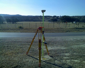
In the oil and gas industry, there is no such thing as a perfect facility. As facilities age and the needs of your company change, you’ll always need to make changes and updates to make sure your facilities still meet those needs. The first step in any such oil and gas survey project should be to conduct  3D laser scanner surveying of the existing facility, which can then be used to create models. Having a 3D model of your current facility can provide you with a number of benefits that will help your update project run smoother.

The Three Main Benefits of 3D Models for Your Oil and Gas Survey

1. Greater accuracy

When planning an update to your existing oil and gas facility, it’s absolutely essential that you have a complete and accurate understanding of the facility as it currently exists. As you make decisions about what needs to be updated, you must be able to take exact measurements; just getting a basic idea of things won’t be good enough.

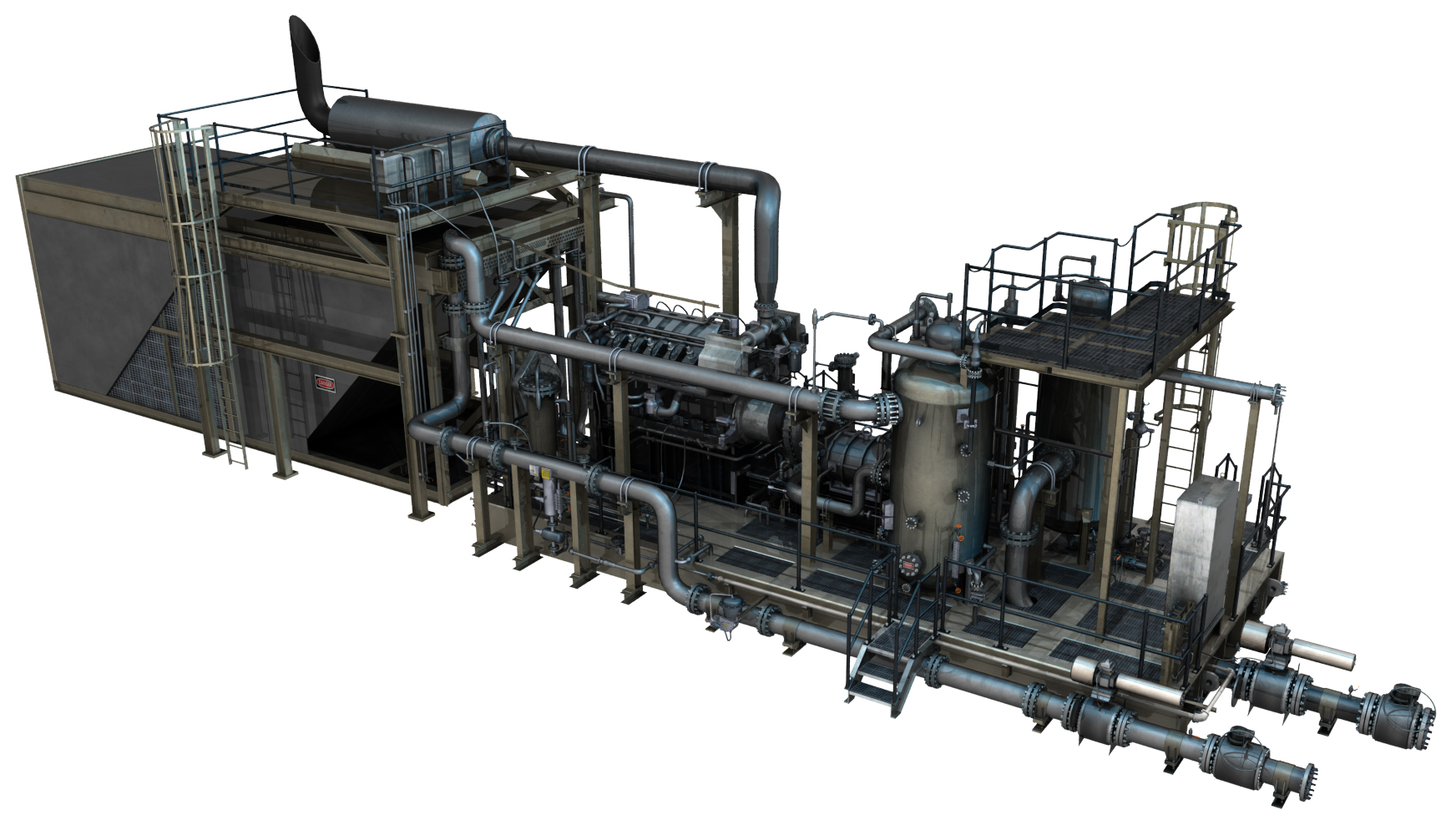
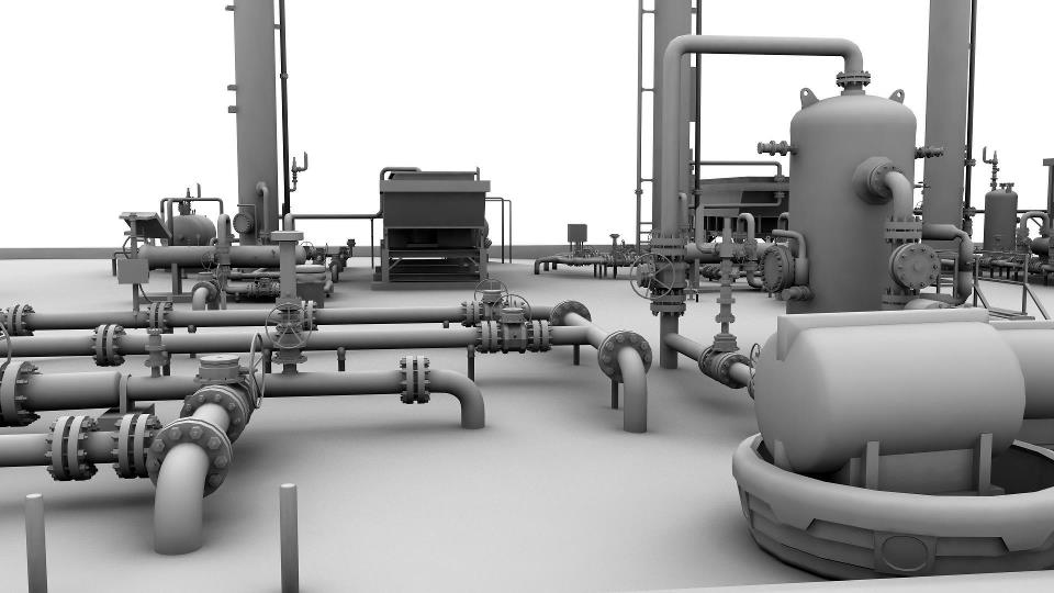
Having a 3D model of your facility supports this capability by providing an easy source of accurate information about the facility. These models are created using 3D laser scanning technology, which bounce thousands of laser points off the facility. As those laser points bounce back, the scanners will track the time it takes them to return and the flight path they follow. The scanners will then assemble a data cloud for all of those laser points, which is then used to support the creation of the 3D model.

Since your model will be based on the data taken from the laser scanners, you can feel completely confident that the data as accurate, and you won’t have to worry that you might be using inexact information gathered by hand.


Check out this demo of accessing point cloud information directly from your browser. You don’t need any special software and the point clouds are hosted as a service instead of having to download hundreds of gigabytes of data.


2. Know about potential issues in advance

Anytime an unexpected issue comes up during the course of an oil and gas facility update, it can have serious complications for the project as a whole. The project team may find themselves having to completely scrap their original plan to account for the newfound issue, or at the very least delay the project while they try to work around it.

These delays and changes to the project plan can be extremely costly and time consuming, in addition to be a source of tremendous frustration for everyone involved. That’s why you’ll want to avoid running into such an issue if at all possible.

The whole reason these issues pop up when you’re not expecting them is because you lack a complete and accurate understanding of your facility. Having a 3D model gives you a simple and efficient method of looking for these issues. Once you’ve found them, having a model also makes it simple for you to come up with a plan that accounts for the issues, so that your project need not be interrupted as a result.

3. Spend less time on planning

Everyone knows that having a strong plan in place before you start on a project is an important part of ensuring the eventual success of that project. In spite of this, it’s still important that you be able to get through the planning phase as quickly as possible, so that you can get down to the actual business of making the update.

Using 3D laser scanning technology to generate accurate representations of a site can help you strike the proper balance between planning quickly and planning thoroughly. While these models are relative quick to create, they can still provide you with all the information you need to fuel a successful project.

To learn more about 3D laser scanner surveying as well as 3D models and how they can benefit your oil and gas project, contact Landpoint today.

How a Land Surveying Company Creates 3D Models

land surveying companyTraditional methods of collecting, rendering, and storing survey data are rapidly being replaced with 3D digital data scanning and modeling. Today, three-dimensional surfaces and objects are converted into highly accurate mathematical representations using laser scanners and 3D modeling software. Thanks to the benefits of 3D laser scanning and modeling, construction project managers enjoy an easy, independent, and cost-effective resource for mapping any type of surface.

Using 3D Models

Contractors, engineers, land surveying companies and historical preservation groups all use data modeling. When creating a model, they start by scanning the area to be modeled with 3D laser scanners.

Scanners collect millions of survey-grade points to aid the engineer and land surveying company with design as well as problem identification and resolution. Once the points are collected the modeling process can then begin. This is useful for:

  • 3D BIM (Building Information Modeling)
  • 3D topographical site scans
  • 3D site representations and modeling
  • Construction As-builts
  • Measurements for erosion control plans
  • Grading volumes
  • Height measurements for equipment and crane mobilization
  • Environmental compliance
  • 3D laser scanners provide fast data collection and an increased safety envelope in difficult environments such as valleys, quarries, landfills, and facility locations.
  • Surveyed contours, volumes, and cross sections may be delivered as 2D or 3D models. They may be 3D survey points and break-lines used to produce digital terrain / elevation and TIN models, or full-detail models used for advanced designing.

How It Works

3D Laser Scanning for Construction

Thanks to Light Detection and Ranging (LIDAR), extremely accurate data can be collected, and therefore more accurate 3D models can be made.Here are some facts about 3D laser scanners:

  • 3D laser scanning uses high speed lasers fired at incredibly-high rates of speed.
  • 3D laser scanners may be Phase Based, where a constant laser energy beam is released, or Time of Flight based, where the scanner calculates the distance based on the laser light phase change.
  • The more, and closer, scans are taken, the more accurate the scan is. Scanned points are typically every 1/4 inch.
  • Each point taken by the scanner’s high resolution digital image is colored according to the photo.
  • Analysts setup scan stations in multiple areas to collect as much data as possible.
  • GPS can be tied to the scan data to make use of existing local coordinate systems.
3D Mapping Software

3D mapping software takes all of the raw scan data and converts it into a format that the modeling software is able to read. Clients can also request the raw scan data for use in AutoCAD, Miscreation, or other architecture/engineering related programs that can import point clouds.

Here are a few facts about 3D mapping software:

  • Many software platforms provide editing, direct access, visualization, spatial data analysis, and CAD modeling.
  • The initial “raw scan file” can be several gigabytes. When compressed and converted into anAutoCad drawing, the file size will normally drop considerably
  • Videos, digital color photos, Point clouds, survey files, and computer models of roads, bridges, and fully textured objects are all common forms of deliverables.

An Example of 3D Modeling for Oil and Gas

Landpoint was contracted to do an As-built 3D intelligent model on a gas processing facility located in Haughton, LA in 2011. The scan produced models within a 1/4 inch of accuracy and provided the contracting company with a complete as-built survey as well as an easy to access asset management model. To learn more about the benefits of 3D laser scanning, contact Landpoint today.

Need an Alta Land Survey? Get It Made With HD Scanners

land-survey1To assist our clients in designing and executing projects in the most efficient way possible, Landpoint relies on the very latest high definition scanning technologies when creating an ALTA land survey. These innovative technologies help our project managers and outside engineers and architects visualize all the components of any site or facility, and it allows us to make better decisions based on the building conditions.

We utilize high definition scanning to meet a variety of professional land surveying needs, including pre-project scanning, the creation of traditional 2D drawings, change detection, catastrophic event mapping and accident reconstruction, and it is particularly helpful in completing scans for ALTA certification.

Using high definition laser scanning, we can complete a field survey for ALTA certification in just one day. In less time than ever before, we can produce fully interactive 3D models, maintenance materials and detailed animations, including complete fly-trough’s alongside the traditional materials expected from an ALTA land survey.

As a professional land surveying firm, high-def laser scanning benefits our clients in many ways:

Reduced Cost

Using the technology significantly reduces the amount of field visits our team has to make to collect data. This cuts the overall cost to you, resulting in more cost-efficient projects.

Future Planning

The data we collect through high definition laser scanning is not just valuable for your current projects, but can be saved and used for your future projects as well. The accurate, detailed data makes future planning far easier.

Quality Assurance

The data collected using high definition scanning is highly accurate. This ensures that your project will be based on the most solid knowledge of your site.

Speed

High definition laser scanning enables us to collect accurate data more quickly than ever before. Instead of taking weeks or months to complete your project, we can have it finished in just days.

This technology gives project managers insight into their locations that was never available before. The result is better project planning, easier decision making and overall more successful projects.

To learn more about getting an ALTA land survey and how HD laser scanning can benefit you, contact us today!

Image By – survcentex

Advancements in Oil and Gas Development with High Definition Scanning

oil and gas developmentFirst used in 1998, laser scanning is now the industry standard for making accurate measurements in even the most complicated environments. This is the future of land surveying, but it is already the norm for us.

How a 3D Laser Scanning Survey Works

A 3D laser scanning survey is appropriate for projects of all sizes, ranging from oil and gas development to historical preservation projects, thanks to advancements in workflows, software and hardware. This technology allows us to collect huge amounts of accurate data at high speeds.

High definition scanning works by moving a narrow beam of laser light across a target. The laser records millions of accurate measurements quickly, then transmits the data to a computer screen. The computer uses this data to create a point cloud that is similar to a 3D model. We also use the technology to scan multiple targets to create virtual walkthroughs, perform containment analysis, draft interactive 3D models and manage inventory.

Producing Highly Accurate Data

The accuracy of data collected with high definition scanning is far superior to that gained by conventional or GPS surveying alone. High definition scanning enables us to reach further afield and collect data in places that were once inaccessible.

Saving Time and Money

After your initial investment, high definition scanning is more affordable than conventional methods. If we need more information about your site, we don’t have to send a survey crew to get it. Instead, we analyze the models and data already collected and extract the information we need. This saves you both money and time.

Better Damage Assessment

We rely on high definition scanning to assess damaged facilities, broken drilling rigs and other problem areas. The technology allows us to quickly and accurately assess the problem and create a viable solution.

If you have never worked with a firm that offers high definition scanning, it is easy to make the switch. You get the added benefits of this technology for the same cost or even less, and get results much faster.   This technological advancement has changed oil and gas development forever. To learn more about how a 3D laser scanning survey can help you, contact us today!