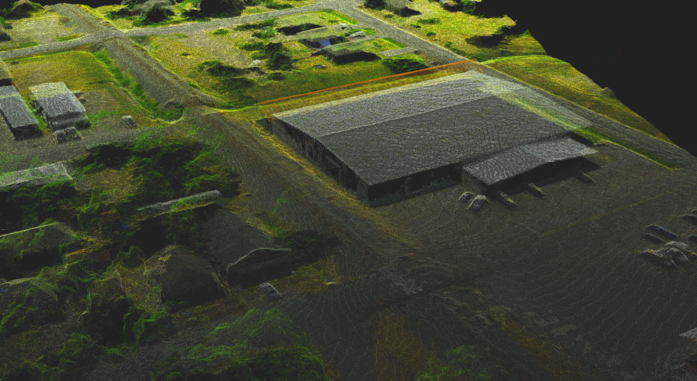
How Does 3D Aerial Mapping Work?
For companies operating in the oil and gas industry, the potential benefits of 3D modeling are clear: when these organizations are able to look at clear, accurate and detailed representations of a piece of land or a facility, it can become much easier for them to make plans, while also feeling confident that any assumptions they make are accurate. One great way to capture the data needed to create 3D models is to use unmanned aerial vehicles (UAVs). Read on to get a quick look at what’s involved with 3D aerial mapping, on a step-by-step basis.
Step 1: Consider Conditions
Of course, using the latest technology and proper technique is important to get great results from your 3D aerial mapping process, but that alone can’t make up for suboptimal conditions. Before you schedule your drone flights to collect the needed data for your 3D models, make sure you think about what time of day would be ideal to capture the best images. Typically, you would want to fly around noon, since that would put the sun directly overhead, and shadows would, therefore, be very short. On the other hand, if you fly too early or too late in the day, the shadows would be more likely to interfere with the accuracy of the model.
In addition, make sure to check the weather for the day you intend to fly, as this can also affect the quality of the images you collect. Of course, rain or wind could make it difficult to fly in the first place, while a very sunny day would also contribute to longer shadows. Ideally, you would fly on an overcast day.
Step 2: Capture Nadir Images
The first images you want your drone to capture when you’re doing 3D aerial mapping are the nadir images, or the images looking down on the terrain or building from directly above. These images will form the baseline of your 3D models. In most cases, it will be quite easy to design an automated flight plan for your drone to capture nadir images. Once the flight plan has been created, you can just let the drone take off on the flight path you set out for it and it will collect the formatted imagery.
Step 3: Capture Oblique Images
Since you’re looking to get a 3D view of the feature in question, viewing it from directly overhead may not always provide adequate perspective. If you’re looking at a piece of terrain that’s relatively flat, then you might be able to get away with using the nadir images alone. However, if you’re looking to model a facility or terrain that has differing altitudes, then you would want to expand on your original nadir images with oblique images.


Oblique images are captured from the side, allowing you to pick up on details you would have missed if you used nadir images alone. You would usually capture these images by flying your drone in a circle around the site, with the camera tilted at a 45-degree angle.
Step 4: Process the Images and Create the Model!
After you’ve captured an array of images from multiple angles, you can use processing software to take those images and stitch them together into a single 3D representation of the feature you were scanning. If you work with the right software, you may be able to turn your images into a usable model in as little as a few hours.
Final Thoughts
3D aerial mapping is something that anyone can do, provided that they take the time to gather knowledge and experience. If you don’t have time to learn how to do it for yourself, then an experienced 3D aerial mapping partner can help. Contact us at Landpoint today to get started.