Connecting Design, Engineering, and Construction: Surveys at All Stages of the Process

Surveys are used throughout all stages of the construction process, from a pre-construction survey to ongoing maintenance and repair surveys. A good survey can identify potential problems with the construction site, locating security flaws and hidden dangers. Here’s an in-depth look on how surveying can improve the effectiveness and safety of construction projects. 

During the Design Stage: Before a Project Starts

Surveys excel before the project even starts. A pre-construction survey will be completed to gain a better understanding of the site that is to be developed. Surveys can detect changes in elevation that have to be addressed, as well as any existing construction that needs to be broken down. If there are trees and rocks that need to be cleared, this will be noted during this stage. 

Once a 3D survey has been taken at the beginning of a project, it can be used in a 3D simulation. These simulations are used to test out designs; architects and engineers can place their construction in a 3D world and see how it will interact with the surrounding environment and weather. The more accurate these surveys are, the more accurate the project can be.

Simulating a project early on reduces the risk for costly construction reworks. When everyone involved can see exactly how the construction will look (and all elements have been accounted for), it’s less likely that the project will run into issues.  

During the Construction: Keeping the Project on Time

During a project, surveys can be used to compare construction plans and models, identifying any major issues and avoiding them before they become time-consuming and costly. Surveys can check the construction site to see if there are any issues emerging, such as security issues or safety hazards. Additionally, these surveys can compare the finalized design with the current product, to make sure that major construction milestones are being met.

Drones can be fitted with both LiDAR (to scan the construction site) and sensors (to identify issues such as overheating). Photogrammetric scans can also be added for more human readable data. Once scans have been completed, construction companies can make sure that the project is shaping up as it should be. If any sensors are triggered, the drones can automatically report its GPS coordinates.

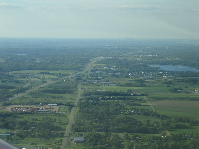
Drones are particularly useful during large scale construction projects, such as pipelines, as they can scan the area more consistently than a human surveyor. A human surveyor may take days to cover the entire construction site. A drone can perform a quick flyover, and can even connect to the sensors located on the IoT. 

When these scans are taken, they can be sent directly back to those in charge of the building development. This provides complete transparency throughout the construction process and gives stakeholders the opportunity to interject if the project doesn’t seem to be going the way that they expected.

After the Construction: Maintenance and Repairs

Construction surveying and layout doesn’t end once the project is done. Once the project has been completed, a final survey can be taken to make sure that everything was built correctly. After this, regular inspections can be used to fine wear and tear. In the pipeline industry, inspections may find areas in which overgrowth could be threatening the line. In wind farms, regular inspections can identify equipment that may be close to breaking.

Performing these types of regular inspections allows a company to find, locate, and mitigate damage much faster, controlling the fidelity of the project and its potential for downtime. Regular inspections improve the safety of a construction site, and ensure that the final project is updated and repaired efficiently. The longer a site goes without needed repairs, the more expensive and extensive those repairs become.

Conclusion

Drone construction surveying and layout is one of the most cost-effective methods of controlling a construction project. Before, during, and after the project, drones can be used to make sure that the project is proceeding on a timely basis. Drones help with identifying repair and maintenance issues even when projects have been completed. From the beginning of a construction project to the end, surveys are able to yield fantastic results. Want to learn more? Contact Landpoint today.

Surveys at Scale - How Landpoint Tackles Survey Projects of Any Size

4 Ways Drones Improve Safety of Pipeline Surveys

Drones are a cost-effective, reliable way to improve the safety of pipeline surveys. There’s a reason why the oil and gas industry has embraced drones so readily: They are uniquely well-suited to improving the safety of pipeline projects. 

But what makes drones so important for pipeline safety? Here’s a list of just a few of the things that drones can do for a pipeline project.

1. Enhanced Regularity

Drone inspections can take place more frequently than other types of inspection. Not only are they cost-effective, but they’re also fast: A single drone can perform pipeline leak detection across an entire pipeline. Human inspectors need to inspect the entire project section by section, often taking quite a lot of time.

Since human inspections are lengthy and expensive, pipeline projects may execute them infrequently, and may consequently miss out on safety hazards. Comparatively, a drone inspection is completed quickly and collects a more robust set of data, providing the information that the pipeline company needs to protect its pipeline integrity.

Frequent inspections will mean that fewer safety hazards and issues fall through the cracks. The more regular and consistent the process is, the more issues will be caught. 

2. A Large Variety of Sensors

Practically any sensor can be used with drone technology. Thermal imaging cameras and other types of sensors are able to detect gas leaks and repair-related issues before they become a major problem, letting the pipeline company respond to these issues more effectively. These wide arrays of IoT sensors can be used in conjunction with drones to respond to potential repair and maintenance issues before they become devastating. 

When drones recognize issues in sensors, they can report their GPS position and the unit that the sensor is in. The sensor information will then be sent back to the project team, and the team will be able to address the problems as needed. Being able to fix problems with a pipeline inspection drone means that the pipeline won’t experience dramatic levels of downtime. Ultimately, this improves the overall pipeline integrity, and leads to reduced costs for the project.

3. No Humans in Harm’s Way

Drones don’t require a crew, which means that people aren’t exposed to potential dangers. With any helicopter or plane flight, the crew is subject to a potential crash or injury. Though the risks of modern flight are minimal, there always remains a slim chance of danger. Drones can fly through areas that have fumes or that could lead to fire or explosion. If the worst happens, then a drone could get damaged, but a human life is never at stake.

Drones are also impervious to many threats that could potentially injure people. Drones are able to fly in many types of weather, and can’t be damaged by things such as gas fumes. Drones will be able to fly even in extremely hot extremely cold weather; this weather might impact a human surveyor, and may occur in areas with pipeline development.

Pipeline issues can be potentially dangerous or hazardous, especially when it comes to fumes. These are areas that no human surveyor or inspector should expected to go into, but drones can do the job and determine how hazardous the area is before it is secured and contained.  

4. Protecting the Environment

A major concern for pipeline projects is that they might adversely impact the environment. With drones, pipeline surveys can be completed quickly to minimize the impact to the surrounding nature, environment, and landscape. Regular safety surveys will identify any potential issues, such as plant and root intrusions into the pipeline itself. Before the pipeline breaks apart and potentially causes a spill, these issues can be addressed. 

This improved safety has a profound impact on a pipeline project. Not only is the project safer for workers and the environment, but it’s also less costly. Being able to improve upon pipeline safety also reduces insurance rates and operating costs. For more information about the benefits of regular drone surveys for pipeline projects, contact Landpoint.

Surveys at Scale - How Landpoint Tackles Survey Projects of Any Size

How a Drone Survey Helps Save Taxpayers Money

A hurricane hit a city, but now the floodwaters have subsided. The government needs to know whether it’s safe to send engineers in to start making repairs, but how can it do so without risking personnel?

Drones, of course. Drones are a safe, effective way to monitor an environment for changes. Drones can report back detailed information about their surroundings: looking for survivors, identifying damage, and determining whether the danger is ongoing. Drones can report on traffic conditions during mass evacuations, or even look for lost pets after a weather event.

Drone technology is usually considered an effective way to save companies money, and to complete projects on time. But when utilized properly, drone surveys can also save taxpayers money on public projects. Drone technology is diverse and versatile, and can be easily applied to everything from natural disasters to municipal engineering products. Here’s what you need to know.  

How Can Drones Be Used for Public Projects?

With photogrammetry and LiDAR, aerial drone surveys can be used to make projects both faster and more efficient. When paired with surveying technology, drones gather accurate, up-to-date information about terrain. And, of course, with regular video feeds, drones can be used to monitor large areas at a time. 

There are a number of applications for this. Accurate drone surveys are able to make government projects faster and more efficient. They are also able to complete initial surveys and maintenance surveys without the need for a ground crew, ultimately saving the project (and taxpayers) money.

Drones are advanced technology that can create high resolution, highly accurate scans through LiDAR and photogrammetric tools. These scans help public projects simulate and test out their new investments, and ultimately save money in many ways.

Addressing Natural Disasters

Natural disasters come in many forms, and most of them strike by surprise. Earthquakes, wildfires, and tornadoes can be sudden and unpredictable. With drone technology, you can see what the extent of a disaster is before boots are on the ground. Otherwise, addressing a natural disaster can be dangerous in itself: Responders and volunteers need to put themselves in the way of danger to assess the situation.

During a natural disaster, drones can be used to look for people who need to be rescued, and direct rescuers accordingly. Drones can see where the damage is most severe, and can route traffic as needed. Further, drones can be used in areas that would be otherwise dangerous for helicopters, as the risk is not as great. Compared to helicopters, drones can fly much lower, and can therefore get a better view of the landscape.

Completing Regular Inspections

Apart from initially developing projects, drones can also able to be used for the purposes of security and safety. Drones can be used to secure a site by detecting unauthorized activity within zones. Many projects involve lengthy roadwork or construction, which may pose safety issues that can be detected through regular surveying. 

A drone can find problems before they become a catastrophe. Drones will be able to identify bridges that need bridge rehabilitation. A bridge that’s shut down is far better than a bridge that collapses. With many types of repair, the repair is faster and cheaper the earlier it’s caught. 

Inspections are often delayed (if not put off entirely) because of their heavy time and cost burden. Without drones, individuals need to survey the entire site, inspecting as they go. Drones can be paired with sensors and other technology to be able to complete surveys quickly and without human intervention. 

Providing Better Levels of Transparency

Public works are public-funded. Drone surveys provide better levels of transparency, by releasing information to the public. As updates are released, the community’s relationship with the government or its agency will strengthen. Drones can be used to report back to the public when projects are being completed, and whether projects will still be finished by their deadline.

There are many reasons terrestrial LiDAR surveys should be a new standard for municipal projects. LIDAR surveys give an extensive look at a project as it’s completed, allowing for corrections to be made. In terms of repairs and safety, LiDAR surveys can alert project managers to the issues they may experience ahead, while also reducing risk.

Surveys at Scale - How Landpoint Tackles Survey Projects of Any Size

Are you ready to get started? Contact Landpoint today to learn more about our aerial data collection services and drone technology.

What Are the Limits of Using Drones in Construction?

Drones are very useful tools for any construction project, but they aren’t without some challenges. There are some limitations to the use of drones in construction, as well as potential complications. Using a company that specializes in drone technology can help you navigate some of these challenges.

Drone Regulations Continue to Change

Rapidly changing regulations can make it confusing for people to get the permits they need, especially if aerial scanning has to be completed in urban areas, like construction sites in the midst of large cities. It may even be difficult to even determine which permits need to be acquired. 

A company that specializes in drone technology will be able to help a construction company navigate these regulations, especially since said regulations may change given the relative newness of drone technology. Changing regulations and permitting processes may occasionally delay a project, but these concerns are primarily for those who work in large, urban areas.

For open spaces and rural locations, drone permits generally aren’t as much of a concern.

Optimal Use of a Drone Requires the Services of a Trained Professional

Drone scans shouldn’t be done by just anyone. If a scan isn’t done by a trained professional, the drones can return inaccurate, incomplete, or erratic results. An improperly controlled drone can even cause property damage. Drones take training to be able to fly well, and the aerial surveying and scanning systems require further training and experience. Imagine a world where you need to send a drone out again because the first scan didn’t get all the data it needed to!

Drones Have a Limited Flight Time

Due to their batteries, drones can only fly for a limited amount of time. If a project must be completed urgently but involves covering a large area, multiple drones may need to be used to ensure complete coverage – or a project manager may want to look into other, potentially more suitable, technology.

Drone technology is changing all the time, and as their battery power is extended, the use of drones in construction grows increasingly practical. For most aerial mapping projects, drones will be more than sufficient. Completing regular maintenance scans is a valuable use of drones in construction, and it generally isn’t time dependent. 

Drones Don’t Fly Well in High Wind Conditions

While drones are agile and reliable, they can’t deal well with high winds. Drones are lightweight and small; high winds can blow them off course and make it impossible for them to get consistent readings. Luckily, it’s rare that a project is so urgent that an inspection or survey cannot wait until high wind conditions have dispersed.

There are certain locations, however, that may regularly experience high winds, and drones will not be as suitable to those locations. When it comes to high winds, airplanes are often used for aerial scanning, as they can fly over the terrain without much issue. Helicopters are another viable option that can safely fly closer to the ground than airplanes can.

Drones May Require a Specialized Data Pipeline

As advanced technology, drone data often needs to be analyzed through a specialized data flow. While this does limit the use of drone technology to companies with access to advanced analytics services, there are a multitude of reasons why construction managers should be embracing complex data analysis like Building Information Modeling.

The need for a specialized data pipeline can be subverted by partnering with a company that manages and analyzes data in-house. An in-house data processing service will be able to provide surveying data in a way that can be understood and utilized by the client company, like 3D maps or charts.

Though there are some limitations to using drones for aerial mapping and construction, they’re still an incredibly useful and versatile technology. Companies such as Landpoint specialize in using and implementing drone technology, but Landpoint – unlike many other mapping and surveying companies – also provides surveys through other aerial scanning vehicles. 

Regardless of their limitations, drones remain a powerful tool in the arsenal of any construction project manager or director. Contact Landpoint today to learn how an aerial survey can make your next project easier.

CTA-Landpoint-UAV

Aerial Imaging Services: A Primer

If you need aerial imaging done, what technology will you use? There are a lot of options open to you, and there isn’t always a clear winner. When choosing your aerial imaging services, you will usually choose both the imaging technology and the aerial vehicle. Any combination of these may be available, so let’s look at the options that may prove to be the best for your specific project.

Different Types of Aerial Imaging

Aerial imaging technology is the way an aerial survey scans the terrain and provides actionable data that can be analyzed. Today, there are two primarily used technologies: LiDAR and photogrammetry.

  • LiDAR. LiDAR technology is currently the most advanced aerial technology today, often used for aerial mapping with drones or other aircraft. LiDAR technology uses lasers to read the terrain below an aerial craft, creating extremely accurate sets of data. Lasers can penetrate brush and thin obstructions like cloth, providing accurate scans even on overgrown terrain.
  • Photogrammetry. Photogrammetry is an older technology that uses photographs to generate imagery based on positioning, perspective, and other captured data. As photogrammetry uses photographs, it can provide coloring along with textured terrain, something that LiDAR scanning cannot. However, because photogrammetry uses 2D photos for analysis, it may not always be as accurate.
  • Combined. Some projects will use both LiDAR and photogrammetry together, producing a highly detailed 3D map in real color. This combination is typically the most intuitively understood by untrained observers, but it will also be more time-consuming and expensive, and may not be necessary for the vast majority of projects.

Your project’s budget and your needed levels of accuracy are going to determine which type of technology is better for you. While LiDAR will always be more accurate, photogrammetry is often more affordable.

Different Types of Aerial Vehicle

Once the surveying technology has been decided upon, the vehicle that is used to capture information needs to be chosen. Different vehicles have different strengths. 

  • Helicopter. Helicopters can fly for a long period of time and can hover close to the ground. However, helicopters need to be manned, and no matter how safe an inspection is, there is always the risk of crew injury due to an accident. Helicopters take longer to deploy than drones do, but can function in weather that may prove an obstacle to drone flights.
  • Plane. Planes are best for surveys over large plots of land, as they fly much faster and at a higher height. They are the most expensive option and do require a manned crew, which can drive up the cost. At the same time, planes are usually more stable during inclement weather than helicopters or drones are. Planes can also take some time to deploy due to the complexity of the craft and the need for crew.
  • Satellite. Traditional satellite mapping refers to a low-resolution map produced by satellites in orbit. Satellite data can be purchased through a satellite company, but it typically won’t provide significant enough resolution for most applications. It’s usually used for preliminary information about a location.
  • UAV. Aerial mapping with drones is rapidly becoming standard, as UAVs are the most versatile option. UAVs are able to fly close to the ground and capture high resolution imagery without any threat to a manned crew. UAVs can be deployed quickly and can finish most aerial surveys within a day, though larger surveys may tax the drone’s range and battery power.

Aerial imaging services are swiftly moving towards drone use as the primary platform for imaging services, but there are still circumstances in which a company may want to use a helicopter or a plane. 

Choosing the Right Aerial Imaging Services

Drone technology tends to provide the best benefits overall, and makes sense for most projects. Still, there are a number of different options available, depending on your project’s unique needs. Working with a company that can provide multiple types of aerial imaging, such as Landpoint, can ensure that you use the right technology for your project. 

Could your next construction or energy project benefit from a detailed aerial imaging service? Contact Landpoint to learn more about how you can put this technology to work

landpint-UAV-CTA

4 Hidden Benefits of Using Oil and Gas Drones

Drones can provide a number of benefits for companies in the oil and gas industry, from reducing costs to improving safety. By integrating drones into their operations, oil and gas companies can improve their surveying, regular maintenance checks, and safety and business processes. Here are some of the hidden benefits of using oil and gas drones. 

1. Provide Detailed 3D Models for Superior Planning and Accuracy

During pipeline development, drones can be used to produce accurate high-resolution surveys. As pipeline development becomes increasingly complex, it becomes necessary to produce increasingly detailed surveys. Drones can be used with technology like LiDAR to get detailed information about terrain, even if that terrain is overgrown and covered with brush.

Better planning and accuracy leads to fewer delays, which can be extraordinarily costly during the process of development. It also leads to fewer incidental issues; finding out that a survey is incorrect or incomplete after the fact can lead to the project needing to be dramatically revised. Altogether, drones speed up and improve upon the process of conducting a survey.

Detailed 3D models can further be used to simulate further development or to test out developments before ground is broken. These 3D models are accurate enough to be used to predict how buildings and structures will interact with future changes. 

2. Maintain Safety Inspections for Improved Environmental and Worker Safety

Oil fields and oil and gas pipelines may not be inspected very often due to the prohibitive cost of ground inspections. Drones can be used for regular aerial inspections, to identify potential issues with work sites, and to improve environmental and worker safety. These inspections can be done faster and more regularly than ground surveys, and so may catch potential safety issues before they become problems.

A single environmental issue can cause millions of dollars in damages, and worker safety issues can damage morale. Having drone safety inspections will increase accountability around a work site and improve its safety record. In addition to surveying for worker safety, drones can inspect locations that would otherwise be prohibitively difficult or unsafe for crew to inspect, due to remoteness, rough terrain, or suspected leaks of hazardous material.

3. Complete Surveys and Inspections for Lower Costs of Maintenance

Surveys and inspections completed through drones cost less, thereby improving an oil and gas company’s bottom line. Lower costs of maintenance can relate directly to the profitability of an oil and gas project, which is important given the fact that oil and gas companies can often fluctuate dramatically in terms of revenue.

In addition to surveying for worker safety, drones are also able to survey for issues related to damage, repair, and maintenance. Commonly, drones can be used to survey a pipeline for visible overgrowth, which can break down the pipeline over time and cause costly issues. Through proactive repairs and maintenance, an oil and gas company can reduce the chances of more serious, costly issues. 

4. Improve Equipment Maintenance through Integration with IoT

In addition to regular pipeline surveying services, drones can be connected directly with sensors and IoT devices to automatically detect issues with equipment. Heat sensors, for instance, can see whether equipment may be running too hot, while communications with IoT devices could discover whether there are meters that are running too high.

By integrating drones with advanced, new technology, an oil and gas field company can create an intelligent network that can identify potential issues with its equipment early, using big data to determine when equipment may fail before it shows signs of failing, and creating better business processes through its analytics. 

These are only some of the major benefits to using oil and gas drones; there are many more besides. Professional drone services have a wide array of benefits for oil and gas companies, from pipeline development to the maintenance of oil rigs and sites. For more information on how drone surveys and inspection can be a critical asset to your next oil or gas project, contact Landpoint today.

Learn-How-to-Increase-the-Efficiency-of-an-Oil-and-Gas-Pipeline-Project

Landpoint Acquires Land Surveying Firm Town and Country Surveyors

Landpoint, a national land surveying and mapping company, announces its recent acquisition of Town and Country Surveyors, LLC. Town and Landpoint acquires Town and Country SurveyorsCountry Surveyors was established in 2003 and has become local leader of surveying services in The Woodlands, TX.

“Town and Country has done a fantastic job in creating a reliable and successful company in the area” says James Souter, CEO of Landpoint. “There are many unique opportunities in partnering with this group of professionals that will benefit customers in the region. We look forward to expanding operations in the area and working closely with the additional team members that have joined our organization” Souter added.

Town and Country Surveyors operates in many different industry sectors including communications, commercial and civil development, and oil and gas. The existing management team at the company has years of experience in the local market. All employees will remain onboard with the company and operations will continuing to run normally.

Landpoint will be upgrading the current operational capacity of Town and Country Surveyors by combining offices with Landpoint’s existing personnel in The Woodlands and providing the company with new high precision surveying equipment, extending UAV (drone) services to existing customers, and implementing new business processes that help automate and improve efficiencies.

About Landpoint
Landpoint is an award winning company of land surveyors and technical specialists. The company provides services to engineering firms, oil and gas companies, and land development companies, as well as to the transportation and residential markets. The value added services and solutions offered by Landpoint are unmatched in the industry, allowing customers to realize significant time and cost savings.

To learn more about Landpoint’s services in The Woodlands, TX and around the country, visit www.landpoint.net.

How New Technology Equals Better Engineering Support

professional land surveyorToday’s civil and construction engineers need access to the right information at the right time in order to support fast, accurate and efficient work. In order to get the visibility they need, engineers depend on engineering support services like land surveying.

In the past, land surveying was a time-consuming process that could seriously delay an engineer’s work. However, there are new technologies in use today that enable engineers to get the visibility and information they need quickly, by significantly speeding up the land surveying process.

Read on to learn more about some of these surveying technologies and to find out how you can put them to work for your organization.

Laser Scanner Surveying

High definition scanning is an innovative technology that allows land surveyors to create detailed representations of a terrain and structures without having to individually visit each point of interest on the job site. Laser scanner surveying helps engineers do their jobs better by providing a more detailed deliverable, and doing it much quicker than a traditional land survey. With terrestrial laser scanning, a process that once took months can now be completed in a matter of a few days, making sure that engineers never have to wait to get the information they need.

High definition scanning, also referred to as LiDAR, works by bouncing laser beams off the terrain and recording a point everywhere the laser hits a surface. Once the area has been scanned, the result is a “point cloud” made up of millions of different points. These millions of points represent a level of detail that engineers could never dream of seeing in the past.

3D Modeling

Once a professional land surveyor has collected data using high definition scanning, they can use those data points to create a survey-grade 3D model of the area. Using this extremely detailed model, engineers are able to get an up-close look at the terrain, without having to waste time by traveling the location themselves.

3D modeling from the point cloud gives engineers a more detailed and accurate look at the terrain and structures they’re going to be working on, and does so in a fraction of the time required to complete a traditional land survey. Also, these models can be used to help inform the survey documents that will drive the entire project forward, ensuring that engineers and all other key stakeholders will always have the information they need right at their fingertips. It’s really no wonder that so many engineers are excited about the possibilities of using 3D modeling as an engineering support tool.

Aerial Mapping

Finally, today’s engineers no longer have to be limited to terrain visibility that is captured from ground level. Using either fixed-wing aircraft, helicopters, or UAV’s, a professional land surveyor has the ability to conduct aerial mapping. This technique can work using a variety of different scanning methods, including the high definition laser scanning described above.

Unlike aerial photography, which merely provides a visual of what the terrain looks like from above, aerial mapping can give engineers a detailed 3D rendering of the terrain, displaying every crack and hole in astonishing detail. Since aircraft have a far greater range of visibility when operating from above than land surveyors do when operating from ground level, aerial mapping can allow quick and efficient scanning of a large area, making it the perfect technology to use on very large engineering projects.

To learn more about new technologies that help engineers work quicker and more effectively,contact Landpoint today.

Image Source : Laura