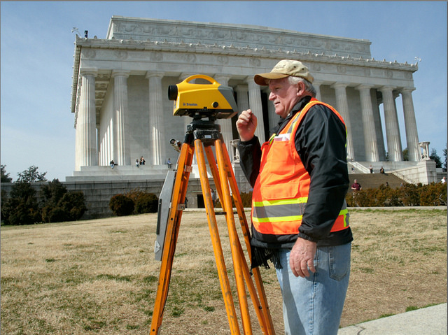
What Should Oil and Gas Companies Look For in a Registered Land Surveyor?

land surveyorIn the business world, standards and regulations exist for a good reason: by creating an agreed-upon set of standards for an entire industry, everyone operating within that industry knows what to expect when it comes to hiring contractors or doing business with other companies. This can help cut down on the amount of surprises a company experiences while working on a project. This post examines the standards and regulations that you should expect from a registered land surveyor.

Standards and Regulations for Land Surveying

The oil and gas industry is filled with different standards and regulations, all of which are aimed at helping companies do business quicker, safer and more efficiently. However, in order to get the best benefits out of these regulations, you have to take the time to understand what they really mean, and how they affect your business.

This is particularly true when it comes to selecting a registered land surveyor to work with. Knowing what standards and regulations land surveyors comply with, and what those standards and regulations really mean, can help you make sure you select the right professional registered land surveyor to work with, and that can make all the difference for your project.

Land surveying standards and regulations that you should be aware of include:

  • Safety regulations
  • Drug and alcohol regulations
  • Pipeline data standards
Safety Regulations

Safety regulations for contractors in the land surveying industry are offered by a number of third party organizations, including:

  • ISNetworld
  • PEC Safety
  • PICS

While each of these different organizations functions in their own unique way, they are all alike in that they offer services for verifying the safety knowledge and compliance of oil and gas surveying professionals. These third party programs often pull from a diverse set of industry safety standards and safety regulations set by state and federal governments.

It’s important that you take a little bit of time to get to know each of these organizations to find out how they’re alike and how they differ; this will help you know exactly what each of these certifications really signifies.

Drug and Alcohol Regulations

Keeping a standard that oversees your contractors’ drug and alcohol usage can play an important role in creating a successful project with no unpleasant surprises or major safety concerns. Fortunately, National Compliance Management Service (NCMS), another third party standards organization, provides drug and alcohol auditing services that are specifically designed to help contractors live up to the expectations of their clients.

These NCMS audits establish a program that helps a contract organization put the specific drug and alcohol requirements of their client organization into practice. This program can include things like written policies, established screening methods, randomized testing, and regularly scheduled annual testing. As a result, any client that establishes a drug and alcohol monitoring program for their contractor organizations through NCMS can always be sure that they have a full and accurate understanding of what steps are being taken to ensure compliance.

Pipeline Data Standards

Pipeline data standards can help give you a better idea of the final product that your registered land surveyor will provide you. Keeping these standards open and well established helps ensure that all companies that work in the oil and gas industry will be able to deliver data to one another without having to worry about custom software programs or vendor-specific data architectures that stand in the way of the free distribution and easy use of data.

The two main pipeline data standards for the oil and gas surveying industry are the Pipeline Open Data Standard (PODS) and the ArcGIS Pipeline Data Model (APDM). These two standards should not be considered competitors; they have some similarities, but function in slightly different ways. Getting to know both of these standards is important, as it will help you select the standard that best meets your needs, and then select a registered professional land surveyor that can work within the context of that standard.

Image Source : Elvert Barnes

How Using Tablets For Construction Vastly Streamlines the Process

professional land surveyorsIn today’s business environment, many different industries are starting to see the advantages of keeping employees connected to their work and each other with mobile devices. This is especially true in surveying. Allowing field crews to access documents and information from mobile devices allows them to be just as productive on site as they would be at an office. This means that projects can progress more quickly, without the need for long delays caused by employees being offline or needing to travel back and forth between a job site and an office.

Traditional surveying handhelds do not offer the variety of applications that are needed in modern surveying. Professional land surveyors, especially those working on oil and gas projects, have a lot more data to collect and process while on site. They also need to be able to review this information, answer emails, and perform any number of other tasks on the fly, which is something that is simply not possible with traditional handhelds.

Fortunately, there is a solution: professional land surveyors can utilize “rugged tablets” for construction, which are designed specifically for use in high-intensity industry settings like an oil and gas job site. These tablets, like the Trimble Yuma 2, are built from the ground up to be tough, effective, and easy to use while on a job site.

These tablets are designed with the importance of accurate GPS data squarely in mind. For example, the Trimble Yuma 2 offers 1-2 meter real time Enhanced GPS positional accuracy, allowing users to get extremely detailed and accurate positions while on the job site.

The GPS abilities of these tablets are also very convenient and easy to use, as they are built right into the tablet itself. Users don’t need to attach an external antenna in order to get an accurate reading; they have everything they need to do that right in their hands. However, these tablets often provide the flexibility to add an external GPS antenna when needed to achieve maximum accuracy.

Greater Strength and Durability

While consumer tablets have made a lot of advancements over the years, the fact remains that these tablets are simply not designed with durability or ruggedness in mind. As far as the tablet manufacturers are concerned, the most stress that will ever be placed on one of these tablets is being dropped from a few feet.

On the other hand, tablets used on oil and gas sites constantly have to deal with dust, water, extreme temperatures, high altitudes, vibrations and shock. A consumer tablet can’t deal with these factors, even if you do slap a hard protective case on them. Surveyors need tablets for construction that are durable by design, and that’s exactly that a rugged tablet is.

A Touchscreen That’s Easy To Use and Read

Most consumer tablets are designed to be used indoors, under optimal conditions. Try using one on a job site, and you’ll have to deal with a glare off the screen that makes it hard to read.

Rugged tablets like the Trimble Yuma 2 offer a screen with an outdoor readable display, as well as the flexibility to control the touch screen using fingers, a stylus, or capacitive gloves. This means that surveyors on oil and gas job sites will always be able to read and control the screens on their tablets, no matter what the conditions.

To learn more about how Landpoint uses tablets for construction and how these devices can help bring unique benefits to your project, download our oil and gas brochure.

Image Source : NEC Corporation of America

How Aerial Survey Drones are Going to Revolutionize the Oil and Gas Industry

land surveyingIt’s no secret that the oil and gas industry is changing: “easy oil” reserves are getting more and more difficult to find, and companies therefore need to find new and innovative ways to drive more efficient operations in order to remain profitable. Unmanned aerial vehicles (UAVs), also known as drones, are the latest technology that’s driving the oil and gas industry forward, giving companies new opportunities to increase their efficiency, effectiveness and profitability.

UAV technology is not exactly new, but it’s only been in recent years that the drones, the batteries they are powered by, and the photography equipment they use to conduct land surveys have become lightweight and affordable enough to be feasible for use in large-scale land surveying operations for the oil and gas industry. This means that we’re currently standing at a crossroads in the history of the industry: those companies that identify UAV technology as the great opportunity it is and prepare themselves to capitalize on it will be in the best position to succeed going forward, while those that don’t will risk falling behind.

While there are a variety of ways in which aerial survey drones can benefit the Oil and Gas industry, one area that will be particularly impacted is land surveying. UAVs can offer three main benefits over more traditional surveying methods:

  • The ability to complete land surveys quicker
  • The ability to create land surveys that have a much higher level of detail
  • The ability to complete land surveys without having to put surveyors in danger
Complete Land Surveys Quicker

One of the clear advantages that UAV surveying offers over traditional surveying methods is the speed at which the surveys can be completed. This is a key benefit, as land surveying is only one of the first steps of many involved with completing an oil and gas project. When the land surveying process can be completed quicker, the rest of the project can proceed as planned, and the company can reach its goals with no delays.

UAV surveying is quicker than traditional surveying because it does not require surveyors to travel over difficult terrain in order to get to the survey site. Instead, the drones are able to travel directly to the site in the air, and then allow surveyors to see the visuals they need, no matter where those surveyors are.

Provide a Higher Level of Detail

Today’s aerial survey drones use top-of-the-line photography technology to provide the high level of detail needed to create a quality land survey. While surveyors operating from the ground might miss out on important details, drones have the ability to look down on a site from above, getting a complete view of everything.

These drones can also change camera angles or move in closer to get a better view of something if necessary. As a result, using drones to help complete land surveys allows oil and gas companies to get a better view than they would otherwise, and therefore increases the chances that a project will be successful.

Keep Surveyors Off Of Dangerous Terrain

Finally, using unmanned aerial vehicles removes the need for surveyors to travel over difficult terrain in order to complete their work. This has a dual benefit of keeping surveyors safe and avoiding accidents that can lead to costly and time-consuming delays.

On the job site, keeping workers safe is always the highest priority. That’s why drone technology, which allows land surveyors to complete their work from a safe position, is such a promising technology for use in the oil and gas industry. Since it also provided quicker, more detailed surveys, UAV technology is a real no-brainer for the oil and gas industry.

To learn more about groundbreaking surveying technologies like aerial survey drones, download our oil and gas brochure.

Image Source: Michael MK Khor

Why Big Data is Critical to the Growth of the Oil and Gas Industry

land surveying technologiesBig data is changing many industries across the world, and oil and gas is no exception. Big data refers to data that is entering business systems at a much higher volume and velocity than ever before. This data is created by a constantly growing network of interconnected systems and devices, creating a new opportunity for businesses to capitalize on the insights around them.

However, while big data presents an opportunity for businesses, it also presents a challenge: organizations that continue to rely on old-fashioned ways of storing, securing and analyzing data will quickly find themselves overwhelmed by the amount of information coming into their business systems. In order to prepare themselves to capitalize on big data, oil and gas organizations need to make sure they have the right tools in place to handle the exponentially growing volume of data and that their company culture is optimally configured to pursue the benefits of big data.

When handled appropriately, big data can offer oil and gas companies three major benefits:

  • The ability to process highly detailed land surveys, like those created using GIS mapping
  • The ability to make exploration and production decisions quickly, and with a higher degree of confidence
  • The ability to build the best and most engaged workforce possible
Process Highly Detailed Land Surveys

When it comes to land surveying, the current state of the industry is clear: there is no more easy oil out there to be found. This means that companies that continue to rely on low-detail land surveying technologies—the kind of technology that may have worked just fine when oil reserves were greater—will soon find these technologies to be time-consuming, inefficient, and unprofitable.

Luckily, there are new land surveying technologies out there that can provide the level of detail needed to run a profitable oil and gas operation in the current energy environment. However, these new technologies, such as GIS mapping, are just as data-intensive as they are detail-intensive. Organizations will need to be ready to handle large volumes of data if they’re going to make the most of these new surveying technologies.

Make Exploration and Production Decisions Quickly and Confidently

Oil and gas companies today have to deal with two competing priorities when it comes to making exploration and production decisions. Making the wrong decision can cost a company time and resources, eating away at profit margins. At the same time, decisions have to made in a timely manner if the company is going to succeed and grow.

With big data, it’s possible for companies to balance both of these priorities. The level of data that’s available in the oil and gas industry today means that it’s no longer necessary to rely on guesswork and intuition. By processing big data and analyzing it to extract the useful business insights, a company can make the right move quickly, while also feeling confident about the decision they’ve made.

Hire the Best and Most Engaged Workforce

The benefits of big data don’t stop in the field; oil and gas organizations can use big data to maximize success in the office as well. By analyzing data patterns to identify skill gaps, adjust recruitment priorities, and make the best, most informed hiring decisions possible, human resources organizations can dramatically reduce the amount of costly bad hires they make.

In addition, once the hires have been made, HR can use big data to make sure that employees are feeling engaged in their work, while also identifying opportunities for greater engagement.

Image Source : supakitmod

Tips for Speeding up As-built Surveys

3D Laser ScanningFor construction projects, anything that gets in the way of the project progressing according to schedule is a roadblock that must be removed as quickly as possible. However, when it comes to as-built surveys, project managers may feel trapped: they need these surveys to make sure their project proceeds safely and accurately, but at the same time, these surveys frequently take weeks to turn around, which often gets in the way of established project schedules.

Since project managers need these as-built surveys to make sure their project are proceeding according to plan, most of them assume that there is nothing they can do other than wait patiently for the surveyors to complete their work. However, two technologies are showing that this no longer has to be the case. Using these technologies, project managers can get the as-built documentation they need, without having to wait too long for them.

Read on to learn more about these two new technologies, and how you can apply them in your own construction projects.

3D Laser Scanning

With 3D laser scanning, land surveyors no longer have to travel from point to point on a job site collecting the information they need to complete their as-built surveys. Instead, they are able to gather all of the information they might need using high-tech laser scanning, which in turn allows them to build accurate 3D models that can give them all the detail they need to complete their work. As a result, a process that once took weeks can now be completed in a matter of a few days.

3D laser scanning, also referred to as LiDAR data collection, works by bouncing laser beams off the area that needs to be surveyed. Then, the scanner records a point everywhere the laser hits a surface. After the laser has scanned the entire job site, the result is a massive “point cloud” made up of millions of survey grade points. These points can then be connected to form an extremely detailed representation of the environment at the job site. Finally, this representation will be transformed into a 3D model, which is then used to support the work of the land surveyor. All of this happens much faster than a traditional as-built survey, which should make project managers everywhere very happy.

Project Management Suite

Unfortunately, actually completing the as-built survey is often just one factor in the construction delays they can cause. Turning your land surveys around quickly is great, but if you can’t put those surveys into the hands of the right people as quickly as possible, then it won’t translate into quicker, more efficient projects.

That’s where a good project management suite comes into the equation. A project management suite can provide a central hub for the entire project, giving all stakeholders a single place to go to upload and download vital project documents as needed.

With this technology in place, a project manager never has to worry about when the land surveyor will get around to sending in the completed as-built documentation. Instead, they can feel confident that they have the most recent and accurate versions of all documents, and that they will instantly be informed when the as-built surveys are ready. Then, they will be able to download and start utilizing those as-built surveys immediately, even if they are on the job site using a mobile device.

To learn more about these new technologies from Landpoint, and how they can help you get your as-built documentation sooner, contact us today.

Image Source: NOAA’s National Ocean Service

How 3D Laser Scanning Services Can Support Multiple Stages of Development

3D laser scanning servicesMore and more businesses are starting to realize the potential benefits offered by 3D laser scanning services. However, many of them fail to recognize just how helpful 3D scanning can be throughout the lifespan of a project. 3D scanning is so inherently valuable because it can provide key visibility at all three main phases of the project: the pre-design phase, the design phase, and the construction phase. Gaining a greater understanding of what role a 3D laser scanning survey plays in each of these three phases is key to understanding just how much of a competitive advantage this technology can provide.

Pre-Design Phase

In the pre-design phase, getting an accurate picture of the terrain and existing structures that are on-site is vital. With this visibility to guide you, you can make better decisions about the best way to move forward with your project. You can also feel confident that your decisions are based on real insights, and not on guesswork or outdated aerial photography.

A 3D laser scanning survey at the pre-design phase is particularly helpful for things like oil and gas facility location surveys and terrain surveys. In both of these examples, 3D laser scanning is both the fastest and most accurate way to get a complete look at the area that is to be developed, providing the right level of understanding to get your project off to a good start. As a result, your project will be better positioned to proceed according to plan, with no delays and no budget overages.

Design Phase

Once you have gained an accurate understanding of the site that is going to be developed, the next logical step is to consider how the development will fit together with the terrain around it. Fortunately, 3D laser scanning can help with this as well, by supporting 3D modeling.

3D modeling gives you greater visibility into how your development will look, in relation to the terrain and any enduring structures around it. This will also help you create the optimum design and identify any potential issues before they get a chance to wreak havoc on your project once the construction process actually begins.

A good example of a design processes where laser scanning surveying can be helpful is with field map preparation for oil and gas facilities. By creating 3D models before you begin construction, you can be more prepared and get started on construction sooner.

Construction Phase

Finally, once it’s time to actually begin the construction process, laser scanning surveying is there to help once again. By allowing you to quickly create as-built surveys, 3D laser scanning gives you greater visibility into how the project is improving the site around it.

Being able to turn these as-built surveys around as quickly as possible is a tremendous benefit for your project, as it insures that the construction process won’t grind to a halt while you are stuck waiting for the surveys to come in. Since 3D laser scanning represents one of the quickest methods of creating as-built surveys, it can be a tremendous value-add to the construction process.

In addition, laser scanning surveying can also help you to identify potentially unsafe environments. Safety should be a top concern for any construction project, and scanning can help project managers be more aware of potential safety issues before they can get in the way of a safe, orderly construction project.

To learn more about how Landpoint 3D laser scanning services can help your business gain visibility and drive value throughout the different phases of your project, contact us today.

Image Source : survcentex

Construction Site Safety: Surveying in Unsafe Environments

land surveying company safetyWorker safety should be the number one focus for all construction project managers. However, since construction work consistently rates among the most dangerous forms of employment in countries across the globe, it is clear that there’s still a lot more that needs to be done to address safety issues on the job site.

How a Land Surveying Company Addresses Construction Site Safety

Part of preparing for construction safety means getting an accurate understanding of what hazards are expected, so you can prepare for and mitigate them as much as possible. From a land surveying perspective, that means knowing where unstable work surfaces might be putting your workers at risk. Using traditional technology, acquiring a survey on a potentially unsafe terrain would require the surveyor to traverse through the rugged landscape in order to gather information. In addition to being extremely time consuming, this process also puts the surveyors themselves at risk.

In many cases, construction site safety can take a back seat when project managers are concerned that the construction project may not be progressing according to schedule. The process for issuing surveys is time consuming, and can lead to forced down time on the job site, which is something that every project manager wants to avoid.

As a result, many project managers are content to proceed with their projects without waiting for the land surveys to be returned. While this may seem like a time-saving measure, it’s actually quite shortsighted, as injuries on the job site caused by lack of terrain visibility can be just as much of a time waster as waiting for land surveys.

Project managers need a solution that will allow them to balance the seemingly contradictory goals of ensuring project safety and avoiding unnecessary delays. With 3D laser scanning technology, there is no reason that project managers can’t achieve both of these important goals.

3D Laser Scanning Helps Balance Speed and Safety

3D laser scanning contributes to increased safety on the job site, as it removes the need for land surveyors to place themselves in harm’s way to complete their surveys. Since the surveyors no longer have to risk going from place to place to manually collect the information, 3D laser scanning can also help avoid project delays, as land surveyors will now be able to turn around their finished work much faster

By making quick and safe land surveys an integrated part of the organization’s construction process, 3D laser scanning can help project managers balance the competing goals of project speed and project safety in a manner that works best for everyone involved.

Aerial Mapping

3D laser scanning technology can also be supported through the use of aerial mapping. Using either fixed-wing aircraft, helicopters, or unmanned aerial vehicles, land surveyors can get the visibility they need to complete terrain maps without having to set foot on dangerous terrain themselves.

When used together with 3D laser scanning, aerial mapping allows construction project managers to get the visibility they need to understand and plan for risk in the construction project, without having to wait for the land surveys to be completed. Together, these technologies are making it so that project managers no longer have to choose between speed and safety.

To learn more about aerial mapping and 3D laser scanning services from Landpoint, and how they can help improve construction site safety, contact us today.

Image Source : Michael Gil

How New Technology Equals Better Engineering Support

professional land surveyorToday’s civil and construction engineers need access to the right information at the right time in order to support fast, accurate and efficient work. In order to get the visibility they need, engineers depend on engineering support services like land surveying.

In the past, land surveying was a time-consuming process that could seriously delay an engineer’s work. However, there are new technologies in use today that enable engineers to get the visibility and information they need quickly, by significantly speeding up the land surveying process.

Read on to learn more about some of these surveying technologies and to find out how you can put them to work for your organization.

Laser Scanner Surveying

High definition scanning is an innovative technology that allows land surveyors to create detailed representations of a terrain and structures without having to individually visit each point of interest on the job site. Laser scanner surveying helps engineers do their jobs better by providing a more detailed deliverable, and doing it much quicker than a traditional land survey. With terrestrial laser scanning, a process that once took months can now be completed in a matter of a few days, making sure that engineers never have to wait to get the information they need.

High definition scanning, also referred to as LiDAR, works by bouncing laser beams off the terrain and recording a point everywhere the laser hits a surface. Once the area has been scanned, the result is a “point cloud” made up of millions of different points. These millions of points represent a level of detail that engineers could never dream of seeing in the past.

3D Modeling

Once a professional land surveyor has collected data using high definition scanning, they can use those data points to create a survey-grade 3D model of the area. Using this extremely detailed model, engineers are able to get an up-close look at the terrain, without having to waste time by traveling the location themselves.

3D modeling from the point cloud gives engineers a more detailed and accurate look at the terrain and structures they’re going to be working on, and does so in a fraction of the time required to complete a traditional land survey. Also, these models can be used to help inform the survey documents that will drive the entire project forward, ensuring that engineers and all other key stakeholders will always have the information they need right at their fingertips. It’s really no wonder that so many engineers are excited about the possibilities of using 3D modeling as an engineering support tool.

Aerial Mapping

Finally, today’s engineers no longer have to be limited to terrain visibility that is captured from ground level. Using either fixed-wing aircraft, helicopters, or UAV’s, a professional land surveyor has the ability to conduct aerial mapping. This technique can work using a variety of different scanning methods, including the high definition laser scanning described above.

Unlike aerial photography, which merely provides a visual of what the terrain looks like from above, aerial mapping can give engineers a detailed 3D rendering of the terrain, displaying every crack and hole in astonishing detail. Since aircraft have a far greater range of visibility when operating from above than land surveyors do when operating from ground level, aerial mapping can allow quick and efficient scanning of a large area, making it the perfect technology to use on very large engineering projects.

To learn more about new technologies that help engineers work quicker and more effectively,contact Landpoint today.

Image Source : Laura

Landpoint Named As One of the Fastest Growing Land Surveying Companies

inc5000smBossier City, LA – For the third year in a row, Landpoint has been named to the Inc. 5000 list of America’s fastest growing privately-held companies. At number 769 and with more than 590% growth, the company has outpaced other land surveying companies across the nation.

Landpoint is one of Louisiana’s 49 privately held companies to make the list, coming in at number 9 in the state this year. The company has also been listed as the number 5 top engineering firm in the nation. By adding over 150 jobs in three years, Landpoint has demonstrated consistent organic growth.

“We are very excited to be included for a third year on Inc’s list of the fastest growing American companies,” said Chad Souter, Vice President of Landpoint. “While we are thrilled to have cracked the top 1,000 companies, we continue to see substantial growth opportunities for our company in the coming years with what we have built,” Souter added. “Our employees take pride in their ability to provide an exceptional service, and they are incredibly deserving of this recognition.”

The Inc. 5000 ranks businesses in a variety of sectors – from engineering and health care, to communications and finance. In these rankings, company revenue and growth are just two of the considerations.

In addition to being listed in the Inc. 5000, Landpoint was also ranked the number three fastest growing engineering services firm by ZweigWhite and was awarded Deal of The Year by the Association for Corporate Growth upon completion of two acquisitions in 2013 and the creation of a platform for future acquisitions.

About Landpoint

Landpoint is an award winning firm that performs land surveying and engineering services for oil and gas, transportation, commercial land development, and alternative energy sectors. The company also provides environmental consulting, GIS mapping and laser scanning. The value added services and solutions offered by Landpoint are unmatched by other land surveying companies, allowing customers to realize significant time and cost savings.

To learn more about Landpoint’s services in around the country, visit https://www.landpoint.net.