A Look at Solar Energy Land Surveying in 2018
When it comes to solar energy, efficiency and cost-cutting are extraordinarily important. In a world that is increasingly looking toward clean energy, it becomes even more necessary to reduce the costs associated with placing solar panels, in addition to optimizing the panels that are placed. Many of these things can be achieved through better land surveying processes. In 2018, it’s likely that new technologies will be used to further refine the processes of land surveying related to solar energy. In this post, we will explore how solar energy land surveying is likely to change in 2018.
Solar land surveying will leverage technology for faster and safer results
In the past, solar land surveying often had to be completed manually. Either individuals had to conduct surveys on foot (costly and dangerous) or teams had to be sent out to conduct aerial scans (costly). Both of these methods were limited in some way, with manual surveyors being unable to cross treacherous terrain, and aerial scanning often being both expensive and dangerous.
Today, there’s an answer: UAVs can be used to conduct aerial scans without manned teams and without the associated risks. UAVs can conduct solar land surveying quickly, exploring the entirety of the area without any personal risk to the operator. As UAVs can fly lower to the ground than manned vehicles, they can provide higher resolution scans than would otherwise be available.
Not only does this mean that organizations can get their survey information faster, but also that it is more accurate. More accurate results decrease the chances that the solar organization could run into issues later on.
Companies will embark on more thorough scanning for greater profit
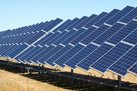
As you probably know, solar panel output is significantly impacted by panel positioning. Not only does the arc of the sun need to be considered, but solar panels need to be placed in a way that they won’t interfere with each other, while also taking up minimal amount of space. It’s often unavoidable that some panels will be disrupted throughout the day; ideally, the setup needs to be constructed to take advantage of the most sun possible. This can involve extraordinarily complex calculations.
Moving forward, simulation and imaging programs will be used to analyze the optimal paths for solar panels, so they can use the least amount of land while yielding the best results throughout the day and the year. A tremendous amount of data will need to be analyzed to determine these optimal solutions, which is becoming possible through machine learning and advanced data analytics.


This process will begin with solar surveying, which will give solar companies large amounts of data regarding the terrain. Modern techniques, such as laser scanning, can create complete digital models of an area so a business can place their solar panels with the best possible positioning. This gets rid of much of the trial and error that would otherwise be required.
An increase of accuracy regarding how solar panels are placed can ultimately lead to some substantial improvements in the efficiency and operation of these solar panels. Accurate 3D scans reduce the amount of time it takes to plan and map an area, while even minute changes in placement could yield significant energy results over time.
Further, by fine-tuning and optimizing placement and orientation, companies will be able to make the best use of their land, avoiding excessive and unnecessary land costs.
Looking Forward
Solar energy land surveying in 2018 is going to become a fine-tuned, data-driven process. With the help of UAV/drone technology and better data analytics, solar energy companies will be able to quickly identify the correct placement of their solar panels and install them with confidence. Ultimately, this will produce more energy at a far lower cost to the business, reducing overhead and improving savings related to solar energy.