Is it Time to Switch to a New Pipeline Surveyor?

Far too many project leaders have come to look at the land surveying process as a necessary evil: something they have to rush through as quickly as possible so that they can get started on the actual construction process. While rapid turnaround is definitely a good thing, focusing on it exclusively can cause you to miss out on the real value that an effective land surveying partner can offer your project.

If your pipeline surveyor is just going through the motions, then it may be time for you to replace them with a company that can get you better results. Read on to learn a few factors you should take into consideration when you’re thinking of replacing your pipeline surveyor.

Does your surveyor use the latest technology?

Like every other industry out there, pipeline surveying is in a state of disruption and reinvention, driven primarily by groundbreaking new technologies. In order to overcome the modern challenges facing them—including increasingly crowded pipeline rights of way—project leaders need to look to modern solutions. Simply put, the traditional surveying methods that have been in use for so long now are no longer enough to get the job done.

Find out if your pipeline surveyor is taking full advantage of things like drones, cloud data storage, laser scanning, and 3D modeling. When used properly, these new technologies can drive tremendous value throughout your project lifecycle.

Can your surveyor turn data around quickly?

At the top of this post, we stressed that speed of turnaround is not the only factor you should use to judge a surveyor. That being said, if a company is doing other things right, a faster turnaround may occur naturally.

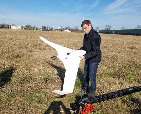
For instance, a company taking advantage of drone technology to capture survey data will be able to cover long distances quickly. If the surveyor has the infrastructure in place in order to easily process raw survey data, then the survey results can often be ready for the customer in less than 24 hours—much faster than a company could turn data around using traditional surveying methods. When you use drones, you don’t have to sacrifice survey quality to get rapid turnaround.

Does your surveyor provide detailed, accurate results?

The data that a pipeline surveyor captures at the beginning of a project will be used to make decisions throughout the project lifecycle. That’s why it’s important that the surveyor capture as much relevant data as possible, to give project stakeholders the best chance to make informed decisions. When project leaders make decisions based on accurate assumptions, it can lead to fewer costly, time-consuming mistakes, and contribute to a more efficient, profitable project overall.

Once again, applying new technologies such as drones can help a surveyor achieve this goal. With the help of increasingly affordable high-definition cameras and laser scanners, drones can capture the high volumes of data that modern projects demand.

Is your pipeline surveyor able to ramp up for large projects quickly?

When it comes to selecting a surveying partner for your pipeline, size does matter. That’s because pipeline projects typically span hundreds of miles, a fact that places a significant burden on the surveyor.

Not only do they have to capture large volumes of data in a relatively short period of time, but they also have to be able to transfer, process and store that data. It’s important to work with a surveyor that understands this challenge and has experience overcoming it. If your surveyor is mainly accustomed to smaller projects, then they may not be the best option to work on your pipeline.

Final Thoughts

If your surveyor isn’t prepared to support you, then it might be helpful to consider another option. Contact Landpoint today to learn more about how we can help you.


Landpoint-CTA-New-(1)

Solar Land Surveying: Why it Pays to Get 3D Models

With interest in renewable energy technologies at an all-time high, it’s no surprise to see an explosion of new companies getting involved with solar energy projects. If you represent one of those new companies, then you may be unsure about the best way to get started with your project.

Like any other major construction project, a solar energy installation requires an initial land survey to gather the data needed to create an informed project plan. Taking advantage of the latest surveying technologies can help ensure that you get the kind of high-quality survey results you need to get the best ROI from your solar farm. Read on to learn more about solar land surveying and why 3D models based on laser scanning data can be so beneficial.

Using Drones for Solar Land Surveying

Unmanned aerial vehicles (UAVs), commonly referred to as drones, are an exciting new technology that’s redefining what’s possible when it comes to solar land surveying. Aerial data collection can cover large areas more quickly than traditional surveying methods, ensuring a rapid turnaround of survey results.

Today’s drones can be equipped with increasingly affordable data capturing devices, such as 3D laser scanners, which use LiDAR technology. LiDAR works by emitting millions of laser points from the scanner toward the land that is being surveyed. After the laser points bounce off the terrain being scanned, the scanner will track their flight path on the way back. The results of all the laser point flight paths will be aggregated into a single point cloud, which in turn can be used to show an extremely accurate representation of the land being surveyed. This data can then be used to create precise 3D models of the land in question.

Creating 3D Topographical Models Based on Laser Scans

Success with solar energy projects depends heavily on preparing the site and positioning the solar collectors in a manner that allows those collectors to be as efficient as possible when collecting solar rays. Solar project leaders must consider a variety of different factors when planning their installation, from the elevation of the land they build on, to the angles at which the solar collectors are positioned.

Having a 3D model of an area based on extremely accurate laser scans can certainly help these project leaders make more informed decisions. Instead of having to make educated guesses about what’s best for their project, they can use their models to perform detailed simulations and see for themselves what the best plan of action would be moving forward. This helps them save time and money by knowing what they should do in advance, rather than having to rely on trial and error.

Use Model Data to Automate Solar Site Prep

Finally, using 3D models for solar energy projects can continue to pay dividends even after the actual project work begins. Today’s site grading machines have the ability to feed topographical data directly to the machine itself. This allows the grading machine to conduct automated site prep work based on the exact conditions in will face in the field. This removes the potential for error that always exists with any human machine operator and ensures that the grading process will happen quickly, with no need for rework.

By conducting site prep work based on detailed, accurate models, a project leader can feel confident that their new job site will be graded in a manner that will support the best solar project results possible.

Need Solar Land Surveying?

If you’re still feeling unsure about how to get started with your solar energy project, the experts at Landpoint are here to help. Contact us today to learn more.
CTA-Landpoint-Wind

Why Land Survey Companies Are Moving to the Cloud

The exponential growth of data is disrupting many different industries, and land surveying is no exception. Land survey companies are finding themselves handling more data than ever before.

On the one hand, this fact allows them to provide their clients with more complete, accurate survey results, which in turn can help the clients make more informed decisions regarding their projects. On the other hand, handling this influx of new data using traditional data management technologies may not always be possible, and companies that aren’t properly prepared may find themselves completely overwhelmed. Fortunately, new developments in cloud computing are empowering land survey companies to adjust to this new reality and use data to its fullest potential and provide project managers with a simpler, more cost-effective alternative.

Read on for a closer look at how moving to the cloud is redefining what companies can do with land survey data.

Flexible, Scalable Data Storage

Today’s land survey companies have to store survey results for thousands of different projects, with some of that data stretching back hundreds of years. As time goes on, each new project the company takes on will likely be more data intensive than the last one, especially with the amount of data that new technologies like drones generate.

Storing all of this data in a traditional on-premises data center would be impractical. Every time the company outgrows their existing data storage capacity, they would have to manually add new capacity to their data center, causing great expense and inconvenience.

By adopting a cloud-based infrastructure, the land surveying company can simply scale up its storage capacity whenever they need to, and the CSP will handle it behind the scenes. The result is that the land survey company will never have to run out of capacity. In addition, they’ll also free themselves up to spend less time worrying about their storage infrastructure, and more time thinking about the work that actually matters for their business.

Make Data Available Across Geographic Locations

Today’s construction project work is more distributed than ever before. Keeping everybody on the same page—whether they’re in the main office or out on the job site—is a key factor in ensuring the project goes according to plan.

As survey document files become more data intensive, and thus larger, sending them from person to person becomes time consuming and inefficient. With cloud data storage, users can simply pull the latest copy of a document from a centralized location. The cloud server can be accessed using any device. This includes mobile devices, so any worker in the field will have the same ability to access the documents they need as their counterparts back at the office.

Easily Share Data With Customers

At the end of the day, the land survey company’s whole reason for collecting data is to make it available for customers to use, and cloud data storage platforms like Landpoint’s True Atlas helps in this regard as well. Land survey companies that take advantage of cloud data storage can provide an added level of value for their customers.

Instead of simply dumping the processed data into their customer’s lap and then leaving them to figure out how to store, manage and apply it, a cloud-enabled land surveyor can store the data themselves, giving their customers with one less thing to worry about. In addition, the cloud can provide security and access control, ensuring that the right people—and only the right people—have access to the data when and where they need it.

Final Thoughts

Cloud technology is making it easier than ever for land survey companies to manage data. In an era that’s increasingly defined by data growth, shouldn’t you work with a land surveying partner that’s equipped to handle that growth with the latest technology? Contact Landpoint today to learn more about our innovative approach to cloud data management.

Landpoint-CTA-New2

A Brief History of Drone Data Collection

With drone technology becoming increasingly affordable, it’s no surprise to see more people using it, both for commercial and recreational purposes. We are certainly living in exciting times, as the possibilities surrounding drone use seem practically endless. However, while it may seem like drones popped into the popular consciousness within the last five or 10 years, the current popularity of drones is built on a foundation that stretches back decades. In many ways, it’s important to understand where drone data collection comes from in order to use them to their fullest potential today.

Growing from Military Roots

The primary push behind aerial data collection originally came from the military sector, before expanding into the civilian sector. The United States military, in particular, played a leading role in funding and prioritizing drone research, and drones have been used in US military conflicts for much longer than some people might realize. Depending on how one defines the word “drone,” their use may stretch back as far as the Civil War, when both Union and Confederate armies applied unmanned hot air balloons to conduct aerial surveillance.

In 1935, the British military unveiled the DH.82 Queen Bee, a radio-controlled pilotless biplane that was used as a target drone for training anti-aircraft gunners. The Queen Bee was among the earliest examples of what we would today consider a drone. In fact, the Queen Bee is most likely the reason we call pilotless aircraft “drones.” The term originally referred to a type of worker bee, and most sources agree it was applied to aircraft as an homage to the Queen Bee.

The Rise of The Drone Hobbyist

Developing in parallel to military drone technology was a thriving base of model aviation enthusiasts. The earliest hobbyists were active for years before the creation of the FAA, during which time they operated in a legal gray area. To help fill the gap, the Academy of Model Aeronautics (AMA) was founded and began offering community-based training programs for drone pilots.

Although the AMA was originally founded explicitly to promote recreational use of drones, their actions in those early days were highly influential when the FAA eventually created drone regulations. In fact, the first federal guidelines regulating drone use were based on the AMA’s training programs. The AMA and the FAA continue to work together today to ensure the safe use of drones.

From Hobby to Serious Business

To understand the recent rise in commercial UAV usage, one must stop to consider the fact that commercial drone flights were still officially illegal according to federal guidelines as recently as the mid-2000s. Since then, a lot has changed, as federal regulators have attempted to balance the need for safe drone operations with the business world’s insatiable demand for drone data collection and all the commercial possibilities it presents. In the end, the FAA simply couldn’t continue to outlaw drones forever.

The next decade was marked by tentative steps toward loosening drone regulations, with some drone operators testing the boundaries along the way. At one point, businesses wishing to used drones had to get a Certificate of Authorization (COA), a demanding process that required the business to be sponsored by a public agency such as a university. The upshot was that larger companies had no problem getting approval, while smaller ones continued to be shut out.

Today, drone regulations continue to develop, but it’s now easier than ever to get started. Companies wishing to fly drones commercially still have to apply for permission from the FAA, but the process is now much simpler. Because of this, businesses of all sizes are now getting involved with drones.

Learn More About Drone Data Collection

While drone regulations have softened somewhat, it still helps to work with a partner that can help you navigate the process. Contact Landpoint today to get started.

landpint-UAV-CTA

3D Laser Scanning Services and Virtual Construction

Today’s construction project managers have to deal with challenges that their predecessors could never have imagined. Whether it’s building new infrastructure projects to support a growing population or replacing aging infrastructure that no longer functions as required, project managers frequently find themselves having to address multiple levels of complexity, while simultaneously ensuring speed and efficiency.

Since they’re facing new challenges, it would not make sense for project managers to continue relying on the modeling tools they commonly used in the past. Tape measures, levels, and other simple tools may have served them well before now, but they’re simply not up to the challenges facing modern construction projects. Groundbreaking new technologies such as 3D laser scanning and building information modeling (BIM) are helping engineers and project managers take a new approach to addressing the new challenges facing them.

Modern trends in BIM

BIM is not a new concept, but some recent developments are making it possible for industry leaders to start applying BIM in new, innovative ways. One example of such a trend is the growing importance of mobility in BIM. Now, with growing numbers of companies able to provide mobile access to their stakeholders wherever they might by in the world, it’s easier than ever before to get BIM models to the people who need them to do their jobs well, right when they need them.

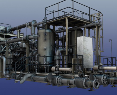
Another trend that’s opening new doors in BIM is the growing affordability of 3D laser scanning. It is now easier than ever for companies to capture extremely detailed and accurate laser scans of a site or building, and then feed that data into their 3D BIM models. This ensures that those models will be as accurate as possible.

Working with a complete 3D laser scanning services provider helps increase efficiency

One result of the growing availability of 3D laser scanning is that a lot of new scanning providers are making their way into the marketplace. These 3D laser scanning services providers offer their customers varying levels of experience and expertise, so it’s very important that customers take the time to properly evaluate the decision and make the right choice.

Ideally, you would want to work with a provider that offers end-to-end services, from the initial scanning all the way through to delivering the final models. Working with the same company for all these services will help streamline the process and cut down on duplication of efforts. This means that your finished models will be ready for you to use sooner and that you may end up paying significantly less than you would if you sourced services from multiple vendors.

Provide complete, accurate information across the entire project

Today’s laser scanners can take up to 1 million measurements per second. Clearly, we’re talking about a level of detail and accuracy that previous generations of construction professionals would never have thought possible. Feeding these scans into BIM models and pairing them with the results of photogrammetry conducted by drone is a great way to help stakeholders across the entire project make better, more informed decisions. By viewing an area exactly how it currently exists, and then modeling proposed changes before they’re made, construction project managers can take a lot of guesswork out of the equation.

In addition, BIM models based on laser scanning data allow office workers to make sure their project documentation is exactly right before they send it off to the field for use. Getting these things right in advance is a great way to cut down on expensive and time-consuming rework.

Oil-and-Gas-eBook-CTA

Why Land Survey Companies Are Focusing on Automation

With increasing complexity and a customer base that is growing all the time, oil and gas companies are always on the lookout for new opportunities to increase efficiency and improve results across the project lifecycle. Land survey companies that work closely with oil and gas companies to enable their success have taken up this charge, exploring a variety of new technologies to help drive automation. By automating key project tasks, land survey companies can help their oil and gas companies enjoy a number of key benefits, and ultimately be successful in a changing industry landscape.

Read on for a closer look at how land survey companies are using automation, and how this new trend might benefit you.

Faster turnaround times and lower costs with GIS

For many project managers in the oil and gas space, the land surveying process has long been a necessary evil. Although a good land survey can drive value throughout the project lifecycle, there will always be people who look at it as one more hurdle they have to clear before they can start on the actual project work.

Luckily, with modern technology such as GIS mapping, these project managers can take advantage of automation that allows them to get quick and cost-effect surveys without having to sacrifice accuracy. By removing manual data capture and processing from the equation, today’s land survey companies are providing their customers with a more efficient approach to getting the survey data they need.

More data to be shared across project stakeholder teams

Across industries, the advent of big data is helping key stakeholders make better, more informed decisions, and the oil and gas industry is certainly no exception. Land survey companies can use drones to help their customers take this data-driven approach.

These unmanned aerial vehicles can cover more terrain than traditional land surveying teams, including difficult-to-reach areas. This ensures that oil and gas companies will have plenty of relevant survey data to share with their engineers, planners and construction managers. As a result, none of these stakeholders will ever find themselves in the dark; instead, they can feel confident they have the insights they need to make the right decision.

Data can be fed directly into machine control

Just as data is helping humans do their jobs better, it can also help improve the way construction machines such as graders and pavers operate. By feeding data directly to these machines, construction project managers can feel certain that the machines will operate exactly the way they should operate, based on the actual conditions around them.

No matter how experienced human machine operators are, they are still human, so there will always be the possibility for them to make an expensive and time-consuming error. Automating this aspect of the project can help ensure precision, and provide one less thing for the project manager to worry about.

Monitoring site changes to help with planning and construction

Gathering land survey data manually is expensive and time-consuming enough the first time around; as a result, very few companies would bother with performing this process more than is absolutely necessary.

On the other hand, gathering data with drones is such a quick, streamlined process that there’s nothing to stop a company from performing multiple surveys. This allows them to keep up with any changes that might be occurring at the site over time so that they can properly account for those changes when creating their project plan.

Final thoughts

For oil and gas companies, the challenge is clear: companies that make the most of automation can gain a competitive advantage, while those that don’t will fall behind. Shouldn’t you work with a land survey company that shares your dedication to pursuing automation? Contact Landpoint

CTA-Landpoint-UAV

Drone Surveying: How Surveyors Overcome the Data Deluge

In the drone surveying industry, like in many other industries, data is becoming more important than ever. As survey results become more accurate and detailed, UAV survey companies will have to handle larger amounts of data. Those companies that are able to keep up with the data deluge will be able to provide their clients with unprecedented levels of business value, delivered without delay. At the same time, companies that aren’t properly prepared for exponential data growth will find themselves overwhelmed, and the surveys they collect will be of little value to their clients.

As a result, project managers that need to hire a drone surveying provider should stop thinking about potential providers as drone companies, and start thinking about them as data companies that happen to use drones. This post will explore what that shift in perspective entails.

Transfer and process data quickly

Capturing data during the initial UAV survey is certainly important, as getting the survey right is integral to eventually getting the project right. However, once the data has been captured, speed becomes the new priority.

If a surveying provider can transfer data from the field with no latency—a real challenge in the age of massive data growth—and automate key aspects of the initial processing, then they can provide their clients with a useable product in less than 24 hours. This ensures that the land surveying process won’t form a bottleneck that prevents the project from being completed on time and under budget.

Make data easy to store and access

Even after the data has gone through initial processing, surveying providers can offer their customers greater business value by helping them store that data. Many surveyors provide cloud storage options for their customers. As a result, those customers can feel confident they’ll always have the storage capacity they need, without having to build the storage infrastructure themselves.

In addition, a cloud storage platform can be used to ensure universal access to the stakeholders who need it, from any place and on any device. Ideally, the surveyor will allow users to access the data they need in a non-proprietary web interface.

Make it easy to find key insights hidden in data

One of the greatest challenges any organization can face when it comes to data is separating the data that’s pertinent to a particular project from the data that isn’t. As the amount of data entering systems continues to skyrocket, this will only continue to become more difficult.

Surveying providers can help their customers tackle this issue by creating advanced algorithms that help automate this process. Instead of requiring users to manually comb through mountains of data looking for the bits that interest them—an extremely time-consuming and expensive process—these algorithms do most of the heavy lifting, leaving the clients with only the data they need.

Create the ideal infrastructure for managing data

One of the reasons it’s so important for surveyors to provide data services to their customers is that it’s simply not practical for a customer to build a hardware infrastructure to manage that data themselves. The rate of data growth is so rapid that it increasingly makes sense for a few service providers to manage data on behalf of their customers, taking advantage of economies of scale.

Surveying providers are able to provide top-of-the-line data management infrastructures, based on the latest hardware, because managing their customers’ data is an integral part of their business. This allows them to develop expertise and efficiencies that customers would never be able to develop on their own while keeping up with the latest changes in land surveying.

Final thoughts

In an era increasingly defined by data, it’s no longer enough for a surveyor to simply capture data for their customers and then leave them to their own devices. To learn more about how a data-savvy drone surveying provider can create important benefits for your project, contact us at Landpoint today.

CTA-Landpoint-UAV

How Pipeline Survey Companies Are Using Drones to Improve Safety

For pipeline survey companies, keeping up with the latest technologies is necessary to provide clients with the quick, accurate survey results they need to succeed in a changing construction landscape. In addition, new technologies such as drone surveying can also play an important role in improving safety on the job site. This post will take a closer look at how groundbreaking pipeline survey companies are already using drone surveying technology to improve safety for pipeline surveyors, construction workers, and people living near the right of way.

Conduct planning and data collection without putting surveyors on the ground

First and foremost, drone surveying provides a safer experience than traditional surveying methods because it allows surveyors to cover large amounts of terrain without having to venture into that terrain themselves. This is noteworthy because the land itself can be a major source of threats for pipeline surveyors.

When a proposed pipeline route crosses difficult terrain, goes near a dangerous water crossing, or cuts through wild animal habitats, there are risks involved with having workers conduct data collection in those areas. With drone surveying, workers can collect all the data they need about these potential problem areas without having to set foot in them. By avoiding these threats altogether, surveyors can ensure a data collection process that is uninterrupted by time-consuming and dangerous accidents.

Construction monitoring

After the project itself is underway, drone surveying can continue to play a pivotal role in ensuring the safety of workers by making it easier to conduct construction monitoring.

Surveying companies may wish to conduct construction monitoring to gather project data to be used in as-built surveys and other forms of project documentation. What’s significant about using drone surveying to complete this monitoring is that drones can work around the construction workers as they perform their tasks. Not only does this save time by removing the need for project shutdowns, but it also helps remove risk, as it allows both the construction workers and the surveyors to complete their respective tasks without getting in each other’s way.

Post-construction documentation and analysis

Once the project has been completed, there are still a variety of opportunities to use drone surveying to increase safety.  For instance, drones can be used to survey finished projects to verify that the project has been completed as planned and that there are no potential safety issues.

Drones can complete this kind of surveying faster and with a higher degree of detail than could be achieved with traditional surveying methods. Simply put, this means that drones are more likely to find safety issues if they do exist, and to find them quickly so that they can be addressed without delaying the opening of the pipeline.

Routine maintenance and inspection

Finally, drone surveying can be used to help increase safety even after the pipeline is up and running. Pipeline leaks and other malfunctions can present a serious source of risk for people living near the pipeline. At the same time, manually monitoring for issues can be time consuming and expensive, and presents its own risks for the people assigned to do the monitoring.

With drone surveying, companies can monitor pipelines easily and cost-effectively. Drone surveying can also help companies be proactive about performing maintenance. Not only does catching potential issues early make maintenance easier and less expensive, but it also helps companies avoid serious leaks that could pose safety threats to the communities living around the pipeline right of way.

Safety is just one of the benefits of using drones for pipeline surveying. To learn more, contact the experts at Landpoint today.

Landpoint-CTA-New-(1)