Land Surveying Firm Landpoint Named on Zweig Group’s 2015 Hot List

2015 Hot Firm WinnerLandpoint announces its fourth consecutive inclusion on the 2015 Zweig Group Hot Firm List. Placing at #4, the company continues to rank as one of the top 100 fastest growing firms in the architecture, engineering, planning, and environmental consulting industry throughout the United States and Canada.

“We are extremely honored to be on the list with some of the most highly recognized companies in the industry” said Chad Souter, Vice President at Landpoint. “We work hard to provide the most innovative services on the market. It’s very exciting to see the growth within the company that has taken place because of our continued ability to provide more efficient and higher quality services” Souter continued.

Headquartered in Bossier City, Louisiana, Landpoint is a land surveying firm with over 225 professionals across the nation. The company has recently been commended for its growth by leveraging advanced technologies that other land surveying firms are not able to manage.

The Zweig Group Hot Firm List examines more than 100,000 firms in the United States to determine the fastest growing A/E/P and environmental consulting firms that have outperformed the economy and their competitors to become leaders in their chosen fields.

“You have to be doing something right or you wouldn’t make these lists. When you consider that there are 100,000-plus design/planning/engineering/environmental consulting firms out there, being at the top of the growth stats is a real accomplishment, and it says that the marketplace is responding to your offerings, said Mark Zweig, Zweig Group founder, regarding last year’s winners.

This is not the first time that Landpoint was recognized as one of the top land surveying companies. n fact, this award joins the many other accolades Landpoint has recently acquired. In October 2014, Landpoint was honored as the Southwest’s Oil and Gas Engineering Company of the Year. Landpoint has also ranked on the Inc. 5000 list twice in the past five years as well as Inc.’s Build 100 list.

About Landpoint

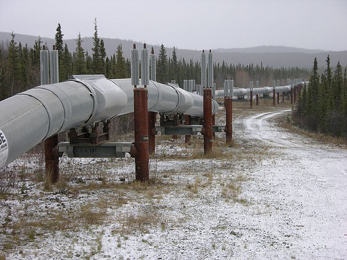
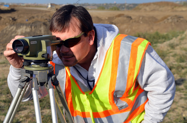
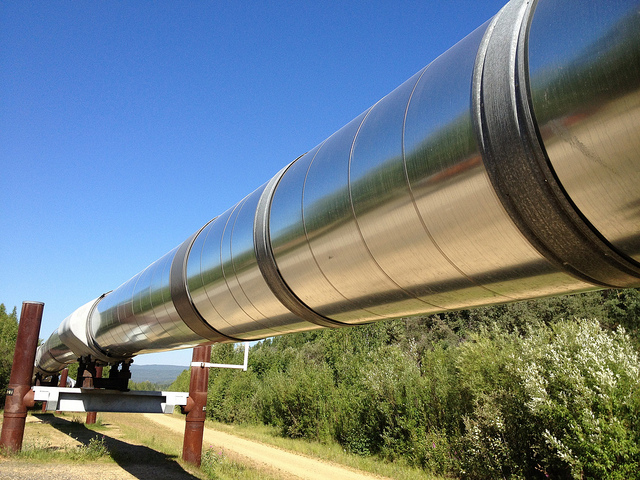
Landpoint is an award winning land surveying firm that offers variety of surveying and engineering services for oil and gas, transportation, commercial land development, and residential real estate companies. The company also provides consulting, GIS mapping, UAV operations (drones), and laser scanning. The value added services and solutions offered by Landpoint are unmatched in the industry, allowing customers to realize significant time and cost savings.

To learn more about Landpoint’s services around the country, visit www.landpoint.net.

Why Distance is No Longer a Challenge For Pipeline Surveys

pipeline development, pipeline surveyingIn the pipeline development process, collecting the data for large areas of land has always been one of the most difficult and time consuming aspects of the entire project. This is particularly true when it comes to remote areas that are difficult to reach. In the past, oil and gas companies would have to rely on land surveyors to travel to these locations over difficult terrain for preliminary data collection. This process could be very time-consuming, as the pipeline development project could not begin until the surveyors had the chance to travel all the way out to the terrain in question, complete their data gathering, and then travel back with their data.

Fortunately, new pipeline surveying technologies have made it so that building pipelines through difficult terrain and hard-to-reach areas no longer has to be an impediment to completing projects on time. In this post, we’ll review how unmanned aerial vehicles (UAVs), also known as drones, can help significantly speed up your pipeline development project, especially for projects that cover large distances.

Faster Pipeline Surveys

What makes UAVs so beneficial to the pipeline surveying process is the fact that they can travel quickly over long distances, bringing remote locations closer to you. They also have the ability to relay images back to land surveyors on the ground, which allows the land surveyors to begin working immediately, rather than having to wait until they return from the field. Working with a professional land surveying firm that offers aerial data collection services, you’ll be able to enjoy turnaround of ready-to-use survey documents in as little as 24 hours, regardless of the distances involved or the difficulty of the terrain. This makes aerial data collection through UAVs a much less time-consuming process than conducting pipeline surveys through traditional methods.

The surveying images provided by UAVs are taken using the latest in high-resolution cameras, offering a level of detail of one centimeter per pixel. Using these extremely accurate images and point cloud data helps land surveyors create the kind of detailed pipeline survey documents that today’s pipeline development projects require.

Safer Pipeline Surveys

In addition to making it quicker and easier to conduct land surveys in remote, hard-to-reach locations, UAVs are also beneficial because they remove the need for the land surveyors to enter dangerous areas of the field themselves. This makes the whole process of gathering land data significantly safer, especially when difficult terrain is involved. Aside from the obvious human costs that occur whenever a land surveyor is seriously injured, safety should also be a concern because of the financial costs and the delays that these accidents can bring about.

In the past, aerial data collection was often performed using manned aerial vehicles. While these vehicles can offer some of the benefits offered by UAVs, it’s important to remember that putting someone in an airplane still puts them at risk, particularly when they have to fly over remote locations and difficult terrain to gather needed data. In the end, the only truly safe way of gathering data for land surveying projects is by keeping surveyors out of the field altogether, allowing them to work from the comfort and safety of an office setting. UAVs provide this ability, making them among the safest technologies for gathering land data.

In order to gain all of the benefits of UAVs discussed here, you need to make sure that you work with a professional land surveying firm that has the knowledge and expertise to help you put UAVs to work on your pipeline development project. To learn more about how we can help with your project, view an example of our recent surveying work. Or, to get started with using UAVs to support your land surveying efforts, contact Landpoint today.

Image Source: Ryan McFarland

Unmanned Aerial Vehicle

How Surveyors Can Get Data from Those “Hard to Reach” Locations

Aerial Data CollectionIn the past, rough terrain was one of the biggest obstacles for oil and gas companies that needed an area surveyed. This issue would come up frequently, as pipelines often covered long distances and crossed over remote and difficult terrain. Because of this, waiting for land surveyors to gather data for the entire proposed pipeline route was often one of the most time-consuming and frustrating aspects of the entire project.

Fortunately, things have changed in recent years: new technologies have been developed that allow land surveys to be completed quickly, even when the survey involves gathering data from locations that are difficult to reach. In addition to speeding up pipeline development projects significantly, these new technologies can also save money for oil and companies by cutting down on the total number of hours that land surveyors need to work, and also contribute to a safer pipeline development project, by removing the need for land surveyors to put themselves in harm’s way by crossing difficult terrain.

As is the case with most new technologies, the land surveying technologies in question are only beneficial to those who take the time to learn what they’re all about and how they’re used. In this post, we’ll cover a couple of the land surveying technologies that are completely revolutionizing pipeline development, and help you get a jump start on making the most of them.

Unmanned Aerial Vehicles (UAVs)

Unmanned aerial vehicles, also known as drones, can offer a number of clear benefits when it comes to collecting land surveying data in difficult terrain. These UAVs are able to fly over difficult terrain and cover large distances faster than earthbound land surveyors ever could.

While the idea of using aerial data collection to speed up the land surveying process is certainly not a new one, UAVs represent a completely new take on the concept. Manned airplanes aren’t able to get as close to the ground as UAVs can, and are also unable to move with the level of pinpoint accuracy and control that UAVs can. Of course, there’s also the fact that putting land surveyors in airplanes can be just as dangerous as asking them to cover difficult terrain on land. The only land surveying method that can promise complete safety is the one that doesn’t require the land surveyors to enter the field in the first place.

In addition, today’s high-definition cameras have developed to the point where using them on UAVs is practical. As a result, UAVs are able to quickly relay extremely detailed and accurate images back to surveyors in an office setting, where they can begin to use those images to complete their work.

Laser Scanning (LiDAR)

Laser scanning technology, also known as LiDAR, can be used to support terrestrial or aerial data collection by creating extremely detailed scans of the terrain as it actually exists. By using LiDAR, fewer on-the-ground scans are needed, resulting in less time spend trying to traverse difficult terrain.

LiDAR works by setting up a scanner that bounces thousands of laser points off of a particular building or terrain. The scanner then measures the flight path of those laser points as they return, and combines those points into a data cloud that can used to create a detailed representation of the thing that’s being scanned. This technology can be used to create scans that are accurate to within four millimeters, a level of accuracy that traditional land surveying technologies simply can’t match.

At Landpoint, we have a team of experienced professional land surveyors that can help you put these new technologies to work on your pipeline development project. Look over some examples of our recent pipeline development projects to learn more, or contact us today to get started.

Image Source: Richard Unten

Expanding an Oil and Gas Facility? Consider 3D Laser Scanning Services

3D PrintIf your organization is considering making an update or addition to an existing oil and gas facility, there are no shortage of issues you must account for. You must be able to design your addition so that it can quickly and easily integrate with the existing facility. This is the only way to ensure that the facility won’t have to go offline for longer than necessary during the construction process and will be up and running at its full potential as soon as possible after the addition.

Unfortunately, the addition of new elements requires you to have exact measurements of the existing facility. This is where using the latest land surveying technologies can be beneficial. By using employing 3D laser scanning services to create exact models of your existing facility before you begin working on the addition, you’ll be able to take exact measurements, allowing you to determine things like pipe configurations in advance. In turn, this will ensure that your oil and gas facility addition project will proceed according to schedule.

In this post, we’ll talk a little bit about how 3D laser scanning services work, go over some of the specific benefits it can offer your project, and describe how you can get started making the most of this technology.

3D Laser Scanning: A Brief Overview

3D laser scanning works by setting up a series of scanners around the facility that is to be scanned. These scanners will then user a laser, then track the flight path of those lasers as they bounce back off the surface of the facility. By combining data about the flight paths of these many different laser points into a single data cloud, the 3D laser scan provides very detailed information that can be used to create extremely realistic and accurate 3D models of the facility in question.

By conducting a 3D laser scan of a facility before the project enters the design phase, organizations will start with a baseline of their current facility, making it quick and easy to design a plan for the new elements that are to be added on to the facility during the construction phase. Since these new pieces can be configured early on in the process, instead of an organization having to wait until later in the design process to configure the components on site, 3D laser scanning can lead to a greatly expedited timeframe for an expansion or upgrade project.

3D Laser Scanning Services Can Help Save Time and Money

The actual on-site scanning of an oil and gas facility can be completed in as fast as a single day, while finished deliverables can often be turned around in less than a week. This makes 3D laser scanning a much faster alternative for gathering information about a facility than traditional scanning methods. In addition, since 3D laser scanning helps provide detailed information about a facility, including exact measurements and potential areas for concern, it contributes to a project that is quicker and more efficient overall. Finally, since 3D laser scanning can help engineers and designers spend less time on measuring and gathering information and more time on actually executing the project, it also helps to cut down on the total costs of the project.

In order to pursue the many benefits of 3D laser scanning for oil and gas facilities projects, it’s important that you work with a trusted, experienced partner that can help you make the most of the technology. This is where Landpoint can help. Review some examples of our recent projects to get a better idea for what we can do with 3D laser scanning, or contact us today to get started.

Why 3D Laser Scanning is Used in Civil Engineering Projects

3d-laser-scanningWhen it comes to executing a civil engineering project, one of the greatest challenges an organization is likely to face is the sheer amount of land that needs to be surveyed. Civil engineering and infrastructure projects tend to cover very large areas, and completing land surveys for these projects can be very time-consuming. As a result, the completion of such a project can be severely delayed.

In order to make sure that their infrastructure projects proceed according to schedule, organizations need to be able to take advantage of the latest in land surveying technologies, which can help survey large areas in a short period of time. One example of such a technology is 3D laser scanning. In this post, we’ll discuss why surveyors are using 3D laser scanning in construction, particularly civil engineering projects, and talk about how you can learn to make the most of the benefits 3D laser scanning offers for your infrastructure projects.

3D laser scanning helps survey large areas quickly

In order to use 3D laser scanning in construction, an organization would set up a series of scanners around the area than needs to be surveyed. The scanners would collect millions of points, which would bounce off the terrain or objects of interest, and then return to the scanner. The scanner would measure the flight path of the laser beam as it returns, and based on the path it takes, plot the coordinates for the surface that the laser bounced off of. By combining this information for thousands of different laser points, the scanners can assemble a data point cloud, which can be used to create a very detailed 3D model of the area that’s being surveyed.

Since laser beams can cover long distances instantaneously, the size of an area to be scanned doesn’t increase the amount of time it takes to turn around the finished land survey. This is what makes the technology a particularly good choice for civil engineering projects which cover large distances.

3D laser scanning for maintenance projects

In addition to its inherent usefulness for new infrastructure projects, 3D laser scanning can also be very beneficial to organizations as they perform maintenance on their existing infrastructure.

Over time, as infrastructure ages and structural integrity begins to falter, organizations must be vigilant to ensure that the infrastructure they’ve built in the past will continue to be useful for many years to come. However, the act of performing maintenance on infrastructure requires you to first know where the potential problem areas are. On large civil engineering projects, the very act of checking for potential problem areas can be a very time-consuming process, to the point where you might spend much more of your time looking for problems than you would actually addressing the problems.

With 3D laser scanning, you can remove the need for manual problem analysis altogether, and significantly speed up the infrastructure maintenance process. Simply conduct a laser scan of a piece of infrastructure, then create a 3D model of it and use that to identify what maintenance work needs to be done to it.

In order to make the most of 3D laser scanning in construction, you need to work with a surveying firm that has experience using the technology to successfully complete projects. That’s where Landpoint can help. Review one of our project examples to learn more about our capacities, or contact us today to get started applying 3D laser scanning to your infrastructure project.

The Environmental Review Process: What You Need to Know

Environmental ReviewFor the community, the goal of an environmental review is to understand the environmental impact of a project and make sure controls are in place to mitigate potential damage. For the business, the goal is to get permits granted so work can begin. Growing environmental awareness means regulatory entities may be stricter than ever. It’s important to treat the environmental review as a priority and give it enough attention. Here’s what you need to know to get through the environmental review process.

Start the Environmental Review Process Early

The environmental review can sometimes take a surprising amount of time to complete. This is because they can take into account a variety of factors such as the impact to local waterways, wetlands, air and wildlife. Getting a permit to work in or around wetlands can take nearly two years by itself. Even when the environmental review process ends with permits granted, they may incorporate restrictions based on the information presented during the review. This means that planning for the project is heavily impacted by the outcome of the review, which is another reason to try to complete the review as quickly as possible.

Begin by identifying all the permits required in each locality so preparation can begin as soon as possible. Multiple levels of government and multiple agencies within each level may be involved in reviewing your project.

Work With a Firm With Experience in the Environmental Review Process

Missing a required permit application can be costly. It isn’t always obvious when specific permits are required; the definition of wetlands and navigable waterways is the result of Supreme Court decisions. The best way to succeed in your environmental review is to work with an experienced company that knows what approvals you need to obtain. Work with a firm that has its own team and doesn’t use a subcontractor to perform this work.

An experienced firm will have relationships with the agencies that review the applications. This lets them keep up with changing requirements and avoid delays by preparing all the necessary documentation in the correct format.

Because multiple federal and state agencies are involved in some reviews, like the section 404 permit the Army Corps of Engineers issues for projects that impact wetlands, guidance from a team with a history of successful applications is crucial. There are multiple kinds of permits issued under section 404 and an experienced team can make sure your project applies for and receives the correct one.

Be Prepared for Both State and Local Regulations

Construction projects are impacted not only by federal environmental regulations like the Clean Water Act but also by state and local regulations. It’s important to realize that state definitions of terms like “wetland” can differ from the federal requirements. Plus, local standards often add additional requirements on top of the state’s. Depending on the location of the project, different reviews may be mandatory. In some cases, the local government may have the ultimate authority to issue the permit, while in others, the city can provide input but the state still makes the decision.

State and local requirements may be reviewed and approved on different timelines from the federal review, so working with a firm that knows the local process can help coordinate activity to meet the project’s needs.

Landpoint provides environmental services that span the entire scope of federal and state permitting, including wetlands and water permits, air emission permits, grassland surveys and site characterizations. Contact us to discuss how we can help you get through your environmental review.

How to Get Improved Accuracy in Your As-Built Surveys

as-built surveysOne of the most critical factors in construction is keeping a project on track. Too often, inaccuracies caused by human error, lack of organization and inefficiencies in the process can quickly derail a project. Suddenly, a construction project that had been moving along smoothly becomes a challenge to keep on schedule.

Regardless of whether you are in the oil or gas industry surveying a prospective new site, or in some other field embarking on a construction project, the last thing you want to worry about is reliance on inaccurate information. Mistakes along the way, like reliance on an inaccurate as-built survey, can cost the entire project in both time and money—and make it difficult to get back on track with either.

As-built surveys are critical to ensure construction projects proceed safely and accurately, but even minor errors can add weeks to the production schedule. While it may seem there is not much a project manager can do to assure accuracy of a survey or the process that follows, two technologies available today can give a boost to confidence and put project managers back in the driver’s seat when it comes to project progress.

Terrestrial Laser Scanning Reduces Human Error

One of the ways new technologies are helping to improve project accuracy is through 3D laser scanning. Rather than having to move from point to point on a job site to gather all the necessary information needed to complete the as-built survey, this technology enables surveyors to use terrestrial laser scanning to compile all the information they need. From there, they are able to build accurate 3D models that provide the necessary detail to complete their work. Turnaround time is shaved from a few weeks to a few days, but just as critical, human error is nearly eliminated from the equation.

Also known as LiDAR data collection, terrestrial laser scanning works by bouncing laser beams off the area to be surveyed. The scanner records a point every place the laser hits a surface. The result is an enormous “point cloud” made of millions of survey grade points. The individual points can then be connected to create a detailed representation of the job site environment.

Project Management Suite Assures Accuracy

The second piece of technology providing improved accuracy to the construction process is a cloud based project management suite. A project management suite serves as a central hub for your entire project. Anyone involved in the project and holding access to the management suite can view, upload and download the most current versions of critical project documents.

Gone are the days of wondering whether or not you have the most current information relating to the project. Instead, you and the other project stakeholders can feel confident you are looking at the most recent, most accurate documents available. Rather than keeping track of document versions, the project management suite keeps track of those details for you. The results are accurate, up-to-date materials that all parties can access, even from a mobile device out on the job site.

To learn how these new technologies from Landpoint can improve accuracy of your as-built surveys and keep your project on track afterward, contact us today.

Image source: U.S. Army Corps

The Biggest Roadblocks to Getting Pipeline Surveys Done

pipeline surveyingThe pipeline construction process start and end with surveys to document topography, plan routes, and record the as- built status. Congested pipeline right-of-ways today make accurate surveys critical to planning routes. Whether front-end or backend, pipeline surveying needs to be done fast to meeting deadlines and make the pipeline operational.

Make sure your surveying company can overcome these hurdles during the pipeline construction process:

Pipeline surveys need to get done fast. Surveys need to be completed on time to meet proposal due dates and avoid pushing back project deadlines. But you can’t speed up a survey if it means losing comprehensive data. The only way to get all the data needed quickly is to use all the advanced technology available, rather than relying on manual surveying methods.

Speed up pipeline planning by using UAVs. Unmanned aerial vehicles (UAVs) can cover ground quickly, capturing high-accuracy data. Long battery life means a single UAV can complete a large scan. Mobile devices and a sophisticated data communications network transmit data quickly and cloud-based project management makes it available anywhere.

UAV scans are also great when questions come up while work is already in progress. They can provide a quick look that shows how the project has evolved and help figure out how to respond to problems or opportunities.

Pipeline survey areas are bigPipeline surveying covers miles, not a few acres in someone’s backyard. The same tech that helps meet time constraints helps cover the ground. UAVs can survey 400 acres per hour and aren’t slowed down by rough terrain. UAVs can conduct scans from lower altitude than manned aerial vehicles, meaning they collect better data. This is the only way to cover a large survey area effectively in terms of accuracy.

Because UAVs reduce the need for pilots in the air or surveyors roaming the ground, safety is improved, too. The UAVs also have a high level of accuracy, meaning fewer problems in the field later.

Pipeline surveying captures a lot of dataBecause of the large distances surveyed and the large amounts of data captured by laser scanning, an immense amount of data is created. Modern oil and gas pipelines, which need to be routed through more populated areas, need a high level of detail that basic topographical maps don’t provide.

But the data is only valuable if it’s usable, which means putting it into multiple formats, using GIS applications that provide detailed maps and support analysis, and using a cloud-based project management site to keep data available and streamline the workflow.

The GIS systems go beyond topographical maps to highlight geographical issues and environmental constraints plus existing pipelines, easements, and other factors. Having the data in the cloud means authorized users can access the files from anywhere there’s an Internet connection. You don’t need to worry about bringing the right printouts with you; as long as you’ve got a smartphone or tablet, you can call up the exact view you need.

Overcome the Roadblocks

The best way to get around the roadblocks common to oil and gas pipeline construction is to work with an experienced team—professional surveyors, GIS analysts, CAD technicians, engineers, and other technical experts—that uses the latest technology, high quality instruments, advanced data communications, and project management methods. Put all these together and pipeline surveying can be completed quickly and accurately, giving pipeline companies the information needed to plan, build, and operate their pipelines.

Landpoint is expert in applying technology to the pipeline construction process and can provide pipeline surveys covering miles of ground. Contact us for more information about pipeline surveys we’ve completed and how we’d complete yours.

Image source: Maureen

Unmanned Aerial Vehicle

What Factors Do You Need to Consider When Looking for 3D Laser Scanning Services

Before starting a construction project, you need to know what’s already out there. The more information you have up front, the fewer surprises you’ll encounter once work gets started. Laser scanning offers the most detailed and specific information you can get in a map or survey, as it bounces lasers off of targets to form a precise point cloud. To make sure you get the most benefit from using 3D laser scanning services, keep these questions in mind:

How good is the captured data?

A map that isn’t based on good data is at best a pretty picture. Compared to other surveying techniques, 3D laser scanning is a high-definition process that captures millions of data points. Modern scans are accurate to within 4mm, making maps generated from this data extremely useful for planning purposes.

How quickly is the data available?

Depending on who you go with for you 3D laser scanning services, data can be acquired from the ground or from the air. Scanning from the air can be completed quickly, as drones can cover 400 acres per hour. Drones travel faster than land-based surveyors because they can just fly over rough terrain without being affected by it. Aerial scans can also be quicker to perform because drones can be operated remotely; the operator doesn’t need to travel with the machinery.

How usable is the data?

It doesn’t matter how quickly you get the 3D laser scan survey if it doesn’t provide the data in a format you can work with. These days, simple PDF files of a topographic map aren’t nearly flexible enough, but at the same time, you can’t work directly with the hundreds of gigabytes of raw data captured during the mapping process.

The captured data point clouds need to be turned into digital elevations and other 3D models. GIS and other analytics software let you work with the numbers, while virtual reality technology can literally let you walk through the mapped environment.

It’s also important to be able to access the 3D scan output from anywhere, on any device, at any time even—or maybe especially—when workers are out in the field. When data is stored “in the cloud,” it’s always accessible, wherever you are. Having the scan always available means you can easily use the map to adjust your plan to the current circumstances, rather than being locked into an early decision or having an expensive delay while an issue is sorted out.


Check out this demo of accessing point cloud information directly from your browser. You don’t need any special software and the point clouds are hosted as a service instead of having to download hundreds of gigabytes of data.

How experienced is the firm doing the mapping?

The oil and gas boom has led to a corresponding boom in surveyors, but new companies don’t have the experience to get the job done right. Because important decisions are made based on what the map shows, it’s important to work with an experienced surveying firm. Make sure the firm has a history of success in working with current technology.

How expensive will it be to capture the data?

It’s almost impossible to avoid cost as a factor in your decision making process. You need to get the data you need, but in a cost-effective way. A 3D laser scan survey done from the air, using UAVs, are often cheaper as well as quicker and safer than ground-based surveys. Keep in mind that data you can use flexibly is more valuable than data that isn’t flexible, so a higher up-front cost can be more cost-effective when you take a long-term point of view.

Having a good map helps you find your way, make better, more cost-effective plans and document the legalities of infrastructure. If you want to capture the data you need to manage your project, contact Landpoint to find out how our 3D laser scanning services will help you get your job done.