Landpoint Expands Its Land Surveying Services to Include UAVs

UAV Surveying, Drone Surveying, Aerial Survey Drone, UAV Lidar Survey
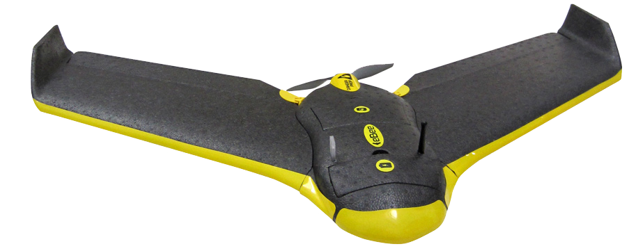
Award winning land surveying company, Landpoint, was granted a Section 333 status by the Federal Aviation Administration last month, allowing the company to expand its land surveying services by using Unmanned Aerial Vehicles (UAVs) for commercial purposes.

Section 333 status is granted on a case-by-case basis for certain unmanned aircraft to perform commercial operations. This certificate is a verification of qualifications as it provides operators who wish to pursue safe and legal entry into the National Airspace System with the legal means to do so. This designation is very important for those companies like Landpoint that provide aerial land surveys and other land surveying services where aerial data is required.

“This is a great asset for Landpoint, and a very exciting time says vice president Chad Souter. We are really pushing the boundaries in this rising industry. The regulatory approval is a very positive point of progression, and shows that we strive to find new ways to innovate and provide better value to our clients.”

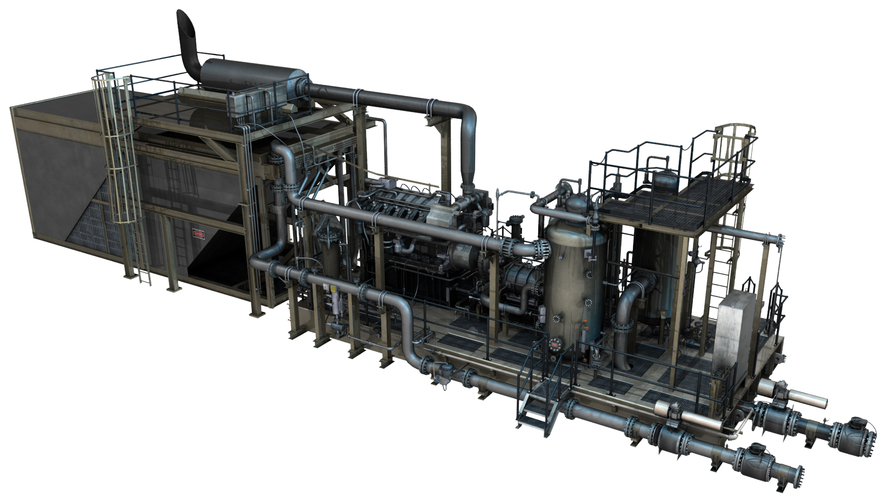
This exemption is only available to industries covering precision agriculture, film-making, power line and pipeline inspections and oil and gas flare stack inspections. The status expands Landpoint’s UAV surveying and aerial data collection services from end to end, which includes data capture, analysis, and sophisticated data distribution.

With certified UAV operators and automated aerial survey drones, Landpoint is able to survey large areas in a day and provide deliverables within 24 hours of the initial survey. Since the company had already been experimenting with the use of UAVs for land surveying purposes, Landpoint has developed a wealth of experience using this technology. This puts Landpoint ahead of the game when it comes to land surveying services that incorporate UAVs.

Any oil and gas companies looking to have surveys executed using UAVs should visit Landpoint’s website at www.landpoint.net for more assistance.

Landpoint named Engineering Company of the Year in Oil & Gas Awards

The Woodlands, TX – Landpoint was named Oil & Gas Engineering Company of the Year for 2015, marking the second consecutive year to receive the award. The annual Southwest and Mid-continent gala ceremony was held at the The Westin Dallas Park in Dallas, TX, where hundreds of oil and gas executives gathered together to SWMC-winner-2015_portrait3x1celebrate Operational Excellence, innovations in technology, CSR, Health & Safety and Environmental Stewardship.

Landpoint Recognized as the Best Engineering Company for Oil and Gas

The Engineering Company of The Year Award recognizes engineering excellence and notable achievements in the region. Celebrating the companies which have met the exacting specifications and technologically advanced demands of the energy sector, the judging panel reward proven projects spanning oilfield infrastructure projects, gathering stations, pipeline work as well as any work carried out on processing stations, distribution facilities and streamlining projects. Landpoint scored highest in the category with such remarks from the judges as:

“The introduction of UAVs (drones) to collect and gather data as part of Landpoint’s service to their clients enables them to collect and share huge amounts of geographical and topographical information rapidly. Such an effective solution can be specifically tailored to their client’s needs enabling the company to move faster and more cost effectively to deliver on their projects.”

One of the primary reasons why Landpoint has been recognized as the best engineering company is due to its use of drones. Landpoint has started using UAV systems on new infrastructure projects to streamline the data collection process at all phases and for multiple business units including engineering and environmental. Additionally, pipeline inspection services have been added to the service line as the technology has been developed further over the past few months.

About Landpoint

Landpoint is an award winning land surveying company. Teams of professional land surveyors, engineers, and technical specialists provide technology-driven solutions for projects of all sizes across the US. See more at https://www.landpoint.net.
About the Oil & Gas Awards

The Oil & Gas Awards recognize the outstanding achievements made within the upstream and midstream sectors of the North American oil and gas industry. The Awards are a platform for the industry to demonstrate and celebrate the advances made in the key areas of environment, efficiency, innovation, corporate social responsibility and health and safety. The Awards show the industry’s motivation to develop by recognizing and rewarding the efforts of corporations and individuals. For more information about the Oil & Gas Awards, all regional awards and award categories can be reviewed on their website athttp://www.oilandgasawards.com.

3 Reasons to Get 3D Models of Your Oil and Gas Facilities

In the oil and gas industry, there is no such thing as a perfect facility. As facilities age and the needs of your company change, you’ll always need to make changes and updates to make sure your facilities still meet those needs. The first step in any such oil and gas survey project should be to conduct  3D laser scanner surveying of the existing facility, which can then be used to create models. Having a 3D model of your current facility can provide you with a number of benefits that will help your update project run smoother.

The Three Main Benefits of 3D Models for Your Oil and Gas Survey

1. Greater accuracy

When planning an update to your existing oil and gas facility, it’s absolutely essential that you have a complete and accurate understanding of the facility as it currently exists. As you make decisions about what needs to be updated, you must be able to take exact measurements; just getting a basic idea of things won’t be good enough.

Having a 3D model of your facility supports this capability by providing an easy source of accurate information about the facility. These models are created using 3D laser scanning technology, which bounce thousands of laser points off the facility. As those laser points bounce back, the scanners will track the time it takes them to return and the flight path they follow. The scanners will then assemble a data cloud for all of those laser points, which is then used to support the creation of the 3D model.

Since your model will be based on the data taken from the laser scanners, you can feel completely confident that the data as accurate, and you won’t have to worry that you might be using inexact information gathered by hand.


Check out this demo of accessing point cloud information directly from your browser. You don’t need any special software and the point clouds are hosted as a service instead of having to download hundreds of gigabytes of data.


2. Know about potential issues in advance

Anytime an unexpected issue comes up during the course of an oil and gas facility update, it can have serious complications for the project as a whole. The project team may find themselves having to completely scrap their original plan to account for the newfound issue, or at the very least delay the project while they try to work around it.

These delays and changes to the project plan can be extremely costly and time consuming, in addition to be a source of tremendous frustration for everyone involved. That’s why you’ll want to avoid running into such an issue if at all possible.

The whole reason these issues pop up when you’re not expecting them is because you lack a complete and accurate understanding of your facility. Having a 3D model gives you a simple and efficient method of looking for these issues. Once you’ve found them, having a model also makes it simple for you to come up with a plan that accounts for the issues, so that your project need not be interrupted as a result.

3. Spend less time on planning

Everyone knows that having a strong plan in place before you start on a project is an important part of ensuring the eventual success of that project. In spite of this, it’s still important that you be able to get through the planning phase as quickly as possible, so that you can get down to the actual business of making the update.

Using 3D laser scanning technology to generate accurate representations of a site can help you strike the proper balance between planning quickly and planning thoroughly. While these models are relative quick to create, they can still provide you with all the information you need to fuel a successful project.

To learn more about 3D laser scanner surveying as well as 3D models and how they can benefit your oil and gas project, contact Landpoint today.