How Professional Land Surveyors of Colorado Help With Subdivision Development

residential land surveyWhen it comes to building new residential subdivisions, many would agree that the most important work occurs before the project even gets underway. Having a high quality residential land survey can set the right tone for everything that comes later on in the project. In this post, we’ll examine how King Surveyors, a subsidiary of Landpoint and one of the premier professional land surveyors of Colorado, can give you the residential land survey that helps you get off on the right foot toward a successful subdivision development project.

Benefits of Working With King Surveyors For Your Residential Land Survey

1. Subdivision plan development

For multifamily residential development project such as apartment buildings, success depends on having a good plan in place. Coming up with such a plan can help you identify the optimum location for the new development, make the most of the land you have available to you, make sure you’re ready to build in a safe and effective manner, and come up with a concise project schedule, so that you can start seeing a return on your investment as soon as possible.

The professionals at King Surveyors have the experience to know what elements need to go into a great subdivision plan and are able to walk you through the process to make sure that the plan you come up with includes all of those things.
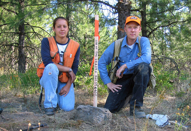
2. Land surveying

Once you have a subdivision development plan in place, King Surveyors can also help you with implementing that plan. Our team of experienced residential land surveyors is able to turn around accurate, detailed survey documents quickly. This means that not only will you be able to start putting your project into development quickly, with no lengthy delays while you wait for the survey documents to be turned around, but you’ll also be able to feel confident that all the engineering work performed on your project will be based on the most accurate information available.

3. Site permits

As a builder, there are probably many things you’d rather spend your time worrying about than site permits. However, these permits are simply a part of life when it comes to developing subdivisions, and you can’t afford to ignore them if you intend to complete a successful project. That’s why it helps to have a team of professionals at your disposal to worry about those site permits for you.

With the help of the team at King Surveyors, you can be absolutely certain that your project has all of the site permits it needs to proceed, without actually having to worry about getting those permits yourself. As a result, you can free up yourself and your team to focus on more important matters related to your project.

4. Other considerations

As you design and build your subdivision, other key issues are going to come into play, including erosion, stormwater management and wetlands protection. These issues may not be things that you spend a lot of time thinking about on a daily basis, but they do have the potential to completely derail your development project if you’re not careful about how you handle them.

As one of the top professional land surveyors of Colorado, King Surveyors can help you understand what issues you need to worry about when it comes to your specific project, and then help you make sure those issues are taken care of and won’t get in the way of a successful project.

Please contact us to discuss how we could help with your subdivision development project.

Image source: Bureau of Land Management

A Look at How Shared Data Helps Oil and Gas Projects

Oil and Gas SurveyingWe are living in an era when new technologies such as cloud computing and big data are completely changing the way industries operate, and oil and gas surveying is certainly no exception. In fact, the oil and gas industry is particularly well suited to benefit from these technologies: as oil and gas drilling has become more complex over the years due to increased activity and crowded pipeline rights of way, big data has made it possible for oil and gas engineers to operate more intelligently and continue meeting their production goals. At the same time, cloud computing has been influential in ensuring that all employees working on a project have access to the same data. In this post, we’ll discuss the benefits of shared data on the cloud for oil and gas projects in more detail.

Covering Long Distances

Globalization is becoming the norm in business today, and it’s no longer unusual to see project teams spread out over long distances. However, this has always been the case with oil and gas projects; drilling, refining, and shipping have always taken place in different locations, and pipelines have always been needed to cover those long distances.

Now, with cloud data solutions, all oil and gas employees can gain access to a technology that allows them to share project and survey data with their colleagues, no matter where in the world those colleagues might be located. The data transfer can happen instantaneously, so the distances between office and field workers practically melt away to nothing.

Ensuring Accuracy and Version Control

Other forms of communication and data sharing, such as email, aren’t as effective as cloud-based sharing, specifically because they aren’t centralized. When you have a large team that’s spread out geographically, it’s important that everyone be on the same page, and working with the latest and most accurate data.

A cloud based data sharing platform provides this centralization. Any time a team member shares a survey document or other piece of data with a team member, it’s also made available for everyone else on the team to see. As circumstances change over time, having this centralized platform in place makes it easier for everyone to feel confident that they always have the right data in hand. If there’s every a question about what data they should be using, a team member need only access the data sharing platform, and they’ll instantly be able to pull up a record of the most recent data.

A data sharing platform also serves as an archive for important historical data. In the event that a user ever needs to look back at data from earlier in the project, the data sharing platform gives them that capability as well.

Universal Access

Another important reason that cloud data sharing platforms can help with oil and gas projects is that they can be accessed from anywhere, on any device. Team members working in the field using mobile devices will have access to the exact same platform that their colleagues in the office using traditional workstations will. The data that’s placed on the platform can be saved and accessed equally on both sets of devices.

This means that office workers will always be able to transfer standard operating procedures and other important project information to workers in the field, while those field workers will be able to instantly transfer survey data from the site back to the engineers in the office who need that data in order to get started with their work. The universal nature of a cloud data sharing platform can encourage better communication and speed up key aspects of the project.

To learn more about cloud data sharing for oil and gas surveying, contact Landpoint today.

Image source: SarahTz

Aerial Data Collection: How UAVs Can Help With Road Surveys

Aerial Data CollectionAs you build new roads, finding ways to speed up and improve the land surveying process can be extremely beneficial. After all, since roads tend to cover long distances, the process of gathering survey data can often be more time-consuming than it is on other municipal construction projects. In this post, we’ll examine how the use of drones for surveying can speed up this process and lead to faster, more efficient road building.

Benefits of Aerial Data Collection for Road Surveys

Speed

The main problem with traditional land surveying techniques when applied to road building projects in that they take too long. Surveyors may find themselves having to cover long distances to collect all the needed data to support a project. In the time that this data collection is going on, the rest of the project will have to shut down to wait for the surveyors to return, leading to wasted time and resources.

On the other hand, UAVs can cover long distances quickly, traveling as the crow flies, which makes them an especially good choice for road building projects. They are also able to relay information back to engineers in a central office while still in the air, instead of having to wait until they’ve returned to share the data they’ve collected. This practically removes the waiting period involved with gathering road survey data, and allows those engineers to proceed with their work immediately.

Safety

Aerial mapping drones can contribute to greater safety in road surveying specifically because they are unmanned. Traditional land surveying methods require the surveyors to travel over land, often through difficult terrain that is hard to reach. Just being in such an environment dramatically increased the chance that a surveyor would be involved in a workplace accident. On the other hand, UAVs allow surveyors to conduct all of their data collection activity from the safety and comfort of a central office.

In addition, UAVs are safer than other forms of aerial data collection. While fixed wing airplanes can offer some of the advantages of UAVs when it comes to data collection, these planes usually have to be very small and fly close to the ground in order to operate effectively. As a result, it is impossible to fully ensure the safety of a person who has to go up in such a plane. By using drones for surveying, personnel can keep their feet planted firmly on the ground.

Accuracy

While speed and safety are fairly obvious and straightforward benefits of using UAVs to support road surveying, many people fail to realize that these devices can also offer an impressive level of accuracy in data collection. Recent developments in high-resolution camera technologies have made it feasible to create drones that can reliably capture images with 1 centimeter per pixel resolution. UAVs can also operate closer to the ground than fixed-wing aircrafts, allowing them to capture images from better angles.

The high level of accuracy provided by UAVs can lead to a more effective road building project overall. Engineers can enter into a project feeling confident about the data they have in hand. In addition, by beginning the road building project with the most complete and accurate data possible, a company can dramatically reduce the likelihood that they’ll end up having to go back and make an expensive and time-consuming change to the project due to an error that came about because of bad survey data.

Final thoughts on using drones for surveying

If you’re ready to put the benefits of using an aerial mapping drone to work on your road building project, Landpoint is here to help. Contact us today for more details.

Image source: Simon Fraser University

Land Surveying Firm Landpoint Named on Zweig Group’s 2015 Hot List

2015 Hot Firm WinnerLandpoint announces its fourth consecutive inclusion on the 2015 Zweig Group Hot Firm List. Placing at #4, the company continues to rank as one of the top 100 fastest growing firms in the architecture, engineering, planning, and environmental consulting industry throughout the United States and Canada.

“We are extremely honored to be on the list with some of the most highly recognized companies in the industry” said Chad Souter, Vice President at Landpoint. “We work hard to provide the most innovative services on the market. It’s very exciting to see the growth within the company that has taken place because of our continued ability to provide more efficient and higher quality services” Souter continued.

Headquartered in Bossier City, Louisiana, Landpoint is a land surveying firm with over 225 professionals across the nation. The company has recently been commended for its growth by leveraging advanced technologies that other land surveying firms are not able to manage.

The Zweig Group Hot Firm List examines more than 100,000 firms in the United States to determine the fastest growing A/E/P and environmental consulting firms that have outperformed the economy and their competitors to become leaders in their chosen fields.

“You have to be doing something right or you wouldn’t make these lists. When you consider that there are 100,000-plus design/planning/engineering/environmental consulting firms out there, being at the top of the growth stats is a real accomplishment, and it says that the marketplace is responding to your offerings, said Mark Zweig, Zweig Group founder, regarding last year’s winners.

This is not the first time that Landpoint was recognized as one of the top land surveying companies. n fact, this award joins the many other accolades Landpoint has recently acquired. In October 2014, Landpoint was honored as the Southwest’s Oil and Gas Engineering Company of the Year. Landpoint has also ranked on the Inc. 5000 list twice in the past five years as well as Inc.’s Build 100 list.

About Landpoint

Landpoint is an award winning land surveying firm that offers variety of surveying and engineering services for oil and gas, transportation, commercial land development, and residential real estate companies. The company also provides consulting, GIS mapping, UAV operations (drones), and laser scanning. The value added services and solutions offered by Landpoint are unmatched in the industry, allowing customers to realize significant time and cost savings.

To learn more about Landpoint’s services around the country, visit www.landpoint.net.