Landpoint Acquires Land Surveying Firm Town and Country Surveyors

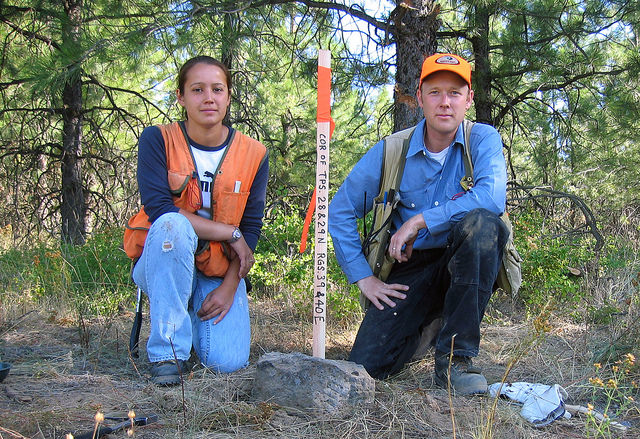
Landpoint, a national land surveying and mapping company, announces its recent acquisition of Town and Country Surveyors, LLC. Town and Landpoint acquires Town and Country SurveyorsCountry Surveyors was established in 2003 and has become local leader of surveying services in The Woodlands, TX.

“Town and Country has done a fantastic job in creating a reliable and successful company in the area” says James Souter, CEO of Landpoint. “There are many unique opportunities in partnering with this group of professionals that will benefit customers in the region. We look forward to expanding operations in the area and working closely with the additional team members that have joined our organization” Souter added.

Town and Country Surveyors operates in many different industry sectors including communications, commercial and civil development, and oil and gas. The existing management team at the company has years of experience in the local market. All employees will remain onboard with the company and operations will continuing to run normally.

Landpoint will be upgrading the current operational capacity of Town and Country Surveyors by combining offices with Landpoint’s existing personnel in The Woodlands and providing the company with new high precision surveying equipment, extending UAV (drone) services to existing customers, and implementing new business processes that help automate and improve efficiencies.

About Landpoint
Landpoint is an award winning company of land surveyors and technical specialists. The company provides services to engineering firms, oil and gas companies, and land development companies, as well as to the transportation and residential markets. The value added services and solutions offered by Landpoint are unmatched in the industry, allowing customers to realize significant time and cost savings.

To learn more about Landpoint’s services in The Woodlands, TX and around the country, visit www.landpoint.net.

How Virtual Reality is Perfect for Industrial Training

Industrial TrainingWhat if you could train your team to run a working industrial facility before they even step foot in the building? What might have seemed like a fantasy is now very much a possibility due to virtual reality (VR) technology. Your employees can now explore a detailed 3D model of your facility, allowing them to gain all of the knowledge and experience they need without the danger or complications of actually having to enter the facility themselves. In this post, we’ll talk about how virtual reality for industrial training can be beneficial to your organization.

About The Virtual Reality Boom

First, it may be helpful to learn a little bit about virtual reality technology itself and how far the technology has come in recent years. It may seem like the hype surrounding virtual reality has long surpassed its actual usefulness, but signs show that may be about to change.

The Oculus Rift virtual reality headset is finally expected to launch to consumers in early 2016, after several years of industry buzz and anticipation. Even now, there are already about 180,000 Oculus kits in the hands of developers, indicating that momentum is building toward a rich and diverse virtual reality marketplace right from the launch.

The launch has important applications for gaming, but most industry observers agree that the technology will have serious business applications as well, including tasks such as industrial training. In addition, money is pouring into VR from some of the biggest names in the technology industry, including Facebook (which acquired Oculus in 2014), Microsoft, and Google.

Clearly, what has been a niche concept for so long is finally ready to become a part of the mainstream technology marketplace. With so much buzz and funding for virtual reality, it’s easy to imagine a time in the not-so-distant future when VR headsets will be as ubiquitous as smartphones and tablets are today.

Why Virtual Reality for Industrial Training Makes Sense

To put it quite simply, VR for industrial training has so much potential because it offers the benefit of actually exploring a facility, without having to physically be there. This means that training sessions can be held without the risk of interfering with normal operations. The technology required to produce detailed 3D models of industrial facilities is already widely available; it only makes sense that more companies will start choosing to take advantage of those models by putting their trainees in virtual reality situations.

Another reason VR can be so useful for training purposes is that your employees will feel more engaged in the process. While traditional training programs can be boring, causing your trainees to tune out, VR training offers the thrill of getting to use the latest technology, ensuring that your employees will be involved and paying attention. As a result, you’ll be able to spend less time training your employees, while still getting beneficial results.

Finally, VR for industrial training solves a problem that trainers have been grappling with for a long time now: the best way to learn the intricacies of a facility are to explore the facility and experience them for yourself, but doing so isn’t always going to be safe or practical. With virtual reality, your trainees will be able to explore a detailed 3D model of your facility in full scale, and be able to interact with the facility in real time. When they actually enter your facility, they’ll have the confidence that comes from feeling like they’ve already been there before. Best of all, they won’t have to risk injury in order to get that confidence.

If you are ready to take advantage of VR for industrial training, Landpoint can help by providing the 3D models you need. Contact us today to learn more about getting a 3D model for your virtual reality training program.

Image source: Maurizio Pesce

Texas Land Surveyors West Company Offering Engineering Services

Engineering ServicesWest Company, a division of Landpoint, announces enhanced engineering services at multiple locations in West Texas for their existing and prospective client base. These new services utilize UAV / UAS / Drone technology to create commercial and industrial development projects.

“West Company is pleased to offer businesses in Texas its enhanced engineering services, says company president Macon McDonald. We are ready and able to assist organizations across multiple industries in their need for engineering services that are reliable, thorough and effective. With multiple locations in Texas, we can support a number of clients at one time while building relationships and maintaining high levels of customer service.”

West Company’s engineering services provide a number of solutions, including planning & zoning, land development, municipal works, construction and utility infrastructure. In-depth areas include topographic mapping, subdivision platting and design, as-built surveys, plats of topography, environmental reviews, area computations, oil/gas field map preparation, digital terrain modeling and other support services that assist in getting projects done.

West Company is a constant innovator when it comes to engineering services. Recently, West Company began offering surveys created using unmanned aerial vehicles. These surveys can be completed in a fraction of the time it takes a traditional survey and at reduced cost as well.

Texas Based Land Surveyors

A game-changer in utility design, coordination and asset management, West Company helps organizations to complete construction projects quickly and as efficiently as possible. From concept development through construction, West Company works closely with clients to meet their goals. With multiple locations in West Texas, the company can maximize efficiency while assisting on numerous projects for their clients.

Thanks to its proven track record, West Company is constantly recognized as one of the best Texas land surveyors.

Landpoint Expands Its Land Surveying Services to Include UAVs

UAV Surveying, Drone Surveying, Aerial Survey Drone, UAV Lidar SurveyAward winning land surveying company, Landpoint, was granted a Section 333 status by the Federal Aviation Administration last month, allowing the company to expand its land surveying services by using Unmanned Aerial Vehicles (UAVs) for commercial purposes.

Section 333 status is granted on a case-by-case basis for certain unmanned aircraft to perform commercial operations. This certificate is a verification of qualifications as it provides operators who wish to pursue safe and legal entry into the National Airspace System with the legal means to do so. This designation is very important for those companies like Landpoint that provide aerial land surveys and other land surveying services where aerial data is required.

“This is a great asset for Landpoint, and a very exciting time says vice president Chad Souter. We are really pushing the boundaries in this rising industry. The regulatory approval is a very positive point of progression, and shows that we strive to find new ways to innovate and provide better value to our clients.”

This exemption is only available to industries covering precision agriculture, film-making, power line and pipeline inspections and oil and gas flare stack inspections. The status expands Landpoint’s UAV surveying and aerial data collection services from end to end, which includes data capture, analysis, and sophisticated data distribution.

With certified UAV operators and automated aerial survey drones, Landpoint is able to survey large areas in a day and provide deliverables within 24 hours of the initial survey. Since the company had already been experimenting with the use of UAVs for land surveying purposes, Landpoint has developed a wealth of experience using this technology. This puts Landpoint ahead of the game when it comes to land surveying services that incorporate UAVs.

Any oil and gas companies looking to have surveys executed using UAVs should visit Landpoint’s website at www.landpoint.net for more assistance.

Landpoint named Engineering Company of the Year in Oil & Gas Awards

The Woodlands, TX – Landpoint was named Oil & Gas Engineering Company of the Year for 2015, marking the second consecutive year to receive the award. The annual Southwest and Mid-continent gala ceremony was held at the The Westin Dallas Park in Dallas, TX, where hundreds of oil and gas executives gathered together to SWMC-winner-2015_portrait3x1celebrate Operational Excellence, innovations in technology, CSR, Health & Safety and Environmental Stewardship.

Landpoint Recognized as the Best Engineering Company for Oil and Gas

The Engineering Company of The Year Award recognizes engineering excellence and notable achievements in the region. Celebrating the companies which have met the exacting specifications and technologically advanced demands of the energy sector, the judging panel reward proven projects spanning oilfield infrastructure projects, gathering stations, pipeline work as well as any work carried out on processing stations, distribution facilities and streamlining projects. Landpoint scored highest in the category with such remarks from the judges as:

“The introduction of UAVs (drones) to collect and gather data as part of Landpoint’s service to their clients enables them to collect and share huge amounts of geographical and topographical information rapidly. Such an effective solution can be specifically tailored to their client’s needs enabling the company to move faster and more cost effectively to deliver on their projects.”

One of the primary reasons why Landpoint has been recognized as the best engineering company is due to its use of drones. Landpoint has started using UAV systems on new infrastructure projects to streamline the data collection process at all phases and for multiple business units including engineering and environmental. Additionally, pipeline inspection services have been added to the service line as the technology has been developed further over the past few months.

About Landpoint

Landpoint is an award winning land surveying company. Teams of professional land surveyors, engineers, and technical specialists provide technology-driven solutions for projects of all sizes across the US. See more at https://www.landpoint.net.
About the Oil & Gas Awards

The Oil & Gas Awards recognize the outstanding achievements made within the upstream and midstream sectors of the North American oil and gas industry. The Awards are a platform for the industry to demonstrate and celebrate the advances made in the key areas of environment, efficiency, innovation, corporate social responsibility and health and safety. The Awards show the industry’s motivation to develop by recognizing and rewarding the efforts of corporations and individuals. For more information about the Oil & Gas Awards, all regional awards and award categories can be reviewed on their website athttp://www.oilandgasawards.com.

3 Reasons to Get 3D Models of Your Oil and Gas Facilities

In the oil and gas industry, there is no such thing as a perfect facility. As facilities age and the needs of your company change, you’ll always need to make changes and updates to make sure your facilities still meet those needs. The first step in any such oil and gas survey project should be to conduct  3D laser scanner surveying of the existing facility, which can then be used to create models. Having a 3D model of your current facility can provide you with a number of benefits that will help your update project run smoother.

The Three Main Benefits of 3D Models for Your Oil and Gas Survey

1. Greater accuracy

When planning an update to your existing oil and gas facility, it’s absolutely essential that you have a complete and accurate understanding of the facility as it currently exists. As you make decisions about what needs to be updated, you must be able to take exact measurements; just getting a basic idea of things won’t be good enough.

Having a 3D model of your facility supports this capability by providing an easy source of accurate information about the facility. These models are created using 3D laser scanning technology, which bounce thousands of laser points off the facility. As those laser points bounce back, the scanners will track the time it takes them to return and the flight path they follow. The scanners will then assemble a data cloud for all of those laser points, which is then used to support the creation of the 3D model.

Since your model will be based on the data taken from the laser scanners, you can feel completely confident that the data as accurate, and you won’t have to worry that you might be using inexact information gathered by hand.


Check out this demo of accessing point cloud information directly from your browser. You don’t need any special software and the point clouds are hosted as a service instead of having to download hundreds of gigabytes of data.


2. Know about potential issues in advance

Anytime an unexpected issue comes up during the course of an oil and gas facility update, it can have serious complications for the project as a whole. The project team may find themselves having to completely scrap their original plan to account for the newfound issue, or at the very least delay the project while they try to work around it.

These delays and changes to the project plan can be extremely costly and time consuming, in addition to be a source of tremendous frustration for everyone involved. That’s why you’ll want to avoid running into such an issue if at all possible.

The whole reason these issues pop up when you’re not expecting them is because you lack a complete and accurate understanding of your facility. Having a 3D model gives you a simple and efficient method of looking for these issues. Once you’ve found them, having a model also makes it simple for you to come up with a plan that accounts for the issues, so that your project need not be interrupted as a result.

3. Spend less time on planning

Everyone knows that having a strong plan in place before you start on a project is an important part of ensuring the eventual success of that project. In spite of this, it’s still important that you be able to get through the planning phase as quickly as possible, so that you can get down to the actual business of making the update.

Using 3D laser scanning technology to generate accurate representations of a site can help you strike the proper balance between planning quickly and planning thoroughly. While these models are relative quick to create, they can still provide you with all the information you need to fuel a successful project.

To learn more about 3D laser scanner surveying as well as 3D models and how they can benefit your oil and gas project, contact Landpoint today.

How Professional Land Surveyors of Colorado Help With Subdivision Development

residential land surveyWhen it comes to building new residential subdivisions, many would agree that the most important work occurs before the project even gets underway. Having a high quality residential land survey can set the right tone for everything that comes later on in the project. In this post, we’ll examine how King Surveyors, a subsidiary of Landpoint and one of the premier professional land surveyors of Colorado, can give you the residential land survey that helps you get off on the right foot toward a successful subdivision development project.

Benefits of Working With King Surveyors For Your Residential Land Survey

1. Subdivision plan development

For multifamily residential development project such as apartment buildings, success depends on having a good plan in place. Coming up with such a plan can help you identify the optimum location for the new development, make the most of the land you have available to you, make sure you’re ready to build in a safe and effective manner, and come up with a concise project schedule, so that you can start seeing a return on your investment as soon as possible.

The professionals at King Surveyors have the experience to know what elements need to go into a great subdivision plan and are able to walk you through the process to make sure that the plan you come up with includes all of those things.

2. Land surveying

Once you have a subdivision development plan in place, King Surveyors can also help you with implementing that plan. Our team of experienced residential land surveyors is able to turn around accurate, detailed survey documents quickly. This means that not only will you be able to start putting your project into development quickly, with no lengthy delays while you wait for the survey documents to be turned around, but you’ll also be able to feel confident that all the engineering work performed on your project will be based on the most accurate information available.

3. Site permits

As a builder, there are probably many things you’d rather spend your time worrying about than site permits. However, these permits are simply a part of life when it comes to developing subdivisions, and you can’t afford to ignore them if you intend to complete a successful project. That’s why it helps to have a team of professionals at your disposal to worry about those site permits for you.

With the help of the team at King Surveyors, you can be absolutely certain that your project has all of the site permits it needs to proceed, without actually having to worry about getting those permits yourself. As a result, you can free up yourself and your team to focus on more important matters related to your project.

4. Other considerations

As you design and build your subdivision, other key issues are going to come into play, including erosion, stormwater management and wetlands protection. These issues may not be things that you spend a lot of time thinking about on a daily basis, but they do have the potential to completely derail your development project if you’re not careful about how you handle them.

As one of the top professional land surveyors of Colorado, King Surveyors can help you understand what issues you need to worry about when it comes to your specific project, and then help you make sure those issues are taken care of and won’t get in the way of a successful project.

Please contact us to discuss how we could help with your subdivision development project.

Image source: Bureau of Land Management

A Look at How Shared Data Helps Oil and Gas Projects

Oil and Gas SurveyingWe are living in an era when new technologies such as cloud computing and big data are completely changing the way industries operate, and oil and gas surveying is certainly no exception. In fact, the oil and gas industry is particularly well suited to benefit from these technologies: as oil and gas drilling has become more complex over the years due to increased activity and crowded pipeline rights of way, big data has made it possible for oil and gas engineers to operate more intelligently and continue meeting their production goals. At the same time, cloud computing has been influential in ensuring that all employees working on a project have access to the same data. In this post, we’ll discuss the benefits of shared data on the cloud for oil and gas projects in more detail.

Covering Long Distances

Globalization is becoming the norm in business today, and it’s no longer unusual to see project teams spread out over long distances. However, this has always been the case with oil and gas projects; drilling, refining, and shipping have always taken place in different locations, and pipelines have always been needed to cover those long distances.

Now, with cloud data solutions, all oil and gas employees can gain access to a technology that allows them to share project and survey data with their colleagues, no matter where in the world those colleagues might be located. The data transfer can happen instantaneously, so the distances between office and field workers practically melt away to nothing.

Ensuring Accuracy and Version Control

Other forms of communication and data sharing, such as email, aren’t as effective as cloud-based sharing, specifically because they aren’t centralized. When you have a large team that’s spread out geographically, it’s important that everyone be on the same page, and working with the latest and most accurate data.

A cloud based data sharing platform provides this centralization. Any time a team member shares a survey document or other piece of data with a team member, it’s also made available for everyone else on the team to see. As circumstances change over time, having this centralized platform in place makes it easier for everyone to feel confident that they always have the right data in hand. If there’s every a question about what data they should be using, a team member need only access the data sharing platform, and they’ll instantly be able to pull up a record of the most recent data.

A data sharing platform also serves as an archive for important historical data. In the event that a user ever needs to look back at data from earlier in the project, the data sharing platform gives them that capability as well.

Universal Access

Another important reason that cloud data sharing platforms can help with oil and gas projects is that they can be accessed from anywhere, on any device. Team members working in the field using mobile devices will have access to the exact same platform that their colleagues in the office using traditional workstations will. The data that’s placed on the platform can be saved and accessed equally on both sets of devices.

This means that office workers will always be able to transfer standard operating procedures and other important project information to workers in the field, while those field workers will be able to instantly transfer survey data from the site back to the engineers in the office who need that data in order to get started with their work. The universal nature of a cloud data sharing platform can encourage better communication and speed up key aspects of the project.

To learn more about cloud data sharing for oil and gas surveying, contact Landpoint today.

Image source: SarahTz

Aerial Data Collection: How UAVs Can Help With Road Surveys

Aerial Data CollectionAs you build new roads, finding ways to speed up and improve the land surveying process can be extremely beneficial. After all, since roads tend to cover long distances, the process of gathering survey data can often be more time-consuming than it is on other municipal construction projects. In this post, we’ll examine how the use of drones for surveying can speed up this process and lead to faster, more efficient road building.

Benefits of Aerial Data Collection for Road Surveys

Speed

The main problem with traditional land surveying techniques when applied to road building projects in that they take too long. Surveyors may find themselves having to cover long distances to collect all the needed data to support a project. In the time that this data collection is going on, the rest of the project will have to shut down to wait for the surveyors to return, leading to wasted time and resources.

On the other hand, UAVs can cover long distances quickly, traveling as the crow flies, which makes them an especially good choice for road building projects. They are also able to relay information back to engineers in a central office while still in the air, instead of having to wait until they’ve returned to share the data they’ve collected. This practically removes the waiting period involved with gathering road survey data, and allows those engineers to proceed with their work immediately.

Safety

Aerial mapping drones can contribute to greater safety in road surveying specifically because they are unmanned. Traditional land surveying methods require the surveyors to travel over land, often through difficult terrain that is hard to reach. Just being in such an environment dramatically increased the chance that a surveyor would be involved in a workplace accident. On the other hand, UAVs allow surveyors to conduct all of their data collection activity from the safety and comfort of a central office.

In addition, UAVs are safer than other forms of aerial data collection. While fixed wing airplanes can offer some of the advantages of UAVs when it comes to data collection, these planes usually have to be very small and fly close to the ground in order to operate effectively. As a result, it is impossible to fully ensure the safety of a person who has to go up in such a plane. By using drones for surveying, personnel can keep their feet planted firmly on the ground.

Accuracy

While speed and safety are fairly obvious and straightforward benefits of using UAVs to support road surveying, many people fail to realize that these devices can also offer an impressive level of accuracy in data collection. Recent developments in high-resolution camera technologies have made it feasible to create drones that can reliably capture images with 1 centimeter per pixel resolution. UAVs can also operate closer to the ground than fixed-wing aircrafts, allowing them to capture images from better angles.

The high level of accuracy provided by UAVs can lead to a more effective road building project overall. Engineers can enter into a project feeling confident about the data they have in hand. In addition, by beginning the road building project with the most complete and accurate data possible, a company can dramatically reduce the likelihood that they’ll end up having to go back and make an expensive and time-consuming change to the project due to an error that came about because of bad survey data.

Final thoughts on using drones for surveying

If you’re ready to put the benefits of using an aerial mapping drone to work on your road building project, Landpoint is here to help. Contact us today for more details.

Image source: Simon Fraser University