Landpoint Awarded Third Place on 2014 ZweigWhite Hot Firm List

zweigwhite2014Landpoint is excited to announce that it has been awarded the #3 spot on the 2014 ZweigWhite Hot Firm List. This marks the third consecutive year that the company has been awarded a spot on the exclusive list which ranks the top 100 fastest growing firms in the A/E/P and environmental consulting industry.

“We are thrilled to have placed so high on this year’s list” says James Souter, CEO of Landpoint. “Our team has worked very hard to support and control the growth we’ve been experiencing.”

Landpoint has grown to more than 220 professionals, from land surveyors to licensed professional engineers, who are located across the nation. Many of its operations are located in extremely active energy development zones. The company has secured long term relationships with some of the largest clients in the Eagle Ford, Permian Basin, Haynesville Shale, and other emerging oil and gas formations. Additionally, Landpoint and its subsidiaries provide surveying and engineering services for municipalities, construction firms, and industrial companies.

The list looks at more than 100,000 firms located in the United States and Canada and only recognizes those who have outperformed the economy and their competitors. The economic recovery is well underway as firms on the list in 2014 boast an impressive median growth rate of 72 percent, up significantly from 44 percent in 2013.

“Getting on The ZweigWhite Hot Firm list is a tremendous achievement,” said Mark Zweig, ZweigWhite founder. “That’s especially true now the economy is doing better,” Zweig added. “The goal post is getting higher”

The Hot Firm award is the most recent of several accolades presented to Landpoint for 2014. Earlier this year the Association for Corporate Growth awarded Landpoint with the “Deal of the Year” award after successfully creating and executing a long-term acquisition strategy and integration platform. In 2013 Landpoint completed transactions with King Surveyors of Windsor, Colorado and West Company of Midland in Midland, TX.

Oil and Gas Surveying: Simplifying Pipeline Route Selection

oil and gas surveyIf you are using pipelines to transport oil and gas, then one of the most crucial first steps for your project is going to be route selection. Where you put your pipelines is going to affect not just how much pipe to buy but have legal and environmental issues as well. The best pipeline transport routes move oil and gas in the safest, most economically efficient way possible and have the least impact to the environment and landowners. The oil and gas pipeline routes are defined by the pipeline size(s), terrain, soils, and engineering analysis requirements.

The engineers’ assessment based on survey data is essential to the oil and gas pipeline construction project. The most direct route is not always optimal and each solution has an associated cost and schedule increase. Failure to thoroughly investigate all features of the intended route and surrounding lands quickly adds additional time and cost. Thankfully, quality oil and gas surveys can help to mitigate costly errors, geotechnical mishaps, regulatory issues and breaches.

Pipeline Planning

The shortest route is generally not possible due to physical obstacles and environmental limitations that can get in the way. To mitigate costly oversights, surveys should provide engineers typographic, geographic, boundary, environmental, and other in-depth data to help them determine things like:

  • Corridor Selection
  • Route Survey
  • Foreign Pipeline Identification
Selecting a Route During an Oil and Gas Pipeline Construction Project

To determine the preferred / final route, oil and gas survey information should highlight and map constraints within the route corridor. Negotiations can then begin, construction limitations and potential impacts addressed, schedules made, construction method(s) determined and a traffic management plan prepared. The survey should involve the following:

  • A detailed survey of the route and the pipeline’s construction environment.
  • Access roads, construction camps, staging, facility, cathodic protection, and mainline valve sites should be surveyed at this stage.
  • Pipeline corridor design and above-ground facilities locations should be completed in the field.
  • Surveyors should contact appropriate authorities/third parties to obtain information about unknown development or encroachment along the route, underground obstructions, as well as other pipelines, services, and structures that may be in the way. Surveyors should also meet with landowners and land agents along the proposed route.
  • Land and environmental corridor surveys should be wide enough to cover sufficient width and depth around the provisional route and have sufficient accuracy to identify all features that could adversely influence installation and operation of the pipeline.
  • The selected route should be recorded on appropriately-scaled alignment sheets that include significant point coordinates and contour lines.
  • Geo-hazards can be identified and addressed. Geo-hazards are “geological, hydro-geological, or geomorphological events.” The extreme result of a geological hazard on the pipeline is a rupture. This is why terrain evaluation and risk analysis are imperative to selecting the most appropriate pipeline route.
  • Early-stage terrain evaluation and assessments can be performed to reduce design and construction time and cost. Costly remedial measures or site restoration is prevented and the operability of the pipeline is maintained.

Learn more about how land surveying can impact your oil and gas pipeline construction project by downloading Landpoint’s oil & gas brochure.


Oil and Gas Engineering Challenges in the Niobrara Shale

land surveying servicesThe oil and gas development opportunities being explored in the Niobrara Shale area are numerous and have presented the region as a prospectively lucrative venture for many energy companies. However, this has also lead to a number of challenges for oil and gas engineering firms.

Niobrara Shale and the Recent Boom

The Niobrara Shale is attracting large investments from companies in the energy and oil and gas development sector, due to its oil rich and easy to drill stratum. An amount of $4 billion was invested by some of the top companies in the sector during 2013, with plans to pursue drilling activities in 2014 as well.

  • Drilling sites: The 4 major enterprises operating in Niobrara have identified around 15,000 potential drilling sites within the location, targetting the huge amount of oil and gas reserves that the area possesses. Moreover, smaller companies have outlined 5,000 other locations which are prospective spots for oil and gas drilling in Niobrara shale.
  • Increase in rig sites: The North American Rig Count has estimated a 50% increase in the number of oil rigs within the area, only within the past 22 months. The alluring prospects presented by Niobrara Shale has given rise to the amount of investment done by energy sector companies, with around $1 billion already spent on the rail terminals, pipelines and plants, for the processing and shipping of oil.
  • Economic boom: The investment activities in the region have resulted in an economic boom in the area, the effects of which are easily discernible all across the Front Range. Many energy investment companies are still evaluating the true potential of Niobrara, and regard it as a highly lucrative region for exploring and discovering oil and gas development opportunities.
  • Rising demand for drill permits: Statistics show that in the latter part of 2013, there were around 1000 drilling permits which were issued in the Niobrara Shale basin, whereas 250 were still pending. This is evidence of the vast drilling and exploration opportunities being offered by the region for oil and gas development.

Niobrara is included in the list of different shales within the country, which have increased the domestic output of the state to exceed their oil imports, since 1995.

Challenges by Oil and Gas Engineering Firms Faced With Developing the Area

Though Niobrara Shale is rapidly being recognized as an abundant resource of oil and gas reserves in the industry, there are still a number of challenges in its path towards success. These include:

  • Land surveying: Finding quality land surveyors is a major challenge for companies in the energy sector who want to explore the resource potential offered by Niobrara. There are quite a number of land survey companies, but they sometimes lack the appropriate team size and a mobile professional group of professionals, to competently handle large exploration projects, which are major challenges and a cause for delays.
  • Political and community resistance: Many political segments and community associations are resistant to the extent of development change which is fast penetrating into the suburbs of the Niobrara basin, which is one of the major challenges to the development endeavors in the area.
  • Technological expertise: Not many service providers have technological expertise to make use of the instrumentation and software, like GIS mapping, cloud based data sharing, high definition scanning, and many other important services.
  • Permit  issuance: In order to pursue development projects within the area, permits are a necessity, and due to the rising demand, the process has become time consuming, making it difficult for investment companies to explore and develop Niobrara.

In Niobrara, land surveying and exploration is critical to the development of the area. If you are seeking an oil and gas engineering firm, then get a no obligation quote from Landpoint.

Image by : USFWS Mountain-Prairie

How Surveying With Drones Changes Everything

8725078749_b8baf91344_zUnmanned aerial vehicles (UAVs), otherwise known as “drones,” are among the most important technological advances that have been introduced to the land surveying industry in quite some time. These small, ultra-light weight aircraft can be piloted by remote and can take detailed survey information while simultaneously transmitting that data back to the head office. This creates highly accurate maps and provides valuable data to companies and individuals who are considering major projects on large areas of land. In this article, we will take a look at how surveying with drones can help Oil and Gas companies get better, more accurate data.

Why Use Drones for Surveying?

There are a number of reasons why drones are an ideal addition to any land surveying project and can increase accuracy and return on investment.

  • Highly accurate, high-definition maps can be created in a fraction of the time that used to be required
  • Data of all sorts can be gathered by the drone including photography, Lidar, and video
  • All information can be instantly uploaded to a server where it can be accessed by authorized individuals anywhere in the world
  • It becomes much easier to reach difficult locations with drones. This makes using drones significantly safer in certain situations.

These are just a few of the reasons why this technology has been so important to the industry. As applied robotics continue to increase in complexity, there is very little doubt that the capabilities of surveying drones and the breadth of data that they can collected will only increase.

How Land Surveying With Drones Works

While not common place today, more companies are recognizing the benefits of using drone technology in order to produce things like base maps and other important pieces of the surveying puzzle.

To put it simply, drones are deployed over the area to be surveyed equipped with a number of important pieces of scanning technology. Among these are 3D laser scanners that sweep over the region and give the surveyor highly detailed images and ideas of what the terrain actually looks like.

The data from the 3D laser scanners can be used in a process called GIS mapping, which is the creation of a digital map through the employment of cartographic sciences, advanced computer skills, and statistical analysis. The map provided by this process is not only high definition and easy to use, but also gives very specific information regarding the area in an easy to access format.

The GIS map and other data is stored using cloud technology so that what is being seen by the drone and the resultant reports can be instantly uploaded to a server that will provide access to authorized parties. Not only is this the quickest way to inform decision makers on the results of surveys, it also allows them to be informed no matter where they are so long as there is an Internet connection.

Advancing With the Times

More companies are changing their land surveying services to take advantage of the new technologies becoming available. They are finding a much higher return on investment due to more accurate data being accumulated by fewer people in less time with quicker results. Not working with a modern surveyor employing the best techniques is far too expensive a proposition for many companies, and they are finding the change worthwhile.

At the time of writing, the legal use of drones for surveying purposes has not been approved by the government. However, Landpoint has already begun investing in Research and Development for drones so that when they do become legal it can offer this service to its customers soon after.

If you’re interested in seeing what a difference the latest advance in land surveying technology can make, both in terms of accuracy and bottom line, don’t hesitate to request a no obligation quote so that you can see for yourself the incredible benefits.


Image by : Don McCullough

Overlooked Benefits of Using GIS for Surveying

Behind Theodolite

What is GIS Used For?

GIS (Geographic Information System) provides a central location for data and analysis critical to today’s surveying, planning, construction, and management. It allows professional land surveyors a way to provide more accurate and less expensive surveys.

While these features alone are enough to justify using GIS, there are a number of additional benefits of using GIS and Surveying which can add value to commercial, industrial and oil & gas construction projects. These provide additional value not just to the surveyors but to their clients as well. In this article, we explore three of the overlooked benefits of using GIS and how they impact a construction project.

The Additional Benefits of Using GIS Technology for Land Surveying

Most sophisticated professional land surveyors rely on GIS in their everyday work processes. In addition to more rapid data collection and better planning, design, construction, and resource management, GIS benefits the professional land surveyor with the following:

1. Better Decision Making
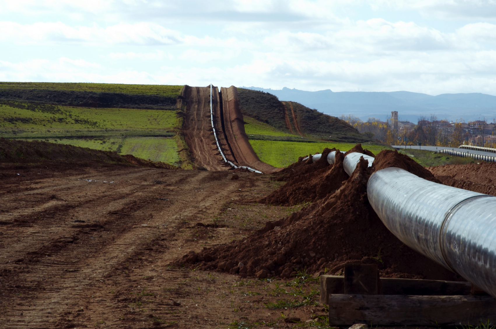
Collected, analyzed, and mapped data help managers make better and more informed decisions about plan location and design. Construction projects depend on a wealth of data for things like site selection, accesses and easements, zoning restrictions, conservation of environmentally sensitive areas, natural resource extraction, existing utilities and community resources. GIS provides this additional information, allowing for informed decision making and concise planning in consideration of location, people, and the environment.

2. Reliable Records Retention
Historic data, documents, and maps provide a basis for a prospective project’s feasibility. More accurate background information leads to more options to satisfy all concerns about the project. This gives design managers, politicians, and interest groups the right data about location, resources, and previous development to drive project outcome.

Equally important are as-built drawings, updated base maps, and current data after the project is completed. Government organizations in particular are responsible for maintaining authoritative public records regarding changes of geography (geographic accounting), topography, and land use. Zoning, population, land ownership, administrative boundaries, and private access roads to restricted lands, are contained in the GIS cultural geographic records. Physical geography such as forest clearing, biological assessments, environmental deviations, landmarks, courses, measurements, and water resources (hatcheries, intakes and dams) are also a part of GIS geographic records.

3. Better Land Use Management
GIS is quickly becoming the standard for government and larger corporations. It’s an important tool that helps to envision, develop, and formally illustrate ideas of expansion, acquisition, and notable resolution to congestion, pollution, and resource availability concerns.

Historical data may be used as base maps for conceptualizing, understanding, and prescribing action and utilizing available resources. Various data overlays provide additional geographic data, recurring patterns, sensitive areas, hazards and relationships associated with practical land use, environment, and security issues.

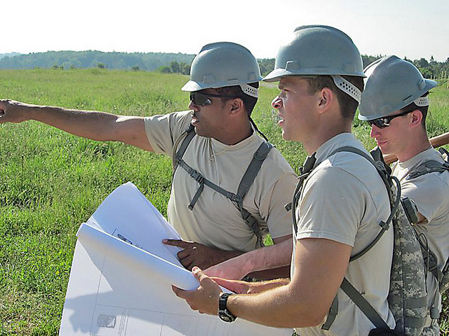
Environmental Impact Statements (EIS) require large amounts of varying kinds of data to be collected and analyzed. Project permits by government agencies hinges on collected EIS and BA (Biological Assessment) data. The project team is typically comprised of personnel in the office and out in the field, the client, and consultants. All members need access to surveys and analysis data at some point during the decision making and construction problem solving stages. Information sharing is critical for managing teams in remote areas. GIS offers a central database resource that all groups may access, analyze, and input into the project’s conversation.

GIS has transformed how organizations manage their resources, solve problems, make decisions, and communicate. To learn more about the benefits of using GIS for land surveying, please feel free to contact us with any questions that you may have.

landpoint-cta

Professional Land Surveyors Helping Reduce the Risk of Drilling Dry Wells

Oil and Gas ProjectsGIS technology is critical when mapping well sites for drilling operations. The cost of drilling a dry well can quickly eat into an operation’s budget. However, a professional land surveyor can use GIS mapping to leverage central geological and physical datasets to help analyze, summarize, and make determinations more effective planning.

Finding the Right Location

Geologists typically analyze the prospective well drilling area by checking rock and soils types, land terrain, as well as the gravitational and magnetic area fields. Geologists perform seismic surveys and test for hydrocarbons in and around the site. Seismic surveys are not fool proof as they may find what appears to be an excellent reserve trap but which may turn out to be dry when drilled. Dry holes are the lack of charging or breaching of previously charged reservoirs where the hydrocarbons have escaped. Geochemical soil gas surveys used in conjunction with seismic surveys can significantly improve successful hydrocarbon exploration ratios and reduce “dry hole” risk.

Once geologists select the prospective well drilling location, surveyors are called to stake the well site. It is the job of professional land surveyors to prepare 2D and 3D mappings. A plat map, stamped and signed by one of the licensed land surveyors, showing the staked well location is required by various states prior to drilling. This provides insurance of the correct location, to the best of the geologist and land surveyor’s knowledge. Erroneous information may result in the drilling company losing the ability to hydraulically fracture all segments of the downhole well lateral, or encounter a dry well. It is not uncommon for a well to be relocated several times on the surface before drilling. Accurate documentation is vital.

Prior to Drilling

The drilling site must be prepared and free from hazards. The professional land surveyors should conduct a line location survey in preparation to level the drill site as well as for the excavation of the reserve and settling pits. Access roads and the drill pad must be staked and prepared prior to commencing drilling operations.

Cost and Consequences of Dry Drilling

Drilling risks may be moderate to high depending on the proximity of drilling to existing producing wells. Wildcat or high risk drilling occurs greater than 1.5 miles from the nearest producing oil well or 3 miles from the nearest producing gas well. Conversely, low risk, developmental drilling operations, are within half a mile of oil or within one mile of gas wells already drilled and producing. Geochemistry is not as critical, but is useful in determining where blind compartments of stratigraphic traps lie. Outpost drilling offers moderate risk. Drilling is located within 0.5 – 1.5 miles of the nearest producing oil well or 1-3 miles to the nearest active gas well. Geochemistry is a cost efficient means of locating the extreme limits of newly-discovered fields.

When GIS tools are not used during analysis, dry drilling can occur. Dry drilling is loss of circulation and fluid. Although the well is bored, the fluid does not rise to the top. Operation losses may be as little as a broken drill bit or as major as a damaged wellbore, drill string, snapped pipe, or damaged rig. In terms of barrels per day and revenue, a “minor loss” is considered to upto 470 barrels in a 48 hour period. Severe losses exceed 470 barrels or occur when fluid gushes to the surface and is wasted or lost.

To learn more about how experienced professional land surveyors can help with oil and gas projects, download our free ebook about modern land surveying technologies.

Top North American Large Infrastructure Projects to Watch

Land SurveyingAs the world’s population rises, so too does the need for additional infrastructure. This has led to a greater number of large infrastructure projects, which in turn has led to a greater need for land surveying and engineering services. These projects range from roads and highways to oil and gas pipelines and other energy related structures. When completed, many of these projects will have a huge impact not just on the local communities but in some cases all of North America and even the world.

While there are a number of impressive infrastructure projects, these are some of the most current and exciting projects that are either underway or close to being started:

  • The $6.2 billion Dulles Transit Extension in Washington, D.C. started in 2008 is the largest Metro system expansion in the city’s history. Mostly above-ground public transportation, it will provide access from Downtown D.C. to Dulles Airport and North Virginia suburbs. One intent is to reduce traffic congestion on the Beltway.
  • The $746 million Lone Star Transmission Competitive Renewable Energy Zone 345-KV Electric Transmission Line is Texas’ largest single transmission project. It consists of 320 miles of new lines. Six hundred seventy-one parcels are crossed by the new lines. Three 345kV substations and two compensation stations are part of the construction. Ten million dollars in property tax revenue will be generated in the first operation year.
  • The estimated $2.5 billion Crescent Corridor Expansion is an aggressive series of freight rail projects running from New Orleans to New Jersey through thirteen states. Intermodal terminals and approximately 300 miles of track is planned. Freight companies desire cost savings while achieving the removal of interstate congestion and pollution. The upgrade depends on public funding, and is tentatively scheduled for completion by 2030.
  • The $3.1 billion Alaskan Way Viaduct project is intended to strengthen Seattle’s iconic double-decker, elevated highway that runs through downtown, adjacent to the Puget Sound. A 2001 earthquake damaged an already weakened structure. Replacing the viaduct is more cost-effective than repairing it. Initial debate about replacing the elevated roadway with a tunnel delayed the project. The tunnel will create more open space along the waterfront and the south portion of roadway will be rebuilt. Both structures are designed to withstand a 9.0 earthquake. The 2015 completion date may be delayed however, due to the immense tunnel boring machine breaking down and sitting inactive for months.
  • Although no longer a US territory, the 99-year old Panama Canal is currently undergoing a $5.25 billion expansion. Three 1,400-foot long by 180-foot wide by 60-foot deep locks will be added to each end and the Atlantic end will be dredged. Strict environmental and reforestation phases are part of the project. The upgrade that will accommodate larger container vessels is hailed by the largest global shipping companies. Begun in 2007, the Canal Expansion Program has become a major trainer and employer of land surveyors, engineers, inspectors, and others.
  • The $5.3-billion Alberta, Canada to Nebraska Keystone XL oil pipeline has been a political issue for many years. The project that potentially provides the US decades of fuel, extends the existing Keystone pipeline carrying Canadian crude oil and diluted bitumen to Nebraska and Illinois to continue to other Midwest and Texas Gulf refineries and saltwater ports. The Contractor says the pipeline is the safest ever built. Environmentalists and alternative energy advocates are not convinced and there have been spill prevention, leakage, and potable water concerns among communities along the route.

For more information about land surveying for large infrastructure projects, please feel free to contact us. Landpoint has extensive experience with various infrastructure projects, especially when it comes to oil and gas.

Image by : Khunaspix

Construction Project Planning Tips for Managing Multiple Survey Teams

Land SurveyorsA survey assignment’s complexity depends on the type of surveys needed, the time required to complete the field work, and the office time it takes to process the data and generate maps and plans. It’s not uncommon on large projects to utilize several different land surveying teams.

When the job calls for more than one survey team, the land surveyor’s primary intent is to efficiently collect all necessary data. The challenge, however, is to effectively plan, coordinate, and manage these teams in such a way to avoid mis communications and task redundancy, overlap, and need to re-survey. This post provides a number of construction project planning tips in order to help managers seamlessly oversee these multiple teams.

Managing Multiple Land Survey Teams

Land surveying firms offer a variety of services. For any major project there is a need for:

  • Pre-construction planning
  • Amendments and changes
  • Construction
  • Post-construction

Within any project phase there are needs to simultaneously provide layout, staking and control services:

  • Permits– Accesses, drainage and pipeline crossings, river and stream diversions, relocations.
  • Environment Concerns– Pre-construction and construction delineation and mitigation.
  • Site Design / Earthwork – Boundary lines and plats, well pads, staging, building, production.
  • Layout And Control – Grade, pipe and pipeline bridges, structure and equipment foundations
  • Geotech Data – Borrow sites, volume calculations, bearing capacity, slope stability
  • Post Construction – As-builts, claims.

Criteria for Survey Team Management

Utilization of the latest land surveying technologies and current software is important to efficiency. Land surveyor teams with better tools are more flexible, mobile, and scalable. The land surveying manager then is not as concerned with equipment reliability, availability, and accuracy, and can focus on deploying teams that can fully execute their assignment in a timely manner.

There are three basic things that can be done in order to effectively coordinate multiple survey teams and help ensure survey assignments are completed on time and within budget:

1. Utilize Land Surveyors Experienced In Working Together And/or Familiar With The Particular Region.

When teams have experience working together, there is usually better communication. This communication is especially helpful if at least one of the teams has experience working in the region that is being surveyed, as they can provide better insight into how to go about the survey.

Land surveying teams are comprised of a party chief/lead, and technicians knowledgeable in the specialty (utility, right of way, seismic, geotechnical, and environmental, boundaries) that the particular assignment requires. Familiarity with the region, landmarks, markers, and unique obstacles such as streams, rivers, rugged terrain and total open space help reduce the potential for unpreparedness and unnecessary complications. These issues can include un-calibrated equipment, poor field organization, slow decision making and problem solving delays. It is also not uncommon to find a survey team lost enroute to a remote jobsite. When at least one team is experienced working in a particular region, they are able to communicate and wok through the challenges.

2. Establish Criteria for Plats at the Start of a Project

Preliminary plats are used as a starting point for most projects. They are considered comprehensive tools and may be changed during the course of the project. They should contain significant information to lay out the proposed project. Plat maps should show:

  • As-built geological data and legal descriptions
  • Identified boundaries, floodplains, drainage courses, road accesses, easement, right of way
  • Past and proposed site development
  • Underground as well as above-ground structures
  • Ownership, occupancy, legal rights, third-party rights, claims, and liens

However, different surveying teams may use different criteria for each of the plats that they create. This can create confusion and miscommunication when information needs to be compared between plats from two different teams. If you are bringing in multiple survey teams, make sure to establish the criteria for the plats early on to prevent this confusion.

3. Utilize a Project Management System

A project management system is invaluable to construction project planning. A project management system allows different survey teams to easily share information on a single platform and collaborate effectively with the client. This improves communication between teams and creates a single depository of information for them to put upload data to. This greatly increases the speed from which the multiple teams work and makes it less likely to have discrepancies between data collected between the two different teams.

For more information on construction project planning for oil and gas companies, download our free eBook on the latest land surveying technologies and how they benefit oil and gas projects.

Image By : Georgia National Guard

Why Scalability is Key to Oil & Gas Surveying

land surveying projectsScalability is the ability to quickly adjust to changing conditions as they occur. Projects need to continue even when new information changes the nature of the operation and demands an increase in scope. When it comes to oil and gas projects, land surveyors must meet deadlines, manage change, and ensure the end result meets company needs and regulatory standards.

As oil and gas industry operations expand, land surveying scalability becomes a major challenge. Many surveying companies are small and unable to scale, while others may not be able to scale quickly enough to accommodate oil and gas companies’ needs. As a result, companies may experience much longer turnaround times. “Time is money,” and increased survey turnaround is inefficient and costly.

It is extremely beneficial when land surveying firms can efficiently and effectively provide accurate oil and gas field data to aid engineers in decision making and problem resolution. Land surveyors may be required to change course quickly. Regardless of conditions and obstacles, oil and gas surveying projects must meet deadlines and milestones. To do so, they need the team and the technology to be able to easily handle project changes as well as the ability to properly manage resources once they are in place.

Land Surveying Projects & Scalable Technologies

Most oil and gas surveying projects are multi-phased, from field data collection, to surveyors review, to client deliverable distribution. Oil and gas surveys tend to become more complex as the project progresses. An original survey may turn into re-rotes, moves, and overall scope increases, requiring more resources and in many cases additional skill sets. The survey firm should have the capacity and resources to be able to add additional crews and equipment as needed.

Having access to some of the latest surveying technologies enhances scalability. For example, the best GIS uses significantly more data and keeps all of the information in the cloud. Data is made available through smartphones and tablets, enhancing communication between teams and keeping everyone in the loop. When information is kept in a central location and made easily available to those in the field, it means that no matter how many new teams are added, everyone will still be on the same page.

Some important methods, programs, and project management features indicating a surveying company is focused on continued scalability are:

  • Advanced GNSS
  • 3D scanning applications
  • Mobility / mobile devices
  • A real-time, in-house project management system
  • Knowledge of oil and gas companies’ multiple land leases and operations
  • A large pool of readily-available on-call survey teams
  • A reputation for updating and incorporating the latest technologies
  • Professionals that are knowledgeable of the most current land survey technologies

The Benefits of Scalable Oil and Gas Surveying

Ultimately, partnering with a firm that can easily scale helps your oil and gas project with three critical elements:

  1. Speed – By being able to add additional resources as soon as they are needed, a scalable land surveying company can vastly reduce the time needed to complete a project.
  2. Accuracy – A land surveying company needs to have a broad skill set and experience in a number of different oil and gas surveying related disciplines in order to take on the additional tasks that may come up in a project. If they do not have these things, they may attempt to take on tasks with mixed results.
  3. Efficiency – The more a project expands and changes, the more necessary it is that the surveying company be able to communicate with other teams and share information.

It is better for an oil and gas company to pick a land surveying company that can scale right from the start, instead of having to change midway when it becomes clear that the current surveying company cant. For more information, take a look at our oil and gas brochure.